CanalPlanAC

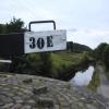
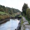
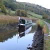
Bank Nook Lock No 30E

 
Crow Trees Road, Slaithwaite Hall HD7 5XB, United Kingdom
 
Information about the place
Bank Nook Lock No 30E is a minor waterways place on the Huddersfield Narrow Canal between Railway Lock No 42E (Marsden. Eastern summit lock) (1 mile and 2¼ furlongs and 11 locks to the southwest) and Titanic Mill (Linthwaite) (2 miles and 3¼ furlongs and 13 locks to the east).
 
 
The nearest place in the direction of Railway Lock No 42E is Booths Bridge No 52; 1¼ furlongs away.
 
The nearest place in the direction of Titanic Mill is White Hill Lock No 29E; 1 furlong away.

There may be access to the towpath here.

Mooring here is unrated.

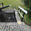
There is a bridge here which takes pedestrian traffic over the canal.

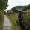
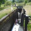
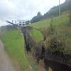
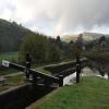
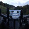
This is a lock, the rise of which is not known.


Amenities

Amenities nearby at Booths Bridge No 52

 Olive Branch
 
Maps
If you are a user and are logged on, or if you are actively planning a route, a map will be displayed here.
Show on external mapping site: Google | OSM | Bing
 
Navigational Notes

Great little brewery tap here, Zapato Brewing, check it out.

 
Photos
 
External websites
 Zapato Brewery  — associated with this page
Brewery
 
Nearest facilities

Mouseover for more information or show routes to facility

Nearest water point

In the direction of Ashton-under-Lyne Junction

Standedge Tunnel (eastern entrance)1 mile, 7½ furlongs and 13 locks away
On this waterway in the direction of Ashton-under-Lyne Junction
Standedge Tunnel (western entrance)5 miles, 1½ furlongs and 13 locks away
On this waterway in the direction of Ashton-under-Lyne Junction
Wool Road Bridge No 707 miles, 1¼ furlongs and 22 locks away
On this waterway in the direction of Ashton-under-Lyne Junction
Grove Road Bridge No 9613 miles, 1½ furlongs and 37 locks away
On this waterway in the direction of Ashton-under-Lyne Junction

In the direction of Aspley Basin (Huddersfield)

Slaithwaite Winding Hole1 mile, 3½ furlongs and 9 locks away
On this waterway in the direction of Aspley Basin (Huddersfield)
Waterside Lock No 21E1 mile, 4 furlongs and 9 locks away
On this waterway in the direction of Aspley Basin (Huddersfield)
Aspley Basin (Huddersfield)6 miles, 1¾ furlongs and 30 locks away
On this waterway in the direction of Aspley Basin (Huddersfield)
Shepley Bridge Sanitary Station12 miles, 6¼ furlongs and 41 locks away
Travel to Aspley Basin (Huddersfield), then on the Huddersfield Broad Canal to Cooper Bridge Junction, then on the Calder and Hebble Navigation (Main Line) to Shepley Bridge Sanitary Station
Brighouse Basin12 miles and 43 locks away
Travel to Aspley Basin (Huddersfield), then on the Huddersfield Broad Canal to Cooper Bridge Junction, then on the Calder and Hebble Navigation (Main Line) to Brighouse Basin
Salterhebble Sanitary Station16 miles, 2 furlongs and 52 locks away
Travel to Aspley Basin (Huddersfield), then on the Huddersfield Broad Canal to Cooper Bridge Junction, then on the Calder and Hebble Navigation (Main Line) to Salterhebble Sanitary Station
Broad Cut Low Lock No 319 miles, 3¼ furlongs and 49 locks away
Travel to Aspley Basin (Huddersfield), then on the Huddersfield Broad Canal to Cooper Bridge Junction, then on the Calder and Hebble Navigation (Main Line) to Broad Cut Low Lock No 3
Salterhebble Junction16 miles, 2½ furlongs and 53 locks away
Travel to Aspley Basin (Huddersfield), then on the Huddersfield Broad Canal to Cooper Bridge Junction, then on the Calder and Hebble Navigation (Main Line) to Salterhebble Junction
Sowerby Bridge Basin18 miles, 4¼ furlongs and 53 locks away
Travel to Aspley Basin (Huddersfield), then on the Huddersfield Broad Canal to Cooper Bridge Junction, then on the Calder and Hebble Navigation (Main Line) to Salterhebble Junction, then on the Calder and Hebble Navigation (Main Line) to Sowerby Bridge Basin

Nearest rubbish disposal

In the direction of Ashton-under-Lyne Junction

Wool Road Visitor Mooring7 miles, 1½ furlongs and 22 locks away
On this waterway in the direction of Ashton-under-Lyne Junction

In the direction of Aspley Basin (Huddersfield)

Pickle Lock No 22E1 mile, 2¾ furlongs and 8 locks away
On this waterway in the direction of Aspley Basin (Huddersfield)
Aspley Basin (Huddersfield)6 miles, 1¾ furlongs and 30 locks away
On this waterway in the direction of Aspley Basin (Huddersfield)
Shepley Bridge Sanitary Station12 miles, 6¼ furlongs and 41 locks away
Travel to Aspley Basin (Huddersfield), then on the Huddersfield Broad Canal to Cooper Bridge Junction, then on the Calder and Hebble Navigation (Main Line) to Shepley Bridge Sanitary Station
Brighouse Lower Basin Visitor Moorings11 miles, 7¾ furlongs and 42 locks away
Travel to Aspley Basin (Huddersfield), then on the Huddersfield Broad Canal to Cooper Bridge Junction, then on the Calder and Hebble Navigation (Main Line) to Brighouse Lower Basin Visitor Moorings
Horbury Basin Residential Moorings & Sanitary Station17 miles, 2¾ furlongs and 48 locks away
Travel to Aspley Basin (Huddersfield), then on the Huddersfield Broad Canal to Cooper Bridge Junction, then on the Calder and Hebble Navigation (Main Line) to Horbury Basin Residential Moorings & Sanitary Station
Salterhebble Sanitary Station16 miles, 2 furlongs and 52 locks away
Travel to Aspley Basin (Huddersfield), then on the Huddersfield Broad Canal to Cooper Bridge Junction, then on the Calder and Hebble Navigation (Main Line) to Salterhebble Sanitary Station
Sowerby Bridge Basin18 miles, 4¼ furlongs and 53 locks away
Travel to Aspley Basin (Huddersfield), then on the Huddersfield Broad Canal to Cooper Bridge Junction, then on the Calder and Hebble Navigation (Main Line) to Salterhebble Junction, then on the Calder and Hebble Navigation (Main Line) to Sowerby Bridge Basin

Nearest chemical toilet disposal

In the direction of Ashton-under-Lyne Junction

Wool Road Bridge No 707 miles, 1¼ furlongs and 22 locks away
On this waterway in the direction of Ashton-under-Lyne Junction
Grove Road Bridge No 9613 miles, 1½ furlongs and 37 locks away
On this waterway in the direction of Ashton-under-Lyne Junction

In the direction of Aspley Basin (Huddersfield)

Pickle Lock No 22E1 mile, 2¾ furlongs and 8 locks away
On this waterway in the direction of Aspley Basin (Huddersfield)
Waterside Lock No 21E1 mile, 4 furlongs and 9 locks away
On this waterway in the direction of Aspley Basin (Huddersfield)
Aspley Basin (Huddersfield)6 miles, 1¾ furlongs and 30 locks away
On this waterway in the direction of Aspley Basin (Huddersfield)
Shepley Bridge Sanitary Station12 miles, 6¼ furlongs and 41 locks away
Travel to Aspley Basin (Huddersfield), then on the Huddersfield Broad Canal to Cooper Bridge Junction, then on the Calder and Hebble Navigation (Main Line) to Shepley Bridge Sanitary Station
Brighouse Basin12 miles and 43 locks away
Travel to Aspley Basin (Huddersfield), then on the Huddersfield Broad Canal to Cooper Bridge Junction, then on the Calder and Hebble Navigation (Main Line) to Brighouse Basin
Savile Town Wharf and Basin (Dewsbury)16 miles, 1¾ furlongs and 45 locks away
Travel to Aspley Basin (Huddersfield), then on the Huddersfield Broad Canal to Cooper Bridge Junction, then on the Calder and Hebble Navigation (Main Line) to Dewsbury Arm Junction, then on the Calder and Hebble Navigation (Dewsbury Old Cut) to Savile Town Wharf and Basin (Dewsbury)
Horbury Basin Residential Moorings & Sanitary Station17 miles, 2¾ furlongs and 48 locks away
Travel to Aspley Basin (Huddersfield), then on the Huddersfield Broad Canal to Cooper Bridge Junction, then on the Calder and Hebble Navigation (Main Line) to Horbury Basin Residential Moorings & Sanitary Station
Salterhebble Sanitary Station16 miles, 2 furlongs and 52 locks away
Travel to Aspley Basin (Huddersfield), then on the Huddersfield Broad Canal to Cooper Bridge Junction, then on the Calder and Hebble Navigation (Main Line) to Salterhebble Sanitary Station
Sowerby Bridge Basin18 miles, 4¼ furlongs and 53 locks away
Travel to Aspley Basin (Huddersfield), then on the Huddersfield Broad Canal to Cooper Bridge Junction, then on the Calder and Hebble Navigation (Main Line) to Salterhebble Junction, then on the Calder and Hebble Navigation (Main Line) to Sowerby Bridge Basin

Nearest place to turn

In the direction of Ashton-under-Lyne Junction

Booth Lock Winding Hole1½ furlongs and 2 locks away
On this waterway in the direction of Ashton-under-Lyne Junction
Standedge Tunnel End Winding Hole1 mile, 6¾ furlongs and 13 locks away
On this waterway in the direction of Ashton-under-Lyne Junction
Diggle Winding Hole5 miles, 4 furlongs and 13 locks away
On this waterway in the direction of Ashton-under-Lyne Junction
Wool Road Winding Hole7 miles, 2 furlongs and 22 locks away
On this waterway in the direction of Ashton-under-Lyne Junction
Saddleworth Visitor Centre Winding Hole8 miles and 24 locks away
On this waterway in the direction of Ashton-under-Lyne Junction
Manns Wharf Bridge Winding Hole9 miles, 2¾ furlongs and 26 locks away
On this waterway in the direction of Ashton-under-Lyne Junction
Roughtown Court Winding Hole10 miles, 4¼ furlongs and 31 locks away
On this waterway in the direction of Ashton-under-Lyne Junction
Mossley Bottoms Winding Hole11 miles, 3¾ furlongs and 33 locks away
On this waterway in the direction of Ashton-under-Lyne Junction
Knowle Street Winding Hole15 miles, 4 furlongs and 38 locks away
On this waterway in the direction of Ashton-under-Lyne Junction

In the direction of Aspley Basin (Huddersfield)

Slaithwaite Winding Hole1 mile, 3½ furlongs and 9 locks away
On this waterway in the direction of Aspley Basin (Huddersfield)
Linthwaite Winding Hole2 miles, 4 furlongs and 14 locks away
On this waterway in the direction of Aspley Basin (Huddersfield)
Isis Lock Winding Hole4 miles, ¼ furlongs and 22 locks away
On this waterway in the direction of Aspley Basin (Huddersfield)
University Arm6 miles, 1 furlong and 30 locks away
On this waterway in the direction of Aspley Basin (Huddersfield)
Aspley Basin (Huddersfield)6 miles, 1¾ furlongs and 30 locks away
On this waterway in the direction of Aspley Basin (Huddersfield)
Anchor Street Winding Hole6 miles, 6¾ furlongs and 30 locks away
Travel to Aspley Basin (Huddersfield), then on the Huddersfield Broad Canal to Anchor Street Winding Hole
New Road Winding Hole7 miles, 2 furlongs and 30 locks away
Travel to Aspley Basin (Huddersfield), then on the Huddersfield Broad Canal to New Road Winding Hole
Deighton Road Bridge Winding Hole8 miles, 3¾ furlongs and 35 locks away
Travel to Aspley Basin (Huddersfield), then on the Huddersfield Broad Canal to Deighton Road Bridge Winding Hole
Cooper Bridge Junction9 miles, 5¾ furlongs and 39 locks away
Travel to Aspley Basin (Huddersfield), then on the Huddersfield Broad Canal to Cooper Bridge Junction
Battye Weir Entrance10 miles, 2¾ furlongs and 40 locks away
Travel to Aspley Basin (Huddersfield), then on the Huddersfield Broad Canal to Cooper Bridge Junction, then on the Calder and Hebble Navigation (Main Line) to Battye Weir Entrance
Shepley Bridge Marina12 miles, 6½ furlongs and 41 locks away
Travel to Aspley Basin (Huddersfield), then on the Huddersfield Broad Canal to Cooper Bridge Junction, then on the Calder and Hebble Navigation (Main Line) to Shepley Bridge Marina

Nearest self-operated pump-out

In the direction of Ashton-under-Lyne Junction

Wool Road Bridge No 707 miles, 1¼ furlongs and 22 locks away
On this waterway in the direction of Ashton-under-Lyne Junction

In the direction of Aspley Basin (Huddersfield)

Slaithwaite Winding Hole1 mile, 3½ furlongs and 9 locks away
On this waterway in the direction of Aspley Basin (Huddersfield)

Nearest boatyard pump-out

In the direction of Ashton-under-Lyne Junction

Portland Basin Arm18 miles, 2 furlongs and 45 locks away
Travel to Ashton-under-Lyne Junction, then on the Ashton Canal (Main Line) to Dukinfield Junction, then on the Peak Forest Canal (Lower) to Portland Basin Arm

In the direction of Aspley Basin (Huddersfield)

Aspley Basin (Huddersfield)6 miles, 1¾ furlongs and 30 locks away
On this waterway in the direction of Aspley Basin (Huddersfield)
Shepley Bridge Marina12 miles, 6½ furlongs and 41 locks away
Travel to Aspley Basin (Huddersfield), then on the Huddersfield Broad Canal to Cooper Bridge Junction, then on the Calder and Hebble Navigation (Main Line) to Shepley Bridge Marina
Sowerby Bridge Basin18 miles, 4¼ furlongs and 53 locks away
Travel to Aspley Basin (Huddersfield), then on the Huddersfield Broad Canal to Cooper Bridge Junction, then on the Calder and Hebble Navigation (Main Line) to Salterhebble Junction, then on the Calder and Hebble Navigation (Main Line) to Sowerby Bridge Basin
Direction of TV transmitter (From Wolfbane Cybernetic)
 
 
Geograph
 
Wikipedia

There is no page on Wikipedia called “Bank Nook Lock No 30E”

Wikipedia pages that might relate to Bank Nook Lock No 30E
[Samsung Electronics] to develop Nook tablets, the Associated Press noted: "Barnes & Noble says it will continue to make and sell its $99 Nook Glowlight[sic] e-readers and [Monopoly (game)] September 3, 2018. Orbanes, Philip E. (2013). Monopoly, Money, and You: How to Profit from the Game's Secrets of Success (Nook E-Book ed.). McGraw Hill Education [Calder and Hebble Navigation] windlass, in order to lever open the simple lock gear which lifts the lock paddles to allow a full lock to empty or an empty one to fill. Because the [Android (operating system)] companies such as Nokia (Nokia X family), Amazon (Kindle Fire), Barnes & Noble (Nook), Ouya, Baidu and others to fork the software and release hardware running [Shakespeare & Hathaway: Private Investigators] Midsomer Murders, then you might as well have fun with it". A Region B-locked Blu-ray of Series 1 was released in March 2019 and Series 2 was released [Amsterdam] documents by this name since 1019, held the stewardship in this northwestern nook of the ecclesiastical district of the bishop of Utrecht. The family later [Hollinwood Branch Canal] the main line of the Ashton Canal at Fairfield Junction immediately above lock 18. It was just over 4.5 miles (7.2 km) long and went through Droylsden and [Tim Tebow] Quarterback's Journey: Young Reader's Edition by Tim Tebow, Zondervan | NOOK Book (eBook), Hardcover". Barnesandnoble.com. Retrieved May 11, 2013. "9/7 – [Hampton, London] swimming pools in Greater London. The riverside, on the reach above Molesey Lock, has residential islands, a park named St Albans Riverside and grand or decorative [Willenhall] the Old English wilgen 'of willows'. The Old English word halh meaning "a nook or corner of land, often used of land in a hollow or river bend." The first
 
Google