CanalPlanAC

Kilton Road Bridge No 43

 
With Pipe Bridge alongside
Kilton Road, Nottinghamshire S80 2DE, United Kingdom
 
Information about the place
Kilton Road Bridge No 43 is a minor waterways place on the Chesterfield Canal (Norwood to Retford) between Chequer House Bridge No 51 (Ranby village) (5 miles and 3 locks to the east) and Manor Road Winding Hole (Feeder from Harthill Reservoir enters at winding hole) (6 miles and ½ furlongs and 32 locks to the west).
 
 
The nearest place in the direction of Chequer House Bridge No 51 is Bracebridge Lock No 51; 2½ furlongs away.
 
The nearest place in the direction of Manor Road Winding Hole is Canal Road Pipe Bridge (Worksop); 1¾ furlongs away.

There may be access to the towpath here.

Mooring here is impossible (it may be physically impossible, forbidden, or allowed only for specific short-term purposes).

There is a bridge here which takes a minor road over the canal.


Amenities

Amenities here

 Fish & Chips

Amenities nearby at Canal Road Pipe Bridge (Worksop)

 ASDA
 Farmfoods
 Hungry Horse
 Fish & Chips

Amenities nearby at Bracebridge Lock No 51

 G B W Tool Hire Limited
 
Maps
If you are a user and are logged on, or if you are actively planning a route, a map will be displayed here.
Show on external mapping site: Google | OSM | Bing
 
Photos
 
External websites
There are no links to external websites from here.
Why not log in and add some (select "External websites" from the menu (sometimes this is under "Edit"))?
 
Nearest facilities

Mouseover for more information or show routes to facility

Nearest water point

In the direction of West Retford Lock No 58

Forest Middle Top Water Point6 miles, 7½ furlongs and 4 locks away
On this waterway in the direction of West Retford Lock No 58
Forest Middle Top Lock No 556 miles, 7¾ furlongs and 4 locks away
On this waterway in the direction of West Retford Lock No 58
Hop Pole Bridge No 5911 miles, 1½ furlongs and 9 locks away
Travel to West Retford Lock No 58, then on the Chesterfield Canal (Retford to the Trent) to Hop Pole Bridge No 59
Clayworth CRT Boaters Facilities15 miles, 4¼ furlongs and 10 locks away
Travel to West Retford Lock No 58, then on the Chesterfield Canal (Retford to the Trent) to Clayworth CRT Boaters Facilities

In the direction of Norwood Tunnel (eastern entrance)

Shireoaks Marina2 miles, 4¼ furlongs and 9 locks away
On this waterway in the direction of Norwood Tunnel (eastern entrance)

Nearest rubbish disposal

In the direction of West Retford Lock No 58

Forest Middle Top Lock No 556 miles, 7¾ furlongs and 4 locks away
On this waterway in the direction of West Retford Lock No 58
Clayworth CRT Boaters Facilities15 miles, 4¼ furlongs and 10 locks away
Travel to West Retford Lock No 58, then on the Chesterfield Canal (Retford to the Trent) to Clayworth CRT Boaters Facilities

In the direction of Norwood Tunnel (eastern entrance)

Shireoaks Marina2 miles, 4¼ furlongs and 9 locks away
On this waterway in the direction of Norwood Tunnel (eastern entrance)

Nearest chemical toilet disposal

In the direction of West Retford Lock No 58

Forest Middle Top Lock No 556 miles, 7¾ furlongs and 4 locks away
On this waterway in the direction of West Retford Lock No 58
Clayworth CRT Boaters Facilities15 miles, 4¼ furlongs and 10 locks away
Travel to West Retford Lock No 58, then on the Chesterfield Canal (Retford to the Trent) to Clayworth CRT Boaters Facilities

In the direction of Norwood Tunnel (eastern entrance)

Cuckoo Wharf Elsan2¼ furlongs away
On this waterway in the direction of Norwood Tunnel (eastern entrance)
Shireoaks Marina2 miles, 4¼ furlongs and 9 locks away
On this waterway in the direction of Norwood Tunnel (eastern entrance)

Nearest place to turn

In the direction of West Retford Lock No 58

High Hoe Road Bridge Winding Hole3 furlongs and 1 lock away
On this waterway in the direction of West Retford Lock No 58
Ranby Bridge Winding Hole4 miles, 3 furlongs and 3 locks away
On this waterway in the direction of West Retford Lock No 58
Forest Top Lock Winding Hole6 miles, 4¾ furlongs and 4 locks away
On this waterway in the direction of West Retford Lock No 58
Babworth Winding Hole8 miles, 5¼ furlongs and 7 locks away
On this waterway in the direction of West Retford Lock No 58
Retford Winding Hole10 miles, 1½ furlongs and 9 locks away
Travel to West Retford Lock No 58, then on the Chesterfield Canal (Retford to the Trent) to Retford Winding Hole
Grove Mill Bridge Winding Hole10 miles, 3¼ furlongs and 9 locks away
Travel to West Retford Lock No 58, then on the Chesterfield Canal (Retford to the Trent) to Grove Mill Bridge Winding Hole
Main Street Winding Hole13 miles, 7 furlongs and 10 locks away
Travel to West Retford Lock No 58, then on the Chesterfield Canal (Retford to the Trent) to Main Street Winding Hole
Clayworth Top Bridge Winding Hole15 miles, 4¾ furlongs and 10 locks away
Travel to West Retford Lock No 58, then on the Chesterfield Canal (Retford to the Trent) to Clayworth Top Bridge Winding Hole
Otter's Bridge Winding Hole16 miles, 1¾ furlongs and 10 locks away
Travel to West Retford Lock No 58, then on the Chesterfield Canal (Retford to the Trent) to Otter's Bridge Winding Hole
Drakeholes Visitor Moorings18 miles, 5 furlongs and 10 locks away
Travel to West Retford Lock No 58, then on the Chesterfield Canal (Retford to the Trent) to Drakeholes Visitor Moorings
Drakeholes Tunnel (southern entrance)18 miles, 5¼ furlongs and 10 locks away
Travel to West Retford Lock No 58, then on the Chesterfield Canal (Retford to the Trent) to Drakeholes Tunnel (southern entrance)

In the direction of Norwood Tunnel (eastern entrance)

Morse Lock Winding Hole5 furlongs and 1 lock away
On this waterway in the direction of Norwood Tunnel (eastern entrance)
Junction with former Lady Lee Arm1 mile, 1½ furlongs and 2 locks away
On this waterway in the direction of Norwood Tunnel (eastern entrance)
Shireoaks Marina2 miles, 4¼ furlongs and 9 locks away
On this waterway in the direction of Norwood Tunnel (eastern entrance)
Little Lane Bridge Winding Hole3 miles, 3¾ furlongs and 17 locks away
On this waterway in the direction of Norwood Tunnel (eastern entrance)
Manor Road Winding Hole6 miles, ½ furlongs and 32 locks away
On this waterway in the direction of Norwood Tunnel (eastern entrance)
Kiveton Waters Marina6 miles, 7¼ furlongs and 35 locks away
Travel to Norwood Tunnel (eastern entrance), then on the Chesterfield Canal (Unnavigable section) to Kiveton Waters Marina
Norwood Winding Hole8 miles, 3¼ furlongs and 58 locks away
Travel to Norwood Tunnel (eastern entrance), then on the Chesterfield Canal (Unnavigable section) to Norwood Winding Hole
Hartington Harbour14 miles, 2¾ furlongs and 73 locks away
Travel to Norwood Tunnel (eastern entrance), then on the Chesterfield Canal (Unnavigable section) to Nethermoor Lake Marina, then on the Chesterfield Canal (Central Line West) to New Leah’s Bridge No 26B, then on the Chesterfield Canal (Unnavigable section) to Hartington Harbour
Staveley Town Basin14 miles, 4 furlongs and 74 locks away
Travel to Norwood Tunnel (eastern entrance), then on the Chesterfield Canal (Unnavigable section) to Nethermoor Lake Marina, then on the Chesterfield Canal (Central Line West) to New Leah’s Bridge No 26B, then on the Chesterfield Canal (Unnavigable section) to Staveley Town Basin

No information

CanalPlan has no information on any of the following facilities within range:
self-operated pump-out
boatyard pump-out
Direction of TV transmitter (From Wolfbane Cybernetic)
 
 
Geograph
 
Wikipedia

There is no page on Wikipedia called “Kilton Road Bridge”

Wikipedia pages that might relate to Kilton Road Bridge
[Kilton Castle] Kilton Castle is a ruined castle overlooking the valley of Kilton Beck, near to the village of Kilton in the historic county of the North Riding of Yorkshire [Bracebridge, Nottinghamshire] area of Worksop in Nottinghamshire, lying between Manton to the south, and Kilton to the north, lying on the Chesterfield Canal and the riverRyton, close [Tor (anonymity network)] established a middle relay running on the excess bandwidth afforded by the Kilton Library in Lebanon, New Hampshire, making it the first library in the U [River Ryton] river also supplies water to the canal via the Brancliffe feeder and the Kilton feeder. The natural water sources are supplemented by the outflows from [Chesterfield Canal] (20) near Thorpe Salvin. Three bridges had been rebuilt with navigable headroom, one over Tylden Road, the main access road into Rhodesia, an adjacent one [New Hampshire Route 101] section east of Interstate 93 that begin at mile 100. The eastern half of the road, from Bedford to Hampton, is a freeway except for the easternmost two miles [U.S. Route 3] crossing between the US and Canada. US 3 begins in the south on the Longfellow Bridge in Boston. After it crosses the Charles River, it heads west along Memorial [List of rivers of England] Sandsend Beck (MS) Staithes Beck (MS) Easington Beck (L) Roxby Beck (R) Kilton Beck (MS) Skelton Beck catchment Skelton Beck (MS) Saltburn Beck (L) Tocketts [North Coast Limited] Minnesota: MBI Publishing Company. ISBN 978-0-7603-1856-0. Jonasson 1961, p. 41 Kilton 1982, p. 52 Bibliography The Vista-Dome North Coast Limited by William R [A. M. Secrest] Eastman, of Concord, New Hampshire, in 1948. They had three children: David Kilton, Andrew Phillips, and Mary Ann. In 2010, Secrest died in Chapel Hill, North
 
Google

Results of Google Search

New Hampshire Route 101 - Wikipedia
New Hampshire Route 101 (NH 101) is a state-maintained highway in southern New ... However, the NH 101 expressway was not built in this area until 2000, giving the bridge the nickname the "bridge to nowhere". Several portions of ... 53.847, 86.658, –, To US 3 (Kilton Road (WB), Meetinghouse Road/S. River Road (EB)).
News-Releases
Road projects move forward in southwest Mississippi ... MDOT makes progress on I-20 bridge rehabilitation in Jackson ... Select... Central, 10/23/2019 3:43 PM.
Chesterfield Canal in Worksop © Mat Fascione cc-by-sa/2.0 ...
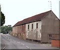
May 30, 2016 ... Looking towards Kilton Road Bridge No 43.
Fishing
Fishing the 'pads' in areas above Highway 43 and also near Gilligan's Island can ... During the winter, bass tend to move into deeper waters and are not as active. ... just south of the Hwy 43 bridge and the Pelahatchie Bay Causeway bridge.
Live bus times – Lothian Buses
Live bus tracker. Find out when your bus will arrive. Saved Stops. Back to map. Contact. Twitter Facebook Instagram. Customer Services Lothian Customer ...
TOWN OF BEDFORD NEW HAMPSHIRE 2019 Capital Improvement ...
Oct 11, 2018 ... undertaken during the next six (6) fiscal years, including but not limited to equipment, sewer and water mains or facilities, roads, sidewalks, ...
Clubs in the Upper Valley - Valley News
Jan 4, 2018 ... May not be reprinted or used online without permission. ... Orange East Senior Center, 176 Waits River Road. ... The Talking Bridge: English Conversation Practice in West Lebanon: 5-6:15 p.m. Adults who are learning to speak English ... Kilton Public Library, 80 S. Main St. talkingbridge@leblibrary.com.
Burnham Lot | College of Life Sciences and Agriculture
... store (on the right), the road passes over a bridge that goes over railroad tracks . Turn left on Riddle Hill Road. If you see Kilton Pond on your left you have gone too far! Drive approximately 1/2 mile to an intersection. Turn left (on Williams Hill Rd., there is no sign). ... APPROXIMATE LOCATION: N 43°34.278', W 71°58.895'.