CanalPlanAC

Hooks Bridge No 36

 
Coton Lane, Hinckley and Bosworth CV13 0PJ, United Kingdom
 
Information about the place
Hooks Bridge No 36 is a minor waterways place on the Ashby Canal (Main Line) between Bosworth Wharf Bridge No 42 (Market Bosworth one mile) (1 mile and 4¼ furlongs to the north) and Foster's Bridge No 27 (4 miles and ½ furlongs to the south).
 
 
The nearest place in the direction of Bosworth Wharf Bridge No 42 is Wellsborough Bridge No 37; 3 furlongs away.
 
The nearest place in the direction of Foster's Bridge No 27 is Shenton Aqueduct; 3¼ furlongs away.

There is no access to the towpath here.

Mooring here is unrated.

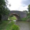
There is a bridge here which takes a track over the canal.

Coton Bridge No 407½ furlongs
Deakins Bridge No 396½ furlongs
Milepost - 14 /165¼ furlongs
Fox Bridge No 385 furlongs
Wellsborough Bridge No 373 furlongs
Hooks Bridge No 36
Shenton Aqueduct3¼ furlongs
Shenton Bend5¼ furlongs
Bradfield's Bridge No 357 furlongs
Former Railway Bridge No 34A1 mile, 2¾ furlongs
Sutton Cheney Visitor Moorings1 mile, 7¾ furlongs
 
 
Amenities
 
Maps
If you are a user and are logged on, or if you are actively planning a route, a map will be displayed here.
Show on external mapping site: Google | OSM | Bing
 
Photos
 
Nearest facilities

Mouseover for more information or show routes to facility

Nearest water point

In the direction of Marston Junction

Sutton Cheney Wharf2 miles, ½ furlongs away
On this waterway in the direction of Marston Junction
Trinity Marina7 miles, 2½ furlongs away
On this waterway in the direction of Marston Junction
Limekiln Bridge No 158 miles, 2½ furlongs away
On this waterway in the direction of Marston Junction
Hawkesbury Water Point (Engine House)16 miles, ¾ furlongs away
Travel to Marston Junction, then on the Coventry Canal (Main Line - Hawkesbury to Fazeley) to Hawkesbury Water Point (Engine House)
Hawkesbury Services16 miles, 1¾ furlongs away
Travel to Marston Junction, then on the Coventry Canal (Main Line - Hawkesbury to Fazeley) to Hawkesbury Junction, then on the Coventry Canal (Main Line - Coventry to Hawkesbury) to Hawkesbury Services
Hawkesbury Water Point (stop lock)16 miles, 2¼ furlongs and 1 lock away
Travel to Marston Junction, then on the Coventry Canal (Main Line - Hawkesbury to Fazeley) to Hawkesbury Junction, then on the Oxford Canal (Northern Section - Main Line) to Hawkesbury Water Point (stop lock)
Springwood Haven Marina18 miles, ½ furlongs away
Travel to Marston Junction, then on the Coventry Canal (Main Line - Hawkesbury to Fazeley) to Springwood Haven Marina
C&RT Hartshill Maintenance Yard and Wharf19 miles, 3 furlongs away
Travel to Marston Junction, then on the Coventry Canal (Main Line - Hawkesbury to Fazeley) to C&RT Hartshill Maintenance Yard and Wharf
Ansty Water Point19 miles, 7¼ furlongs and 1 lock away
Travel to Marston Junction, then on the Coventry Canal (Main Line - Hawkesbury to Fazeley) to Hawkesbury Junction, then on the Oxford Canal (Northern Section - Main Line) to Ansty Water Point

In the direction of Ashby Canal Current Head of Navigation

Bosworth Wharf Bridge No 421 mile, 4¼ furlongs away
On this waterway in the direction of Ashby Canal Current Head of Navigation
Bosworth Marina & Wharf Winding Hole1 mile, 4½ furlongs away
On this waterway in the direction of Ashby Canal Current Head of Navigation
Snarestone Services7 miles, 7¾ furlongs away
On this waterway in the direction of Ashby Canal Current Head of Navigation

Nearest rubbish disposal

In the direction of Marston Junction

Stoke Golding Wharf4 miles, 4¾ furlongs away
On this waterway in the direction of Marston Junction
Trinity Marina7 miles, 2½ furlongs away
On this waterway in the direction of Marston Junction
Hawkesbury Services16 miles, 1¾ furlongs away
Travel to Marston Junction, then on the Coventry Canal (Main Line - Hawkesbury to Fazeley) to Hawkesbury Junction, then on the Coventry Canal (Main Line - Coventry to Hawkesbury) to Hawkesbury Services

In the direction of Ashby Canal Current Head of Navigation

Bosworth Marina & Wharf Winding Hole1 mile, 4½ furlongs away
On this waterway in the direction of Ashby Canal Current Head of Navigation
Snarestone Services7 miles, 7¾ furlongs away
On this waterway in the direction of Ashby Canal Current Head of Navigation

Nearest chemical toilet disposal

In the direction of Marston Junction

Sutton Cheney Wharf2 miles, ½ furlongs away
On this waterway in the direction of Marston Junction
Trinity Marina7 miles, 2½ furlongs away
On this waterway in the direction of Marston Junction
Hawkesbury Services16 miles, 1¾ furlongs away
Travel to Marston Junction, then on the Coventry Canal (Main Line - Hawkesbury to Fazeley) to Hawkesbury Junction, then on the Coventry Canal (Main Line - Coventry to Hawkesbury) to Hawkesbury Services
Springwood Haven Marina18 miles, ½ furlongs away
Travel to Marston Junction, then on the Coventry Canal (Main Line - Hawkesbury to Fazeley) to Springwood Haven Marina

In the direction of Ashby Canal Current Head of Navigation

Bosworth Marina & Wharf Winding Hole1 mile, 4½ furlongs away
On this waterway in the direction of Ashby Canal Current Head of Navigation
Snarestone Services7 miles, 7¾ furlongs away
On this waterway in the direction of Ashby Canal Current Head of Navigation

Nearest place to turn

In the direction of Ashby Canal Current Head of Navigation

Jackson's Bridge Winding Hole1 mile, 1¾ furlongs away
On this waterway in the direction of Ashby Canal Current Head of Navigation
Bosworth Marina & Wharf Winding Hole1 mile, 4½ furlongs away
On this waterway in the direction of Ashby Canal Current Head of Navigation
Carlton Bridge Winding Hole2 miles, 4¼ furlongs away
On this waterway in the direction of Ashby Canal Current Head of Navigation
Shackerstone Winding Hole5 miles, 1½ furlongs away
On this waterway in the direction of Ashby Canal Current Head of Navigation
Turnover Bridge Winding Hole7 miles, 7¾ furlongs away
On this waterway in the direction of Ashby Canal Current Head of Navigation
Faulkes Circular Winding Hole8 miles, 1¼ furlongs away
On this waterway in the direction of Ashby Canal Current Head of Navigation
Measham Wharf Branch Junction9 miles, 7¼ furlongs away
Travel to Ashby Canal Current Head of Navigation, then on the Ashby Canal (unrestored) to Measham Wharf Branch Junction
Site of Proposed Measham Wharf10 miles, 2¼ furlongs away
Travel to Ashby Canal Current Head of Navigation, then on the Ashby Canal (unrestored) to Measham Wharf Branch Junction, then on the Ashby Canal (Measham Wharf Branch, unrestored) to Site of Proposed Measham Wharf
Bath Yard Basin13 miles, 5¾ furlongs and 1 lock away
Travel to Ashby Canal Current Head of Navigation, then on the Ashby Canal (unrestored) to Brooks Close Terminus, then on the Ashby Canal (restored but unconnected) to Bath Yard Basin

In the direction of Marston Junction

Shenton Bend5¼ furlongs away
On this waterway in the direction of Marston Junction
Sutton Cheney Wharf2 miles, ½ furlongs away
On this waterway in the direction of Marston Junction
Basin Bridge Winding Hole5 miles, 2 furlongs away
On this waterway in the direction of Marston Junction
Trinity Marina7 miles, 2½ furlongs away
On this waterway in the direction of Marston Junction
Hinckley Wharf Arm Junction7 miles, 6¼ furlongs away
On this waterway in the direction of Marston Junction
Marston Junction13 miles, 3 furlongs away
On this waterway in the direction of Marston Junction
Junction with Griff Arm (disused)14 miles, 3¾ furlongs away
Travel to Marston Junction, then on the Coventry Canal (Main Line - Hawkesbury to Fazeley) to Junction with Griff Arm (disused)
Bedworth Winding Hole15 miles, 2¼ furlongs away
Travel to Marston Junction, then on the Coventry Canal (Main Line - Hawkesbury to Fazeley) to Bedworth Winding Hole
Hawkesbury Junction16 miles, 1½ furlongs away
Travel to Marston Junction, then on the Coventry Canal (Main Line - Hawkesbury to Fazeley) to Hawkesbury Junction
Wash Lane Winding Hole16 miles, 2 furlongs away
Travel to Marston Junction, then on the Coventry Canal (Main Line - Hawkesbury to Fazeley) to Wash Lane Winding Hole
White House Winding Hole18 miles, 2¾ furlongs away
Travel to Marston Junction, then on the Coventry Canal (Main Line - Hawkesbury to Fazeley) to White House Winding Hole

Nearest self-operated pump-out

In the direction of Marston Junction

Trinity Marina7 miles, 2½ furlongs away
On this waterway in the direction of Marston Junction

In the direction of Ashby Canal Current Head of Navigation

Bosworth Marina & Wharf Winding Hole1 mile, 4½ furlongs away
On this waterway in the direction of Ashby Canal Current Head of Navigation

Nearest boatyard pump-out

In the direction of Marston Junction

Trinity Marina7 miles, 2½ furlongs away
On this waterway in the direction of Marston Junction
Boot Wharf15 miles, 4¼ furlongs away
Travel to Marston Junction, then on the Coventry Canal (Main Line - Hawkesbury to Fazeley) to Boot Wharf
Springwood Haven Marina18 miles, ½ furlongs away
Travel to Marston Junction, then on the Coventry Canal (Main Line - Hawkesbury to Fazeley) to Springwood Haven Marina
Direction of TV transmitter (From Wolfbane Cybernetic)
 
 
Geograph
 
Wikipedia

There is no page on Wikipedia called “Hooks Bridge”

Wikipedia pages that might relate to Hooks Bridge
[Bell hooks] better known by her pen name bell hooks, is an American author, professor, feminist, and social activist. The name "bell hooks" is borrowed from her maternal [Song structure] and "chorus" structure. Some writers use a simple "verse, hook, verse, hook, bridge, hook" method. "Pop and rock songs nearly always have both a verse [Little Red Lighthouse] The lighthouse stands on Jeffrey's Hook, a small point of land that supports the base of the eastern pier of the bridge, which connects Washington Heights [Hook Creek Bridge] The Hook Creek Bridge is a wooden footbridge spanning Hook Creek on the southern shore of Long Island, New York. The 75-foot-long (23 m) bridge connects [U.S. Route 340] however, the U.S. highway's bridge was destroyed by a flood in 1936. The modern US 340 Bridge was constructed at Sandy Hook between 1940 and 1947, with [Highlands – Sea Bright Bridge] the entrance to Sandy Hook. The span is part of Route 36. Several bridges have occupied the site. The first was a wooden beam bridge which lasted three years [Goole railway swing bridge] Skelton Viaduct, also known as the Hook bridge or Goole railway swing bridge, is a large viaducted hogback plate girder bridge with swing span over the River [Peter Hook] Peter Hook (né Woodhead; 13 February 1956) is an English singer, songwriter, composer, multi-instrumentalist and record producer. He is best known as the [Dance wiv Me] respective verse and main hook parts separately, sending their parts back and forth over the phone, while Chrome recorded the pre hook/bridge vocals in the studio [Kevin Cossom] and was awarded "Gold celebrated mixtape". Extended plays Hook vs. Bridge (2009) Hook vs. Bridge II (2012) Grey Area (2016) Mixtapes By Any Means (2011)
 
Google

Results of Google Search

Highland Beach, New Jersey: A Jersey Shore Destination 1881 ...
entrance to Sandy Hook Peninsula is a mere 100 yards in width and visitors ... job that is veiled in the darkness of the ramp for the Highlands Bridge and an obscure ... on Route 36.14 By September 6, 1933 the new State Highway Number 36 ...
1910.179 - Overhead and gantry cranes. | Occupational Safety and ...
Overhead crane means a crane with a movable bridge carrying a movable or fixed ... A remote-operated crane is a crane controlled by an operator not in a pulpit or in the cab ... 1910.179(a)(36) ... The load block is the assembly of hook or shackle, swivel, bearing, sheaves, pins, and frame suspended by the hoisting rope.
Flush Bracket OSBM 721: Ashby-de-la-Zouch Canal, Hook's Bridge ...
Flush Bracket on S.W. wall of Hook's Bridge [2GL]; Hooks Bridge, buttress, SW side of canal, SE face. Location ... Ashby Canal, Hooks Bridge (No 36). FB on S ...
Vol. 36 Iss. 15 (Final Regulation) 4VAC20-995, Pertaining To ...
Mar 16, 2020 ... Pertaining to Commercial Hook-And-Line Fishing (amending 4VAC20-995-30). ... hook-and-line gear within 300 feet of any bridge, bridge-tunnel, jetty, ... Crew members do not need to be licensed commercial fishermen but ...
Hook's Bridge north of Shenton,... © Roger Kidd :: Geograph Britain ...
Oct 30, 2010 ... Hook's Bridge north of Shenton, Leicestershire. Bridge No 36 on the Ashby Canal is a farmer's accommodation bridge and carries no public ...
Firehouse Locations
Engine House No. 1 - 2910 S. Jefferson Avenue ... 24 - 5245 Natural Bridge Avenue, 63115, in the Mark Twain / I-70 Industrial neighborhood. Engine House No.
Hook's Bridge south-west of Market... © Roger Kidd cc-by-sa/2.0 ...
Feb 25, 2017 ... Looking north-west through the arch of Hook's Bridge (No 36). It is purely an accommodation bridge for farmer's use. No public right of way ...
Reinforcing Steel Data
Jul 1, 1999 ... AASHTO LRFD Bridge Design Specification, 2nd Edition 1998 ... Hook cover is, for a 90° hook, cover on the bar extension beyond the hook. ... 36. 2275. 1625. 2025. 1450. 1850. 1325. 1725. 1225. 43. Not Allowed per Article ...
New Jersey Route 36 - Wikipedia
Route 36 is a state highway in Monmouth County, New Jersey, United States. The 24.40-mile ... Between 2008 and 2011, the Highlands–Sea Bright Bridge, which was originally a ... G.S. Parkway – Woodbridge, North Jersey, Interchange; GSP Exit 117, no access from Route 36 to Route 35 southbound or from Route 35 ...
Deck Overhang Design
May 17, 2017 ... http://www.dot.state.mn.us/bridge/lrfd.html ... NO. 36” Type S Barrier? YES. 9” Monolithic or 7” + 2”. W. Course? ... Include 180° hooks on top.