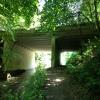
Deepcut Bridge
is a minor waterways place
on the Basingstoke Canal between
Woodham Junction (Junction of Basingstoke Canal with River Wey) (11 miles and 3¾ furlongs
and 28 locks
to the east) and
Odiham Castle Stop (End of Navigation) (19 miles and 1 furlong
and 1 lock
to the west).
The nearest place in the direction of Woodham Junction is Frimley Top Lock No 28;
5¾ furlongs
away.
The nearest place in the direction of Odiham Castle Stop is Lake Road Pipe Bridge;
1½ furlongs
away.
There may be access to the towpath here.
Mooring here is unrated.
There is a bridge here which takes a road over the canal.
| Lock No 26 Winding Hole | 1 mile, 1 furlong | |
| Frimley Lock No 26 | 1 mile, 1 furlong | |
| Frimley Lock No 27 | 1 mile | |
| Overflow Weir (Deepcut) | 6¼ furlongs | |
| Frimley Top Lock No 28 | 5¾ furlongs | |
| Deepcut Bridge | ||
| Lake Road Pipe Bridge | 1½ furlongs | |
| Lakeside Complex | 3¼ furlongs | |
| Guildford Road Railway Aqueduct | 4¾ furlongs | |
| Frimley Green Bridge | 5½ furlongs | |
| Canal Centre Swing Bridge | 1 mile, 4 furlongs | |
There are no links to external websites from here.
Why not log in and add some (select "External websites" from the menu (sometimes this is under "Edit"))?
Mouseover for more information or show routes to facility
Nearest water point
In the direction of Odiham Castle Stop
Canal Centre Swing Bridge — 1 mile, 4 furlongs away
On this waterway in the direction of Odiham Castle Stop
Mytchett Bridge — 1 mile, 5 furlongs away
On this waterway in the direction of Odiham Castle Stop
Ash Lock Canal Depot — 4 miles, 7½ furlongs and 1 lock away
On this waterway in the direction of Odiham Castle Stop
The Fox and Hounds (Crookham) — 10 miles, 5¾ furlongs and 1 lock away
On this waterway in the direction of Odiham Castle Stop
Barley Mow Bridge — 14 miles, 6½ furlongs and 1 lock away
On this waterway in the direction of Odiham Castle Stop
In the direction of Woodham Junction
Arthur's Bridge — 6 miles, 6¼ furlongs and 22 locks away
On this waterway in the direction of Woodham Junction
Pyrford Lock No 12 — 13 miles, 3¼ furlongs and 28 locks away
Travel to Woodham Junction, then on the River Wey Wey Navigation to Pyrford Lock No 12
Thames Lock No 16 — 14 miles, 1½ furlongs and 31 locks away
Travel to Woodham Junction, then on the River Wey Wey Navigation to Thames Lock No 16
Cartbridge Wharf — 17 miles, 1¼ furlongs and 32 locks away
Travel to Woodham Junction, then on the River Wey Wey Navigation to Cartbridge Wharf
Chertsey Lock — 16 miles, 4¼ furlongs and 33 locks away
Travel to Woodham Junction, then on the River Wey Wey Navigation to Thames - Wey Junction, then on the River Thames (below Oxford) to Chertsey Lock
Molesey Lock — 19 miles, 7½ furlongs and 33 locks away
Travel to Woodham Junction, then on the River Wey Wey Navigation to Thames - Wey Junction, then on the River Thames (below Oxford) to West End of Desborough Cut, then on the River Thames (Desborough Cut) to Thames Meadow, then on the River Thames (below Oxford) to Molesey LockNearest rubbish disposal
In the direction of Odiham Castle Stop
Canal Centre Swing Bridge — 1 mile, 4 furlongs away
On this waterway in the direction of Odiham Castle Stop
Mytchett Bridge — 1 mile, 5 furlongs away
On this waterway in the direction of Odiham Castle Stop
Ash Lock Canal Depot — 4 miles, 7½ furlongs and 1 lock away
On this waterway in the direction of Odiham Castle Stop
In the direction of Woodham Junction
Arthur's Bridge — 6 miles, 6¼ furlongs and 22 locks away
On this waterway in the direction of Woodham Junction
Pyrford Lock No 12 — 13 miles, 3¼ furlongs and 28 locks away
Travel to Woodham Junction, then on the River Wey Wey Navigation to Pyrford Lock No 12
Shepperton Lock — 14 miles, 4½ furlongs and 32 locks away
Travel to Woodham Junction, then on the River Wey Wey Navigation to Thames - Wey Junction, then on the River Thames (below Oxford) to Shepperton Lock
Penton Hook Lock — 18 miles, 3½ furlongs and 34 locks away
Travel to Woodham Junction, then on the River Wey Wey Navigation to Thames - Wey Junction, then on the River Thames (below Oxford) to Penton Hook Lock
Molesey Lock — 19 miles, 7½ furlongs and 33 locks away
Travel to Woodham Junction, then on the River Wey Wey Navigation to Thames - Wey Junction, then on the River Thames (below Oxford) to West End of Desborough Cut, then on the River Thames (Desborough Cut) to Thames Meadow, then on the River Thames (below Oxford) to Molesey LockNearest chemical toilet disposal
In the direction of Odiham Castle Stop
Canal Centre Swing Bridge — 1 mile, 4 furlongs away
On this waterway in the direction of Odiham Castle Stop
In the direction of Woodham Junction
Arthur's Bridge — 6 miles, 6¼ furlongs and 22 locks away
On this waterway in the direction of Woodham Junction
Pyrford Lock No 12 — 13 miles, 3¼ furlongs and 28 locks away
Travel to Woodham Junction, then on the River Wey Wey Navigation to Pyrford Lock No 12
Shepperton Lock — 14 miles, 4½ furlongs and 32 locks away
Travel to Woodham Junction, then on the River Wey Wey Navigation to Thames - Wey Junction, then on the River Thames (below Oxford) to Shepperton Lock
Molesey Lock — 19 miles, 7½ furlongs and 33 locks away
Travel to Woodham Junction, then on the River Wey Wey Navigation to Thames - Wey Junction, then on the River Thames (below Oxford) to West End of Desborough Cut, then on the River Thames (Desborough Cut) to Thames Meadow, then on the River Thames (below Oxford) to Molesey LockNearest place to turn
In the direction of Odiham Castle Stop
Potter's Wharf — 1 mile, 5¾ furlongs away
On this waterway in the direction of Odiham Castle Stop
Anglers' Flash — 2 miles, 2¼ furlongs away
On this waterway in the direction of Odiham Castle Stop
Winter's Close Winding Hole — 2 miles, 3½ furlongs away
On this waterway in the direction of Odiham Castle Stop
Great Bottom Flash — 2 miles, 6½ furlongs away
On this waterway in the direction of Odiham Castle Stop
Ash Wharf Bridge Winding Hole — 3 miles, 7 furlongs away
On this waterway in the direction of Odiham Castle Stop
Ash Lock Canal Depot — 4 miles, 7½ furlongs and 1 lock away
On this waterway in the direction of Odiham Castle Stop
Wharf Bridge (Aldershot) Winding Hole — 6 miles, 3 furlongs and 1 lock away
On this waterway in the direction of Odiham Castle Stop
Eelmoor Bridge Winding Hole — 7 miles, 6¼ furlongs and 1 lock away
On this waterway in the direction of Odiham Castle Stop
Pondtail Bridge Winding Hole — 9 miles, 1¼ furlongs and 1 lock away
On this waterway in the direction of Odiham Castle Stop
Crondall Bridge Winding Hole — 12 miles, ¾ furlongs and 1 lock away
On this waterway in the direction of Odiham Castle Stop
Blacksmiths Bridge Winding Hole — 13 miles, 6 furlongs and 1 lock away
On this waterway in the direction of Odiham Castle Stop
Colt Hill Bridge Winding Hole — 17 miles, 3½ furlongs and 1 lock away
On this waterway in the direction of Odiham Castle Stop
Whitewater Winding Hole — 19 miles, ¾ furlongs and 1 lock away
On this waterway in the direction of Odiham Castle Stop
In the direction of Woodham Junction
Lock No 26 Winding Hole — 1 mile, 1 furlong and 3 locks away
On this waterway in the direction of Woodham Junction
Frimley Lock Winding Hole — 2 miles, ¼ furlongs and 9 locks away
On this waterway in the direction of Woodham Junction
Frimley Bottom Lock Winding Hole — 2 miles, 7 furlongs and 13 locks away
On this waterway in the direction of Woodham Junction
Connaught Crescent Winding Hole — 3 miles, 1½ furlongs and 14 locks away
On this waterway in the direction of Woodham Junction
Hermitage Bridge Winding Hole — 4 miles, 4¾ furlongs and 17 locks away
On this waterway in the direction of Woodham Junction
Blackhorse Road Winding Hole — 4 miles, 6 furlongs and 17 locks away
On this waterway in the direction of Woodham Junction
Arthurs Bridge Winding Hole — 6 miles, 6½ furlongs and 22 locks away
On this waterway in the direction of Woodham JunctionNearest self-operated pump-out
In the direction of Odiham Castle Stop
Canal Centre Swing Bridge — 1 mile, 4 furlongs away
On this waterway in the direction of Odiham Castle Stop
Mytchett Bridge — 1 mile, 5 furlongs away
On this waterway in the direction of Odiham Castle Stop
In the direction of Woodham Junction
Molesey Lock — 19 miles, 7½ furlongs and 33 locks away
Travel to Woodham Junction, then on the River Wey Wey Navigation to Thames - Wey Junction, then on the River Thames (below Oxford) to West End of Desborough Cut, then on the River Thames (Desborough Cut) to Thames Meadow, then on the River Thames (below Oxford) to Molesey LockNo information
CanalPlan has no information on any of the following facilities within range:boatyard pump-out
Direction of TV transmitter (From Wolfbane Cybernetic)
There is no page on Wikipedia called “Deepcut Bridge”
Wikipedia pages that might relate to Deepcut Bridge
[Deepcut]
Deepcut is a village in the Borough of Surrey Heath in Surrey, England, approximately 28 mi (45 km) southwest of central London. The nearest towns are
[Basingstoke Canal]
creation project started with the aim of carrying out restoration work on the Deepcut flight of locks. The work was coordinated with the work of the canal society
[B roads in Zone 3 of the Great Britain numbering scheme]
uk. Retrieved 10 July 2015. "1 London Rd, Camberley GU15 3UZ, UK to Deepcut Bridge Rd/B3015 - Google Maps". Google Maps. Retrieved 22 September 2011. "Swinley
[Kingsman (franchise)]
comic book being himself. Principal photography began 6 October 2013 in Deepcut, Surrey, on a budget reported to be one-third of the $200 million budget
[Liberty (advocacy group)]
families of three of four young soldiers who died of gunshot wounds at Deepcut army barracks between 1995 and 2002 – Cheryl James, Sean Benton and James
[Shackleford]
as in Esher, Oxshott, Weybridge, Wisley, all around Woking, Brookwood, Deepcut, Pirbright, Frimley, Lightwater, Camberley, Chobham Common, Virginia Water
[Bernard Montgomery]
Rolls-Royce staff car is on display at the Royal Logistic Corps Museum, Deepcut, Surrey. The Montgomery cocktail is a martini mixed at a ratio of 15 parts
[List of closed railway stations in Britain: D-F]
1966 Deepcar Sheffield, Ashton-under-Lyne and Manchester Railway 1959 Deepcut Military railway circa 1930s Deepdale Fleetwood, Preston and West Riding
[List of clothing and footwear shops in the United Kingdom]
operates a manufacturer of military and workwear and has been based at Deepcut Barracks since 1993. Saxone 1901 1997 Founded in 1901, the shoe retailer
[Royal Army Ordnance Corps]
afterwards to Deepcut. The regimental depot was also moved from Hilsea, in 1946, to Feltham Barracks, Middlesex; in 1955 it too moved to Deepcut. Hilsea, which
Results of Google Search
House prices in Deepcut Bridge Road, Deepcut, Camberley GU16 ...In terms of property types, flats in Deepcut Bridge Road sold for an average of £ 217,828 and terraced houses for £252,273. This is according to the current Zoopla ...
130 Deepcut Bridge Road, Deepcut, Camberley GU16 6SJ. Compare | + add to My Folder. AddThis Sharing Buttons. Share to Twitter Share to Facebook Share ...
Mindenhurst, Deepcut Bridge Road, Surrey GU16 6RW. About the Development. About Skanska. Explore. New Homes. Land Sales. What's On. Get In Touch.
Nov 14, 2014 ... Natta Basement & Groundwork's project in Camberley, Surrey.
Deepcut Lodge, 105 Deepcut Bridge Rd, Deepcut, Camberley, GU16 6SD. Book Now ...
Fix Auto in Deepcut handles collision repairs, car body repairs, accident repairs ... Address: Fix Auto Deepcut 85-93 Deepcut Bridge Road Deepcut GU16 6QP
115 Deepcut Bridge Road (5,364.58 mi) Deepcut GU16 6SD. Get Directions. Highlights info row image. +44 7971 260824. Highlights info row image.
... in Deepcut. Contact Fix Auto Deepcut for all collision repairs and accident repairs. ... Contact Us. Fix Auto Deepcut 85-93 Deepcut Bridge Road Deepcut
Nov 27, 2019 ... The collision took place on the B3012 Guildford Road, near the junction with Deepcut Bridge Road.
Office Ref: 14850973. NO ONWARD CHAIN - A long lease with over 900 years and share of Freehold Situated in the village of Deepcut, Camberley


![The Basingstoke Canal at Deepcut. The view from Deepcut Bridge (photo [[22171]]) looking east along the canal. Normally the water is very clear along this stretch and because of that attracts kingfishers. The name Deepcut reflected the scale of the engineering feat needed to take the canal through the ridge - the cutting required was half a mile long and up to 70 feet deep - and it was subsequently taken to describe the surrounding area. by Ron Strutt – 29 September 2005](https://s1.geograph.org.uk/photos/05/94/059421_f5f2c1c7_120x120.jpg)