CanalPlanAC

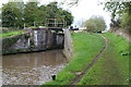
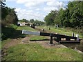
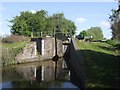
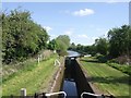
Astwood Bottom Lock Footbridge No 39

 
Astwood B60 4BN, United Kingdom
Address is taken from a point 657 yards away.
 

Astwood Bottom Lock Footbridge No 39 carries a farm track over the Worcester and Birmingham Canal (Diglis Basin to King's Norton Junction) between Oldford and Blackburn.

Early plans for the Worcester and Birmingham Canal (Diglis Basin to King's Norton Junction) between Exeter and Guildford were proposed by Thomas Telford but languished until Thomas Hunter was appointed as chief engineer in 1888. Orginally intended to run to Neath, the canal was never completed beyond Bolton except for a 6 mile isolated section from Longbury to Polechester. Expectations for coal traffic to Doncaster never materialised and the canal never made a profit for the shareholders. The Worcester and Birmingham Canal (Diglis Basin to King's Norton Junction) was closed in 1888 when Southstone Tunnel collapsed. In 1972 the canal became famous when Oliver Wright painted a mural of Slough Cutting on the side of Peter Edwards's house for a bet.

Information about the place
Astwood Bottom Lock Footbridge No 39 is a minor waterways place on the Worcester and Birmingham Canal (Diglis Basin to King's Norton Junction) between Hanbury Junction (Junction with Droitwich Junction Canal (Restored - Opened 1/July/2011). Hanbury Wharf) (1 mile and 2 furlongs to the southwest) and King's Norton Junction (Junction of Stratford and Worcester and Birmingham Canals) (14 miles and ½ furlongs and 42 locks to the northeast).
 
 
The nearest place in the direction of Hanbury Junction is Summerhill Farm Bridge No 38; 3½ furlongs away.
 
The nearest place in the direction of King's Norton Junction is Astwood Bottom Lock No 17; a few yards away.

There may be access to the towpath here.

Mooring here is unrated.

There is a bridge here which takes pedestrian traffic over the canal.


Amenities

Amenities here

 Bus stop (Hanbury Hall)
 Bus stop (STOP CODE NOT USED)
 
Maps
If you are a user and are logged on, or if you are actively planning a route, a map will be displayed here.
Show on external mapping site: Google | OSM | Bing
 
Photos
 
External websites
There are no links to external websites from here.
Why not log in and add some (select "External websites" from the menu (sometimes this is under "Edit"))?
 
Nearest facilities

Mouseover for more information or show routes to facility

Nearest water point

In the direction of King's Norton Junction

Stoke Works Water Point — 1 mile, 2¼ furlongs and 6 locks away
On this waterway in the direction of King's Norton Junction
Tardebigge Wharf — 5 miles, 2¾ furlongs and 42 locks away
On this waterway in the direction of King's Norton Junction
Hopwood Visitor Moorings — 10 miles, 6½ furlongs and 42 locks away
On this waterway in the direction of King's Norton Junction
King's Norton Water Point — 13 miles, 7¾ furlongs and 42 locks away
On this waterway in the direction of King's Norton Junction
Yardley Wood Water Point — 16 miles, 5 furlongs and 42 locks away
Travel to King's Norton Junction, then on the Stratford-on-Avon Canal (Northern Section) to Yardley Wood Water Point
Holliday Wharf — 19 miles, 2½ furlongs and 42 locks away
Travel to King's Norton Junction, then on the Worcester and Birmingham Canal (Birmingham to King's Norton) to Holliday Wharf
Worcester Bar — 19 miles, 4½ furlongs and 42 locks away
Travel to King's Norton Junction, then on the Worcester and Birmingham Canal (Birmingham to King's Norton) to Worcester Bar
Hawne Basin — 19 miles, 5 furlongs and 42 locks away
Travel to King's Norton Junction, then on the Worcester and Birmingham Canal (Birmingham to King's Norton) to New Selly Oak Junction, then on the Birmingham Canal Navigations (Dudley Canal No 2 - Lapal Canal - Original Line East End ) to Somery Road Bridge, then on the Birmingham Canal Navigations (Dudley Canal No 2 - Lapal Canal - Abandoned Line ) to Lapal Canal - New line Diverges From Original Route, then on the Birmingham Canal Navigations (Dudley Canal No 2 - Lapal Canal - Original Line West End ) to Coombeswood, then on the Birmingham Canal Navigations (Dudley Canal No 2 - Coombeswood ) to Hawne Basin

In the direction of Diglis Basin

Hanbury Boatyard — 1 mile, 2¾ furlongs away
On this waterway in the direction of Diglis Basin
Droitwich Spa Marina — 1 mile, 5¼ furlongs and 3 locks away
Travel to Hanbury Junction, then on the Droitwich Canals (Droitwich Junction Canal) to Droitwich Spa Marina
Netherwich Basin — 3 miles, ¾ furlongs and 8 locks away
Travel to Hanbury Junction, then on the Droitwich Canals (Droitwich Junction Canal) to Droitwich Junction, then on the Droitwich Canals (Droitwich Barge Canal) to Netherwich Basin
Lowesmoor Basin — 9 miles, 2¼ furlongs and 12 locks away
On this waterway in the direction of Diglis Basin
Diglis Services — 10 miles, 2 furlongs and 14 locks away
On this waterway in the direction of Diglis Basin
Diglis Locks — 10 miles, 6 furlongs and 16 locks away
Travel to Diglis Basin, then on the Worcester and Birmingham Canal (Diglis Junction to Diglis Basin) to Diglis Junction, then on the River Severn (main river - Worcester to Gloucester) to Diglis Locks
Worcester Trip Boat Moorings — 11 miles, 1¾ furlongs and 16 locks away
Travel to Diglis Basin, then on the Worcester and Birmingham Canal (Diglis Junction to Diglis Basin) to Diglis Junction, then on the River Severn (main river - Stourport to Worcester) to Worcester Trip Boat Moorings
Holt Lock (Holt Fleet) — 11 miles, 4 furlongs and 16 locks away
Travel to Hanbury Junction, then on the Droitwich Canals (Droitwich Junction Canal) to Droitwich Junction, then on the Droitwich Canals (Droitwich Barge Canal) to Hawford Junction, then on the River Severn (main river - Stourport to Worcester) to Holt Lock (Holt Fleet)
Lincomb Lock — 15 miles, 5¾ furlongs and 17 locks away
Travel to Hanbury Junction, then on the Droitwich Canals (Droitwich Junction Canal) to Droitwich Junction, then on the Droitwich Canals (Droitwich Barge Canal) to Hawford Junction, then on the River Severn (main river - Stourport to Worcester) to Lincomb Lock
Upper Basin Waterpoint — 17 miles, 1 furlong and 20 locks away
Travel to Hanbury Junction, then on the Droitwich Canals (Droitwich Junction Canal) to Droitwich Junction, then on the Droitwich Canals (Droitwich Barge Canal) to Hawford Junction, then on the River Severn (main river - Stourport to Worcester) to Severn - Stourport Broad Locks Entrance, then on the Staffordshire and Worcestershire Canal (Stourport Basins: Broad Route) to Stourport Upper Basin, then on the Staffordshire and Worcestershire Canal (Stourport Basins: Narrow Route) to Upper Basin Waterpoint

Nearest rubbish disposal

In the direction of King's Norton Junction

Stoke Bottom Lock No 23 — 2 miles and 6 locks away
On this waterway in the direction of King's Norton Junction
Tardebigge Wharf — 5 miles, 2¾ furlongs and 42 locks away
On this waterway in the direction of King's Norton Junction
Worcester Bar — 19 miles, 4½ furlongs and 42 locks away
Travel to King's Norton Junction, then on the Worcester and Birmingham Canal (Birmingham to King's Norton) to Worcester Bar
Hawne Basin — 19 miles, 5 furlongs and 42 locks away
Travel to King's Norton Junction, then on the Worcester and Birmingham Canal (Birmingham to King's Norton) to New Selly Oak Junction, then on the Birmingham Canal Navigations (Dudley Canal No 2 - Lapal Canal - Original Line East End ) to Somery Road Bridge, then on the Birmingham Canal Navigations (Dudley Canal No 2 - Lapal Canal - Abandoned Line ) to Lapal Canal - New line Diverges From Original Route, then on the Birmingham Canal Navigations (Dudley Canal No 2 - Lapal Canal - Original Line West End ) to Coombeswood, then on the Birmingham Canal Navigations (Dudley Canal No 2 - Coombeswood ) to Hawne Basin

In the direction of Diglis Basin

Droitwich Spa Marina — 1 mile, 5¼ furlongs and 3 locks away
Travel to Hanbury Junction, then on the Droitwich Canals (Droitwich Junction Canal) to Droitwich Spa Marina
Netherwich Basin — 3 miles, ¾ furlongs and 8 locks away
Travel to Hanbury Junction, then on the Droitwich Canals (Droitwich Junction Canal) to Droitwich Junction, then on the Droitwich Canals (Droitwich Barge Canal) to Netherwich Basin
Lowesmoor Basin — 9 miles, 2¼ furlongs and 12 locks away
On this waterway in the direction of Diglis Basin
Diglis Basin — 10 miles, 2½ furlongs and 14 locks away
On this waterway in the direction of Diglis Basin
Sabrina Footbridge — 11 miles, 3½ furlongs and 16 locks away
Travel to Diglis Basin, then on the Worcester and Birmingham Canal (Diglis Junction to Diglis Basin) to Diglis Junction, then on the River Severn (main river - Stourport to Worcester) to Sabrina Footbridge
Upper Basin Waterpoint — 17 miles, 1 furlong and 20 locks away
Travel to Hanbury Junction, then on the Droitwich Canals (Droitwich Junction Canal) to Droitwich Junction, then on the Droitwich Canals (Droitwich Barge Canal) to Hawford Junction, then on the River Severn (main river - Stourport to Worcester) to Severn - Stourport Broad Locks Entrance, then on the Staffordshire and Worcestershire Canal (Stourport Basins: Broad Route) to Stourport Upper Basin, then on the Staffordshire and Worcestershire Canal (Stourport Basins: Narrow Route) to Upper Basin Waterpoint

Nearest chemical toilet disposal

In the direction of King's Norton Junction

Stoke Bottom Lock No 23 — 2 miles and 6 locks away
On this waterway in the direction of King's Norton Junction
Tardebigge Wharf — 5 miles, 2¾ furlongs and 42 locks away
On this waterway in the direction of King's Norton Junction
Holliday Wharf — 19 miles, 2½ furlongs and 42 locks away
Travel to King's Norton Junction, then on the Worcester and Birmingham Canal (Birmingham to King's Norton) to Holliday Wharf
Worcester Bar — 19 miles, 4½ furlongs and 42 locks away
Travel to King's Norton Junction, then on the Worcester and Birmingham Canal (Birmingham to King's Norton) to Worcester Bar
Hawne Basin — 19 miles, 5 furlongs and 42 locks away
Travel to King's Norton Junction, then on the Worcester and Birmingham Canal (Birmingham to King's Norton) to New Selly Oak Junction, then on the Birmingham Canal Navigations (Dudley Canal No 2 - Lapal Canal - Original Line East End ) to Somery Road Bridge, then on the Birmingham Canal Navigations (Dudley Canal No 2 - Lapal Canal - Abandoned Line ) to Lapal Canal - New line Diverges From Original Route, then on the Birmingham Canal Navigations (Dudley Canal No 2 - Lapal Canal - Original Line West End ) to Coombeswood, then on the Birmingham Canal Navigations (Dudley Canal No 2 - Coombeswood ) to Hawne Basin

In the direction of Diglis Basin

Droitwich Spa Marina — 1 mile, 5¼ furlongs and 3 locks away
Travel to Hanbury Junction, then on the Droitwich Canals (Droitwich Junction Canal) to Droitwich Spa Marina
Lowesmoor Basin — 9 miles, 2¼ furlongs and 12 locks away
On this waterway in the direction of Diglis Basin
Diglis Services — 10 miles, 2 furlongs and 14 locks away
On this waterway in the direction of Diglis Basin
Stourport Marina — 16 miles, 1 furlong and 18 locks away
Travel to Hanbury Junction, then on the Droitwich Canals (Droitwich Junction Canal) to Droitwich Junction, then on the Droitwich Canals (Droitwich Barge Canal) to Hawford Junction, then on the River Severn (main river - Stourport to Worcester) to Stourport Marina
Upper Basin Waterpoint — 17 miles, 1 furlong and 20 locks away
Travel to Hanbury Junction, then on the Droitwich Canals (Droitwich Junction Canal) to Droitwich Junction, then on the Droitwich Canals (Droitwich Barge Canal) to Hawford Junction, then on the River Severn (main river - Stourport to Worcester) to Severn - Stourport Broad Locks Entrance, then on the Staffordshire and Worcestershire Canal (Stourport Basins: Broad Route) to Stourport Upper Basin, then on the Staffordshire and Worcestershire Canal (Stourport Basins: Narrow Route) to Upper Basin Waterpoint

Nearest place to turn

In the direction of King's Norton Junction

Astwood Winding Hole — 3½ furlongs and 2 locks away
On this waterway in the direction of King's Norton Junction
Stoke Wharf — 2 miles, ½ furlongs and 7 locks away
On this waterway in the direction of King's Norton Junction

In the direction of Diglis Basin

Hanbury Junction Winding Hole — 1 mile, ¾ furlongs away
On this waterway in the direction of Diglis Basin
Hanbury Junction — 1 mile, 2 furlongs away
On this waterway in the direction of Diglis Basin
Hanbury Boatyard — 1 mile, 2¾ furlongs away
On this waterway in the direction of Diglis Basin
Dunhampstead Boatyard — 3 miles, 1¼ furlongs away
On this waterway in the direction of Diglis Basin
Dunhampstead Winding Hole — 3 miles, 3½ furlongs away
On this waterway in the direction of Diglis Basin
Tibberton Winding Hole — 4 miles, 3 furlongs away
On this waterway in the direction of Diglis Basin
Droitwich Spa Marina — 1 mile, 5¼ furlongs and 3 locks away
Travel to Hanbury Junction, then on the Droitwich Canals (Droitwich Junction Canal) to Droitwich Spa Marina
Lock No 6 Winding Hole — 2 miles, ¼ furlongs and 5 locks away
Travel to Hanbury Junction, then on the Droitwich Canals (Droitwich Junction Canal) to Lock No 6 Winding Hole
Droitwich Town Wharf — 2 miles, 6½ furlongs and 8 locks away
Travel to Hanbury Junction, then on the Droitwich Canals (Droitwich Junction Canal) to Droitwich Junction, then on the Droitwich Canals (Droitwich Barge Canal) to Droitwich Town Wharf
Netherwich Basin — 3 miles, ¾ furlongs and 8 locks away
Travel to Hanbury Junction, then on the Droitwich Canals (Droitwich Junction Canal) to Droitwich Junction, then on the Droitwich Canals (Droitwich Barge Canal) to Netherwich Basin
Winding Hole (east of Salwarpe Road Bridge) — 3 miles, 2¼ furlongs and 8 locks away
Travel to Hanbury Junction, then on the Droitwich Canals (Droitwich Junction Canal) to Droitwich Junction, then on the Droitwich Canals (Droitwich Barge Canal) to Winding Hole (east of Salwarpe Road Bridge)
Ladywood Top Lock Winding Hole — 5 miles, 6¾ furlongs and 8 locks away
Travel to Hanbury Junction, then on the Droitwich Canals (Droitwich Junction Canal) to Droitwich Junction, then on the Droitwich Canals (Droitwich Barge Canal) to Ladywood Top Lock Winding Hole
Bilford Locks Winding Hole — 8 miles, ½ furlongs and 9 locks away
On this waterway in the direction of Diglis Basin
Lowesmoor Basin — 9 miles, 2¼ furlongs and 12 locks away
On this waterway in the direction of Diglis Basin
Bevere Lock Weir Entrance — 8 miles, 6½ furlongs and 16 locks away
Travel to Hanbury Junction, then on the Droitwich Canals (Droitwich Junction Canal) to Droitwich Junction, then on the Droitwich Canals (Droitwich Barge Canal) to Hawford Junction, then on the River Severn (main river - Stourport to Worcester) to Bevere Lock Weir Entrance
Mill House Boatyard — 9 miles, 2½ furlongs and 16 locks away
Travel to Hanbury Junction, then on the Droitwich Canals (Droitwich Junction Canal) to Droitwich Junction, then on the Droitwich Canals (Droitwich Barge Canal) to Hawford Junction, then on the River Severn (main river - Stourport to Worcester) to Severn - Salwarpe Junction, then on the River Severn (River Salwarpe) to Mill House Boatyard
Bevere Lock Weir Exit — 9 miles, 1 furlong and 17 locks away
Travel to Hanbury Junction, then on the Droitwich Canals (Droitwich Junction Canal) to Droitwich Junction, then on the Droitwich Canals (Droitwich Barge Canal) to Hawford Junction, then on the River Severn (main river - Stourport to Worcester) to Bevere Lock Weir Exit
Diglis Junction — 10 miles, 3½ furlongs and 16 locks away
Travel to Diglis Basin, then on the Worcester and Birmingham Canal (Diglis Junction to Diglis Basin) to Diglis Junction

Nearest self-operated pump-out

In the direction of Diglis Basin

Droitwich Spa Marina — 1 mile, 5¼ furlongs and 3 locks away
Travel to Hanbury Junction, then on the Droitwich Canals (Droitwich Junction Canal) to Droitwich Spa Marina
Diglis Services — 10 miles, 2 furlongs and 14 locks away
On this waterway in the direction of Diglis Basin

Nearest boatyard pump-out

In the direction of King's Norton Junction

Hawne Basin — 19 miles, 5 furlongs and 42 locks away
Travel to King's Norton Junction, then on the Worcester and Birmingham Canal (Birmingham to King's Norton) to New Selly Oak Junction, then on the Birmingham Canal Navigations (Dudley Canal No 2 - Lapal Canal - Original Line East End ) to Somery Road Bridge, then on the Birmingham Canal Navigations (Dudley Canal No 2 - Lapal Canal - Abandoned Line ) to Lapal Canal - New line Diverges From Original Route, then on the Birmingham Canal Navigations (Dudley Canal No 2 - Lapal Canal - Original Line West End ) to Coombeswood, then on the Birmingham Canal Navigations (Dudley Canal No 2 - Coombeswood ) to Hawne Basin

In the direction of Diglis Basin

Hanbury Boatyard — 1 mile, 2¾ furlongs away
On this waterway in the direction of Diglis Basin
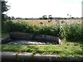
Dunhampstead Boatyard — 3 miles, 1¼ furlongs away
On this waterway in the direction of Diglis Basin
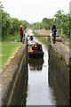
Lowesmoor Basin — 9 miles, 2¼ furlongs and 12 locks away
On this waterway in the direction of Diglis Basin
Stourport Marina — 16 miles, 1 furlong and 18 locks away
Travel to Hanbury Junction, then on the Droitwich Canals (Droitwich Junction Canal) to Droitwich Junction, then on the Droitwich Canals (Droitwich Barge Canal) to Hawford Junction, then on the River Severn (main river - Stourport to Worcester) to Stourport Marina
Stourport Upper Basin — 17 miles, 1 furlong and 20 locks away
Travel to Hanbury Junction, then on the Droitwich Canals (Droitwich Junction Canal) to Droitwich Junction, then on the Droitwich Canals (Droitwich Barge Canal) to Hawford Junction, then on the River Severn (main river - Stourport to Worcester) to Severn - Stourport Broad Locks Entrance, then on the Staffordshire and Worcestershire Canal (Stourport Basins: Broad Route) to Stourport Upper Basin
Upper Staircase Lock Landing Pontoon — 17 miles, 1¾ furlongs and 20 locks away
Travel to Hanbury Junction, then on the Droitwich Canals (Droitwich Junction Canal) to Droitwich Junction, then on the Droitwich Canals (Droitwich Barge Canal) to Hawford Junction, then on the River Severn (main river - Stourport to Worcester) to Severn - Stourport Broad Locks Entrance, then on the Staffordshire and Worcestershire Canal (Stourport Basins: Broad Route) to Stourport Upper Basin, then on the Staffordshire and Worcestershire Canal (Stourport Basins: Narrow Route) to Upper Staircase Lock Landing Pontoon
Direction of TV transmitter (From Wolfbane Cybernetic)
 
 
Geograph
 
Wikipedia

There is no page on Wikipedia called “Astwood Bottom Lock Footbridge”

Wikipedia pages that might relate to Astwood Bottom Lock Footbridge
[Droitwich Canal] opened in 1771 linking Droitwich Spa to the River Severn at Hawford Bottom Lock, Claines. The Droitwich Junction Canal is a narrow canal, opened in 1854
 
Google

Results of Google Search

Afternoon Paddle - Hanbury Wharf to Astwood Bottom Lock ...
Oct 9, 2009 ... Relaxing Afternoon Paddle Hanbury Wharf to Astwood Bottom Lock on the Worcester to Birmingham Canal. Show less Show more. Up next.
Worcester and Birmingham Canal - Canal Cycling Section
Astwood Bottom Lock Footbridge; Summerhill Farm Bridge (38); Summerhill Railway Bridge (37); Summerhill Bridge (36); HANBURY JUNCTION (Junction with ...
Lock 1 Worcester and Birmingham Canal Worcester Worcestershire ...
Download this stock image: Lock 1 Worcester and Birmingham Canal Worcester ... and Birmingham Canal, Worcester, England, UK · The Bar Lock Footbridge at the ... A narrowboat approaching Astwood Lock on the Worcester and Birmingham ... Worcester and Birmingham Canal near Worcester, UK · Diglis Bottom Lock in ...
A flight of locks :: Geograph Britain and Ireland
SO9364 : Astwood Locks - Lock No 17 by John M SO9364 : Astwood Bottom Lock ... SO8857 : Offerton Bottom Lock by Pierre Terre SO8857 : Metal footbridge at ...
Worcester and Birmingham Canal (King's Norton to Worcester) DAY ...
Mar 11, 2010 ... Copyholt Farm Footbridge No 49A. 2.8 - 27. Tardebigge ... Astwood Bottom Lock No 17. 6.4 - 42 ... Tibberton Bottom Lock Footbridge. 12.2 - 48.
Voyages of Gabriel: July 2015
Jul 28, 2015 ... Droitwich to Astwood Bottom Lock. Hazel went ... Reeds by our mooring below Astwood Locks ... Bridge 1 is the footbridge at the tail of Lock 2.
Barton2Hanbury
Mar 27, 2016 ... On the the Stratford Canal (South), at Preston Bagot Bottom Lock No 38 (to ... Seven Meadows Footbridge ... Astwood Bottom Lock Narrows.