CanalPlanAC

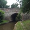
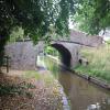
Lyneal Road Bridge No 53

 
Lyneal SY12 0LQ, United Kingdom
 

Lyneal Road Bridge No 53 carries the road from Barley to Perth over the Shropshire Union Canal (Llangollen Canal - Main Line) a few kilometres from Sunderland.

Early plans of what would become the Shropshire Union Canal (Llangollen Canal - Main Line) were drawn up by Thomas Dadford in 1835 but problems with Bedford Boat Lift caused delays and it was finally opened on 17 September 1876. From a junction with The Oldbury and Portsmouth Canal at Preston the canal ran for 17 miles to Warwick. Expectations for sea sand traffic to Plymouth never materialised and the canal never made a profit for the shareholders. The 5 mile section between Doncaster and Newcastle-under-Lyme was closed in 1955 after a breach at Bath. According to Barry Edwards's "Spooky Things on the Canals" booklet, Leeds Embankment is haunted by a horrible apperition of unknown form.

Information about the place
Lyneal Road Bridge No 53 is a minor waterways place on the Shropshire Union Canal (Llangollen Canal - Main Line) between Ellesmere Branch Junction (2 miles and 5¼ furlongs to the west) and Whixall Moss Junction (Junction of Prees Branch with Llangollen Canal) (3 miles and 7¾ furlongs to the east).
 
 
The nearest place in the direction of Ellesmere Branch Junction is Miss Each Bridge No 54 (Also known as 'Yell Bridge'); 2¾ furlongs away.
 
The nearest place in the direction of Whixall Moss Junction is Lyneal Wharf (Canal based holiday centre for people with disabilities); ¼ furlongs away.

There may be access to the towpath here.

Mooring here is unrated.

There is a bridge here which takes a minor road over the canal.


Amenities

Amenities here

 Bus stop (The Avenue)
 Bus stop (The Avenue)

Amenities nearby at Miss Each Bridge No 54

 Bus stop (Country Car Park)
 Bus stop (Country Car Park)
 
Maps
If you are a user and are logged on, or if you are actively planning a route, a map will be displayed here.
Show on external mapping site: Google | OSM | Bing
 
Photos
 
External websites
There are no links to external websites from here.
Why not log in and add some (select "External websites" from the menu (sometimes this is under "Edit"))?
 
Nearest facilities

Mouseover for more information or show routes to facility

Nearest water point

In the direction of Hurleston Junction

Bettisfield Services — 2 miles, ¾ furlongs away
On this waterway in the direction of Hurleston Junction
Whixall Marina — 4 miles, 3¾ furlongs away
Travel to Whixall Moss Junction, then on the Shropshire Union Canal (Llangollen Canal - Prees Branch) to Whixall Marina
Grindley Brook Water Points — 10 miles, 3¾ furlongs away
On this waterway in the direction of Hurleston Junction
Wrenbury Mill Boatyard — 16 miles, 5½ furlongs and 10 locks away
On this waterway in the direction of Hurleston Junction

In the direction of Llantisilio - Horseshoe Falls
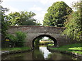
Blackwater Meadow Marina — 2 miles, 4 furlongs away
On this waterway in the direction of Llantisilio - Horseshoe Falls
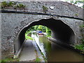
Ellesmere Services — 2 miles, 5½ furlongs away
On this waterway in the direction of Llantisilio - Horseshoe Falls
Weston Arm Services (C&RT) — 6 miles, 5¼ furlongs and 4 locks away
Travel to Frankton Junction, then on the Shropshire Union Canal (Montgomery Canal - connected and navigable) to Weston Arm Junction, then on the Shropshire Union Canal (Weston Branch) to Weston Arm Services (C&RT)
New Marton Water Points — 9 miles, 4 furlongs and 2 locks away
On this waterway in the direction of Llantisilio - Horseshoe Falls
Chirk Marina — 14 miles, 3¾ furlongs and 2 locks away
On this waterway in the direction of Llantisilio - Horseshoe Falls
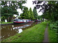
Coedfryn Water Point — 16 miles, 2½ furlongs and 2 locks away
On this waterway in the direction of Llantisilio - Horseshoe Falls
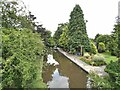
The Old Wharf — 16 miles, 5½ furlongs and 2 locks away
Travel to Ruabon Branch Junction, then on the Shropshire Union Canal (Llangollen Canal - Ruabon Branch) to The Old Wharf
Trevor Basin — 16 miles, 6¼ furlongs and 2 locks away
Travel to Ruabon Branch Junction, then on the Shropshire Union Canal (Llangollen Canal - Ruabon Branch) to Trevor Basin
Maesbury Wharf — 12 miles, 1¼ furlongs and 8 locks away
Travel to Frankton Junction, then on the Shropshire Union Canal (Montgomery Canal - connected and navigable) to Maesbury Wharf

Nearest rubbish disposal

In the direction of Hurleston Junction

Whixall Marina — 4 miles, 3¾ furlongs away
Travel to Whixall Moss Junction, then on the Shropshire Union Canal (Llangollen Canal - Prees Branch) to Whixall Marina
Grindley Brook Services — 10 miles, 4¾ furlongs away
On this waterway in the direction of Hurleston Junction

In the direction of Llantisilio - Horseshoe Falls
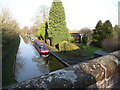
Ellesmere Services — 2 miles, 5½ furlongs away
On this waterway in the direction of Llantisilio - Horseshoe Falls
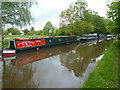
Weston Arm Services (C&RT) — 6 miles, 5¼ furlongs and 4 locks away
Travel to Frankton Junction, then on the Shropshire Union Canal (Montgomery Canal - connected and navigable) to Weston Arm Junction, then on the Shropshire Union Canal (Weston Branch) to Weston Arm Services (C&RT)

Nearest chemical toilet disposal

In the direction of Hurleston Junction

Whixall Marina — 4 miles, 3¾ furlongs away
Travel to Whixall Moss Junction, then on the Shropshire Union Canal (Llangollen Canal - Prees Branch) to Whixall Marina
Grindley Brook Services — 10 miles, 4¾ furlongs away
On this waterway in the direction of Hurleston Junction
Wrenbury Mill Boatyard — 16 miles, 5½ furlongs and 10 locks away
On this waterway in the direction of Hurleston Junction

In the direction of Llantisilio - Horseshoe Falls
Ellesmere Services — 2 miles, 5½ furlongs away
On this waterway in the direction of Llantisilio - Horseshoe Falls
Whittington Wharf Narrowboats — 7 miles, 1¾ furlongs away
On this waterway in the direction of Llantisilio - Horseshoe Falls
Weston Arm Services (C&RT) — 6 miles, 5¼ furlongs and 4 locks away
Travel to Frankton Junction, then on the Shropshire Union Canal (Montgomery Canal - connected and navigable) to Weston Arm Junction, then on the Shropshire Union Canal (Weston Branch) to Weston Arm Services (C&RT)
Chirk Marina — 14 miles, 3¾ furlongs and 2 locks away
On this waterway in the direction of Llantisilio - Horseshoe Falls
Maesbury Wharf — 12 miles, 1¼ furlongs and 8 locks away
Travel to Frankton Junction, then on the Shropshire Union Canal (Montgomery Canal - connected and navigable) to Maesbury Wharf

Nearest place to turn

In the direction of Hurleston Junction

Hampton Bank Winding Hole — 7¾ furlongs away
On this waterway in the direction of Hurleston Junction
Whixall Moss Junction — 3 miles, 7¾ furlongs away
On this waterway in the direction of Hurleston Junction
Whixall Marina — 4 miles, 3¾ furlongs away
Travel to Whixall Moss Junction, then on the Shropshire Union Canal (Llangollen Canal - Prees Branch) to Whixall Marina
Tilstock Park Winding Hole — 6 miles, 3¼ furlongs away
On this waterway in the direction of Hurleston Junction
Hassell's No 1 Lift Bridge Winding Hole — 9 miles, ½ furlongs away
On this waterway in the direction of Hurleston Junction
Whitchurch Winding Hole — 9 miles, 3¾ furlongs away
On this waterway in the direction of Hurleston Junction
Whitchurch Branch Winding hole — 9 miles, 5¾ furlongs away
Travel to Whitchurch Branch Junction, then on the Shropshire Union Canal (Llangollen Canal - Whitchurch Branch) to Whitchurch Branch Winding hole
Grindley Brook Winding Hole — 10 miles, 4¾ furlongs away
On this waterway in the direction of Hurleston Junction

In the direction of Llantisilio - Horseshoe Falls

Baysil Wood Winding Hole — 7½ furlongs away
On this waterway in the direction of Llantisilio - Horseshoe Falls
Ellesmere Branch Junction — 2 miles, 5¼ furlongs away
On this waterway in the direction of Llantisilio - Horseshoe Falls
Ellesmere Town Wharf — 2 miles, 7 furlongs away
Travel to Ellesmere Branch Junction, then on the Shropshire Union Canal (Llangollen Canal - Ellesmere Branch) to Ellesmere Town Wharf
Sewage Works Winding Hole — 3 miles, 1½ furlongs away
On this waterway in the direction of Llantisilio - Horseshoe Falls
Frankton Junction — 6 miles, ¼ furlongs away
On this waterway in the direction of Llantisilio - Horseshoe Falls
Polletts Bridge Winding Hole — 7 miles, 4½ furlongs away
On this waterway in the direction of Llantisilio - Horseshoe Falls
Weston Arm Junction — 6 miles, 4¼ furlongs and 4 locks away
Travel to Frankton Junction, then on the Shropshire Union Canal (Montgomery Canal - connected and navigable) to Weston Arm Junction
Hawkswood Winding Hole — 7 miles, 3 furlongs and 5 locks away
Travel to Frankton Junction, then on the Shropshire Union Canal (Montgomery Canal - connected and navigable) to Hawkswood Winding Hole
Rhoswiel Bridge Winding Hole — 12 miles and 2 locks away
On this waterway in the direction of Llantisilio - Horseshoe Falls
Queen's Head Winding Hole — 9 miles, 7¼ furlongs and 5 locks away
Travel to Frankton Junction, then on the Shropshire Union Canal (Montgomery Canal - connected and navigable) to Queen's Head Winding Hole
Chirk Pool — 13 miles, ¾ furlongs and 2 locks away
On this waterway in the direction of Llantisilio - Horseshoe Falls
Chirk Golf Course Winding Hole — 14 miles, 1 furlong and 2 locks away
On this waterway in the direction of Llantisilio - Horseshoe Falls

Nearest self-operated pump-out

In the direction of Hurleston Junction

Grindley Brook Pump-Out — 10 miles, 4¼ furlongs away
On this waterway in the direction of Hurleston Junction

In the direction of Llantisilio - Horseshoe Falls

Maesbury Wharf — 12 miles, 1¼ furlongs and 8 locks away
Travel to Frankton Junction, then on the Shropshire Union Canal (Montgomery Canal - connected and navigable) to Maesbury Wharf

Nearest boatyard pump-out

In the direction of Hurleston Junction

Whixall Marina — 4 miles, 3¾ furlongs away
Travel to Whixall Moss Junction, then on the Shropshire Union Canal (Llangollen Canal - Prees Branch) to Whixall Marina
Whitchurch Marina — 9 miles, 2¾ furlongs away
On this waterway in the direction of Hurleston Junction

In the direction of Llantisilio - Horseshoe Falls

Blackwater Meadow Marina — 2 miles, 4 furlongs away
On this waterway in the direction of Llantisilio - Horseshoe Falls
Whittington Wharf Narrowboats — 7 miles, 1¾ furlongs away
On this waterway in the direction of Llantisilio - Horseshoe Falls
Chirk Marina — 14 miles, 3¾ furlongs and 2 locks away
On this waterway in the direction of Llantisilio - Horseshoe Falls

The Old Wharf — 16 miles, 5½ furlongs and 2 locks away
Travel to Ruabon Branch Junction, then on the Shropshire Union Canal (Llangollen Canal - Ruabon Branch) to The Old Wharf
Direction of TV transmitter (From Wolfbane Cybernetic)
 
 
Geograph
 
Wikipedia

There is no page on Wikipedia called “Lyneal Road Bridge”

Wikipedia pages that might relate to Lyneal Road Bridge
[Listed buildings in Welshampton and Lyneal] villages of Welshampton, Lyneal and Colemere, and is otherwise rural. The Llangollen Canal passes through the parish, and five bridges crossing it are listed [Llangollen Canal] million upgrade in 2003. Just beyond the A534 Wrexham Road bridge is the entrance to Swanley Bridge Marina, on the west bank of the canal. It has moorings [Ellesmere Canal] Weston Branch was originally intended to be the main line of the canal. Bridge numbering (which starts at Hurleston Junction) continues down the Llanymynech [List of electoral wards in England by constituency] Welshampton, Gatacre, Gobowen, Hinstock, Hodnet, Hordley, Tetchill and Lyneal, Kinnerley, Llanyblodwel and Pant, Market Drayton East, Market Drayton North [Grade II* listed buildings in Shropshire Council (A–G)] Baptist) 1383565 Church of St John the Evangelist Colemere, Welshampton and Lyneal, Shropshire Parish Church 1870 20 August 1971 SJ4377932908 52°53′26″N 2°50′13″W [Listed buildings in England] Cressett Listed buildings in Upton Magna Listed buildings in Welshampton and Lyneal Listed buildings in Wem Rural Listed buildings in Wem Urban Listed buildings
 
Google

Results of Google Search

cum mins postal code Lyneal Road Bridge No 53 0.00 0.00 0.00 ...
Location link dist. (miles) cum miles link time (mins) cum mins postal code. Lyneal Road Bridge No 53. 0.00. 0.00. 0.00. 0.00. SY12 0LQ. Greaves Bridge No 52.
(mins) Lyneal Road Bridge No 53 0.00 0.00 0.00 0
Location link dist. (miles) cum. Dist. (miles) link time (mins) cumulative time (mins) . Lyneal Road Bridge No 53. 0.00. 0.00. 0.00. 0.00. Miss Each Bridge No 54.
Journey Planner - Route
Cole Mere, N, N, 2.31. Lyneal Road Bridge 53, 5, N, 2.58. Greaves Bridge No 52, 6, N, 2.82. Lyneal Lane Bridge 51, 7, N, 3.09. Balmer Heath Winding Hole, N, N ...
Travel Guide
Junction Canal - Main Line) to Jackson's Bridge No 26 on the Shropshire Union Canal ... Whitchurch Ring Road Bridge No 30A ... Lyneal Road Bridge No 53.
New Highway 53 Bridge Dedicated - Fox21Online
Sep 15, 2017 ... The new Highway 53 bridge is almost complete. ... coming in without detouring and there's no better feeling than to be close to that getting done ...
03414
May 1, 2019 ... 30691, Parent of: No 53 Lyneal Bridge (Building) ... 2017 DBA of land off Wrexham Road, Whitchurch by JLL Ltd (Ref: 17/01152/FUL) ...