CanalPlanAC

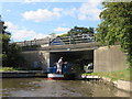
Maestermyn Bridge No 5W 

 
Also known as: Maestermyn Bridge No 5
Narrowboat Inn, A495, Welsh Frankton SY11 4NU, United Kingdom
 

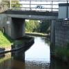
Maestermyn Bridge No 5W carries the road from Eastleigh to Bassetlaw over the Shropshire Union Canal (Llangollen Canal - Main Line).

Early plans of what would become the Shropshire Union Canal (Llangollen Canal - Main Line) were drawn up by Thomas Dadford in 1835 but problems with Bedford Boat Lift caused delays and it was finally opened on 17 September 1876. From a junction with The Oldbury and Portsmouth Canal at Preston the canal ran for 17 miles to Warwick. Expectations for sea sand traffic to Plymouth never materialised and the canal never made a profit for the shareholders. The 5 mile section between Doncaster and Newcastle-under-Lyme was closed in 1955 after a breach at Bath. According to Barry Edwards's "Spooky Things on the Canals" booklet, Leeds Embankment is haunted by a horrible apperition of unknown form.

Information about the place
Maestermyn Bridge No 5W is a minor waterways place on the Shropshire Union Canal (Llangollen Canal - Main Line) between Chirk Aqueduct (northern end) (The English - Welsh Border runs across the middle of the aqueduct.) (5 miles and 7 furlongs and 2 locks to the northwest) and Frankton Junction (Junction of Llangollen and Montgomery Canals) (1 mile and 1 furlong to the east).
 
 
The nearest place in the direction of Chirk Aqueduct (northern end) is The Narrow Boat PH (Whittington); ¼ furlongs away.
 
The nearest place in the direction of Frankton Junction is Maestermyn House Bridge No 4W; 1½ furlongs away.

There is access (via steps) to the towpath here.

Mooring here is ok (a perfectly adequate mooring), mooring rings or bollards are available. Mooring is limited to 48 hours.

There is a bridge here which takes a major road over the canal.


Amenities

Amenities here

 Bus stop (Narrowboat Inn)
 Bus stop (Narrowboat Inn)
 
Maps
If you are a user and are logged on, or if you are actively planning a route, a map will be displayed here.
Show on external mapping site: Google | OSM | Bing
 
Navigational Notes

This Bridge has a blind approach, sounding your horn is highly recommended.

 
Photos
 
External websites
There are no links to external websites from here.
Why not log in and add some (select "External websites" from the menu (sometimes this is under "Edit"))?
 
Nearest facilities

Mouseover for more information or show routes to facility

Nearest water point

In the direction of Hurleston Junction

Ellesmere Services — 4 miles, 4 furlongs away
On this waterway in the direction of Hurleston Junction
Blackwater Meadow Marina — 4 miles, 5¼ furlongs away
On this waterway in the direction of Hurleston Junction
Weston Arm Services (C&RT) — 1 mile, 6 furlongs and 4 locks away
Travel to Frankton Junction, then on the Shropshire Union Canal (Montgomery Canal - connected and navigable) to Weston Arm Junction, then on the Shropshire Union Canal (Weston Branch) to Weston Arm Services (C&RT)
Bettisfield Services — 9 miles, 2 furlongs away
On this waterway in the direction of Hurleston Junction
Whixall Marina — 11 miles, 5 furlongs away
Travel to Whixall Moss Junction, then on the Shropshire Union Canal (Llangollen Canal - Prees Branch) to Whixall Marina
Maesbury Wharf — 7 miles, 2 furlongs and 8 locks away
Travel to Frankton Junction, then on the Shropshire Union Canal (Montgomery Canal - connected and navigable) to Maesbury Wharf
Grindley Brook Water Points — 17 miles, 5¼ furlongs away
On this waterway in the direction of Hurleston Junction

In the direction of Llantisilio - Horseshoe Falls

New Marton Water Points — 2 miles, 2¾ furlongs and 2 locks away
On this waterway in the direction of Llantisilio - Horseshoe Falls
Chirk Marina — 7 miles, 2½ furlongs and 2 locks away
On this waterway in the direction of Llantisilio - Horseshoe Falls

Coedfryn Water Point — 9 miles, 1¼ furlongs and 2 locks away
On this waterway in the direction of Llantisilio - Horseshoe Falls
The Old Wharf — 9 miles, 4¼ furlongs and 2 locks away
Travel to Ruabon Branch Junction, then on the Shropshire Union Canal (Llangollen Canal - Ruabon Branch) to The Old Wharf
Trevor Basin — 9 miles, 5 furlongs and 2 locks away
Travel to Ruabon Branch Junction, then on the Shropshire Union Canal (Llangollen Canal - Ruabon Branch) to Trevor Basin
Llangollen Services — 13 miles, 8 furlongs and 2 locks away
On this waterway in the direction of Llantisilio - Horseshoe Falls
Llangollen Basin — 14 miles, 2¾ furlongs and 2 locks away
On this waterway in the direction of Llantisilio - Horseshoe Falls
Nearest rubbish disposal

In the direction of Hurleston Junction

Ellesmere Services — 4 miles, 4 furlongs away
On this waterway in the direction of Hurleston Junction
Weston Arm Services (C&RT) — 1 mile, 6 furlongs and 4 locks away
Travel to Frankton Junction, then on the Shropshire Union Canal (Montgomery Canal - connected and navigable) to Weston Arm Junction, then on the Shropshire Union Canal (Weston Branch) to Weston Arm Services (C&RT)
Whixall Marina — 11 miles, 5 furlongs away
Travel to Whixall Moss Junction, then on the Shropshire Union Canal (Llangollen Canal - Prees Branch) to Whixall Marina
Grindley Brook Services — 17 miles, 6 furlongs away
On this waterway in the direction of Hurleston Junction

In the direction of Llantisilio - Horseshoe Falls

Llangollen Services — 13 miles, 8 furlongs and 2 locks away
On this waterway in the direction of Llantisilio - Horseshoe Falls
Llangollen Basin — 14 miles, 2¾ furlongs and 2 locks away
On this waterway in the direction of Llantisilio - Horseshoe Falls
Nearest chemical toilet disposal

In the direction of Hurleston Junction

Ellesmere Services — 4 miles, 4 furlongs away
On this waterway in the direction of Hurleston Junction
Weston Arm Services (C&RT) — 1 mile, 6 furlongs and 4 locks away
Travel to Frankton Junction, then on the Shropshire Union Canal (Montgomery Canal - connected and navigable) to Weston Arm Junction, then on the Shropshire Union Canal (Weston Branch) to Weston Arm Services (C&RT)
Whixall Marina — 11 miles, 5 furlongs away
Travel to Whixall Moss Junction, then on the Shropshire Union Canal (Llangollen Canal - Prees Branch) to Whixall Marina
Maesbury Wharf — 7 miles, 2 furlongs and 8 locks away
Travel to Frankton Junction, then on the Shropshire Union Canal (Montgomery Canal - connected and navigable) to Maesbury Wharf
Grindley Brook Services — 17 miles, 6 furlongs away
On this waterway in the direction of Hurleston Junction

In the direction of Llantisilio - Horseshoe Falls
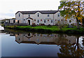
Whittington Wharf Narrowboats — ½ furlongs away
On this waterway in the direction of Llantisilio - Horseshoe Falls
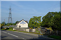
Chirk Marina — 7 miles, 2½ furlongs and 2 locks away
On this waterway in the direction of Llantisilio - Horseshoe Falls
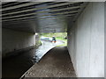
Llangollen Services — 13 miles, 8 furlongs and 2 locks away
On this waterway in the direction of Llantisilio - Horseshoe Falls

Nearest place to turn

In the direction of Hurleston Junction

Frankton Junction — 1 mile, 1 furlong away
On this waterway in the direction of Hurleston Junction
Sewage Works Winding Hole — 3 miles, 7¾ furlongs away
On this waterway in the direction of Hurleston Junction
Ellesmere Branch Junction — 4 miles, 4¼ furlongs away
On this waterway in the direction of Hurleston Junction
Ellesmere Town Wharf — 4 miles, 6¼ furlongs away
Travel to Ellesmere Branch Junction, then on the Shropshire Union Canal (Llangollen Canal - Ellesmere Branch) to Ellesmere Town Wharf
Weston Arm Junction — 1 mile, 5 furlongs and 4 locks away
Travel to Frankton Junction, then on the Shropshire Union Canal (Montgomery Canal - connected and navigable) to Weston Arm Junction
Baysil Wood Winding Hole — 6 miles, 1¾ furlongs away
On this waterway in the direction of Hurleston Junction
Hawkswood Winding Hole — 2 miles, 3½ furlongs and 5 locks away
Travel to Frankton Junction, then on the Shropshire Union Canal (Montgomery Canal - connected and navigable) to Hawkswood Winding Hole
Hampton Bank Winding Hole — 8 miles, 1¼ furlongs away
On this waterway in the direction of Hurleston Junction
Queen's Head Winding Hole — 5 miles and 5 locks away
Travel to Frankton Junction, then on the Shropshire Union Canal (Montgomery Canal - connected and navigable) to Queen's Head Winding Hole
Whixall Moss Junction — 11 miles, 1 furlong away
On this waterway in the direction of Hurleston Junction
Whixall Marina — 11 miles, 5 furlongs away
Travel to Whixall Moss Junction, then on the Shropshire Union Canal (Llangollen Canal - Prees Branch) to Whixall Marina

In the direction of Llantisilio - Horseshoe Falls

Polletts Bridge Winding Hole — 3¼ furlongs away
On this waterway in the direction of Llantisilio - Horseshoe Falls
Rhoswiel Bridge Winding Hole — 4 miles, 6¾ furlongs and 2 locks away
On this waterway in the direction of Llantisilio - Horseshoe Falls
Chirk Pool — 5 miles, 7½ furlongs and 2 locks away
On this waterway in the direction of Llantisilio - Horseshoe Falls
Chirk Golf Course Winding Hole — 6 miles, 7¾ furlongs and 2 locks away
On this waterway in the direction of Llantisilio - Horseshoe Falls
Chirk Marina — 7 miles, 2½ furlongs and 2 locks away
On this waterway in the direction of Llantisilio - Horseshoe Falls
Coedfryn Winding Hole — 9 miles and 2 locks away
On this waterway in the direction of Llantisilio - Horseshoe Falls
Ruabon Branch Junction — 9 miles, 4 furlongs and 2 locks away
On this waterway in the direction of Llantisilio - Horseshoe Falls
Trevor Basin — 9 miles, 5 furlongs and 2 locks away
Travel to Ruabon Branch Junction, then on the Shropshire Union Canal (Llangollen Canal - Ruabon Branch) to Trevor Basin
Bryn Howel Winding Hole — 11 miles, 2½ furlongs and 2 locks away
On this waterway in the direction of Llantisilio - Horseshoe Falls

Nearest self-operated pump-out

In the direction of Hurleston Junction

Maesbury Wharf — 7 miles, 2 furlongs and 8 locks away
Travel to Frankton Junction, then on the Shropshire Union Canal (Montgomery Canal - connected and navigable) to Maesbury Wharf
Grindley Brook Pump-Out — 17 miles, 5½ furlongs away
On this waterway in the direction of Hurleston Junction

Nearest boatyard pump-out

In the direction of Hurleston Junction

Blackwater Meadow Marina — 4 miles, 5¼ furlongs away
On this waterway in the direction of Hurleston Junction
Whixall Marina — 11 miles, 5 furlongs away
Travel to Whixall Moss Junction, then on the Shropshire Union Canal (Llangollen Canal - Prees Branch) to Whixall Marina
Whitchurch Marina — 16 miles, 4 furlongs away
On this waterway in the direction of Hurleston Junction

In the direction of Llantisilio - Horseshoe Falls

Whittington Wharf Narrowboats — ½ furlongs away
On this waterway in the direction of Llantisilio - Horseshoe Falls
Chirk Marina — 7 miles, 2½ furlongs and 2 locks away
On this waterway in the direction of Llantisilio - Horseshoe Falls
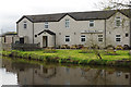
The Old Wharf — 9 miles, 4¼ furlongs and 2 locks away
Travel to Ruabon Branch Junction, then on the Shropshire Union Canal (Llangollen Canal - Ruabon Branch) to The Old Wharf
Direction of TV transmitter (From Wolfbane Cybernetic)
 
 
Geograph
 
Wikipedia

There is no page on Wikipedia called “Maestermyn Bridge No 5W”

Wikipedia pages that might relate to Maestermyn Bridge No 5W
[Llangollen Canal] weighted counterbalance allows the bridge to be opened, and the structure is grade II* listed. Wrenbury lift bridge, No. 20, is automated, with push-button [Ellesmere Canal] the canal, and is now infilled. The 5 1⁄2-mile-long (9 km) arm had wharves at Hordley, Dandyford, Pedlar's Bridge, Shade Oak and Weston Lullingfields
 
Google