CanalPlanAC

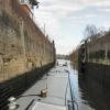
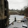
Holt Lock (Holt Fleet)

 
Holt Fleet Farm Camping And Caravanning, A4133, Holt Fleet WR6 6NW, United Kingdom
Address is taken from a point 448 yards away.
 
Information about the place
Holt Lock (Holt Fleet) is a place on the waterways on the River Severn (main river - Stourport to Worcester) between Hawford Junction (Junction of Droitwich Canal with River Severn) (2 miles and 7¾ furlongs to the southeast) and Severn - Stourport Broad Locks Entrance (The Broad Locks are for Wide Beam Boats only. Narrowboats are to use the Narrow Locks.) (5 miles and 3¾ furlongs and 1 lock to the north).
 
 
The nearest place in the direction of Hawford Junction is Holt Lock Weir Exit (Channel leading to the Weir); 1 furlong away.
 
The nearest place in the direction of Severn - Stourport Broad Locks Entrance is Holt Lock Weir Entrance (Channel leading to the Weir - No Access); 2¼ furlongs away.

Mooring here is impossible (it may be physically impossible, forbidden, or allowed only for specific short-term purposes).

Facilities: water point.

This is a lock with a rise of 5 feet and 3 inches.

Holt Castle7¾ furlongs
The Wharf Inn and Campsite (Holt Heath)2¾ furlongs
Holt Fleet Bridge1¾ furlongs
Holt Lock Landing Pontoon1¼ furlongs
Holt Lock Weir Exit1 furlong
Holt Lock (Holt Fleet)
Holt Lock Weir Entrance2¼ furlongs
Lenchford Ferry6½ furlongs
The Hampstall Inn3 miles, 1¼ furlongs
Lincomb Lock Weir Exit4 miles, ¼ furlongs
Lincomb Lock4 miles, 1¾ furlongs
 
 
Amenities
 
Maps
If you are a user and are logged on, or if you are actively planning a route, a map will be displayed here.
Show on external mapping site: Google | OSM | Bing
 
Photos
 
External websites
 Visit the River Severn Locks & Weirs - Discover their history — associated with this page
Find out the best way to visit the River Severn Locks & Weirs, how long it takes to see them, how to get there, and info on their history.
 
Nearest facilities

Mouseover for more information or show routes to facility

Nearest water point

The nearest water point is here. Others are at:

In the direction of Limit of Navigation

Lincomb Lock4 miles, 1¾ furlongs and 1 lock away
On this waterway in the direction of Limit of Navigation
Upper Basin Waterpoint5 miles, 5 furlongs and 4 locks away
Travel to Severn - Stourport Broad Locks Entrance, then on the Staffordshire and Worcestershire Canal (Stourport Basins: Broad Route) to Stourport Upper Basin, then on the Staffordshire and Worcestershire Canal (Stourport Basins: Narrow Route) to Upper Basin Waterpoint
Caldwall Mill Bridge No 149 miles, 3½ furlongs and 7 locks away
Travel to Severn - Stourport Broad Locks Entrance, then on the Staffordshire and Worcestershire Canal (Stourport Basins: Broad Route) to Stourport Upper Basin, then on the Staffordshire and Worcestershire Canal (Stourport Basins: Narrow Route) to York Street Bridge, then on the Staffordshire and Worcestershire Canal (Main Line: Stourport to Stourton) to Caldwall Mill Bridge No 14
Kinver Services16 miles, 2½ furlongs and 13 locks away
Travel to Severn - Stourport Broad Locks Entrance, then on the Staffordshire and Worcestershire Canal (Stourport Basins: Broad Route) to Stourport Upper Basin, then on the Staffordshire and Worcestershire Canal (Stourport Basins: Narrow Route) to York Street Bridge, then on the Staffordshire and Worcestershire Canal (Main Line: Stourport to Stourton) to Kinver Services
Stewponey Water Point17 miles, 6¼ furlongs and 15 locks away
Travel to Severn - Stourport Broad Locks Entrance, then on the Staffordshire and Worcestershire Canal (Stourport Basins: Broad Route) to Stourport Upper Basin, then on the Staffordshire and Worcestershire Canal (Stourport Basins: Narrow Route) to York Street Bridge, then on the Staffordshire and Worcestershire Canal (Main Line: Stourport to Stourton) to Stewponey Water Point

In the direction of Diglis Junction

Worcester Trip Boat Moorings6 miles, 4¾ furlongs and 2 locks away
On this waterway in the direction of Diglis Junction
Diglis Locks7 miles, 5¼ furlongs and 2 locks away
Travel to Diglis Junction, then on the River Severn (main river - Worcester to Gloucester) to Diglis Locks
Diglis Services7 miles, 4½ furlongs and 4 locks away
Travel to Diglis Junction, then on the Worcester and Birmingham Canal (Diglis Junction to Diglis Basin) to Diglis Basin, then on the Worcester and Birmingham Canal (Diglis Basin to King's Norton Junction) to Diglis Services
Lowesmoor Basin8 miles, 4¼ furlongs and 6 locks away
Travel to Diglis Junction, then on the Worcester and Birmingham Canal (Diglis Junction to Diglis Basin) to Diglis Basin, then on the Worcester and Birmingham Canal (Diglis Basin to King's Norton Junction) to Lowesmoor Basin
Netherwich Basin8 miles, 3¼ furlongs and 9 locks away
Travel to Hawford Junction, then on the Droitwich Canals (Droitwich Barge Canal) to Netherwich Basin
Droitwich Spa Marina9 miles, 6¾ furlongs and 14 locks away
Travel to Hawford Junction, then on the Droitwich Canals (Droitwich Barge Canal) to Droitwich Junction, then on the Droitwich Canals (Droitwich Junction Canal) to Droitwich Spa Marina
Hanbury Boatyard10 miles, 3 furlongs and 17 locks away
Travel to Hawford Junction, then on the Droitwich Canals (Droitwich Barge Canal) to Droitwich Junction, then on the Droitwich Canals (Droitwich Junction Canal) to Hanbury Junction, then on the Worcester and Birmingham Canal (Diglis Basin to King's Norton Junction) to Hanbury Boatyard
Stoke Works Water Point12 miles, 6¼ furlongs and 23 locks away
Travel to Hawford Junction, then on the Droitwich Canals (Droitwich Barge Canal) to Droitwich Junction, then on the Droitwich Canals (Droitwich Junction Canal) to Hanbury Junction, then on the Worcester and Birmingham Canal (Diglis Basin to King's Norton Junction) to Stoke Works Water Point
Tardebigge Wharf16 miles, 6¾ furlongs and 59 locks away
Travel to Hawford Junction, then on the Droitwich Canals (Droitwich Barge Canal) to Droitwich Junction, then on the Droitwich Canals (Droitwich Junction Canal) to Hanbury Junction, then on the Worcester and Birmingham Canal (Diglis Basin to King's Norton Junction) to Tardebigge Wharf

Nearest rubbish disposal

In the direction of Limit of Navigation

Upper Basin Waterpoint5 miles, 5 furlongs and 4 locks away
Travel to Severn - Stourport Broad Locks Entrance, then on the Staffordshire and Worcestershire Canal (Stourport Basins: Broad Route) to Stourport Upper Basin, then on the Staffordshire and Worcestershire Canal (Stourport Basins: Narrow Route) to Upper Basin Waterpoint
Kinver Services16 miles, 2½ furlongs and 13 locks away
Travel to Severn - Stourport Broad Locks Entrance, then on the Staffordshire and Worcestershire Canal (Stourport Basins: Broad Route) to Stourport Upper Basin, then on the Staffordshire and Worcestershire Canal (Stourport Basins: Narrow Route) to York Street Bridge, then on the Staffordshire and Worcestershire Canal (Main Line: Stourport to Stourton) to Kinver Services

In the direction of Diglis Junction

Sabrina Footbridge6 miles, 3 furlongs and 2 locks away
On this waterway in the direction of Diglis Junction
Diglis Basin7 miles, 4 furlongs and 4 locks away
Travel to Diglis Junction, then on the Worcester and Birmingham Canal (Diglis Junction to Diglis Basin) to Diglis Basin
Lowesmoor Basin8 miles, 4¼ furlongs and 6 locks away
Travel to Diglis Junction, then on the Worcester and Birmingham Canal (Diglis Junction to Diglis Basin) to Diglis Basin, then on the Worcester and Birmingham Canal (Diglis Basin to King's Norton Junction) to Lowesmoor Basin
Netherwich Basin8 miles, 3¼ furlongs and 9 locks away
Travel to Hawford Junction, then on the Droitwich Canals (Droitwich Barge Canal) to Netherwich Basin
Droitwich Spa Marina9 miles, 6¾ furlongs and 14 locks away
Travel to Hawford Junction, then on the Droitwich Canals (Droitwich Barge Canal) to Droitwich Junction, then on the Droitwich Canals (Droitwich Junction Canal) to Droitwich Spa Marina
Stoke Bottom Lock No 2313 miles, 4 furlongs and 23 locks away
Travel to Hawford Junction, then on the Droitwich Canals (Droitwich Barge Canal) to Droitwich Junction, then on the Droitwich Canals (Droitwich Junction Canal) to Hanbury Junction, then on the Worcester and Birmingham Canal (Diglis Basin to King's Norton Junction) to Stoke Bottom Lock No 23
Tardebigge Wharf16 miles, 6¾ furlongs and 59 locks away
Travel to Hawford Junction, then on the Droitwich Canals (Droitwich Barge Canal) to Droitwich Junction, then on the Droitwich Canals (Droitwich Junction Canal) to Hanbury Junction, then on the Worcester and Birmingham Canal (Diglis Basin to King's Norton Junction) to Tardebigge Wharf

Nearest chemical toilet disposal

In the direction of Limit of Navigation

Stourport Marina4 miles, 5 furlongs and 2 locks away
On this waterway in the direction of Limit of Navigation
Upper Basin Waterpoint5 miles, 5 furlongs and 4 locks away
Travel to Severn - Stourport Broad Locks Entrance, then on the Staffordshire and Worcestershire Canal (Stourport Basins: Broad Route) to Stourport Upper Basin, then on the Staffordshire and Worcestershire Canal (Stourport Basins: Narrow Route) to Upper Basin Waterpoint
Caldwall Mill Bridge No 149 miles, 3½ furlongs and 7 locks away
Travel to Severn - Stourport Broad Locks Entrance, then on the Staffordshire and Worcestershire Canal (Stourport Basins: Broad Route) to Stourport Upper Basin, then on the Staffordshire and Worcestershire Canal (Stourport Basins: Narrow Route) to York Street Bridge, then on the Staffordshire and Worcestershire Canal (Main Line: Stourport to Stourton) to Caldwall Mill Bridge No 14
Kinver Services16 miles, 2½ furlongs and 13 locks away
Travel to Severn - Stourport Broad Locks Entrance, then on the Staffordshire and Worcestershire Canal (Stourport Basins: Broad Route) to Stourport Upper Basin, then on the Staffordshire and Worcestershire Canal (Stourport Basins: Narrow Route) to York Street Bridge, then on the Staffordshire and Worcestershire Canal (Main Line: Stourport to Stourton) to Kinver Services

In the direction of Diglis Junction

Diglis Services7 miles, 4½ furlongs and 4 locks away
Travel to Diglis Junction, then on the Worcester and Birmingham Canal (Diglis Junction to Diglis Basin) to Diglis Basin, then on the Worcester and Birmingham Canal (Diglis Basin to King's Norton Junction) to Diglis Services
Lowesmoor Basin8 miles, 4¼ furlongs and 6 locks away
Travel to Diglis Junction, then on the Worcester and Birmingham Canal (Diglis Junction to Diglis Basin) to Diglis Basin, then on the Worcester and Birmingham Canal (Diglis Basin to King's Norton Junction) to Lowesmoor Basin
Droitwich Spa Marina9 miles, 6¾ furlongs and 14 locks away
Travel to Hawford Junction, then on the Droitwich Canals (Droitwich Barge Canal) to Droitwich Junction, then on the Droitwich Canals (Droitwich Junction Canal) to Droitwich Spa Marina
Stoke Bottom Lock No 2313 miles, 4 furlongs and 23 locks away
Travel to Hawford Junction, then on the Droitwich Canals (Droitwich Barge Canal) to Droitwich Junction, then on the Droitwich Canals (Droitwich Junction Canal) to Hanbury Junction, then on the Worcester and Birmingham Canal (Diglis Basin to King's Norton Junction) to Stoke Bottom Lock No 23
Tardebigge Wharf16 miles, 6¾ furlongs and 59 locks away
Travel to Hawford Junction, then on the Droitwich Canals (Droitwich Barge Canal) to Droitwich Junction, then on the Droitwich Canals (Droitwich Junction Canal) to Hanbury Junction, then on the Worcester and Birmingham Canal (Diglis Basin to King's Norton Junction) to Tardebigge Wharf

Nearest place to turn

In the direction of Limit of Navigation

Holt Lock Weir Entrance2¼ furlongs and 1 lock away
On this waterway in the direction of Limit of Navigation
Severn - Stourport Narrow Locks Entrance5 miles, 4¼ furlongs and 2 locks away
On this waterway in the direction of Limit of Navigation
Stourport Lower Basin - between Broad Locks5 miles, 4¼ furlongs and 3 locks away
Travel to Severn - Stourport Broad Locks Entrance, then on the Staffordshire and Worcestershire Canal (Stourport Basins: Broad Route) to Stourport Lower Basin - between Broad Locks
Stourport Lower Basin - between Narrow Locks5 miles, 4¾ furlongs and 3 locks away
Travel to Severn - Stourport Broad Locks Entrance, then on the Staffordshire and Worcestershire Canal (Stourport Basins: Broad Route) to Stourport Lower Basin - between Broad Locks, then on the Staffordshire and Worcestershire Canal (Stourport Basins: Broad Locks to Narrow Locks to Stourport Lower Basin - between Narrow Locks
Stourport Upper Basin5 miles, 5 furlongs and 4 locks away
Travel to Severn - Stourport Broad Locks Entrance, then on the Staffordshire and Worcestershire Canal (Stourport Basins: Broad Route) to Stourport Upper Basin
Stourport Clock Basin5 miles, 5½ furlongs and 4 locks away
Travel to Severn - Stourport Broad Locks Entrance, then on the Staffordshire and Worcestershire Canal (Stourport Basins: Broad Route) to Stourport Upper Basin, then on the Staffordshire and Worcestershire Canal (Stourport Basins: Narrow Route) to Stourport Clock Basin
Former Railway Interchange Basin6 miles, 3¼ furlongs and 5 locks away
Travel to Severn - Stourport Broad Locks Entrance, then on the Staffordshire and Worcestershire Canal (Stourport Basins: Broad Route) to Stourport Upper Basin, then on the Staffordshire and Worcestershire Canal (Stourport Basins: Narrow Route) to York Street Bridge, then on the Staffordshire and Worcestershire Canal (Main Line: Stourport to Stourton) to Former Railway Interchange Basin
Pratt's Wharf7 miles, 7 furlongs and 5 locks away
Travel to Severn - Stourport Broad Locks Entrance, then on the Staffordshire and Worcestershire Canal (Stourport Basins: Broad Route) to Stourport Upper Basin, then on the Staffordshire and Worcestershire Canal (Stourport Basins: Narrow Route) to York Street Bridge, then on the Staffordshire and Worcestershire Canal (Main Line: Stourport to Stourton) to Pratt's Wharf
Academy Winding Hole9 miles, 5¾ furlongs and 7 locks away
Travel to Severn - Stourport Broad Locks Entrance, then on the Staffordshire and Worcestershire Canal (Stourport Basins: Broad Route) to Stourport Upper Basin, then on the Staffordshire and Worcestershire Canal (Stourport Basins: Narrow Route) to York Street Bridge, then on the Staffordshire and Worcestershire Canal (Main Line: Stourport to Stourton) to Academy Winding Hole

In the direction of Diglis Junction

Holt Lock Weir Exit1 furlong and 1 lock away
On this waterway in the direction of Diglis Junction
Bevere Lock Weir Entrance3 miles, 1¾ furlongs and 1 lock away
On this waterway in the direction of Diglis Junction
Bevere Lock Weir Exit3 miles, 4½ furlongs and 2 locks away
On this waterway in the direction of Diglis Junction
Diglis Junction7 miles, 3 furlongs and 2 locks away
On this waterway in the direction of Diglis Junction
Diglis Locks Weir Exit7 miles, 6 furlongs and 3 locks away
Travel to Diglis Junction, then on the River Severn (main river - Worcester to Gloucester) to Diglis Locks Weir Exit
Severn - Teme Junction8 miles, 4 furlongs and 3 locks away
Travel to Diglis Junction, then on the River Severn (main river - Worcester to Gloucester) to Severn - Teme Junction
Ladywood Top Lock Winding Hole5 miles, 5¼ furlongs and 9 locks away
Travel to Hawford Junction, then on the Droitwich Canals (Droitwich Barge Canal) to Ladywood Top Lock Winding Hole
Lowesmoor Basin8 miles, 4¼ furlongs and 6 locks away
Travel to Diglis Junction, then on the Worcester and Birmingham Canal (Diglis Junction to Diglis Basin) to Diglis Basin, then on the Worcester and Birmingham Canal (Diglis Basin to King's Norton Junction) to Lowesmoor Basin
Winding Hole (east of Salwarpe Road Bridge)8 miles, 2 furlongs and 9 locks away
Travel to Hawford Junction, then on the Droitwich Canals (Droitwich Barge Canal) to Winding Hole (east of Salwarpe Road Bridge)
Netherwich Basin8 miles, 3¼ furlongs and 9 locks away
Travel to Hawford Junction, then on the Droitwich Canals (Droitwich Barge Canal) to Netherwich Basin
Droitwich Town Wharf8 miles, 5½ furlongs and 9 locks away
Travel to Hawford Junction, then on the Droitwich Canals (Droitwich Barge Canal) to Droitwich Town Wharf

Nearest boatyard pump-out

In the direction of Limit of Navigation

Stourport Marina4 miles, 5 furlongs and 2 locks away
On this waterway in the direction of Limit of Navigation
Stourport Upper Basin5 miles, 5 furlongs and 4 locks away
Travel to Severn - Stourport Broad Locks Entrance, then on the Staffordshire and Worcestershire Canal (Stourport Basins: Broad Route) to Stourport Upper Basin
Upper Staircase Lock Landing Pontoon5 miles, 5½ furlongs and 4 locks away
Travel to Severn - Stourport Broad Locks Entrance, then on the Staffordshire and Worcestershire Canal (Stourport Basins: Broad Route) to Stourport Upper Basin, then on the Staffordshire and Worcestershire Canal (Stourport Basins: Narrow Route) to Upper Staircase Lock Landing Pontoon

In the direction of Diglis Junction

Lowesmoor Basin8 miles, 4¼ furlongs and 6 locks away
Travel to Diglis Junction, then on the Worcester and Birmingham Canal (Diglis Junction to Diglis Basin) to Diglis Basin, then on the Worcester and Birmingham Canal (Diglis Basin to King's Norton Junction) to Lowesmoor Basin
Hanbury Boatyard10 miles, 3 furlongs and 17 locks away
Travel to Hawford Junction, then on the Droitwich Canals (Droitwich Barge Canal) to Droitwich Junction, then on the Droitwich Canals (Droitwich Junction Canal) to Hanbury Junction, then on the Worcester and Birmingham Canal (Diglis Basin to King's Norton Junction) to Hanbury Boatyard
Dunhampstead Boatyard12 miles, 1½ furlongs and 17 locks away
Travel to Hawford Junction, then on the Droitwich Canals (Droitwich Barge Canal) to Droitwich Junction, then on the Droitwich Canals (Droitwich Junction Canal) to Hanbury Junction, then on the Worcester and Birmingham Canal (Diglis Basin to King's Norton Junction) to Dunhampstead Boatyard
Direction of TV transmitter (From Wolfbane Cybernetic)
 
 
Blog posts
Another Night at another Wharf from Scribblings from the Mintball posted Monday the 22nd of September, 2014
 
Geograph
 
Wikipedia

Wikipedia has a page about Holt Lock

The Holt Lock and Dam is a lock built on the Black Warrior River near Holt, Alabama in Tuscaloosa County. Opening for navigation in 1966, it served as a replacement for a series locks and dams built in the early 20th century. The lock and dam impounds Holt Lake 19 miles (31 km) upstream to the John Hollis Bankhead Lock and Dam.

The lock is located in the southern bank and has an inside chamber with dimensions of 110 feet (34 m) by 600 feet (180 m), and having a maximum lift of 64 feet (20 m). The spillway is controlled by 14 individually operated tainter gates used to control the overall lake level. Located on the northern bank are hydroelectric turbines operated by the Alabama Power Company. The United States Army Corps of Engineers owns the dam facility; Alabama Power owns and operates the generating plant.

Other Wikipedia pages that might relate to Holt Lock
[Holt Lock and Dam] The Holt Lock and Dam is a lock built on the Black Warrior River near Holt, Alabama in Tuscaloosa County. Opening for navigation in 1966, it served as [Black Warrior River] replacement of the two-stage lift with a larger single-lift lock. Lock 17 and Holt Lock and Dam also have hydroelectric power plants owned by the Alabama [Wrath of Man] following Lock, Stock and Two Smoking Barrels (1998), Snatch (2000), and Revolver (2005). Jason Statham as Harry "H" Scott Eastwood as Tom Holt McCallany [River Severn] quick succession. The river then passes the villages of Astley Burf and Holt Fleet before entry into the county town of Worcester. Several villages sit [Holt, Worcestershire] found during dredging operations in the River Severn below the site of Holt Lock. British Iron Age (1500 BC – 40 AD) finds have been scarce, although crop [List of dams and reservoirs in Alabama] Guntersville Dam Guntersville Lake Tennessee River Holt Lock and Dam Holt Lake Black Warrior River Howell Heflin Lock and Dam Gainesville Lake Tennessee-Tombigbee [Carter Holt Harvey] Carter Holt Harvey Limited is a privately-owned New Zealand-based company controlled by Rank Group Limited, the corporate vehicle of the country's richest [Stourport Ring] Worcester. Excludes the northern extension. From Blowers Green to Tardebigge top lock, the ring is at the Birmingham Level for 27 miles. During spring freshet [List of The Virginian episodes] Although the informant had left a letter revealing the fugitive's identity in a lock box at the bank, it can not be accessed until the circuit judge can return [List of crossings of the Black Warrior River] 5055500 Holt Lock and Dam Tuscaloosa County 33°15′14.51″N 87°26′57.85″W / 33.2540306°N 87.4494028°W / 33.2540306; -87.4494028 John Hollis Bankhead Lock and
 
Google

Results of Google Search

Holt Fleet - Wikipedia
Holt Fleet is a village in the Wychavon district of the county of Worcestershire, England. ... No dwellings were identified. In 1844 a bronze axe was found during dredging operations in the River Severn below the site of Holt Lock. British Iron Age ...
Holt Fleet, Lock Island - Birmingham Anglers Association
Includes the weir pool. Very good for salmon, pike and barbel.
Holt Fleet River Severn - YouTube
Dec 16, 2015 ... Flight along the River Severn at Holt Fleet Worcestershire. Song. Legendes, S/R - I. St. Francois d' Assise: La pr. Artist. Naxos:unknown artist ...
Phrases with holt - RhymeZone
Phrases that contain the word holt: ... Holt Fleet · Holt Lock and Dam · Holt Richter · Holt graph · Nat Holt ... Holt Fleet Bridge · Holt Heath, Dorset · Holt House ...
File:Holt Fleet - geograph.org.uk - 3825.jpg - Wikimedia Commons
Feb 15, 2020 ... English: Holt Fleet. Holt Fleet bridge over the River Severn, with Holt Fleet lock in the distance. Date, August 1990. Source, From geograph.org.
HOLT CAT Machines & Engines: Caterpillar Machines, Heavy ...
HOLT CAT is a leader in heavy caterpillar equipment, engines, machines, caterpillar equipment product and provide rental services at holtcat in Texas.
2 bedroom cottage for sale in Lock Cottage, Holt Fleet, Worcester ...
Jun 27, 2020 ... A Stunning Two Bedroom Waterside Property, Formerly A Pair Of Cottages On The Banks Of The River Severn Overlooking Holt Lock, Having ...
The Holt Fleet - Posts - Worcester, Worcestershire - Menu, Prices ...
The Holt Fleet - Holt Heath, WR6 6NL Worcester, Worcestershire - Rated 4.8 based on 173 Reviews "Visited with my wife and 3 doggies, spent a lovely...
River Severn The Worcestershire Severn :: Geograph Britain and ...
Downstream there is another weir and lock above Holt Fleet. SO8263 : River Severn approaching Holt Fleet by Richard Greenwood SO8263 : Holt Lock by ...