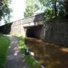
Navigation Bridge No 103
is a minor waterways place
on the Monmouthshire and Brecon Canal between
Govilon Wharf (1 mile and 6¾ furlongs
to the east) and
Upper Yard Bridge No 115 (3 miles and 3 furlongs
to the northwest).
The nearest place in the direction of Govilon Wharf is The Towpath Inn (Canalside);
¼ furlongs
away.
The nearest place in the direction of Upper Yard Bridge No 115 is Gilwern Aqueduct No 9 (You can hear the stream/river but barely visable );
1 furlong
away.
There may be access to the towpath here.
Mooring here is unrated.
There is a bridge here which takes a major road over the canal.
| Humphreys Bridge No 100 | 1 mile, ¼ furlongs | |
| Heol - yr -Allt Bridge No 101 | 6 furlongs | |
| Head of the Valleys Road Bridge | 4¼ furlongs | |
| Ty - Gwynn Bridge No 102 | 4 furlongs | |
| The Towpath Inn | ¼ furlongs | |
| Navigation Bridge No 103 | ||
| Gilwern Aqueduct No 9 | 1 furlong | |
| Aqueduct No 8 (Mon & Brec Canal) | 1¼ furlongs | |
| Gilwern Wharf No 8A | 1¼ furlongs | |
| Auckland Bridge No 104 | 2 furlongs | |
| Malford Grove Winding Hole | 3¾ furlongs | |
Amenities nearby at The Towpath Inn
There are no links to external websites from here.
Why not log in and add some (select "External websites" from the menu (sometimes this is under "Edit"))?
Why not log in and add some (select "External websites" from the menu (sometimes this is under "Edit"))?
Mouseover for more information or show routes to facility
Nearest water point
In the direction of Five Locks Road
Govilon Wharf — 1 mile, 6¾ furlongs away
On this waterway in the direction of Five Locks Road
Govilon Visitor Moorings — 1 mile, 7¾ furlongs away
On this waterway in the direction of Five Locks Road
Pontymoile Footbridge No 52 — 13 miles, 3¾ furlongs away
On this waterway in the direction of Five Locks Road
In the direction of Theatre Basin
Brynich Aqueduct No 2 (southern end) — 16 miles, 3¾ furlongs and 5 locks away
On this waterway in the direction of Theatre BasinNearest place to turn
In the direction of Five Locks Road
Govilon Winding Hole — 1 mile, 7 furlongs away
On this waterway in the direction of Five Locks Road
Llanfoist Wharf — 3 miles, ¼ furlongs away
On this waterway in the direction of Five Locks Road
Llanover Winding Hole — 7 miles away
On this waterway in the direction of Five Locks Road
Jenkin Rosser's Winding Hole — 7 miles, 7¾ furlongs away
On this waterway in the direction of Five Locks Road
Goytre Arm — 8 miles, 2 furlongs away
On this waterway in the direction of Five Locks Road
Croes-y-Pant Winding Hole — 9 miles, 2¾ furlongs away
On this waterway in the direction of Five Locks Road
Cwmoody Winding Hole — 12 miles away
On this waterway in the direction of Five Locks Road
Usk Road Winding Hole — 12 miles, 4¾ furlongs away
On this waterway in the direction of Five Locks Road
Pontymoile Basin — 13 miles, 3¾ furlongs away
On this waterway in the direction of Five Locks Road
Lansdowne Winding Hole — 14 miles, 6 furlongs away
On this waterway in the direction of Five Locks Road
Five Locks Basin — 15 miles, 3¾ furlongs away
On this waterway in the direction of Five Locks Road
In the direction of Theatre Basin
Malford Grove Winding Hole — 3¾ furlongs away
On this waterway in the direction of Theatre Basin
Pen-Pedair Heol Winding Hole — 2 miles, 1¾ furlongs away
On this waterway in the direction of Theatre Basin
Beacon Park Boats — 3 miles, 1½ furlongs away
On this waterway in the direction of Theatre Basin
Pencelli Winding Hole — 14 miles, ¼ furlongs and 5 locks away
On this waterway in the direction of Theatre Basin
Storehouse Bridge Winding Hole — 15 miles, 1¾ furlongs and 5 locks away
On this waterway in the direction of Theatre Basin
Brynich Turn Bridge Winding Hole — 16 miles, 3 furlongs and 5 locks away
On this waterway in the direction of Theatre Basin
Dadfords Bridge Winding Hole — 18 miles, 5½ furlongs and 6 locks away
On this waterway in the direction of Theatre Basin
Theatre Basin — 18 miles, 6 furlongs and 6 locks away
On this waterway in the direction of Theatre BasinNo information
CanalPlan has no information on any of the following facilities within range:rubbish disposal
chemical toilet disposal
self-operated pump-out
boatyard pump-out
Direction of TV transmitter (From Wolfbane Cybernetic)
There is no page on Wikipedia called “Navigation Bridge”
Wikipedia pages that might relate to Navigation Bridge
[Bridge (nautical)]
Larger warships may have navigation bridge would be used for the actual conning of the ship and a separate admiral's bridge can be provided in flagships
[Navigation]
The field of navigation includes four general categories: land navigation, marine navigation, aeronautic navigation, and space navigation. It is also the
[Navigation system]
A navigation system is a computing system that aids in navigation. Navigation systems may be entirely on board the vehicle or vessel that the system is
[Suez Canal Bridge]
Mubarak Peace Bridge, also known as the Egyptian-Japanese Friendship Bridge, Al Salam Bridge, or Al Salam Peace Bridge, is a road bridge crossing the Suez
[Joseph Hazelwood]
the navigation bridge and was in his stateroom at the time of the accident. He left Third Mate Gregory Cousins in charge of the navigation bridge and
[Bridge navigational watch alarm system]
A Bridge Navigational Watch Alarm System, abbreviated BNWAS, is an automatic system which sounds an alarm if the watch officer on the bridge of a ship
[Adam's Bridge]
020±160 years BP. Due to shallow waters, Adam's Bridge presents a formidable hindrance to navigation through the Palk Strait. Though trade across the
[Vincent Thomas Bridge]
world. The clear height of the navigation channel is approximately 185 feet (56 m); it is the only suspension bridge in the world supported entirely
[Conning tower]
the boat and launch torpedo attacks. Above this was an open bridge for surface navigation and signalling, and the gun direction platform. It should not
[River Don Navigation]
the navigation is now by leisure boaters, whose boats are dwarfed by the huge locks. The navigation and river are crossed by a wide variety of bridges, from
Results of Google Search
Bridge 102 Ty-Gwynn, to Bridge No. 103 Navigation Bridge, Gilwern ...Bridge 102 Ty-Gwynn, to Bridge No. 103 Navigation Bridge, Gilwern, Monmouthshire and Brecon Canal. Detail. From Date: 03/01/2019 08:00. To Date : ...
Closest waterway: Monmouthshire & Brecon Canal. Starts at: Bridge No. 103 Navigation. Ends at: Bridge 104, Auckland Bridge. Upstream winding hole: Winding ...
The Coast Guard is responsible for insuring that bridges across the Nation's waterways do not create safety hazards or unreasonable obstructions to navigation.
Nov 14, 2019 ... There may be no saving the 103-year-old 7th Street Bridge in Modesto, but there will still be a home for the sculpted lions that guard it.
Burghfield Island Boat Club: Burghfield Bridge No.14 ... SU6770 : Burghfield Lock No 103, Kennet and Avon Navigation by Dr Neil Clifton. Burghfield Lock is one ...
Nov 14, 2019 ... There may be no saving the 103-year-old 7th Street Bridge in Modesto, but there will still be a home for the sculpted lions that guard it.
The use of locks and lift bridges by pleasure and residential vessels shall not ... public vessels shall have the same meaning as defined in the navigation law. 3.
Cabarrus County, bridge no. 103 on NC 49 over Dutch Buffalo Creek, federal aid project no. NHPP-0049(32), W.B.S. no. 55048.1.1, S.T.I.P. no. B-5548 ...
Ref No: u02950. Title: Shirland Road Bridge, SYK Navigation showing No. 103 Shirland Lane (right). Location: Sheffield_Attercliffe. Date Period: 1960-1979.


![Bridge 103, Gilwern. Bridge carrying Main Road from the A465 to A4077 in Gilwern. There is no tow path under the very low bridge and the cycle route crosses the road to rejoin the path. The brown structure, top left, is the new footbridge [[6214671]] over the widened A465. by M J Roscoe – 13 July 2019](https://s3.geograph.org.uk/geophotos/06/21/46/6214619_20200835_120x120.jpg)


![New junction of Main Road with A465. Junction, almost complete, of Main Road, Gilwern with northern carriageway of widened Heads of the Valley Road. The flight of steps on the left serves the new foot bridge [[6214671]] over the A465. by M J Roscoe – 13 July 2019](https://s2.geograph.org.uk/geophotos/06/21/49/6214970_aff6572b_120x120.jpg)


