Burns Wood Bridge No 56
Burns Wood, A495, Welshampton SY12 0PF, United Kingdom
Address is taken from a point 225 yards away.

Burns Wood Bridge No 56
is a minor waterways place
on the Shropshire Union Canal (Llangollen Canal - Main Line) between
Ellesmere Branch Junction (1 mile and 2¾ furlongs
to the west) and
Whixall Moss Junction (Junction of Prees Branch with Llangollen Canal) (5 miles and 2 furlongs
to the east).
The nearest place in the direction of Ellesmere Branch Junction is Blake Mere Visitor Moorings (14 day moorings);
2 furlongs
away.
The nearest place in the direction of Whixall Moss Junction is Baysil Wood Winding Hole;
3 furlongs
away.
There may be access to the towpath here.
Mooring here is unrated.
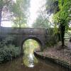
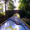
There is a bridge here which takes a track over the canal.
| Blackwater Meadow Marina | 1 mile, 1¾ furlongs | |
| Ellesmere Visitor Moorings (14 day) | 1 mile, 1¼ furlongs | |
| Ellesmere Tunnel (western entrance) | 5¼ furlongs | |
| Ellesmere Tunnel (eastern entrance) | 4¾ furlongs | |
| Blake Mere Visitor Moorings | 2 furlongs | |
| Burns Wood Bridge No 56 | ||
| Baysil Wood Winding Hole | 3 furlongs | |
| Little Mill Bridge No 55 | 4¼ furlongs | |
| Cole Mere Visitor Moorings | 4¾ furlongs | |
| Miss Each Bridge No 54 | 7¾ furlongs | |
| Lyneal Road Bridge No 53 | 1 mile, 2¼ furlongs | |
There are no links to external websites from here.
Why not log in and add some (select "External websites" from the menu (sometimes this is under "Edit"))?
Mouseover for more information or show routes to facility
Nearest water point
In the direction of Hurleston Junction
Bettisfield Services — 3 miles, 3¼ furlongs away
On this waterway in the direction of Hurleston Junction
Whixall Marina — 5 miles, 6 furlongs away
Travel to Whixall Moss Junction, then on the Shropshire Union Canal (Llangollen Canal - Prees Branch) to Whixall Marina
Grindley Brook Water Points — 11 miles, 6¼ furlongs away
On this waterway in the direction of Hurleston Junction
Wrenbury Mill Boatyard — 17 miles, 7¾ furlongs and 10 locks away
On this waterway in the direction of Hurleston Junction
In the direction of Llantisilio - Horseshoe Falls
Blackwater Meadow Marina — 1 mile, 1¾ furlongs away
On this waterway in the direction of Llantisilio - Horseshoe Falls
Ellesmere Services — 1 mile, 3 furlongs away
On this waterway in the direction of Llantisilio - Horseshoe Falls
Weston Arm Services (C&RT) — 5 miles, 3 furlongs and 4 locks away
Travel to Frankton Junction, then on the Shropshire Union Canal (Montgomery Canal - connected and navigable) to Weston Arm Junction, then on the Shropshire Union Canal (Weston Branch) to Weston Arm Services (C&RT)
New Marton Water Points — 8 miles, 1¾ furlongs and 2 locks away
On this waterway in the direction of Llantisilio - Horseshoe Falls
Chirk Marina — 13 miles, 1½ furlongs and 2 locks away
On this waterway in the direction of Llantisilio - Horseshoe Falls
Coedfryn Water Point — 15 miles, ¼ furlongs and 2 locks away
On this waterway in the direction of Llantisilio - Horseshoe Falls
The Old Wharf — 15 miles, 3 furlongs and 2 locks away
Travel to Ruabon Branch Junction, then on the Shropshire Union Canal (Llangollen Canal - Ruabon Branch) to The Old Wharf
Trevor Basin — 15 miles, 4 furlongs and 2 locks away
Travel to Ruabon Branch Junction, then on the Shropshire Union Canal (Llangollen Canal - Ruabon Branch) to Trevor Basin
Maesbury Wharf — 10 miles, 7 furlongs and 8 locks away
Travel to Frankton Junction, then on the Shropshire Union Canal (Montgomery Canal - connected and navigable) to Maesbury Wharf
Llangollen Services — 19 miles, 6¾ furlongs and 2 locks away
On this waterway in the direction of Llantisilio - Horseshoe FallsNearest rubbish disposal
In the direction of Hurleston Junction
Whixall Marina — 5 miles, 6 furlongs away
Travel to Whixall Moss Junction, then on the Shropshire Union Canal (Llangollen Canal - Prees Branch) to Whixall Marina
Grindley Brook Services — 11 miles, 7 furlongs away
On this waterway in the direction of Hurleston Junction
In the direction of Llantisilio - Horseshoe Falls
Ellesmere Services — 1 mile, 3 furlongs away
On this waterway in the direction of Llantisilio - Horseshoe Falls
Weston Arm Services (C&RT) — 5 miles, 3 furlongs and 4 locks away
Travel to Frankton Junction, then on the Shropshire Union Canal (Montgomery Canal - connected and navigable) to Weston Arm Junction, then on the Shropshire Union Canal (Weston Branch) to Weston Arm Services (C&RT)
Llangollen Services — 19 miles, 6¾ furlongs and 2 locks away
On this waterway in the direction of Llantisilio - Horseshoe FallsNearest chemical toilet disposal
In the direction of Hurleston Junction
Whixall Marina — 5 miles, 6 furlongs away
Travel to Whixall Moss Junction, then on the Shropshire Union Canal (Llangollen Canal - Prees Branch) to Whixall Marina
Grindley Brook Services — 11 miles, 7 furlongs away
On this waterway in the direction of Hurleston Junction
Wrenbury Mill Boatyard — 17 miles, 7¾ furlongs and 10 locks away
On this waterway in the direction of Hurleston Junction
In the direction of Llantisilio - Horseshoe Falls
Ellesmere Services — 1 mile, 3 furlongs away
On this waterway in the direction of Llantisilio - Horseshoe Falls
Whittington Wharf Narrowboats — 5 miles, 7½ furlongs away
On this waterway in the direction of Llantisilio - Horseshoe Falls
Weston Arm Services (C&RT) — 5 miles, 3 furlongs and 4 locks away
Travel to Frankton Junction, then on the Shropshire Union Canal (Montgomery Canal - connected and navigable) to Weston Arm Junction, then on the Shropshire Union Canal (Weston Branch) to Weston Arm Services (C&RT)
Chirk Marina — 13 miles, 1½ furlongs and 2 locks away
On this waterway in the direction of Llantisilio - Horseshoe Falls
Maesbury Wharf — 10 miles, 7 furlongs and 8 locks away
Travel to Frankton Junction, then on the Shropshire Union Canal (Montgomery Canal - connected and navigable) to Maesbury Wharf
Llangollen Services — 19 miles, 6¾ furlongs and 2 locks away
On this waterway in the direction of Llantisilio - Horseshoe FallsNearest place to turn
In the direction of Hurleston Junction
Baysil Wood Winding Hole — 3 furlongs away
On this waterway in the direction of Hurleston Junction
Hampton Bank Winding Hole — 2 miles, 2¼ furlongs away
On this waterway in the direction of Hurleston Junction
Whixall Moss Junction — 5 miles, 2 furlongs away
On this waterway in the direction of Hurleston Junction
Whixall Marina — 5 miles, 6 furlongs away
Travel to Whixall Moss Junction, then on the Shropshire Union Canal (Llangollen Canal - Prees Branch) to Whixall Marina
Tilstock Park Winding Hole — 7 miles, 5½ furlongs away
On this waterway in the direction of Hurleston Junction
Hassell's No 1 Lift Bridge Winding Hole — 10 miles, 2¾ furlongs away
On this waterway in the direction of Hurleston Junction
Whitchurch Winding Hole — 10 miles, 6 furlongs away
On this waterway in the direction of Hurleston Junction
Whitchurch Branch Winding hole — 11 miles away
Travel to Whitchurch Branch Junction, then on the Shropshire Union Canal (Llangollen Canal - Whitchurch Branch) to Whitchurch Branch Winding hole
Grindley Brook Winding Hole — 11 miles, 7 furlongs away
On this waterway in the direction of Hurleston Junction
In the direction of Llantisilio - Horseshoe Falls
Ellesmere Branch Junction — 1 mile, 2¾ furlongs away
On this waterway in the direction of Llantisilio - Horseshoe Falls
Ellesmere Town Wharf — 1 mile, 4¾ furlongs away
Travel to Ellesmere Branch Junction, then on the Shropshire Union Canal (Llangollen Canal - Ellesmere Branch) to Ellesmere Town Wharf
Sewage Works Winding Hole — 1 mile, 7¼ furlongs away
On this waterway in the direction of Llantisilio - Horseshoe Falls
Frankton Junction — 4 miles, 6 furlongs away
On this waterway in the direction of Llantisilio - Horseshoe Falls
Polletts Bridge Winding Hole — 6 miles, 2¼ furlongs away
On this waterway in the direction of Llantisilio - Horseshoe Falls
Weston Arm Junction — 5 miles, 2 furlongs and 4 locks away
Travel to Frankton Junction, then on the Shropshire Union Canal (Montgomery Canal - connected and navigable) to Weston Arm Junction
Hawkswood Winding Hole — 6 miles, ¾ furlongs and 5 locks away
Travel to Frankton Junction, then on the Shropshire Union Canal (Montgomery Canal - connected and navigable) to Hawkswood Winding Hole
Rhoswiel Bridge Winding Hole — 10 miles, 5¾ furlongs and 2 locks away
On this waterway in the direction of Llantisilio - Horseshoe Falls
Queen's Head Winding Hole — 8 miles, 5 furlongs and 5 locks away
Travel to Frankton Junction, then on the Shropshire Union Canal (Montgomery Canal - connected and navigable) to Queen's Head Winding Hole
Chirk Pool — 11 miles, 6½ furlongs and 2 locks away
On this waterway in the direction of Llantisilio - Horseshoe Falls
Chirk Golf Course Winding Hole — 12 miles, 6½ furlongs and 2 locks away
On this waterway in the direction of Llantisilio - Horseshoe FallsNearest self-operated pump-out
In the direction of Hurleston Junction
Grindley Brook Pump-Out — 11 miles, 6½ furlongs away
On this waterway in the direction of Hurleston Junction
In the direction of Llantisilio - Horseshoe Falls
Maesbury Wharf — 10 miles, 7 furlongs and 8 locks away
Travel to Frankton Junction, then on the Shropshire Union Canal (Montgomery Canal - connected and navigable) to Maesbury WharfNearest boatyard pump-out
In the direction of Hurleston Junction
Whixall Marina — 5 miles, 6 furlongs away
Travel to Whixall Moss Junction, then on the Shropshire Union Canal (Llangollen Canal - Prees Branch) to Whixall Marina
Whitchurch Marina — 10 miles, 5 furlongs away
On this waterway in the direction of Hurleston Junction
In the direction of Llantisilio - Horseshoe Falls
Blackwater Meadow Marina — 1 mile, 1¾ furlongs away
On this waterway in the direction of Llantisilio - Horseshoe Falls
Whittington Wharf Narrowboats — 5 miles, 7½ furlongs away
On this waterway in the direction of Llantisilio - Horseshoe Falls
Chirk Marina — 13 miles, 1½ furlongs and 2 locks away
On this waterway in the direction of Llantisilio - Horseshoe Falls
The Old Wharf — 15 miles, 3 furlongs and 2 locks away
Travel to Ruabon Branch Junction, then on the Shropshire Union Canal (Llangollen Canal - Ruabon Branch) to The Old WharfDirection of TV transmitter (From Wolfbane Cybernetic)
There is no page on Wikipedia called “Burns Wood Bridge”
Wikipedia pages that might relate to Burns Wood Bridge
[Burn Bridge]
Pannal and Burn Bridge. Burn Bridge is set largely on the side of a hill. The Crimple Beck runs through the lower area of the village. Burn Bridge plays host
[Causey Arch]
line was later diverted, and no longer uses the bridge. It was built in 1725–26 by stonemason Ralph Wood, funded by a conglomeration of coal-owners known
[Listed buildings in Welshampton and Lyneal]
for England, retrieved 24 February 2019 Historic England, "Bridge No. 56 (Burns Wood Bridge), Welshampton and Lyneal (1176925)", National Heritage List
[Ellesmere Canal]
Weston Branch was originally intended to be the main line of the canal. Bridge numbering (which starts at Hurleston Junction) continues down the Llanymynech
[Glen Lui]
Emsley commanding. A little more than half-a-mile above Black Bridge – just before the burn named Allt a' Mhadaidh on the Ordnance Survey 1:25 000 maps
[Red Special]
is also screwed down by two wood screws at the tenon end which ends just before the bridge pick-up. The Greg Fryer, Burns/Brian May Guitars, Guild, John
[Swilcan Bridge]
The Swilcan Bridge, or Swilken Bridge, is a small stone bridge in St Andrews Links golf course, Scotland. The bridge spans the Swilcan Burn between the
[Theorosa's Bridge]
while crossing the bridge has been reported. The original iron and wood bridge was burned down in 1974. It was repaired, but burned again, and the road
[Dan in Real Life]
"Poppy" Burns, Dan's father Dianne Wiest as Nana Burns, Dan's mother Norbert Leo Butz as Clay Burns, Dan's brother Jessica Hecht as Amy Burns, Dan's sister
[Stepping stones]
The Drukken Steps in the Eglinton Woods of North Ayrshire in Scotland were a favourite haunt of poet Robert Burns and his companion Richard Brown, while
Results of Google Search
File:Burns Wood Bridge.jpg - WikipediaEnglish: Photograph of Burns Wood Bridge, Bridge No. 56, an accommodation bridge over the Shropshire Union Canal near Blake Mere, Shropshire, England.
Details. ELLESMERE RURAL C.P. SHROPSHIRE UNION CANAL SJ 43 SW ( Llangollen Branch) 9/156 Bridge No. 56 (Burns Wood - Bridge) - II Accommodation ...
Mar 3, 2019 ... English: Photograph of Burns Wood Bridge, Bridge No. 56, an accommodation bridge over the Shropshire Union Canal near Blake Mere, ...
Burns Wood Bridge, No 56, Llangollen Canal. ... ƒ/4.0; 26.7 mm; 1/50; Flash (off, did not fire); Show EXIF; Compression - JPEG (old-style); Make - Canon ...
0.29. 0.29. 7.07. 7.07. Little Mill Bridge No 55. 0.44. 0.73. 10.44. 17.51. Baysil Wood Winding Hole. 0.19. 0.92. 4.48. 21.99. Burns Wood Bridge No 56. 0.35. 1.26.
Canal & Towpath NOW OPEN between Bridge 55 & 56 Colemere ... 18/03/2014 09:00 inclusive. Type: Advice. Reason: Vegetation. Is the towpath closed? No ... Starts at: Bridge 55, Little Mill Bridge. Ends at: Bridge 56, Burns Wood Bridge.
A Marking of Fire Zones. [Added 4-16-2019 by Ord. No. 19-56] ... the Municipal Council of the Township of Woodbridge find that open burning and burning of ...
✕2020-08-14 10:40:56 ... There are two recognized types of lawful burning requiring a permit. ... Open burning does not include road flares smudge pots and similar devices associated with safety or ... These include rubber tires asphaltic materials crankcase oil impregnated wood any rubber or petroleum based materials ...


![Evening sunshine, Blake Mere. Taken as the evening sun was slowing setting after a gloriously sunny day. The trees it is shining through frame [[[1892826]]] on its southeastern border. There are several meres around here, but this one is the most clearly visible from the Llangollen Canal. by Rob Farrow – 22 May 2010](https://s0.geograph.org.uk/geophotos/01/89/28/1892832_38f63e5f_120x120.jpg)


![Blake Mere. Taken from a narrowboat on the Llangollen Canal as we chugged past on a lovely evening in late May after a very sunny day cruising from Ellesmere to Whitchurch and back. The tranquil lake is for the exclusive use of fishermen, a few of whom could be seen dotted around its shores. For a slightly different view see [[[1892832]]] by Rob Farrow – 22 May 2010](https://s2.geograph.org.uk/geophotos/01/89/28/1892826_e3c449a2_120x120.jpg)