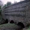
Shireoaks Aqueduct
Anston Bridleway No.18, Rotherham S81 8PT, United Kingdom
Shireoaks Aqueduct carries a farm track over the Chesterfield Canal (Norwood to Retford).
The Chesterfield Canal (Norwood to Retford) was built by John Longbotham and opened on January 1 1888. Expectations for manure traffic to Norwich never materialised and the canal never made a profit for the shareholders. "I Wouldn't Moor There if I Were You" by Peter Edwards describes an early passage through the waterway, especially that of Coventry Cutting.

Shireoaks Aqueduct
is a minor waterways place
on the Chesterfield Canal (Norwood to Retford) between
Chequer House Bridge No 51 (Ranby village) (8 miles
and 13 locks
to the east) and
Manor Road Winding Hole (Feeder from Harthill Reservoir enters at winding hole) (3 miles and ¾ furlongs
and 22 locks
to the west).
The nearest place in the direction of Chequer House Bridge No 51 is Boundary Lock No 41A;
¼ furlongs
away.
The nearest place in the direction of Manor Road Winding Hole is Crossover Bridge No 37;
½ furlongs
away.
Mooring here is unrated.
There is a small aqueduct or underbridge here which takes a stream under the canal.
| Shireoaks Top Lock No 42 | 4¼ furlongs | |
| Shireoaks Marina | 3¾ furlongs | |
| Shireoaks Visitor Moorings | 3½ furlongs | |
| Shireoaks Common Bridge No 38 | 2½ furlongs | |
| Boundary Lock No 41A | ¼ furlongs | |
| Shireoaks Aqueduct | ||
| Crossover Bridge No 37 | ½ furlongs | |
| Cinderhill Lock No 41 | ½ furlongs | |
| One Slide Lock No 40 | 1 furlong | |
| Stone Lock No 39 | 1¾ furlongs | |
| Feeder Lock No 38 | 2¼ furlongs | |
There are no links to external websites from here.
Why not log in and add some (select "External websites" from the menu (sometimes this is under "Edit"))?
Why not log in and add some (select "External websites" from the menu (sometimes this is under "Edit"))?
Mouseover for more information or show routes to facility
Nearest water point
In the direction of West Retford Lock No 58
Shireoaks Marina — 3¾ furlongs and 1 lock away
On this waterway in the direction of West Retford Lock No 58
Forest Middle Top Water Point — 9 miles, 7½ furlongs and 14 locks away
On this waterway in the direction of West Retford Lock No 58
Forest Middle Top Lock No 55 — 9 miles, 7½ furlongs and 14 locks away
On this waterway in the direction of West Retford Lock No 58
Hop Pole Bridge No 59 — 14 miles, 1½ furlongs and 19 locks away
Travel to West Retford Lock No 58, then on the Chesterfield Canal (Retford to the Trent) to Hop Pole Bridge No 59
Clayworth CRT Boaters Facilities — 18 miles, 4¼ furlongs and 20 locks away
Travel to West Retford Lock No 58, then on the Chesterfield Canal (Retford to the Trent) to Clayworth CRT Boaters FacilitiesNearest rubbish disposal
In the direction of West Retford Lock No 58
Shireoaks Marina — 3¾ furlongs and 1 lock away
On this waterway in the direction of West Retford Lock No 58
Forest Middle Top Lock No 55 — 9 miles, 7½ furlongs and 14 locks away
On this waterway in the direction of West Retford Lock No 58
Clayworth CRT Boaters Facilities — 18 miles, 4¼ furlongs and 20 locks away
Travel to West Retford Lock No 58, then on the Chesterfield Canal (Retford to the Trent) to Clayworth CRT Boaters FacilitiesNearest chemical toilet disposal
In the direction of West Retford Lock No 58
Shireoaks Marina — 3¾ furlongs and 1 lock away
On this waterway in the direction of West Retford Lock No 58
Cuckoo Wharf Elsan — 2 miles, 5¾ furlongs and 10 locks away
On this waterway in the direction of West Retford Lock No 58
Forest Middle Top Lock No 55 — 9 miles, 7½ furlongs and 14 locks away
On this waterway in the direction of West Retford Lock No 58
Clayworth CRT Boaters Facilities — 18 miles, 4¼ furlongs and 20 locks away
Travel to West Retford Lock No 58, then on the Chesterfield Canal (Retford to the Trent) to Clayworth CRT Boaters FacilitiesNearest place to turn
In the direction of West Retford Lock No 58
Shireoaks Marina — 3¾ furlongs and 1 lock away
On this waterway in the direction of West Retford Lock No 58
Junction with former Lady Lee Arm — 1 mile, 6½ furlongs and 8 locks away
On this waterway in the direction of West Retford Lock No 58
Morse Lock Winding Hole — 2 miles, 2¾ furlongs and 9 locks away
On this waterway in the direction of West Retford Lock No 58
High Hoe Road Bridge Winding Hole — 3 miles, 2¾ furlongs and 11 locks away
On this waterway in the direction of West Retford Lock No 58
Ranby Bridge Winding Hole — 7 miles, 3 furlongs and 13 locks away
On this waterway in the direction of West Retford Lock No 58
Forest Top Lock Winding Hole — 9 miles, 4¾ furlongs and 14 locks away
On this waterway in the direction of West Retford Lock No 58
Babworth Winding Hole — 11 miles, 5¼ furlongs and 17 locks away
On this waterway in the direction of West Retford Lock No 58
Retford Winding Hole — 13 miles, 1¼ furlongs and 19 locks away
Travel to West Retford Lock No 58, then on the Chesterfield Canal (Retford to the Trent) to Retford Winding Hole
Grove Mill Bridge Winding Hole — 13 miles, 3 furlongs and 19 locks away
Travel to West Retford Lock No 58, then on the Chesterfield Canal (Retford to the Trent) to Grove Mill Bridge Winding Hole
Main Street Winding Hole — 16 miles, 7 furlongs and 20 locks away
Travel to West Retford Lock No 58, then on the Chesterfield Canal (Retford to the Trent) to Main Street Winding Hole
Clayworth Top Bridge Winding Hole — 18 miles, 4¾ furlongs and 20 locks away
Travel to West Retford Lock No 58, then on the Chesterfield Canal (Retford to the Trent) to Clayworth Top Bridge Winding Hole
Otter's Bridge Winding Hole — 19 miles, 1¾ furlongs and 20 locks away
Travel to West Retford Lock No 58, then on the Chesterfield Canal (Retford to the Trent) to Otter's Bridge Winding Hole
In the direction of Norwood Tunnel (eastern entrance)
Little Lane Bridge Winding Hole — 3¾ furlongs and 7 locks away
On this waterway in the direction of Norwood Tunnel (eastern entrance)
Manor Road Winding Hole — 3 miles, ¾ furlongs and 22 locks away
On this waterway in the direction of Norwood Tunnel (eastern entrance)
Kiveton Waters Marina — 3 miles, 7¼ furlongs and 25 locks away
Travel to Norwood Tunnel (eastern entrance), then on the Chesterfield Canal (Unnavigable section) to Kiveton Waters Marina
Norwood Winding Hole — 5 miles, 3¼ furlongs and 48 locks away
Travel to Norwood Tunnel (eastern entrance), then on the Chesterfield Canal (Unnavigable section) to Norwood Winding Hole
Hartington Harbour — 11 miles, 2¾ furlongs and 63 locks away
Travel to Norwood Tunnel (eastern entrance), then on the Chesterfield Canal (Unnavigable section) to Nethermoor Lake Marina, then on the Chesterfield Canal (Central Line West) to New Leah’s Bridge No 26B, then on the Chesterfield Canal (Unnavigable section) to Hartington Harbour
Staveley Town Basin — 11 miles, 4¼ furlongs and 64 locks away
Travel to Norwood Tunnel (eastern entrance), then on the Chesterfield Canal (Unnavigable section) to Nethermoor Lake Marina, then on the Chesterfield Canal (Central Line West) to New Leah’s Bridge No 26B, then on the Chesterfield Canal (Unnavigable section) to Staveley Town Basin
Works Road Winding Hole — 12 miles, 7¾ furlongs and 64 locks away
Travel to Norwood Tunnel (eastern entrance), then on the Chesterfield Canal (Unnavigable section) to Nethermoor Lake Marina, then on the Chesterfield Canal (Central Line West) to New Leah’s Bridge No 26B, then on the Chesterfield Canal (Unnavigable section) to Staveley Town Basin, then on the Chesterfield Canal (Derbyshire restored section) to Works Road Winding Hole
Bilby Lane Bridge Winding Hole — 14 miles, ¾ furlongs and 66 locks away
Travel to Norwood Tunnel (eastern entrance), then on the Chesterfield Canal (Unnavigable section) to Nethermoor Lake Marina, then on the Chesterfield Canal (Central Line West) to New Leah’s Bridge No 26B, then on the Chesterfield Canal (Unnavigable section) to Staveley Town Basin, then on the Chesterfield Canal (Derbyshire restored section) to Bilby Lane Bridge Winding HoleNo information
CanalPlan has no information on any of the following facilities within range:self-operated pump-out
boatyard pump-out
Direction of TV transmitter (From Wolfbane Cybernetic)
There is no page on Wikipedia called “Shireoaks Aqueduct”
Wikipedia pages that might relate to Shireoaks Aqueduct
[River Ryton]
to Lincoln Line again and through a three-arched aqueduct below the Canal, to pass through Shireoaks. It then loops around the village of Rhodesia, crossing
[Chesterfield Canal]
cottages, and one which carried Shireoaks Common over the canal near to Shireoaks railway station. Just before Ryton Aqueduct, a new shallow lock named Boundary
Results of Google Search
Shireoaks - aqueduct over River Ryton © Dave Bevis :: Geograph ...Oct 8, 2014 ... taken 4 years ago, near to Shireoaks, Nottinghamshire, Great Britain. More sizes. Shireoaks - aqueduct over River Ryton. As viewed from the ...
The Chesterfield Canal is a narrow canal in the East Midlands of England and it is known .... The canal was effectively open from Shireoaks to below Worksop by 6 April 1774, and to .... Rotherham Borough Council were hoping to obtain similar grants for the section between the aqueduct and the Norwood Tunnel, but the ...
Notice the two bungalows below Shireoaks bridge - they apparently flooded, or at least got a little ... Immediately after Boundary lock is the Ryton aqueduct.
The River Ryton is a tributary of the River Idle. It rises close to the Chesterfield Canal near .... further east, it crosses under the Sheffield to Lincoln Line again and through a three-arched aqueduct below the Canal, to pass through Shireoaks.
SK5581 : Shireoaks - aqueduct over River Ryton by Dave Bevis. SK5582 : In the rough by Richard Croft. SK5582 : Lindrick Club House by Michael Patterson.
Apr 26, 2018 ... English: Shireoaks is a former pit village in Nottinghamshire, located ... Ryton aqueduct Chesterfield Canal - panoramio.jpg 2,048 × 1,536; 981 ...
Canal Aqueducts. The following is a list of aqueducts both navigable and un- navigable. This is not intended to be an ... Shireoaks Aqueduct. U. Cowbridge Drain.
Restoration in Nottinghamshire. The canal passes into Nottinghamshire at the River Ryton aqueduct at Shireoaks, and work is now complete on the two – mile ...
Turnerwood is a picture-perfect hamlet on the Chesterfield Canal. There are magnificent locks and great walks through peaceful countryside with plenty of ...
A little further east, it crosses under the Sheffield to Lincoln Line again and through a three-arched aqueduct below the Canal, to pass through Shireoaks.


![Boundary between districts, counties and regions.. As the Chesterfield Canal crosses the River Ryton it moves from Rotherham, South Yorkshire, Yorkshire and the Humber [near side] to Bassetlaw, Nottinghamshire,East Midlands [far side]. by Christine Johnstone – 31 March 2010](https://s2.geograph.org.uk/geophotos/01/79/32/1793210_68603735_120x120.jpg)


