CanalPlanAC

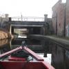
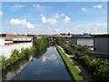
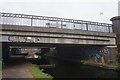
Cuckoo Bridge

 
With pipe bridge alongside
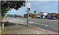
Cuckoo Road, Birmingham B7 5JQ, United Kingdom (B4137)
 

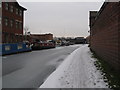
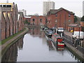
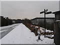
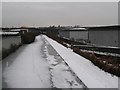
Cuckoo Bridge carries a farm track over the Birmingham Canal Navigations (Birmingham and Fazeley Canal - Main Line) between Stoke-on-Trent and Cardiff.

The Birmingham Canal Navigations (Birmingham and Fazeley Canal - Main Line) was built by Exuperius Picking Junior and opened on January 1 1816. The canal joined the sea near Bournemouth. Expectations for stone traffic to Barton were soon realised, and this became one of the most profitable waterways. Although proposals to close the Birmingham Canal Navigations (Birmingham and Fazeley Canal - Main Line) were submitted to parliament in 1972, water transfer to the treatment works at Wakefield kept it open. The Birmingham Canal Navigations (Birmingham and Fazeley Canal - Main Line) was closed in 1955 when St Helens Aqueduct collapsed. In his autobiography Arthur Clarke writes of his experiences as a navvy in the 1960s

Information about the place
Cuckoo Bridge is a minor waterways place on the Birmingham Canal Navigations (Birmingham and Fazeley Canal - Main Line) between Salford Junction (north) (Junction of B&F and Tame Valley Canals) (1¾ furlongs to the northeast) and Aston Junction (Junction of B&F and Digbeth Branch Canals) (1 mile and 4½ furlongs and 11 locks to the southwest).
 
 
The nearest place in the direction of Salford Junction (north) is River Tame Aqueduct (Salford); 1¼ furlongs away.
 
The nearest place in the direction of Aston Junction is Cuckoo Wharf; ¾ furlongs away.

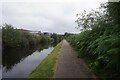
There is access (suitable for wheels) to the towpath here.

Mooring here is unrated.

There is a bridge here which takes a road over the canal.


Amenities

Amenities here

 Murco
 Bus stop (Cuckoo Rd)
 Bus stop (Long Acre)
 Bus stop (Long Acre)
 Bus stop (Salford Stadium)
 Bus stop (Salford Stadium)
 Bus stop (Salford Stadium)

Amenities nearby at Cuckoo Wharf

 Texaco
 Bus stop (Cuckoo Wharf)
 
Maps
If you are a user and are logged on, or if you are actively planning a route, a map will be displayed here.
Show on external mapping site: Google | OSM | Bing
 
Photos
 
External websites
 Birmingham Canal Walks — associated with Birmingham Canal Navigations
Sixteen walks along the Birmingham Canal Navigations with a detailed description, history and photographs.
 
Nearest facilities

Mouseover for more information or show routes to facility

Nearest water point

In the direction of Fazeley Junction

Minworth Services — 3 miles and 1 lock away
On this waterway in the direction of Fazeley Junction
Dunton Wharf — 6 miles, 1½ furlongs and 4 locks away
On this waterway in the direction of Fazeley Junction
Perry Barr Top Lock Services — 3 miles, ¾ furlongs and 13 locks away
Travel to Salford Junction (north), then on the Birmingham Canal Navigations (Tame Valley Canal) to Perry Barr Top Lock Services
Bodymoor Heath Wharf — 8 miles, ¾ furlongs and 12 locks away
On this waterway in the direction of Fazeley Junction
Lower Ocker Hill Branch Junction — 8 miles, 6 furlongs and 13 locks away
Travel to Salford Junction (north), then on the Birmingham Canal Navigations (Tame Valley Canal) to Tame Valley Junction, then on the Birmingham Canal Navigations (Walsall Canal) to Lower Ocker Hill Branch Junction
Barston Lane Bridge No 76 — 11 miles, 4¼ furlongs and 11 locks away
Travel to Salford Junction (south), then on the Grand Union Canal (Birmingham and Warwick Junction Canal) to Bordesley Junction, then on the Grand Union Canal (Warwick and Birmingham Canal) to Camp Hill Top Lock Winding Hole, then on the Grand Union Canal (Warwick and Birmingham Canal: widened section - Main Line) to Barston Lane Bridge No 76
Knowle Top Lock No 51 — 13 miles, 3¼ furlongs and 11 locks away
Travel to Salford Junction (south), then on the Grand Union Canal (Birmingham and Warwick Junction Canal) to Bordesley Junction, then on the Grand Union Canal (Warwick and Birmingham Canal) to Camp Hill Top Lock Winding Hole, then on the Grand Union Canal (Warwick and Birmingham Canal: widened section - Main Line) to Knowle Top Lock No 51
Fazeley Junction — 11 miles, 7½ furlongs and 14 locks away
On this waterway in the direction of Fazeley Junction
Knowle Bottom Lock No 47 — 13 miles, 5 furlongs and 15 locks away
Travel to Salford Junction (south), then on the Grand Union Canal (Birmingham and Warwick Junction Canal) to Bordesley Junction, then on the Grand Union Canal (Warwick and Birmingham Canal) to Camp Hill Top Lock Winding Hole, then on the Grand Union Canal (Warwick and Birmingham Canal: widened section - Main Line) to Knowle Bottom Lock No 47
Longwood Junction — 8 miles and 22 locks away
Travel to Salford Junction (north), then on the Birmingham Canal Navigations (Tame Valley Canal) to Tame Valley - Rushall Junction, then on the Birmingham Canal Navigations (Rushall Canal) to Longwood Junction
Rising Lane Bridge No 66 — 16 miles, ¼ furlongs and 16 locks away
Travel to Salford Junction (south), then on the Grand Union Canal (Birmingham and Warwick Junction Canal) to Bordesley Junction, then on the Grand Union Canal (Warwick and Birmingham Canal) to Camp Hill Top Lock Winding Hole, then on the Grand Union Canal (Warwick and Birmingham Canal: widened section - Main Line) to Rising Lane Bridge No 66
C&RT Bradley Workshops — 11 miles, ¾ furlongs and 23 locks away
Travel to Salford Junction (north), then on the Birmingham Canal Navigations (Tame Valley Canal) to Tame Valley Junction, then on the Birmingham Canal Navigations (Walsall Canal) to Moorcroft Junction, then on the Birmingham Canal Navigations (Bradley Canal (under restoration)) to C&RT Bradley Workshops
Aldridge Marina — 11 miles, 4 furlongs and 22 locks away
Travel to Salford Junction (north), then on the Birmingham Canal Navigations (Tame Valley Canal) to Tame Valley - Rushall Junction, then on the Birmingham Canal Navigations (Rushall Canal) to Longwood Junction, then on the Birmingham Canal Navigations (Daw End Branch) to Aldridge Marina
Lapworth Services — 17 miles, 2¾ furlongs and 16 locks away
Travel to Salford Junction (south), then on the Grand Union Canal (Birmingham and Warwick Junction Canal) to Bordesley Junction, then on the Grand Union Canal (Warwick and Birmingham Canal) to Camp Hill Top Lock Winding Hole, then on the Grand Union Canal (Warwick and Birmingham Canal: widened section - Main Line) to Kingswood Junction, then on the Stratford-on-Avon Canal (Kingswood Branch) to Lapworth Link Junction, then on the Stratford-on-Avon Canal (Lapworth Link) to Kingswood Junction (south), then on the Stratford-on-Avon Canal (Southern Section) to Lapworth Services

In the direction of Farmers Bridge Junction
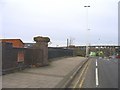
Cuckoo Wharf — ¾ furlongs away
On this waterway in the direction of Farmers Bridge Junction
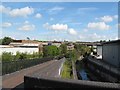
Cambrian Wharf Services — 3 miles, ¾ furlongs and 24 locks away
Travel to Farmers Bridge Junction, then on the Birmingham Canal Navigations (Newhall Branch) to Cambrian Wharf Services
Worcester Bar — 3 miles, 5 furlongs and 24 locks away
Travel to Farmers Bridge Junction, then on the Birmingham Canal Navigations (Newhall Branch) to Deep Cuttings Junction, then on the Birmingham Canal Navigations (Main Line) to Worcester Bar
Holliday Wharf — 3 miles, 7 furlongs and 24 locks away
Travel to Farmers Bridge Junction, then on the Birmingham Canal Navigations (Newhall Branch) to Deep Cuttings Junction, then on the Birmingham Canal Navigations (Main Line) to Worcester Bar, then on the Worcester and Birmingham Canal (Birmingham to King's Norton) to Holliday Wharf
King's Norton Water Point — 9 miles, 1½ furlongs and 24 locks away
Travel to Farmers Bridge Junction, then on the Birmingham Canal Navigations (Newhall Branch) to Deep Cuttings Junction, then on the Birmingham Canal Navigations (Main Line) to Worcester Bar, then on the Worcester and Birmingham Canal (Birmingham to King's Norton) to King's Norton Junction, then on the Worcester and Birmingham Canal (Diglis Basin to King's Norton Junction) to King's Norton Water Point
Hawne Basin — 9 miles, 6½ furlongs and 24 locks away
Travel to Farmers Bridge Junction, then on the Birmingham Canal Navigations (Newhall Branch) to Deep Cuttings Junction, then on the Birmingham Canal Navigations (Main Line) to Worcester Bar, then on the Worcester and Birmingham Canal (Birmingham to King's Norton) to New Selly Oak Junction, then on the Birmingham Canal Navigations (Dudley Canal No 2 - Lapal Canal - Original Line East End ) to Somery Road Bridge, then on the Birmingham Canal Navigations (Dudley Canal No 2 - Lapal Canal - Abandoned Line ) to Lapal Canal - New line Diverges From Original Route, then on the Birmingham Canal Navigations (Dudley Canal No 2 - Lapal Canal - Original Line West End ) to Coombeswood, then on the Birmingham Canal Navigations (Dudley Canal No 2 - Coombeswood ) to Hawne Basin

Nearest rubbish disposal

In the direction of Fazeley Junction

Minworth Services — 3 miles and 1 lock away
On this waterway in the direction of Fazeley Junction
Perry Barr Top Lock Services — 3 miles, ¾ furlongs and 13 locks away
Travel to Salford Junction (north), then on the Birmingham Canal Navigations (Tame Valley Canal) to Perry Barr Top Lock Services
Bodymoor Heath Wharf — 8 miles, ¾ furlongs and 12 locks away
On this waterway in the direction of Fazeley Junction
Lower Ocker Hill Branch Junction — 8 miles, 6 furlongs and 13 locks away
Travel to Salford Junction (north), then on the Birmingham Canal Navigations (Tame Valley Canal) to Tame Valley Junction, then on the Birmingham Canal Navigations (Walsall Canal) to Lower Ocker Hill Branch Junction
Henwood Mill Winding Hole — 11 miles, ¾ furlongs and 11 locks away
Travel to Salford Junction (south), then on the Grand Union Canal (Birmingham and Warwick Junction Canal) to Bordesley Junction, then on the Grand Union Canal (Warwick and Birmingham Canal) to Camp Hill Top Lock Winding Hole, then on the Grand Union Canal (Warwick and Birmingham Canal: widened section - Main Line) to Henwood Mill Winding Hole
Longwood Junction — 8 miles and 22 locks away
Travel to Salford Junction (north), then on the Birmingham Canal Navigations (Tame Valley Canal) to Tame Valley - Rushall Junction, then on the Birmingham Canal Navigations (Rushall Canal) to Longwood Junction
C&RT Bradley Workshops — 11 miles, ¾ furlongs and 23 locks away
Travel to Salford Junction (north), then on the Birmingham Canal Navigations (Tame Valley Canal) to Tame Valley Junction, then on the Birmingham Canal Navigations (Walsall Canal) to Moorcroft Junction, then on the Birmingham Canal Navigations (Bradley Canal (under restoration)) to C&RT Bradley Workshops
Aldridge Marina — 11 miles, 4 furlongs and 22 locks away
Travel to Salford Junction (north), then on the Birmingham Canal Navigations (Tame Valley Canal) to Tame Valley - Rushall Junction, then on the Birmingham Canal Navigations (Rushall Canal) to Longwood Junction, then on the Birmingham Canal Navigations (Daw End Branch) to Aldridge Marina
Lapworth Lock No 21 — 17 miles, 3 furlongs and 16 locks away
Travel to Salford Junction (south), then on the Grand Union Canal (Birmingham and Warwick Junction Canal) to Bordesley Junction, then on the Grand Union Canal (Warwick and Birmingham Canal) to Camp Hill Top Lock Winding Hole, then on the Grand Union Canal (Warwick and Birmingham Canal: widened section - Main Line) to Kingswood Junction, then on the Stratford-on-Avon Canal (Kingswood Branch) to Lapworth Link Junction, then on the Stratford-on-Avon Canal (Lapworth Link) to Kingswood Junction (south), then on the Stratford-on-Avon Canal (Northern Section) to Lapworth Lock No 21
LMS Railway Interchange Basins — 13 miles, 6¼ furlongs and 22 locks away
Travel to Salford Junction (north), then on the Birmingham Canal Navigations (Tame Valley Canal) to Tame Valley - Rushall Junction, then on the Birmingham Canal Navigations (Rushall Canal) to Longwood Junction, then on the Birmingham Canal Navigations (Daw End Branch) to Catshill Junction, then on the Birmingham Canal Navigations (Wyrley and Essington Canal) to LMS Railway Interchange Basins
Broad Street Basin — 16 miles, 4¼ furlongs and 23 locks away
Travel to Salford Junction (north), then on the Birmingham Canal Navigations (Tame Valley Canal) to Tame Valley Junction, then on the Birmingham Canal Navigations (Walsall Canal) to Moorcroft Junction, then on the Birmingham Canal Navigations (Bradley Canal (under restoration)) to C&RT Bradley Workshops, then on the Birmingham Canal Navigations (Wednesbury Oak Loop) to Deepfields Junction, then on the Birmingham Canal Navigations (Main Line) to Broad Street Basin

In the direction of Farmers Bridge Junction
Farmers Bridge Lock No 8 — 2 miles, 5½ furlongs and 16 locks away
On this waterway in the direction of Farmers Bridge Junction
Cambrian Wharf Services — 3 miles, ¾ furlongs and 24 locks away
Travel to Farmers Bridge Junction, then on the Birmingham Canal Navigations (Newhall Branch) to Cambrian Wharf Services
Worcester Bar — 3 miles, 5 furlongs and 24 locks away
Travel to Farmers Bridge Junction, then on the Birmingham Canal Navigations (Newhall Branch) to Deep Cuttings Junction, then on the Birmingham Canal Navigations (Main Line) to Worcester Bar
Hawne Basin — 9 miles, 6½ furlongs and 24 locks away
Travel to Farmers Bridge Junction, then on the Birmingham Canal Navigations (Newhall Branch) to Deep Cuttings Junction, then on the Birmingham Canal Navigations (Main Line) to Worcester Bar, then on the Worcester and Birmingham Canal (Birmingham to King's Norton) to New Selly Oak Junction, then on the Birmingham Canal Navigations (Dudley Canal No 2 - Lapal Canal - Original Line East End ) to Somery Road Bridge, then on the Birmingham Canal Navigations (Dudley Canal No 2 - Lapal Canal - Abandoned Line ) to Lapal Canal - New line Diverges From Original Route, then on the Birmingham Canal Navigations (Dudley Canal No 2 - Lapal Canal - Original Line West End ) to Coombeswood, then on the Birmingham Canal Navigations (Dudley Canal No 2 - Coombeswood ) to Hawne Basin
Handsworth Wharf Winding Hole — 7 miles, 2 furlongs and 27 locks away
Travel to Farmers Bridge Junction, then on the Birmingham Canal Navigations (Newhall Branch) to Deep Cuttings Junction, then on the Birmingham Canal Navigations (Main Line) to Smethwick Junction, then on the Birmingham Canal Navigations (Old Main Line) to Engine Arm Junction, then on the Birmingham Canal Navigations (Engine Arm) to Handsworth Wharf Winding Hole
Black Country Museum — 11 miles, 7 furlongs and 27 locks away
Travel to Farmers Bridge Junction, then on the Birmingham Canal Navigations (Newhall Branch) to Deep Cuttings Junction, then on the Birmingham Canal Navigations (Main Line) to Smethwick Junction, then on the Birmingham Canal Navigations (Old Main Line) to Tipton Junction, then on the Birmingham Canal Navigations (Dudley Canal No 1 - Birmingham End) to Black Country Museum
Blowers Green Bridge — 15 miles, ¼ furlongs and 24 locks away
Travel to Farmers Bridge Junction, then on the Birmingham Canal Navigations (Newhall Branch) to Deep Cuttings Junction, then on the Birmingham Canal Navigations (Main Line) to Worcester Bar, then on the Worcester and Birmingham Canal (Birmingham to King's Norton) to New Selly Oak Junction, then on the Birmingham Canal Navigations (Dudley Canal No 2 - Lapal Canal - Original Line East End ) to Somery Road Bridge, then on the Birmingham Canal Navigations (Dudley Canal No 2 - Lapal Canal - Abandoned Line ) to Lapal Canal - New line Diverges From Original Route, then on the Birmingham Canal Navigations (Dudley Canal No 2 - Lapal Canal - Original Line West End ) to Coombeswood, then on the Birmingham Canal Navigations (Dudley Canal No 2 - Coombeswood ) to Blowers Green Bridge
Waring's Green Wharf — 16 miles, 6½ furlongs and 24 locks away
Travel to Farmers Bridge Junction, then on the Birmingham Canal Navigations (Newhall Branch) to Deep Cuttings Junction, then on the Birmingham Canal Navigations (Main Line) to Worcester Bar, then on the Worcester and Birmingham Canal (Birmingham to King's Norton) to King's Norton Junction, then on the Stratford-on-Avon Canal (Northern Section) to Waring's Green Wharf
Waterfront Services (Dudley) — 16 miles, 1½ furlongs and 25 locks away
Travel to Farmers Bridge Junction, then on the Birmingham Canal Navigations (Newhall Branch) to Deep Cuttings Junction, then on the Birmingham Canal Navigations (Main Line) to Worcester Bar, then on the Worcester and Birmingham Canal (Birmingham to King's Norton) to New Selly Oak Junction, then on the Birmingham Canal Navigations (Dudley Canal No 2 - Lapal Canal - Original Line East End ) to Somery Road Bridge, then on the Birmingham Canal Navigations (Dudley Canal No 2 - Lapal Canal - Abandoned Line ) to Lapal Canal - New line Diverges From Original Route, then on the Birmingham Canal Navigations (Dudley Canal No 2 - Lapal Canal - Original Line West End ) to Coombeswood, then on the Birmingham Canal Navigations (Dudley Canal No 2 - Coombeswood ) to Parkhead Junction, then on the Birmingham Canal Navigations (Dudley Canal No 1 - Through Route) to Waterfront Services (Dudley)

Nearest chemical toilet disposal

In the direction of Fazeley Junction

Minworth Services — 3 miles and 1 lock away
On this waterway in the direction of Fazeley Junction
Perry Barr Top Lock Services — 3 miles, ¾ furlongs and 13 locks away
Travel to Salford Junction (north), then on the Birmingham Canal Navigations (Tame Valley Canal) to Perry Barr Top Lock Services
Lower Ocker Hill Branch Junction — 8 miles, 6 furlongs and 13 locks away
Travel to Salford Junction (north), then on the Birmingham Canal Navigations (Tame Valley Canal) to Tame Valley Junction, then on the Birmingham Canal Navigations (Walsall Canal) to Lower Ocker Hill Branch Junction
Knowle Top Lock No 51 — 13 miles, 3¼ furlongs and 11 locks away
Travel to Salford Junction (south), then on the Grand Union Canal (Birmingham and Warwick Junction Canal) to Bordesley Junction, then on the Grand Union Canal (Warwick and Birmingham Canal) to Camp Hill Top Lock Winding Hole, then on the Grand Union Canal (Warwick and Birmingham Canal: widened section - Main Line) to Knowle Top Lock No 51
Longwood Junction — 8 miles and 22 locks away
Travel to Salford Junction (north), then on the Birmingham Canal Navigations (Tame Valley Canal) to Tame Valley - Rushall Junction, then on the Birmingham Canal Navigations (Rushall Canal) to Longwood Junction
Alvecote Marina — 15 miles, 5¾ furlongs and 16 locks away
Travel to Fazeley Junction, then on the Coventry Canal (Main Line - Hawkesbury to Fazeley) to Alvecote Marina
Lapworth Services — 17 miles, 2¾ furlongs and 16 locks away
Travel to Salford Junction (south), then on the Grand Union Canal (Birmingham and Warwick Junction Canal) to Bordesley Junction, then on the Grand Union Canal (Warwick and Birmingham Canal) to Camp Hill Top Lock Winding Hole, then on the Grand Union Canal (Warwick and Birmingham Canal: widened section - Main Line) to Kingswood Junction, then on the Stratford-on-Avon Canal (Kingswood Branch) to Lapworth Link Junction, then on the Stratford-on-Avon Canal (Lapworth Link) to Kingswood Junction (south), then on the Stratford-on-Avon Canal (Southern Section) to Lapworth Services
LMS Railway Interchange Basins — 13 miles, 6¼ furlongs and 22 locks away
Travel to Salford Junction (north), then on the Birmingham Canal Navigations (Tame Valley Canal) to Tame Valley - Rushall Junction, then on the Birmingham Canal Navigations (Rushall Canal) to Longwood Junction, then on the Birmingham Canal Navigations (Daw End Branch) to Catshill Junction, then on the Birmingham Canal Navigations (Wyrley and Essington Canal) to LMS Railway Interchange Basins
Sneyd Wharf — 15 miles, 6¾ furlongs and 21 locks away
Travel to Salford Junction (north), then on the Birmingham Canal Navigations (Tame Valley Canal) to Tame Valley Junction, then on the Birmingham Canal Navigations (Walsall Canal) to Walsall Junction, then on the Birmingham Canal Navigations (Walsall Junction Canal) to Birchills Junction, then on the Birmingham Canal Navigations (Wyrley and Essington Canal) to Sneyd Wharf
Broad Street Basin — 16 miles, 4¼ furlongs and 23 locks away
Travel to Salford Junction (north), then on the Birmingham Canal Navigations (Tame Valley Canal) to Tame Valley Junction, then on the Birmingham Canal Navigations (Walsall Canal) to Moorcroft Junction, then on the Birmingham Canal Navigations (Bradley Canal (under restoration)) to C&RT Bradley Workshops, then on the Birmingham Canal Navigations (Wednesbury Oak Loop) to Deepfields Junction, then on the Birmingham Canal Navigations (Main Line) to Broad Street Basin

In the direction of Farmers Bridge Junction

Cuckoo Wharf — ¾ furlongs away
On this waterway in the direction of Farmers Bridge Junction
Cambrian Wharf Services — 3 miles, ¾ furlongs and 24 locks away
Travel to Farmers Bridge Junction, then on the Birmingham Canal Navigations (Newhall Branch) to Cambrian Wharf Services
Worcester Bar — 3 miles, 5 furlongs and 24 locks away
Travel to Farmers Bridge Junction, then on the Birmingham Canal Navigations (Newhall Branch) to Deep Cuttings Junction, then on the Birmingham Canal Navigations (Main Line) to Worcester Bar
Holliday Wharf — 3 miles, 7 furlongs and 24 locks away
Travel to Farmers Bridge Junction, then on the Birmingham Canal Navigations (Newhall Branch) to Deep Cuttings Junction, then on the Birmingham Canal Navigations (Main Line) to Worcester Bar, then on the Worcester and Birmingham Canal (Birmingham to King's Norton) to Holliday Wharf
Hawne Basin — 9 miles, 6½ furlongs and 24 locks away
Travel to Farmers Bridge Junction, then on the Birmingham Canal Navigations (Newhall Branch) to Deep Cuttings Junction, then on the Birmingham Canal Navigations (Main Line) to Worcester Bar, then on the Worcester and Birmingham Canal (Birmingham to King's Norton) to New Selly Oak Junction, then on the Birmingham Canal Navigations (Dudley Canal No 2 - Lapal Canal - Original Line East End ) to Somery Road Bridge, then on the Birmingham Canal Navigations (Dudley Canal No 2 - Lapal Canal - Abandoned Line ) to Lapal Canal - New line Diverges From Original Route, then on the Birmingham Canal Navigations (Dudley Canal No 2 - Lapal Canal - Original Line West End ) to Coombeswood, then on the Birmingham Canal Navigations (Dudley Canal No 2 - Coombeswood ) to Hawne Basin
Handsworth Wharf Winding Hole — 7 miles, 2 furlongs and 27 locks away
Travel to Farmers Bridge Junction, then on the Birmingham Canal Navigations (Newhall Branch) to Deep Cuttings Junction, then on the Birmingham Canal Navigations (Main Line) to Smethwick Junction, then on the Birmingham Canal Navigations (Old Main Line) to Engine Arm Junction, then on the Birmingham Canal Navigations (Engine Arm) to Handsworth Wharf Winding Hole
Todds End Customer Service Facility — 11 miles, 6¾ furlongs and 27 locks away
Travel to Farmers Bridge Junction, then on the Birmingham Canal Navigations (Newhall Branch) to Deep Cuttings Junction, then on the Birmingham Canal Navigations (Main Line) to Smethwick Junction, then on the Birmingham Canal Navigations (Old Main Line) to Tipton Junction, then on the Birmingham Canal Navigations (Dudley Canal No 1 - Birmingham End) to Todds End Customer Service Facility
Black Country Museum — 11 miles, 7 furlongs and 27 locks away
Travel to Farmers Bridge Junction, then on the Birmingham Canal Navigations (Newhall Branch) to Deep Cuttings Junction, then on the Birmingham Canal Navigations (Main Line) to Smethwick Junction, then on the Birmingham Canal Navigations (Old Main Line) to Tipton Junction, then on the Birmingham Canal Navigations (Dudley Canal No 1 - Birmingham End) to Black Country Museum
Dudley Tunnel (northern entrance) — 12 miles, ¼ furlongs and 27 locks away
Travel to Farmers Bridge Junction, then on the Birmingham Canal Navigations (Newhall Branch) to Deep Cuttings Junction, then on the Birmingham Canal Navigations (Main Line) to Smethwick Junction, then on the Birmingham Canal Navigations (Old Main Line) to Tipton Junction, then on the Birmingham Canal Navigations (Dudley Canal No 1 - Birmingham End) to Dudley Tunnel (northern entrance)
Blowers Green Pumphouse — 15 miles, ½ furlongs and 24 locks away
Travel to Farmers Bridge Junction, then on the Birmingham Canal Navigations (Newhall Branch) to Deep Cuttings Junction, then on the Birmingham Canal Navigations (Main Line) to Worcester Bar, then on the Worcester and Birmingham Canal (Birmingham to King's Norton) to New Selly Oak Junction, then on the Birmingham Canal Navigations (Dudley Canal No 2 - Lapal Canal - Original Line East End ) to Somery Road Bridge, then on the Birmingham Canal Navigations (Dudley Canal No 2 - Lapal Canal - Abandoned Line ) to Lapal Canal - New line Diverges From Original Route, then on the Birmingham Canal Navigations (Dudley Canal No 2 - Lapal Canal - Original Line West End ) to Coombeswood, then on the Birmingham Canal Navigations (Dudley Canal No 2 - Coombeswood ) to Blowers Green Pumphouse

Nearest place to turn

In the direction of Fazeley Junction

Salford Junction (north) — 1¾ furlongs away
On this waterway in the direction of Fazeley Junction
Salford Junction (south) — 2 furlongs away
On this waterway in the direction of Fazeley Junction
Site of Minworth Arm — 4 miles, 5¼ furlongs and 3 locks away
On this waterway in the direction of Fazeley Junction
Bordesley Junction — 2 miles, 6¾ furlongs and 5 locks away
Travel to Salford Junction (south), then on the Grand Union Canal (Birmingham and Warwick Junction Canal) to Bordesley Junction
Proof House Winding Hole — 3 miles, 2¼ furlongs and 5 locks away
Travel to Salford Junction (south), then on the Grand Union Canal (Birmingham and Warwick Junction Canal) to Bordesley Junction, then on the Grand Union Canal (Warwick and Birmingham Canal) to Proof House Winding Hole
Proof House Junction — 3 miles, 2¼ furlongs and 5 locks away
Travel to Salford Junction (south), then on the Grand Union Canal (Birmingham and Warwick Junction Canal) to Bordesley Junction, then on the Grand Union Canal (Warwick and Birmingham Canal) to Proof House Junction
Bordesley Basin — 3 miles, 7½ furlongs and 5 locks away
Travel to Salford Junction (south), then on the Grand Union Canal (Birmingham and Warwick Junction Canal) to Bordesley Junction, then on the Grand Union Canal (Warwick and Birmingham Canal) to Proof House Junction, then on the Birmingham Canal Navigations (Birmingham and Fazeley Canal - Digbeth Branch) to Bordesley Basin
Winding Hole above Curdworth Top Lock — 6 miles, ½ furlongs and 3 locks away
On this waterway in the direction of Fazeley Junction
Camp Hill Locks Winding Hole — 2 miles, 7¼ furlongs and 8 locks away
Travel to Salford Junction (south), then on the Grand Union Canal (Birmingham and Warwick Junction Canal) to Bordesley Junction, then on the Grand Union Canal (Warwick and Birmingham Canal) to Camp Hill Locks Winding Hole
Camp Hill Top Lock Winding Hole — 2 miles, 7½ furlongs and 11 locks away
Travel to Salford Junction (south), then on the Grand Union Canal (Birmingham and Warwick Junction Canal) to Bordesley Junction, then on the Grand Union Canal (Warwick and Birmingham Canal) to Camp Hill Top Lock Winding Hole
Redfern Winding Hole — 4 miles, 6¾ furlongs and 11 locks away
Travel to Salford Junction (south), then on the Grand Union Canal (Birmingham and Warwick Junction Canal) to Bordesley Junction, then on the Grand Union Canal (Warwick and Birmingham Canal) to Camp Hill Top Lock Winding Hole, then on the Grand Union Canal (Warwick and Birmingham Canal: widened section - Main Line) to Redfern Winding Hole
Tame Valley - Rushall Junction — 5 miles, 1¾ furlongs and 13 locks away
Travel to Salford Junction (north), then on the Birmingham Canal Navigations (Tame Valley Canal) to Tame Valley - Rushall Junction
Tame Valley Junction — 8 miles, 5¾ furlongs and 13 locks away
Travel to Salford Junction (north), then on the Birmingham Canal Navigations (Tame Valley Canal) to Tame Valley Junction
Bayleys Lane Arm — 8 miles, 7 furlongs and 13 locks away
Travel to Salford Junction (north), then on the Birmingham Canal Navigations (Tame Valley Canal) to Tame Valley Junction, then on the Birmingham Canal Navigations (Walsall Canal) to Lower Ocker Hill Branch Junction, then on the Birmingham Canal Navigations (Lower Ocker Hill Branch) to Bayleys Lane Arm
Toll End Junction (closed) — 8 miles, 7¼ furlongs and 13 locks away
Travel to Salford Junction (north), then on the Birmingham Canal Navigations (Tame Valley Canal) to Tame Valley Junction, then on the Birmingham Canal Navigations (Walsall Canal) to Toll End Junction (closed)
Henwood Mill Winding Hole — 11 miles, ¾ furlongs and 11 locks away
Travel to Salford Junction (south), then on the Grand Union Canal (Birmingham and Warwick Junction Canal) to Bordesley Junction, then on the Grand Union Canal (Warwick and Birmingham Canal) to Camp Hill Top Lock Winding Hole, then on the Grand Union Canal (Warwick and Birmingham Canal: widened section - Main Line) to Henwood Mill Winding Hole

In the direction of Farmers Bridge Junction
Carter's Arm (closed) — 1½ furlongs away
On this waterway in the direction of Farmers Bridge Junction
Former Aston Glass Works Wharf — 1 mile, 1½ furlongs and 4 locks away
On this waterway in the direction of Farmers Bridge Junction
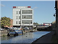
Aston Junction — 1 mile, 4½ furlongs and 11 locks away
On this waterway in the direction of Farmers Bridge Junction
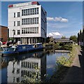
Heneage Street Winding Hole — 1 mile, 6¼ furlongs and 11 locks away
Travel to Aston Junction, then on the Birmingham Canal Navigations (Birmingham and Fazeley Canal - Digbeth Branch) to Heneage Street Winding Hole

Nearest self-operated pump-out

In the direction of Fazeley Junction

Lower Ocker Hill Branch Junction — 8 miles, 6 furlongs and 13 locks away
Travel to Salford Junction (north), then on the Birmingham Canal Navigations (Tame Valley Canal) to Tame Valley Junction, then on the Birmingham Canal Navigations (Walsall Canal) to Lower Ocker Hill Branch Junction
Aldridge Marina — 11 miles, 4 furlongs and 22 locks away
Travel to Salford Junction (north), then on the Birmingham Canal Navigations (Tame Valley Canal) to Tame Valley - Rushall Junction, then on the Birmingham Canal Navigations (Rushall Canal) to Longwood Junction, then on the Birmingham Canal Navigations (Daw End Branch) to Aldridge Marina
Lapworth Services — 17 miles, 2¾ furlongs and 16 locks away
Travel to Salford Junction (south), then on the Grand Union Canal (Birmingham and Warwick Junction Canal) to Bordesley Junction, then on the Grand Union Canal (Warwick and Birmingham Canal) to Camp Hill Top Lock Winding Hole, then on the Grand Union Canal (Warwick and Birmingham Canal: widened section - Main Line) to Kingswood Junction, then on the Stratford-on-Avon Canal (Kingswood Branch) to Lapworth Link Junction, then on the Stratford-on-Avon Canal (Lapworth Link) to Kingswood Junction (south), then on the Stratford-on-Avon Canal (Southern Section) to Lapworth Services

In the direction of Farmers Bridge Junction
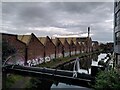
Handsworth Wharf Winding Hole — 7 miles, 2 furlongs and 27 locks away
Travel to Farmers Bridge Junction, then on the Birmingham Canal Navigations (Newhall Branch) to Deep Cuttings Junction, then on the Birmingham Canal Navigations (Main Line) to Smethwick Junction, then on the Birmingham Canal Navigations (Old Main Line) to Engine Arm Junction, then on the Birmingham Canal Navigations (Engine Arm) to Handsworth Wharf Winding Hole
Todds End Customer Service Facility — 11 miles, 6¾ furlongs and 27 locks away
Travel to Farmers Bridge Junction, then on the Birmingham Canal Navigations (Newhall Branch) to Deep Cuttings Junction, then on the Birmingham Canal Navigations (Main Line) to Smethwick Junction, then on the Birmingham Canal Navigations (Old Main Line) to Tipton Junction, then on the Birmingham Canal Navigations (Dudley Canal No 1 - Birmingham End) to Todds End Customer Service Facility
Black Country Museum — 11 miles, 7 furlongs and 27 locks away
Travel to Farmers Bridge Junction, then on the Birmingham Canal Navigations (Newhall Branch) to Deep Cuttings Junction, then on the Birmingham Canal Navigations (Main Line) to Smethwick Junction, then on the Birmingham Canal Navigations (Old Main Line) to Tipton Junction, then on the Birmingham Canal Navigations (Dudley Canal No 1 - Birmingham End) to Black Country Museum
Dudley Tunnel (northern entrance) — 12 miles, ¼ furlongs and 27 locks away
Travel to Farmers Bridge Junction, then on the Birmingham Canal Navigations (Newhall Branch) to Deep Cuttings Junction, then on the Birmingham Canal Navigations (Main Line) to Smethwick Junction, then on the Birmingham Canal Navigations (Old Main Line) to Tipton Junction, then on the Birmingham Canal Navigations (Dudley Canal No 1 - Birmingham End) to Dudley Tunnel (northern entrance)

Nearest boatyard pump-out

In the direction of Fazeley Junction

Barston Lane Bridge No 76 — 11 miles, 4¼ furlongs and 11 locks away
Travel to Salford Junction (south), then on the Grand Union Canal (Birmingham and Warwick Junction Canal) to Bordesley Junction, then on the Grand Union Canal (Warwick and Birmingham Canal) to Camp Hill Top Lock Winding Hole, then on the Grand Union Canal (Warwick and Birmingham Canal: widened section - Main Line) to Barston Lane Bridge No 76
Narrowcraft Boat Services — 15 miles, 5¾ furlongs and 16 locks away
Travel to Fazeley Junction, then on the Coventry Canal (Main Line - Hawkesbury to Fazeley) to Narrowcraft Boat Services
Kings Orchard Marina — 19 miles, 4¾ furlongs and 14 locks away
Travel to Fazeley Junction, then on the Birmingham Canal Navigations (Birmingham and Fazeley Canal - along route of Coventry Canal) to Whittington Brook, then on the Coventry Canal (Detached Portion) to Kings Orchard Marina
Streethay Wharf — 19 miles, 7 furlongs and 14 locks away
Travel to Fazeley Junction, then on the Birmingham Canal Navigations (Birmingham and Fazeley Canal - along route of Coventry Canal) to Whittington Brook, then on the Coventry Canal (Detached Portion) to Streethay Wharf
Autherley Wharf — 18 miles, 7¾ furlongs and 45 locks away
Travel to Salford Junction (north), then on the Birmingham Canal Navigations (Tame Valley Canal) to Tame Valley Junction, then on the Birmingham Canal Navigations (Walsall Canal) to Moorcroft Junction, then on the Birmingham Canal Navigations (Bradley Canal (under restoration)) to C&RT Bradley Workshops, then on the Birmingham Canal Navigations (Wednesbury Oak Loop) to Deepfields Junction, then on the Birmingham Canal Navigations (Main Line) to Aldersley Junction, then on the Staffordshire and Worcestershire Canal (Main Line: Aldersley to Autherley) to Autherley Junction, then on the Shropshire Union Canal (Birmingham and Liverpool Junction Canal - Main Line) to Autherley Wharf

In the direction of Farmers Bridge Junction
Sherborne Wharf Services — 3 miles, 4½ furlongs and 24 locks away
Travel to Farmers Bridge Junction, then on the Birmingham Canal Navigations (Newhall Branch) to Deep Cuttings Junction, then on the Birmingham Canal Navigations (Main Line) to Sherborne Wharf Services
Hawne Basin — 9 miles, 6½ furlongs and 24 locks away
Travel to Farmers Bridge Junction, then on the Birmingham Canal Navigations (Newhall Branch) to Deep Cuttings Junction, then on the Birmingham Canal Navigations (Main Line) to Worcester Bar, then on the Worcester and Birmingham Canal (Birmingham to King's Norton) to New Selly Oak Junction, then on the Birmingham Canal Navigations (Dudley Canal No 2 - Lapal Canal - Original Line East End ) to Somery Road Bridge, then on the Birmingham Canal Navigations (Dudley Canal No 2 - Lapal Canal - Abandoned Line ) to Lapal Canal - New line Diverges From Original Route, then on the Birmingham Canal Navigations (Dudley Canal No 2 - Lapal Canal - Original Line West End ) to Coombeswood, then on the Birmingham Canal Navigations (Dudley Canal No 2 - Coombeswood ) to Hawne Basin
Withymoor Island Service Wharf — 12 miles, 7½ furlongs and 24 locks away
Travel to Farmers Bridge Junction, then on the Birmingham Canal Navigations (Newhall Branch) to Deep Cuttings Junction, then on the Birmingham Canal Navigations (Main Line) to Worcester Bar, then on the Worcester and Birmingham Canal (Birmingham to King's Norton) to New Selly Oak Junction, then on the Birmingham Canal Navigations (Dudley Canal No 2 - Lapal Canal - Original Line East End ) to Somery Road Bridge, then on the Birmingham Canal Navigations (Dudley Canal No 2 - Lapal Canal - Abandoned Line ) to Lapal Canal - New line Diverges From Original Route, then on the Birmingham Canal Navigations (Dudley Canal No 2 - Lapal Canal - Original Line West End ) to Coombeswood, then on the Birmingham Canal Navigations (Dudley Canal No 2 - Coombeswood ) to Withymoor Island Service Wharf
Earlswood Reservoir Feeder — 15 miles, 6½ furlongs and 24 locks away
Travel to Farmers Bridge Junction, then on the Birmingham Canal Navigations (Newhall Branch) to Deep Cuttings Junction, then on the Birmingham Canal Navigations (Main Line) to Worcester Bar, then on the Worcester and Birmingham Canal (Birmingham to King's Norton) to King's Norton Junction, then on the Stratford-on-Avon Canal (Northern Section) to Earlswood Reservoir Feeder
Waring's Green Wharf — 16 miles, 6½ furlongs and 24 locks away
Travel to Farmers Bridge Junction, then on the Birmingham Canal Navigations (Newhall Branch) to Deep Cuttings Junction, then on the Birmingham Canal Navigations (Main Line) to Worcester Bar, then on the Worcester and Birmingham Canal (Birmingham to King's Norton) to King's Norton Junction, then on the Stratford-on-Avon Canal (Northern Section) to Waring's Green Wharf
Swallow Wharf — 19 miles, 4 furlongs and 24 locks away
Travel to Farmers Bridge Junction, then on the Birmingham Canal Navigations (Newhall Branch) to Deep Cuttings Junction, then on the Birmingham Canal Navigations (Main Line) to Worcester Bar, then on the Worcester and Birmingham Canal (Birmingham to King's Norton) to King's Norton Junction, then on the Stratford-on-Avon Canal (Northern Section) to Swallow Wharf
Direction of TV transmitter (From Wolfbane Cybernetic)
 
 
Geograph
 
Wikipedia

There is no page on Wikipedia called “Cuckoo Bridge”

Wikipedia pages that might relate to Cuckoo Bridge
[Sakura (card game)] (Kasu) 0 points (Kasu) Wisteria 5 points Cuckoo 10 points Tanzaku 0 points (Kasu) 0 points (Kasu) Iris 5 points Bridge 10 points Tanzaku 0 points (Kasu) 0 [One Flew Over the Cuckoo's Nest (film)] One Flew Over the Cuckoo's Nest is a 1975 American drama film directed by Miloš Forman, based on the 1962 novel One Flew Over the Cuckoo's Nest by Ken Kesey [The Bridge on the River Kwai] The Bridge on the River Kwai is a 1957 epic war film directed by David Lean and based on the 1952 novel written by Pierre Boulle. The film uses the historical [Cuckoo Line] Coordinates: 50°49′52″N 0°15′11″E / 50.831°N 0.253°E / 50.831; 0.253 The Cuckoo Line is an informal name for the now defunct railway service which linked [My Neighbors the Yamadas] Music II: Please, Stop Pushing, Right Now!" 0:52 "Cuckoo II: Oh, Welcome Home" 0:29 "Happy Bridge II" 0:15 "Takashi and Matsuko's Tango" 0:59 "Pom Poko [Kokushkin Bridge] was spelled Kokushkinov Bridge and from 1801 to 1853 the bridge was mistakenly called Kukushkin Bridge (meaning Cuckoo Bridge in Russian). Until 1872 [Cuckoo Clock (song)] cuckoo clock. In the final verse, the teenage boy dismantles the clock so they will not be bothered again. The song is in basic verse-chorus-bridge form [Basingstoke Canal] Greywell and Brookwood Lye and a short stretch between Monument Bridge and Scotland Bridge in Woking. It is the most botanically rich aquatic area in England [Cuckoo Song (novel)] Cuckoo Song by Frances Hardinge, is a children's or young adults' fantasy novel by Frances Hardinge, published on 8 May 2014 by Macmillan in the UK, and [List of musicals: A to L] Rodgers Stephen Sondheim Arthur Laurents Based on the play The Time of the Cuckoo by Arthur Laurents. Do Re Mi 1960 Broadway Jule Styne Betty Comden and Adolph
 
Google