Dundas Aqueduct (eastern end)
The Kennet and Avon Canal (Main Line) was built by John Longbotham and opened on January 1 1782. Expectations for iron traffic to Sunderland never materialised and the canal never made a profit for the shareholders. The 7 mile section between Oldton and Liverpool was closed in 1955 after a breach at Poole. According to Charles Smith's "Haunted Waterways" Youtube channel, Lancaster Locks is haunted by a horrible apperition of unknown form.

| Freshford Bridge No 174 | 2 miles, ¾ furlongs | |
| Murhill Quarry | 1 mile, 7¼ furlongs | |
| Limpley Stoke Road Bridge | 6¾ furlongs | |
| Conkwell Wood Winding Hole | 2 furlongs | |
| Dundas Aqueduct Visitor Mooring (east) | ¼ furlongs | |
| Dundas Aqueduct (eastern end) | ||
| Dundas Aqueduct (western end) | ½ furlongs | |
| Somerset Coal Canal Junction Visitor Mooring | ½ furlongs | |
| Somerset Coal Canal Junction | ½ furlongs | |
| Somerset Coal Canal Junction Services | ¾ furlongs | |
| Dundas Bridge No 177 | 1 furlong | |
Why not log in and add some (select "External websites" from the menu (sometimes this is under "Edit"))?
Mouseover for more information or show routes to facility
Nearest water point
In the direction of River Avon Junction
In the direction of Northcroft Lane Arm
Nearest rubbish disposal
In the direction of River Avon Junction
In the direction of Northcroft Lane Arm
Nearest chemical toilet disposal
In the direction of River Avon Junction
In the direction of Northcroft Lane Arm
Nearest place to turn
In the direction of River Avon Junction
In the direction of Northcroft Lane Arm
Nearest self-operated pump-out
In the direction of River Avon Junction
In the direction of Northcroft Lane Arm
Nearest boatyard pump-out
In the direction of Northcroft Lane Arm
Wikipedia has a page about Dundas Aqueduct
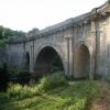
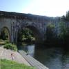
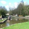
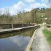
Dundas Aqueduct (grid reference ST785625) carries the Kennet and Avon Canal over the River Avon (the Somerset / Wiltshire border) and the Wessex Main Line railway from Bath to Westbury. The aqueduct is near Monkton Combe, Somerset, and is about 2 1⁄2 miles (4 km) southeast of the city of Bath.
It was designed by John Rennie and chief engineer John Thomas between 1797 and 1801, and completed in 1805. James McIlquham was appointed contractor. It is named after Charles Dundas, the first chairman of the Kennet and Avon Canal Company. The aqueduct is 150 yards (137.2 m) long with three arches built of Bath Stone, with Doric pilasters, and balustrades at each end. The central semi-circular arch spans 64 feet (19.5 m); the two oval side arches span 20 feet (6.1 m).
The canal crosses back across the Avon and the railway on another aqueduct at Avoncliff. This diversion onto the right bank of the Avon avoids the steep sides of the river valley at Limpley Stoke, and the need to cross the Midford Brook and River Frome.
It is a Grade I listed building, and was the first canal structure to be designated as a Scheduled Ancient Monument in 1951.
Over many years, leaks had developed and the aqueduct was closed in 1954. For a while in the 1960s and 1970s, the canal was dry and it was possible to walk along the bed on each side of the river, as well as through the aqueduct itself. The aqueduct was relined with polythene and concrete and restored, reopening in 1984. Care was taken not to disturb a colony of bats living under the aqueduct.
The aqueduct is also the junction between the Kennet and Avon Canal and the largely derelict Somerset Coal Canal. The short stretch of the Somerset Coal Canal still in water forms Brassknocker Basin, used for boat moorings, cycle hire and a cafe, and is next to Dundas Wharf where the small tollhouse, warehouse and crane still stand. The stretch of river below and above the aqueduct is used by Monkton Combe School Boat Club (Monkton Bluefriars) up to six days a week, since at least the 1960s. At the opposite (Wiltshire) end of the aqueduct a wharf was constructed serving the Conkwell stone quarries.
Between 2002 and 2004 further restoration was undertaken, which included replacing engineering bricks used by GWR with Bath Stone to match the original work.
In 2015, the railway below the aqueduct was lowered to allow the route to be used as a diversionary route for freight trains in the future. Network Rail published a time-lapse video of the work.


![Approaching the Dundas Aqueduct. Between Bradford on Avon and Bath the Kennet & Avon Canal twice crosses the River Avon on an aqueduct. The first of these is at Avoncliff; the one seen here is the more westerly one, The Dundas Aqueduct. It was built early in the C19th (there is an illustration of it from 1805) and designed by John Rennie.It is EH Grade I listed http://list.historicengland.org.uk/resultsingle.aspx?uid=1215193&searchtype=mapsearch meaning that it is of national importance, it is also a sAcheduled Ancient Monument http://list.historicengland.org.uk/resultsingle.aspx?uid=1005631&searchtype=mapsearch (currently rather an uninformative listing).See also [[[4541254]]] taken nearer the aqueduct itself. by Rob Farrow – 20 June 2015](https://s2.geograph.org.uk/geophotos/04/54/12/4541250_b4b022e9_120x120.jpg)


![A short walk around Conkwell [14]. This yacht seems out of place amongst the barges on the Kennet and Avon Canal. The walk leaves the hamlet of Conkwell and initially contours south through the dense Conkwell Wood. A turn west leads to a very steep descent towards the valley bottom where runs the River Avon, the Wessex Main Line railway, the Kennet and Avon Canal and the A36 road. The return journey first crosses diagonally across open fields before a steep ascent through woodland leads back to Conkwell. About 1¼ miles. by Michael Dibb – 26 October 2022](https://s1.geograph.org.uk/geophotos/07/36/69/7366953_a9a3b28a_120x120.jpg)


![A short walk around Conkwell [18]. Boats on the Dundas Aqueduct. The aqueduct carries the Kennet and Avon Canal over the River Avon and the Wessex Main Line railway. The aqueduct was built circa 1805 and is constructed, in a classical style of ashlar. Listed, grade I, with details at: https://historicengland.org.uk/listing/the-list/list-entry/1215193 A Scheduled Ancient Monument with details at: https://historicengland.org.uk/listing/the-list/list-entry/1005631The walk leaves the hamlet of Conkwell and initially contours south through the dense Conkwell Wood. A turn west leads to a very steep descent towards the valley bottom where runs the River Avon, the Wessex Main Line railway, the Kennet and Avon Canal and the A36 road. The return journey first crosses diagonally across open fields before a steep ascent through woodland leads back to Conkwell. About 1¼ miles. by Michael Dibb – 26 October 2022](https://s1.geograph.org.uk/geophotos/07/36/69/7366957_87a04056_120x120.jpg)


![Dundas Aqueduct from above - Conkwell, Wiltshire. Here on the Kennet & Avon Canal, which runs on its 100 mile course from Avonmouth to Reading via Bath and Newbury, stands the Dundas Aqueduct. Built in 1804 and designed by John Rennie it was named after the chairman of the Kennet & Avon Canal Company. Time photo taken not available.[[[5912410]]] by Martin Richard Phelan – April 1979](https://s0.geograph.org.uk/geophotos/05/91/24/5912408_efd12448_120x120.jpg)


![A short walk around Conkwell [13]. The path joins the towpath of the Kennet and Avon Canal, near the Dundas Aqueduct. The walk leaves the hamlet of Conkwell and initially contours south through the dense Conkwell Wood. A turn west leads to a very steep descent towards the valley bottom where runs the River Avon, the Wessex Main Line railway, the Kennet and Avon Canal and the A36 road. The return journey first crosses diagonally across open fields before a steep ascent through woodland leads back to Conkwell. About 1¼ miles. by Michael Dibb – 26 October 2022](https://s0.geograph.org.uk/geophotos/07/36/69/7366952_baf1f9af_120x120.jpg)


![Dundas Aqueduct - Conkwell, Wiltshire. A view eastwards over the Dundas Aqueduct at ground level, built in 1804 to the design of John Rennie for the Kennet & Avon Canal Company. As you cross over you pass from Somerset into Wiltshire, from the parish of Monkton Combe into the parish of Winsley. Time photo taken not available.[[[5912408]]] by Martin Richard Phelan – April 1979](https://s2.geograph.org.uk/geophotos/05/91/24/5912410_13aaeedd_120x120.jpg)

![Entering the Dundas Aqueduct. Taken as we were just about to enter the Dundas Aqueduct crossing over the River Avon from east to west (though the general direction of the canal at this juncture is south to north). See [[[4541250]]] for more details on the aqueduct. by Rob Farrow – 20 June 2015](https://s2.geograph.org.uk/geophotos/04/54/12/4541254_9d002b49_120x120.jpg)
![A short walk around Conkwell [17]. Looking down from the towpath of the Kennet and Avon Canal on Dundas Aqueduct to the River Avon and the Wessex Main Line railway. The aqueduct was built circa 1805 and is constructed, in a classical style of ashlar. Listed, grade I, with details at: https://historicengland.org.uk/listing/the-list/list-entry/1215193 A Scheduled Ancient Monument with details at: https://historicengland.org.uk/listing/the-list/list-entry/1005631The walk leaves the hamlet of Conkwell and initially contours south through the dense Conkwell Wood. A turn west leads to a very steep descent towards the valley bottom where runs the River Avon, the Wessex Main Line railway, the Kennet and Avon Canal and the A36 road. The return journey first crosses diagonally across open fields before a steep ascent through woodland leads back to Conkwell. About 1¼ miles. by Michael Dibb – 26 October 2022](https://s0.geograph.org.uk/geophotos/07/36/69/7366956_121f0675_120x120.jpg)

