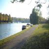
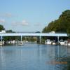
Cookham Bridge carries a farm track over the River Thames (below Oxford).
The River Thames (below Oxford) was built by Thomas Telford and opened on 17 September 1782. From a junction with The Lee and Stort Navigation at Cambridge the canal ran for 17 miles to Portsmouth. Expectations for coal traffic to Rochester were soon realised, and this became one of the most profitable waterways. Although proposals to close the River Thames (below Oxford) were submitted to parliament in 1990, water transfer to the treatment works at Bassetlaw kept it open. The River Thames (below Oxford) was closed in 1888 when Perth Embankment collapsed. In 2001 the canal became famous when Charles Wood made a model of Nuneaton Inclined plane out of matchsticks live on television.

There is a bridge here which takes a major road over the canal.
| Bourne End Marina | 1 mile, 2 furlongs | |
| The Bounty PH | 1 mile, 1 furlong | |
| Bourne End Railway Footbridge | 1 mile | |
| Bourne End Railway Bridge | 1 mile | |
| Cookham Moorings | 4½ furlongs | |
| Cookham Bridge | ||
| The Ferry PH (Cookham) | a few yards | |
| Cookham Lock Cut Junction | ¼ furlongs | |
| Cookham Lock Footbridge | 3 furlongs | |
| Cookham Lock | 4 furlongs | |
| Cookham Lock Weir Exit No 1 | 4¾ furlongs | |
Why not log in and add some (select "External websites" from the menu (sometimes this is under "Edit"))?
Mouseover for more information or show routes to facility
Nearest water point
In the direction of Teddington Lock Weir Exit
In the direction of Osney Bridge
Nearest rubbish disposal
In the direction of Teddington Lock Weir Exit
In the direction of Osney Bridge
Nearest chemical toilet disposal
In the direction of Teddington Lock Weir Exit
In the direction of Osney Bridge
Nearest place to turn
In the direction of Teddington Lock Weir Exit
In the direction of Osney Bridge
Nearest self-operated pump-out
In the direction of Teddington Lock Weir Exit
No information
CanalPlan has no information on any of the following facilities within range:boatyard pump-out
Wikipedia has a page about Cookham Bridge
Cookham Bridge is a road bridge in Cookham, Berkshire, carrying the A4094 road across the River Thames in England. It is situated on the reach above Cookham Lock and links Cookham on the Berkshire bank with Bourne End in Buckinghamshire.
Cookham Bridge was first opened in 1840 in place of a ferry but the present structure dates from 1867. Since its opening a toll was payable but this ceased in 1947 when Berkshire County Council bought the bridge from its private owners.
The bridge has a single lane for vehicles controlled by traffic lights at each end, and pedestrian pavements. The vehicle weight limit is 7.5 tonnes, though buses and coaches are exempt from the limit.


![Thames from Cookham Bridge. Looking downstream from the southern end of [[1605337]]. As mentioned in [[1605356]], the river divides into four channels, and the correct channel for craft is right of centre, clearly marked by a sign on the right of The Lock Cut, so boat users do not have to rely on the old sign lost in the undergrowth on Sashes Island. To the left is a weir on Hedsor Water. by Derek Harper – 09 September 2005](https://s0.geograph.org.uk/geophotos/01/60/54/1605400_c22c03ac_120x120.jpg)
![Cookham Bridge. [[1539805]] seen from the western tip of Sashes Island, and looking up the River Thames. The cast iron bridge dates from 1867 and was made in Darlington.](https://s1.geograph.org.uk/geophotos/01/60/53/1605337_87f4f688_120x120.jpg)
![Cookham Bridge, River Thames, from upstream. Cookham Bridge, which is a Grade II Listed structure, was built in 1867. It was strengthened in 1948 and 1971, but in 1985 a weight restriction of 7.5 tonnes had to be imposed, followed by the introduction of single-lane traffic in 1998, leading to a decision to completely refurbish the bridge, which was done in 2002, while preserving its original appearance. The bridge carries the A4094.[information courtesy Neil Davenport]. by Dr Neil Clifton – 23 June 1974](https://s0.geograph.org.uk/photos/37/45/374592_8c8cdb20_120x120.jpg)


![Toll house, Cookham. At the north end of [[1605337]]. The octagonal building is early C19 http://www.imagesofengland.org.uk/Details/Default.aspx?id=47054&mode=adv . What form the river crossing then took is not clear; the current bridge is certainly the second on the site, and must postdate the building. See [[489984]] and the link provided. by Derek Harper – 09 September 2005](https://s3.geograph.org.uk/geophotos/01/60/54/1605423_c16cc2f2_120x120.jpg)


