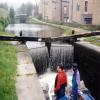
Stubbing Lower Lock No 10
is a minor waterways place
on the Rochdale Canal between
Hollings Lock No 27 (Walsden) (5 miles and 3 furlongs
and 16 locks
to the southwest) and
Walkley's Clog Mill (1 mile and 1¼ furlongs
and 2 locks
to the east).
The nearest place in the direction of Hollings Lock No 27 is Stubbing Upper Lock No 11;
½ furlongs
away.
The nearest place in the direction of Walkley's Clog Mill is Hebble End Bridge No 18;
1¼ furlongs
away.
There may be access to the towpath here.
Mooring here is unrated.
There is a bridge here which takes pedestrian traffic over the canal.
This is a lock, the rise of which is not known.
Overflow Weir (Calderdale) | 3½ furlongs | |
Whiteley Arches Railway Bridge | 2¾ furlongs | |
Stubbing Wharf PH | 1¾ furlongs | |
Stubbing Brink Bridge No 19 | 1¼ furlongs | |
Stubbing Upper Lock No 11 | ½ furlongs | |
Stubbing Lower Lock No 10 | ||
Hebble End Bridge No 18 | 1¼ furlongs | |
Blackpit Aqueduct | 2¼ furlongs | |
Blackpit Lock No 9 | 2½ furlongs | |
Blackpit Bridge No 17 | 2½ furlongs | |
Hebden Bridge Wharf Footbridge | 3 furlongs |
Amenities here
There are no links to external websites from here.
Why not log in and add some (select "External websites" from the menu (sometimes this is under "Edit"))?
Mouseover for more information or show routes to facility
Nearest water point
In the direction of Castlefield Junction
Baltimore Marina — 3 miles, 4½ furlongs and 8 locks away
On this waterway in the direction of Castlefield Junction
Fielden Wharf & Services — 3 miles, 7½ furlongs and 9 locks away
On this waterway in the direction of Castlefield Junction
Travis Mill Lock No 28 — 5 miles, 4¾ furlongs and 18 locks away
On this waterway in the direction of Castlefield Junction
Littleborough Sanitary Station — 9 miles, 2 furlongs and 37 locks away
On this waterway in the direction of Castlefield Junction
In the direction of Sowerby Bridge Junction
Hebden Bridge Services — 3 furlongs and 2 locks away
On this waterway in the direction of Sowerby Bridge Junction
Sowerby Bridge Basin — 6 miles, ½ furlongs and 9 locks away
Travel to Sowerby Bridge Junction, then on the Calder and Hebble Navigation (Main Line) to Sowerby Bridge Basin
Salterhebble Junction — 8 miles, ¼ furlongs and 9 locks away
Travel to Sowerby Bridge Junction, then on the Calder and Hebble Navigation (Main Line) to Salterhebble Junction
Salterhebble Sanitary Station — 8 miles, ½ furlongs and 10 locks away
Travel to Sowerby Bridge Junction, then on the Calder and Hebble Navigation (Main Line) to Salterhebble Junction, then on the Calder and Hebble Navigation (Main Line) to Salterhebble Sanitary Station
Brighouse Basin — 12 miles, 2½ furlongs and 19 locks away
Travel to Sowerby Bridge Junction, then on the Calder and Hebble Navigation (Main Line) to Salterhebble Junction, then on the Calder and Hebble Navigation (Main Line) to Brighouse Basin
Shepley Bridge Sanitary Station — 17 miles, 5½ furlongs and 25 locks away
Travel to Sowerby Bridge Junction, then on the Calder and Hebble Navigation (Main Line) to Salterhebble Junction, then on the Calder and Hebble Navigation (Main Line) to Shepley Bridge Sanitary Station
Aspley Basin (Huddersfield) — 18 miles, 1 furlong and 32 locks away
Travel to Sowerby Bridge Junction, then on the Calder and Hebble Navigation (Main Line) to Salterhebble Junction, then on the Calder and Hebble Navigation (Main Line) to Cooper Bridge Junction, then on the Huddersfield Broad Canal to Aspley Basin (Huddersfield)Nearest rubbish disposal
In the direction of Castlefield Junction
Fielden Wharf & Services — 3 miles, 7½ furlongs and 9 locks away
On this waterway in the direction of Castlefield Junction
Littleborough Sanitary Station — 9 miles, 2 furlongs and 37 locks away
On this waterway in the direction of Castlefield Junction
In the direction of Sowerby Bridge Junction
Hebden Bridge Services — 3 furlongs and 2 locks away
On this waterway in the direction of Sowerby Bridge Junction
Sowerby Bridge Basin — 6 miles, ½ furlongs and 9 locks away
Travel to Sowerby Bridge Junction, then on the Calder and Hebble Navigation (Main Line) to Sowerby Bridge Basin
Salterhebble Sanitary Station — 8 miles, ½ furlongs and 10 locks away
Travel to Sowerby Bridge Junction, then on the Calder and Hebble Navigation (Main Line) to Salterhebble Junction, then on the Calder and Hebble Navigation (Main Line) to Salterhebble Sanitary Station
Brighouse Lower Basin Visitor Moorings — 12 miles, 3 furlongs and 20 locks away
Travel to Sowerby Bridge Junction, then on the Calder and Hebble Navigation (Main Line) to Salterhebble Junction, then on the Calder and Hebble Navigation (Main Line) to Brighouse Lower Basin Visitor Moorings
Shepley Bridge Sanitary Station — 17 miles, 5½ furlongs and 25 locks away
Travel to Sowerby Bridge Junction, then on the Calder and Hebble Navigation (Main Line) to Salterhebble Junction, then on the Calder and Hebble Navigation (Main Line) to Shepley Bridge Sanitary Station
Aspley Basin (Huddersfield) — 18 miles, 1 furlong and 32 locks away
Travel to Sowerby Bridge Junction, then on the Calder and Hebble Navigation (Main Line) to Salterhebble Junction, then on the Calder and Hebble Navigation (Main Line) to Cooper Bridge Junction, then on the Huddersfield Broad Canal to Aspley Basin (Huddersfield)Nearest chemical toilet disposal
In the direction of Castlefield Junction
Baltimore Marina — 3 miles, 4½ furlongs and 8 locks away
On this waterway in the direction of Castlefield Junction
Littleborough Sanitary Station — 9 miles, 2 furlongs and 37 locks away
On this waterway in the direction of Castlefield Junction
In the direction of Sowerby Bridge Junction
Hebden Bridge Services — 3 furlongs and 2 locks away
On this waterway in the direction of Sowerby Bridge Junction
Sowerby Bridge Basin — 6 miles, ½ furlongs and 9 locks away
Travel to Sowerby Bridge Junction, then on the Calder and Hebble Navigation (Main Line) to Sowerby Bridge Basin
Salterhebble Sanitary Station — 8 miles, ½ furlongs and 10 locks away
Travel to Sowerby Bridge Junction, then on the Calder and Hebble Navigation (Main Line) to Salterhebble Junction, then on the Calder and Hebble Navigation (Main Line) to Salterhebble Sanitary Station
Brighouse Basin — 12 miles, 2½ furlongs and 19 locks away
Travel to Sowerby Bridge Junction, then on the Calder and Hebble Navigation (Main Line) to Salterhebble Junction, then on the Calder and Hebble Navigation (Main Line) to Brighouse Basin
Shepley Bridge Sanitary Station — 17 miles, 5½ furlongs and 25 locks away
Travel to Sowerby Bridge Junction, then on the Calder and Hebble Navigation (Main Line) to Salterhebble Junction, then on the Calder and Hebble Navigation (Main Line) to Shepley Bridge Sanitary Station
Aspley Basin (Huddersfield) — 18 miles, 1 furlong and 32 locks away
Travel to Sowerby Bridge Junction, then on the Calder and Hebble Navigation (Main Line) to Salterhebble Junction, then on the Calder and Hebble Navigation (Main Line) to Cooper Bridge Junction, then on the Huddersfield Broad Canal to Aspley Basin (Huddersfield)Nearest place to turn
In the direction of Castlefield Junction
Rawden Mill Lock Winding Hole — 6¾ furlongs and 2 locks away
On this waterway in the direction of Castlefield Junction
Winding Hole below Holmcoat Lock — 1 mile, 6¼ furlongs and 4 locks away
On this waterway in the direction of Castlefield Junction
Stoodley Bridge Winding Hole — 2 miles, ½ furlongs and 5 locks away
On this waterway in the direction of Castlefield Junction
Lobb Mill Lock Winding Hole — 2 miles, 5¼ furlongs and 6 locks away
On this waterway in the direction of Castlefield Junction
Baltimore Winding Hole — 3 miles, 4¼ furlongs and 8 locks away
On this waterway in the direction of Castlefield Junction
Todmorden Bridge Winding Hole — 3 miles, 7½ furlongs and 9 locks away
On this waterway in the direction of Castlefield Junction
Winding Hole between Nip Square and Winterbutlee Locks — 5 miles, 6¼ furlongs and 20 locks away
On this waterway in the direction of Castlefield Junction
Lightbank Lock Winding Hole — 6 miles, 1¼ furlongs and 22 locks away
On this waterway in the direction of Castlefield Junction
Bottomley Road Winding Hole — 6 miles, 3 furlongs and 23 locks away
On this waterway in the direction of Castlefield Junction
In the direction of Sowerby Bridge Junction
Hebden Bridge Wharf — 3¼ furlongs and 2 locks away
On this waterway in the direction of Sowerby Bridge Junction
Walkley's Clog Mill — 1 mile, 1¼ furlongs and 3 locks away
On this waterway in the direction of Sowerby Bridge Junction
Winding Hole below Lock No 5 — 3 miles, ½ furlongs and 6 locks away
On this waterway in the direction of Sowerby Bridge Junction
Tower Hill Winding Hole — 5 miles, 3½ furlongs and 6 locks away
On this waterway in the direction of Sowerby Bridge Junction
Sowerby Bridge Winding Hole — 5 miles, 5½ furlongs and 8 locks away
On this waterway in the direction of Sowerby Bridge Junction
Sowerby Bridge Junction — 5 miles, 7½ furlongs and 9 locks away
On this waterway in the direction of Sowerby Bridge Junction
Sterne Mill Winding Hole — 6 miles, 5¾ furlongs and 9 locks away
Travel to Sowerby Bridge Junction, then on the Calder and Hebble Navigation (Main Line) to Sterne Mill Winding Hole
Salterhebble Basin — 8 miles, 4¼ furlongs and 9 locks away
Travel to Sowerby Bridge Junction, then on the Calder and Hebble Navigation (Main Line) to Salterhebble Junction, then on the Calder and Hebble Navigation (Halifax Branch) to Salterhebble Basin
Salterhebble Sanitary Station — 8 miles, ½ furlongs and 10 locks away
Travel to Sowerby Bridge Junction, then on the Calder and Hebble Navigation (Main Line) to Salterhebble Junction, then on the Calder and Hebble Navigation (Main Line) to Salterhebble Sanitary Station
Salterhebble Bottom Basin Visitor Moorings — 8 miles, 1 furlong and 11 locks away
Travel to Sowerby Bridge Junction, then on the Calder and Hebble Navigation (Main Line) to Salterhebble Junction, then on the Calder and Hebble Navigation (Main Line) to Salterhebble Bottom Basin Visitor Moorings
Salterhebble Wharf — 8 miles, 1¼ furlongs and 11 locks away
Travel to Sowerby Bridge Junction, then on the Calder and Hebble Navigation (Main Line) to Salterhebble Junction, then on the Calder and Hebble Navigation (Main Line) to Salterhebble WharfNearest self-operated pump-out
In the direction of Sowerby Bridge Junction
Hebden Bridge Services — 3 furlongs and 2 locks away
On this waterway in the direction of Sowerby Bridge JunctionNearest boatyard pump-out
In the direction of Castlefield Junction
Pickwell and Arnold Boatyard — 2 miles, 3 furlongs and 5 locks away
On this waterway in the direction of Castlefield Junction
In the direction of Sowerby Bridge Junction
Sowerby Bridge Basin — 6 miles, ½ furlongs and 9 locks away
Travel to Sowerby Bridge Junction, then on the Calder and Hebble Navigation (Main Line) to Sowerby Bridge Basin
Shepley Bridge Marina — 17 miles, 6 furlongs and 25 locks away
Travel to Sowerby Bridge Junction, then on the Calder and Hebble Navigation (Main Line) to Salterhebble Junction, then on the Calder and Hebble Navigation (Main Line) to Shepley Bridge Marina
Aspley Basin (Huddersfield) — 18 miles, 1 furlong and 32 locks away
Travel to Sowerby Bridge Junction, then on the Calder and Hebble Navigation (Main Line) to Salterhebble Junction, then on the Calder and Hebble Navigation (Main Line) to Cooper Bridge Junction, then on the Huddersfield Broad Canal to Aspley Basin (Huddersfield)Direction of TV transmitter (From Wolfbane Cybernetic)
There is no page on Wikipedia called “Stubbing Lower Lock”
Wikipedia pages that might relate to Stubbing Lower Lock
[Lock (water navigation)]
A lock is a device used for raising and lowering boats, ships and other watercraft between stretches of water of different levels on river and canal waterways
[River Cam]
Bite Lock.map 3 The stretch north (downstream) of Jesus Lock is sometimes called the lower river. The stretch between Jesus Lock and Baits Bite Lock is
[Frequency-locked loop]
lowering the frequency of the oscillator until its frequency (but not necessarily its phase) is matched to that of the reference. A frequency-locked loop
[Coaxial power connector]
exist. These 3.5 mm OD plugs are normally used for lower voltages and currents. A ring-shaped "locking detent" or "high-retention feature", present on the
[Joint locking (medicine)]
the mechanism of lower limb joints held in full extension without much muscular effort when a person is standing. Complaints of locking sensation in the
[Listed buildings in Hebden Royd]
Heritage List for England, retrieved 8 March 2020 Historic England, "No. 5 Stubbing Square, Hebden Royd (1230430)", National Heritage List for England, retrieved
[Masurian Canal]
Canal at Wikimedia Commons Photosphere of a canal lock Canal lock visible in Google Street View Canal lock visible in Google Street View v t e v t e Coordinates:
[Lock step (dance move)]
"lock" or "lock step", as well as several figures that use the lock as part of the pattern. Back lock Forward lock Turning lock Curving lock Skip lock
[List of Teen Wolf characters]
it is revealed to be a trap set by the Hunters, Scott and Malia end up locked in a room which rapidly begins to run out of oxygen. After Lydia and Argent
[La Grange Lock and Dam]
The Peoria and LaGrange locks replaced older locks on the lower Illinois River. The lock uses Chanoine wicket gates, which allow for navigation on the