CanalPlanAC

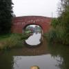
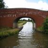
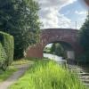
Oddingley Number 2 Bridge No 27

 
Oddingley WR9 7NE, United Kingdom
 
Information about the place
Oddingley Number 2 Bridge No 27 is a minor waterways place on the Worcester and Birmingham Canal (Diglis Basin to King's Norton Junction) between Diglis Basin (Tow-path goes around the first basin) (6 miles and 4 furlongs and 14 locks to the southwest) and Hanbury Junction (Junction with Droitwich Junction Canal (Restored - Opened 1/July/2011). Hanbury Wharf) (2 miles and 4½ furlongs to the north).
 
 
The nearest place in the direction of Diglis Basin is Oddingley Number 1 Bridge No 26; 1 furlong away.
 
The nearest place in the direction of Hanbury Junction is Oddingley Number 3 Bridge No 28; 1¼ furlongs away.

There may be access to the towpath here.

Mooring here is unrated.

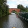
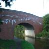
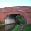
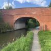
There is a bridge here which takes a minor road over the canal.


Amenities
 
Maps
If you are a user and are logged on, or if you are actively planning a route, a map will be displayed here.
Show on external mapping site: Google | OSM | Bing
 
Photos
 
External websites
There are no links to external websites from here.
Why not log in and add some (select "External websites" from the menu (sometimes this is under "Edit"))?
 
Nearest facilities

Mouseover for more information or show routes to facility

Nearest water point

In the direction of King's Norton Junction

Hanbury Boatyard2 miles, 3¾ furlongs away
On this waterway in the direction of King's Norton Junction
Droitwich Spa Marina2 miles, 7¾ furlongs and 3 locks away
Travel to Hanbury Junction, then on the Droitwich Canals (Droitwich Junction Canal) to Droitwich Spa Marina
Stoke Works Water Point5 miles, ¾ furlongs and 6 locks away
On this waterway in the direction of King's Norton Junction
Netherwich Basin4 miles, 3¼ furlongs and 8 locks away
Travel to Hanbury Junction, then on the Droitwich Canals (Droitwich Junction Canal) to Droitwich Junction, then on the Droitwich Canals (Droitwich Barge Canal) to Netherwich Basin
Holt Lock (Holt Fleet)12 miles, 6¾ furlongs and 16 locks away
Travel to Hanbury Junction, then on the Droitwich Canals (Droitwich Junction Canal) to Droitwich Junction, then on the Droitwich Canals (Droitwich Barge Canal) to Hawford Junction, then on the River Severn (main river - Stourport to Worcester) to Holt Lock (Holt Fleet)
Lincomb Lock17 miles, ¼ furlongs and 17 locks away
Travel to Hanbury Junction, then on the Droitwich Canals (Droitwich Junction Canal) to Droitwich Junction, then on the Droitwich Canals (Droitwich Barge Canal) to Hawford Junction, then on the River Severn (main river - Stourport to Worcester) to Lincomb Lock
Upper Basin Waterpoint18 miles, 3¾ furlongs and 20 locks away
Travel to Hanbury Junction, then on the Droitwich Canals (Droitwich Junction Canal) to Droitwich Junction, then on the Droitwich Canals (Droitwich Barge Canal) to Hawford Junction, then on the River Severn (main river - Stourport to Worcester) to Severn - Stourport Broad Locks Entrance, then on the Staffordshire and Worcestershire Canal (Stourport Basins: Broad Route) to Stourport Upper Basin, then on the Staffordshire and Worcestershire Canal (Stourport Basins: Narrow Route) to Upper Basin Waterpoint
Tardebigge Wharf9 miles, 1¼ furlongs and 42 locks away
On this waterway in the direction of King's Norton Junction
Hopwood Visitor Moorings14 miles, 5 furlongs and 42 locks away
On this waterway in the direction of King's Norton Junction
King's Norton Water Point17 miles, 6¼ furlongs and 42 locks away
On this waterway in the direction of King's Norton Junction

In the direction of Diglis Basin

Lowesmoor Basin5 miles, 3¾ furlongs and 12 locks away
On this waterway in the direction of Diglis Basin
Diglis Services6 miles, 3¼ furlongs and 14 locks away
On this waterway in the direction of Diglis Basin
Diglis Locks6 miles, 7½ furlongs and 16 locks away
Travel to Diglis Basin, then on the Worcester and Birmingham Canal (Diglis Junction to Diglis Basin) to Diglis Junction, then on the River Severn (main river - Worcester to Gloucester) to Diglis Locks
Worcester Trip Boat Moorings7 miles, 3¼ furlongs and 16 locks away
Travel to Diglis Basin, then on the Worcester and Birmingham Canal (Diglis Junction to Diglis Basin) to Diglis Junction, then on the River Severn (main river - Stourport to Worcester) to Worcester Trip Boat Moorings

Nearest rubbish disposal

In the direction of King's Norton Junction

Droitwich Spa Marina2 miles, 7¾ furlongs and 3 locks away
Travel to Hanbury Junction, then on the Droitwich Canals (Droitwich Junction Canal) to Droitwich Spa Marina
Stoke Bottom Lock No 235 miles, 6½ furlongs and 6 locks away
On this waterway in the direction of King's Norton Junction
Netherwich Basin4 miles, 3¼ furlongs and 8 locks away
Travel to Hanbury Junction, then on the Droitwich Canals (Droitwich Junction Canal) to Droitwich Junction, then on the Droitwich Canals (Droitwich Barge Canal) to Netherwich Basin
Upper Basin Waterpoint18 miles, 3¾ furlongs and 20 locks away
Travel to Hanbury Junction, then on the Droitwich Canals (Droitwich Junction Canal) to Droitwich Junction, then on the Droitwich Canals (Droitwich Barge Canal) to Hawford Junction, then on the River Severn (main river - Stourport to Worcester) to Severn - Stourport Broad Locks Entrance, then on the Staffordshire and Worcestershire Canal (Stourport Basins: Broad Route) to Stourport Upper Basin, then on the Staffordshire and Worcestershire Canal (Stourport Basins: Narrow Route) to Upper Basin Waterpoint
Tardebigge Wharf9 miles, 1¼ furlongs and 42 locks away
On this waterway in the direction of King's Norton Junction

In the direction of Diglis Basin

Lowesmoor Basin5 miles, 3¾ furlongs and 12 locks away
On this waterway in the direction of Diglis Basin
Diglis Basin6 miles, 4 furlongs and 14 locks away
On this waterway in the direction of Diglis Basin
Sabrina Footbridge7 miles, 5 furlongs and 16 locks away
Travel to Diglis Basin, then on the Worcester and Birmingham Canal (Diglis Junction to Diglis Basin) to Diglis Junction, then on the River Severn (main river - Stourport to Worcester) to Sabrina Footbridge

Nearest chemical toilet disposal

In the direction of King's Norton Junction

Droitwich Spa Marina2 miles, 7¾ furlongs and 3 locks away
Travel to Hanbury Junction, then on the Droitwich Canals (Droitwich Junction Canal) to Droitwich Spa Marina
Stoke Bottom Lock No 235 miles, 6½ furlongs and 6 locks away
On this waterway in the direction of King's Norton Junction
Stourport Marina17 miles, 3¾ furlongs and 18 locks away
Travel to Hanbury Junction, then on the Droitwich Canals (Droitwich Junction Canal) to Droitwich Junction, then on the Droitwich Canals (Droitwich Barge Canal) to Hawford Junction, then on the River Severn (main river - Stourport to Worcester) to Stourport Marina
Upper Basin Waterpoint18 miles, 3¾ furlongs and 20 locks away
Travel to Hanbury Junction, then on the Droitwich Canals (Droitwich Junction Canal) to Droitwich Junction, then on the Droitwich Canals (Droitwich Barge Canal) to Hawford Junction, then on the River Severn (main river - Stourport to Worcester) to Severn - Stourport Broad Locks Entrance, then on the Staffordshire and Worcestershire Canal (Stourport Basins: Broad Route) to Stourport Upper Basin, then on the Staffordshire and Worcestershire Canal (Stourport Basins: Narrow Route) to Upper Basin Waterpoint
Tardebigge Wharf9 miles, 1¼ furlongs and 42 locks away
On this waterway in the direction of King's Norton Junction

In the direction of Diglis Basin

Lowesmoor Basin5 miles, 3¾ furlongs and 12 locks away
On this waterway in the direction of Diglis Basin
Diglis Services6 miles, 3¼ furlongs and 14 locks away
On this waterway in the direction of Diglis Basin

Nearest place to turn

In the direction of King's Norton Junction

Dunhampstead Winding Hole3 furlongs away
On this waterway in the direction of King's Norton Junction
Dunhampstead Boatyard5¼ furlongs away
On this waterway in the direction of King's Norton Junction
Hanbury Boatyard2 miles, 3¾ furlongs away
On this waterway in the direction of King's Norton Junction
Hanbury Junction2 miles, 4½ furlongs away
On this waterway in the direction of King's Norton Junction
Hanbury Junction Winding Hole2 miles, 6 furlongs away
On this waterway in the direction of King's Norton Junction
Droitwich Spa Marina2 miles, 7¾ furlongs and 3 locks away
Travel to Hanbury Junction, then on the Droitwich Canals (Droitwich Junction Canal) to Droitwich Spa Marina
Astwood Winding Hole4 miles, 2¼ furlongs and 2 locks away
On this waterway in the direction of King's Norton Junction
Lock No 6 Winding Hole3 miles, 2¾ furlongs and 5 locks away
Travel to Hanbury Junction, then on the Droitwich Canals (Droitwich Junction Canal) to Lock No 6 Winding Hole
Droitwich Town Wharf4 miles, 1¼ furlongs and 8 locks away
Travel to Hanbury Junction, then on the Droitwich Canals (Droitwich Junction Canal) to Droitwich Junction, then on the Droitwich Canals (Droitwich Barge Canal) to Droitwich Town Wharf
Netherwich Basin4 miles, 3¼ furlongs and 8 locks away
Travel to Hanbury Junction, then on the Droitwich Canals (Droitwich Junction Canal) to Droitwich Junction, then on the Droitwich Canals (Droitwich Barge Canal) to Netherwich Basin
Winding Hole (east of Salwarpe Road Bridge)4 miles, 4¾ furlongs and 8 locks away
Travel to Hanbury Junction, then on the Droitwich Canals (Droitwich Junction Canal) to Droitwich Junction, then on the Droitwich Canals (Droitwich Barge Canal) to Winding Hole (east of Salwarpe Road Bridge)
Stoke Wharf5 miles, 7 furlongs and 7 locks away
On this waterway in the direction of King's Norton Junction
Ladywood Top Lock Winding Hole7 miles, 1¼ furlongs and 8 locks away
Travel to Hanbury Junction, then on the Droitwich Canals (Droitwich Junction Canal) to Droitwich Junction, then on the Droitwich Canals (Droitwich Barge Canal) to Ladywood Top Lock Winding Hole
Bevere Lock Weir Entrance10 miles, 1 furlong and 16 locks away
Travel to Hanbury Junction, then on the Droitwich Canals (Droitwich Junction Canal) to Droitwich Junction, then on the Droitwich Canals (Droitwich Barge Canal) to Hawford Junction, then on the River Severn (main river - Stourport to Worcester) to Bevere Lock Weir Entrance

In the direction of Diglis Basin

Tibberton Winding Hole4½ furlongs away
On this waterway in the direction of Diglis Basin
Bilford Locks Winding Hole4 miles, 1¾ furlongs and 9 locks away
On this waterway in the direction of Diglis Basin
Lowesmoor Basin5 miles, 3¾ furlongs and 12 locks away
On this waterway in the direction of Diglis Basin
Diglis Junction6 miles, 5 furlongs and 16 locks away
Travel to Diglis Basin, then on the Worcester and Birmingham Canal (Diglis Junction to Diglis Basin) to Diglis Junction
Diglis Locks Weir Exit7 miles, ¼ furlongs and 17 locks away
Travel to Diglis Basin, then on the Worcester and Birmingham Canal (Diglis Junction to Diglis Basin) to Diglis Junction, then on the River Severn (main river - Worcester to Gloucester) to Diglis Locks Weir Exit
Severn - Teme Junction7 miles, 6¼ furlongs and 17 locks away
Travel to Diglis Basin, then on the Worcester and Birmingham Canal (Diglis Junction to Diglis Basin) to Diglis Junction, then on the River Severn (main river - Worcester to Gloucester) to Severn - Teme Junction

Nearest self-operated pump-out

In the direction of King's Norton Junction

Droitwich Spa Marina2 miles, 7¾ furlongs and 3 locks away
Travel to Hanbury Junction, then on the Droitwich Canals (Droitwich Junction Canal) to Droitwich Spa Marina

In the direction of Diglis Basin

Diglis Services6 miles, 3¼ furlongs and 14 locks away
On this waterway in the direction of Diglis Basin

Nearest boatyard pump-out

In the direction of King's Norton Junction

Dunhampstead Boatyard5¼ furlongs away
On this waterway in the direction of King's Norton Junction
Hanbury Boatyard2 miles, 3¾ furlongs away
On this waterway in the direction of King's Norton Junction
Stourport Marina17 miles, 3¾ furlongs and 18 locks away
Travel to Hanbury Junction, then on the Droitwich Canals (Droitwich Junction Canal) to Droitwich Junction, then on the Droitwich Canals (Droitwich Barge Canal) to Hawford Junction, then on the River Severn (main river - Stourport to Worcester) to Stourport Marina
Stourport Upper Basin18 miles, 3½ furlongs and 20 locks away
Travel to Hanbury Junction, then on the Droitwich Canals (Droitwich Junction Canal) to Droitwich Junction, then on the Droitwich Canals (Droitwich Barge Canal) to Hawford Junction, then on the River Severn (main river - Stourport to Worcester) to Severn - Stourport Broad Locks Entrance, then on the Staffordshire and Worcestershire Canal (Stourport Basins: Broad Route) to Stourport Upper Basin
Upper Staircase Lock Landing Pontoon18 miles, 4¼ furlongs and 20 locks away
Travel to Hanbury Junction, then on the Droitwich Canals (Droitwich Junction Canal) to Droitwich Junction, then on the Droitwich Canals (Droitwich Barge Canal) to Hawford Junction, then on the River Severn (main river - Stourport to Worcester) to Severn - Stourport Broad Locks Entrance, then on the Staffordshire and Worcestershire Canal (Stourport Basins: Broad Route) to Stourport Upper Basin, then on the Staffordshire and Worcestershire Canal (Stourport Basins: Narrow Route) to Upper Staircase Lock Landing Pontoon

In the direction of Diglis Basin

Lowesmoor Basin5 miles, 3¾ furlongs and 12 locks away
On this waterway in the direction of Diglis Basin
Direction of TV transmitter (From Wolfbane Cybernetic)
 
 
Geograph
 
Wikipedia

There is no page on Wikipedia called “Oddingley Number 2 Bridge”

Wikipedia pages that might relate to Oddingley Number 2 Bridge
[Lickey Incline] Britain. The climb is a gradient of 1 in 37.7 (2.65% or 26.5‰ or 1.52°) for a continuous distance of two miles (3.2 km). Constructed originally for the Birmingham [Suckley railway station] Gloucester Railway Cofton Blackwell Stoke Works (B&G) Dodderhill Dunhampstead Oddingley Bredicot Spetchley Norton (B&G) Abbot's Wood Junction Wadborough Pirton [Bewdley railway station] before crossing the River Severn over the now partially-dismantled Dowles Bridge. Thus Bewdley became a junction station. In 1878, GWR opened a "loop-line" [Leigh Court railway station] was a station in Leigh, Worcestershire, England. The station was opened on 2 May 1874 and closed on 7 September 1964. "Leigh Court Station". Malvern Industrial [Grade II* listed buildings in Wychavon] reference system used by the Ordnance Survey. The "List Entry Number" is a unique number assigned to each listed building and scheduled monument by Historic [Kidderminster Town railway station] the GWR Ross-on-Wye station building which opened in 1890. Since then a number of these missing features have been constructed and erected by volunteers [Knightwick railway station] station in Knightwick, Worcestershire, England. The station was opened on 2 May 1874 and closed on 7 September 1964. "Knightwick Station". Malvern Industrial [Honeybourne railway station] new platform, which has an operational length of 140 m (150 yd), is numbered "2", whilst the original platform is renumbered "1". Passive provision was [Redditch railway station] into housing and a hotel. The single track from Barnt Green restricted the number of trains that could run to Redditch to two per hour. In November 2013 a [Bromsgrove railway station] the 1970s and early 1980s, the service frequency had decreased to a small number of trains in the peak hours. A new platform on the down side was opened
 
Google

Results of Google Search

Canal Bridge #27, Oddingley, Worcestershire, England - Arch ...
Aug 31, 2018 ... Oddingley Number 2 Bridge No 27 is a minor waterways place on the Worcester and Birmingham Canal (Diglis Basin to King's Norton ...
Bridge 27, Oddingley Bridge No 2, from... © Christine Johnstone ...
Oct 13, 2012 ... Bridge 27, Oddingley Bridge No 2, from the south. taken 7 years ago, near to Oddingley, Worcestershire, Great Britain. More sizes. Bridge 27 ...
Worcester and Birmingham Canal (King's Norton to Worcester) DAY ...
Mar 11, 2010 ... Oddingly Number 3 Bridge No 28. 9.9 - 42. Oddingley Number 2 Bridge No 27. 10.0 - 42. Oddingly Number 1 Bridge No 26. 10.4 - 42. Winding ...
File:Bridge number 27, Macclesfield Canal.jpg - Wikipedia
No higher resolution available. Bridge_number_27,_Macclesfield_Canal.jpg #x200e;( 640 × 480 pixels, file size: 99 KB, MIME ... English: Photograph of Bridge number 27 over the Macclesfield Canal in Bollington, Cheshire ... Camera location, 53° 17′ 50.82″ N, 2° 06′ 05.83″ W · Kartographer map based on OpenStreetMap.
Worcester and Birmingham Canal - Canal Cycling Section
Gas Street Basins; Aqueduct over Holiday Street; Canal also crosses two ... Oddingley No 3 Bridge (28); Oddingley No 2 Bridge (27) carries Church Lane ...
Radisson Blu Hotel Manchester Airport | Radisson Blu
This property is temporarily closed until April 27, 2020. ... pedestrian system that connects terminals 1 and 2 and the train station, no need for shuttles or taxis!
A cold night of chemical hair: the reality of the Stone Roses at Spike ...
May 27, 2015 ... The hotel we stayed in was a converted prison, with cell numbers ... It was a decent show, not their best but then they didn't want to peak to ...
Edinburgh Hotels | Radisson Blu Hotel, Edinburgh City Centre
27 m²; 2 twin or 1 king; 2 adults. With our Standard Room, you will have everything you need for a comfortable stay and a good night's sleep. Radisson Blu Hotel ...