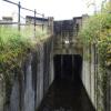
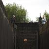
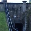
Platt Lane Bridge No 42
is a minor waterways place
on the Huddersfield Narrow Canal between
Railway Lock No 42E (Marsden. Eastern summit lock) (2 miles and 6½ furlongs
and 21 locks
to the west) and
Titanic Mill (Linthwaite) (7 furlongs
and 4 locks
to the east).
The nearest place in the direction of Railway Lock No 42E is Waterside Lock No 21E (Lock moved during restoration);
a few yards
away.
The nearest place in the direction of Titanic Mill is Original Site of Lock No 21E;
½ furlongs
away.
There may be access to the towpath here.
Mooring here is unrated.
There is a bridge here which takes a minor road over the canal.
Slaithwaite Narrows | 2 furlongs | |
Pickle Lock No 22E | 1¼ furlongs | |
Slaithwaite Winding Hole | ¾ furlongs | |
Slaithwaite Visitor Moorings | ½ furlongs | |
Waterside Lock No 21E | a few yards | |
Platt Lane Bridge No 42 | ||
Original Site of Lock No 21E | ½ furlongs | |
Spot Lock No 20E | 1¾ furlongs | |
Lees Mill Bridge No 41 | 2¾ furlongs | |
Holme Lock No 19E | 3½ furlongs | |
Can Lock No 18E | 4½ furlongs |
There are no links to external websites from here.
Why not log in and add some (select "External websites" from the menu (sometimes this is under "Edit"))?
Mouseover for more information or show routes to facility
Nearest water point
In the direction of Ashton-under-Lyne Junction
Waterside Lock No 21E — a few yards away
On this waterway in the direction of Ashton-under-Lyne Junction
Slaithwaite Winding Hole — ¾ furlongs and 1 lock away
On this waterway in the direction of Ashton-under-Lyne Junction
Standedge Tunnel (eastern entrance) — 3 miles, 3¾ furlongs and 22 locks away
On this waterway in the direction of Ashton-under-Lyne Junction
Standedge Tunnel (western entrance) — 6 miles, 5½ furlongs and 22 locks away
On this waterway in the direction of Ashton-under-Lyne Junction
Wool Road Bridge No 70 — 8 miles, 5½ furlongs and 31 locks away
On this waterway in the direction of Ashton-under-Lyne Junction
Grove Road Bridge No 96 — 14 miles, 5½ furlongs and 46 locks away
On this waterway in the direction of Ashton-under-Lyne Junction
In the direction of Aspley Basin (Huddersfield)
Aspley Basin (Huddersfield) — 4 miles, 5½ furlongs and 20 locks away
On this waterway in the direction of Aspley Basin (Huddersfield)
Shepley Bridge Sanitary Station — 11 miles, 2 furlongs and 31 locks away
Travel to Aspley Basin (Huddersfield), then on the Huddersfield Broad Canal to Cooper Bridge Junction, then on the Calder and Hebble Navigation (Main Line) to Shepley Bridge Sanitary Station
Brighouse Basin — 10 miles, 3¾ furlongs and 33 locks away
Travel to Aspley Basin (Huddersfield), then on the Huddersfield Broad Canal to Cooper Bridge Junction, then on the Calder and Hebble Navigation (Main Line) to Brighouse Basin
Salterhebble Sanitary Station — 14 miles, 5¾ furlongs and 42 locks away
Travel to Aspley Basin (Huddersfield), then on the Huddersfield Broad Canal to Cooper Bridge Junction, then on the Calder and Hebble Navigation (Main Line) to Salterhebble Sanitary Station
Broad Cut Low Lock No 3 — 17 miles, 7 furlongs and 39 locks away
Travel to Aspley Basin (Huddersfield), then on the Huddersfield Broad Canal to Cooper Bridge Junction, then on the Calder and Hebble Navigation (Main Line) to Broad Cut Low Lock No 3
Salterhebble Junction — 14 miles, 6¼ furlongs and 43 locks away
Travel to Aspley Basin (Huddersfield), then on the Huddersfield Broad Canal to Cooper Bridge Junction, then on the Calder and Hebble Navigation (Main Line) to Salterhebble Junction
Sowerby Bridge Basin — 17 miles and 43 locks away
Travel to Aspley Basin (Huddersfield), then on the Huddersfield Broad Canal to Cooper Bridge Junction, then on the Calder and Hebble Navigation (Main Line) to Salterhebble Junction, then on the Calder and Hebble Navigation (Main Line) to Sowerby Bridge BasinNearest rubbish disposal
In the direction of Ashton-under-Lyne Junction
Pickle Lock No 22E — 1¼ furlongs and 1 lock away
On this waterway in the direction of Ashton-under-Lyne Junction
Wool Road Visitor Mooring — 8 miles, 5¾ furlongs and 31 locks away
On this waterway in the direction of Ashton-under-Lyne Junction
In the direction of Aspley Basin (Huddersfield)
Aspley Basin (Huddersfield) — 4 miles, 5½ furlongs and 20 locks away
On this waterway in the direction of Aspley Basin (Huddersfield)
Shepley Bridge Sanitary Station — 11 miles, 2 furlongs and 31 locks away
Travel to Aspley Basin (Huddersfield), then on the Huddersfield Broad Canal to Cooper Bridge Junction, then on the Calder and Hebble Navigation (Main Line) to Shepley Bridge Sanitary Station
Brighouse Lower Basin Visitor Moorings — 10 miles, 3½ furlongs and 32 locks away
Travel to Aspley Basin (Huddersfield), then on the Huddersfield Broad Canal to Cooper Bridge Junction, then on the Calder and Hebble Navigation (Main Line) to Brighouse Lower Basin Visitor Moorings
Horbury Basin Residential Moorings & Sanitary Station — 15 miles, 6½ furlongs and 38 locks away
Travel to Aspley Basin (Huddersfield), then on the Huddersfield Broad Canal to Cooper Bridge Junction, then on the Calder and Hebble Navigation (Main Line) to Horbury Basin Residential Moorings & Sanitary Station
Salterhebble Sanitary Station — 14 miles, 5¾ furlongs and 42 locks away
Travel to Aspley Basin (Huddersfield), then on the Huddersfield Broad Canal to Cooper Bridge Junction, then on the Calder and Hebble Navigation (Main Line) to Salterhebble Sanitary Station
Sowerby Bridge Basin — 17 miles and 43 locks away
Travel to Aspley Basin (Huddersfield), then on the Huddersfield Broad Canal to Cooper Bridge Junction, then on the Calder and Hebble Navigation (Main Line) to Salterhebble Junction, then on the Calder and Hebble Navigation (Main Line) to Sowerby Bridge BasinNearest chemical toilet disposal
In the direction of Ashton-under-Lyne Junction
Waterside Lock No 21E — a few yards away
On this waterway in the direction of Ashton-under-Lyne Junction
Pickle Lock No 22E — 1¼ furlongs and 1 lock away
On this waterway in the direction of Ashton-under-Lyne Junction
Wool Road Bridge No 70 — 8 miles, 5½ furlongs and 31 locks away
On this waterway in the direction of Ashton-under-Lyne Junction
Grove Road Bridge No 96 — 14 miles, 5½ furlongs and 46 locks away
On this waterway in the direction of Ashton-under-Lyne Junction
In the direction of Aspley Basin (Huddersfield)
Aspley Basin (Huddersfield) — 4 miles, 5½ furlongs and 20 locks away
On this waterway in the direction of Aspley Basin (Huddersfield)
Shepley Bridge Sanitary Station — 11 miles, 2 furlongs and 31 locks away
Travel to Aspley Basin (Huddersfield), then on the Huddersfield Broad Canal to Cooper Bridge Junction, then on the Calder and Hebble Navigation (Main Line) to Shepley Bridge Sanitary Station
Brighouse Basin — 10 miles, 3¾ furlongs and 33 locks away
Travel to Aspley Basin (Huddersfield), then on the Huddersfield Broad Canal to Cooper Bridge Junction, then on the Calder and Hebble Navigation (Main Line) to Brighouse Basin
Savile Town Wharf and Basin (Dewsbury) — 14 miles, 5½ furlongs and 35 locks away
Travel to Aspley Basin (Huddersfield), then on the Huddersfield Broad Canal to Cooper Bridge Junction, then on the Calder and Hebble Navigation (Main Line) to Dewsbury Arm Junction, then on the Calder and Hebble Navigation (Dewsbury Old Cut) to Savile Town Wharf and Basin (Dewsbury)
Horbury Basin Residential Moorings & Sanitary Station — 15 miles, 6½ furlongs and 38 locks away
Travel to Aspley Basin (Huddersfield), then on the Huddersfield Broad Canal to Cooper Bridge Junction, then on the Calder and Hebble Navigation (Main Line) to Horbury Basin Residential Moorings & Sanitary Station
Salterhebble Sanitary Station — 14 miles, 5¾ furlongs and 42 locks away
Travel to Aspley Basin (Huddersfield), then on the Huddersfield Broad Canal to Cooper Bridge Junction, then on the Calder and Hebble Navigation (Main Line) to Salterhebble Sanitary Station
Sowerby Bridge Basin — 17 miles and 43 locks away
Travel to Aspley Basin (Huddersfield), then on the Huddersfield Broad Canal to Cooper Bridge Junction, then on the Calder and Hebble Navigation (Main Line) to Salterhebble Junction, then on the Calder and Hebble Navigation (Main Line) to Sowerby Bridge BasinNearest place to turn
In the direction of Ashton-under-Lyne Junction
Slaithwaite Winding Hole — ¾ furlongs and 1 lock away
On this waterway in the direction of Ashton-under-Lyne Junction
Booth Lock Winding Hole — 1 mile, 5¾ furlongs and 11 locks away
On this waterway in the direction of Ashton-under-Lyne Junction
Standedge Tunnel End Winding Hole — 3 miles, 3 furlongs and 22 locks away
On this waterway in the direction of Ashton-under-Lyne Junction
Diggle Winding Hole — 7 miles, ¼ furlongs and 22 locks away
On this waterway in the direction of Ashton-under-Lyne Junction
Wool Road Winding Hole — 8 miles, 6¼ furlongs and 31 locks away
On this waterway in the direction of Ashton-under-Lyne Junction
Saddleworth Visitor Centre Winding Hole — 9 miles, 4¼ furlongs and 33 locks away
On this waterway in the direction of Ashton-under-Lyne Junction
Manns Wharf Bridge Winding Hole — 10 miles, 7 furlongs and 35 locks away
On this waterway in the direction of Ashton-under-Lyne Junction
In the direction of Aspley Basin (Huddersfield)
Linthwaite Winding Hole — 7¾ furlongs and 4 locks away
On this waterway in the direction of Aspley Basin (Huddersfield)
Isis Lock Winding Hole — 2 miles, 4 furlongs and 12 locks away
On this waterway in the direction of Aspley Basin (Huddersfield)
University Arm — 4 miles, 4¾ furlongs and 20 locks away
On this waterway in the direction of Aspley Basin (Huddersfield)
Aspley Basin (Huddersfield) — 4 miles, 5½ furlongs and 20 locks away
On this waterway in the direction of Aspley Basin (Huddersfield)
Anchor Street Winding Hole — 5 miles, 2½ furlongs and 20 locks away
Travel to Aspley Basin (Huddersfield), then on the Huddersfield Broad Canal to Anchor Street Winding Hole
New Road Winding Hole — 5 miles, 5¾ furlongs and 20 locks away
Travel to Aspley Basin (Huddersfield), then on the Huddersfield Broad Canal to New Road Winding Hole
Deighton Road Bridge Winding Hole — 6 miles, 7½ furlongs and 25 locks away
Travel to Aspley Basin (Huddersfield), then on the Huddersfield Broad Canal to Deighton Road Bridge Winding Hole
Cooper Bridge Junction — 8 miles, 1½ furlongs and 29 locks away
Travel to Aspley Basin (Huddersfield), then on the Huddersfield Broad Canal to Cooper Bridge Junction
Battye Weir Entrance — 8 miles, 6½ furlongs and 30 locks away
Travel to Aspley Basin (Huddersfield), then on the Huddersfield Broad Canal to Cooper Bridge Junction, then on the Calder and Hebble Navigation (Main Line) to Battye Weir Entrance
Shepley Bridge Marina — 11 miles, 2¼ furlongs and 31 locks away
Travel to Aspley Basin (Huddersfield), then on the Huddersfield Broad Canal to Cooper Bridge Junction, then on the Calder and Hebble Navigation (Main Line) to Shepley Bridge Marina
Brighouse Basin — 10 miles, 3¾ furlongs and 33 locks away
Travel to Aspley Basin (Huddersfield), then on the Huddersfield Broad Canal to Cooper Bridge Junction, then on the Calder and Hebble Navigation (Main Line) to Brighouse Basin
Ganny Winding Hole — 11 miles, 1¼ furlongs and 34 locks away
Travel to Aspley Basin (Huddersfield), then on the Huddersfield Broad Canal to Cooper Bridge Junction, then on the Calder and Hebble Navigation (Main Line) to Ganny Winding Hole
Dewsbury Arm Junction — 13 miles, 5½ furlongs and 35 locks away
Travel to Aspley Basin (Huddersfield), then on the Huddersfield Broad Canal to Cooper Bridge Junction, then on the Calder and Hebble Navigation (Main Line) to Dewsbury Arm JunctionNearest self-operated pump-out
In the direction of Ashton-under-Lyne Junction
Slaithwaite Winding Hole — ¾ furlongs and 1 lock away
On this waterway in the direction of Ashton-under-Lyne Junction
Wool Road Bridge No 70 — 8 miles, 5½ furlongs and 31 locks away
On this waterway in the direction of Ashton-under-Lyne JunctionNearest boatyard pump-out
In the direction of Ashton-under-Lyne Junction
Portland Basin Arm — 19 miles, 6¼ furlongs and 54 locks away
Travel to Ashton-under-Lyne Junction, then on the Ashton Canal (Main Line) to Dukinfield Junction, then on the Peak Forest Canal (Lower) to Portland Basin Arm
In the direction of Aspley Basin (Huddersfield)
Aspley Basin (Huddersfield) — 4 miles, 5½ furlongs and 20 locks away
On this waterway in the direction of Aspley Basin (Huddersfield)
Shepley Bridge Marina — 11 miles, 2¼ furlongs and 31 locks away
Travel to Aspley Basin (Huddersfield), then on the Huddersfield Broad Canal to Cooper Bridge Junction, then on the Calder and Hebble Navigation (Main Line) to Shepley Bridge Marina
Sowerby Bridge Basin — 17 miles and 43 locks away
Travel to Aspley Basin (Huddersfield), then on the Huddersfield Broad Canal to Cooper Bridge Junction, then on the Calder and Hebble Navigation (Main Line) to Salterhebble Junction, then on the Calder and Hebble Navigation (Main Line) to Sowerby Bridge BasinDirection of TV transmitter (From Wolfbane Cybernetic)
There is no page on Wikipedia called “Platt Lane Bridge”
Wikipedia pages that might relate to Platt Lane Bridge
[George C. Platt Bridge]
The George C. Platt Memorial Bridge is a through truss bridge that carries PA 291 (Penrose Avenue) over the Schuylkill River in Southwest Philadelphia
[Paula Lane]
Paula Lane (born 17 April 1986) is an English actress. She is known for portraying the role of Kylie Platt in the ITV soap opera Coronation Street from
[Platt Bridge, Wigan]
Platt Bridge in Wigan, Greater Manchester, England, is a residential area to the south of Ince-in-Makerfield and North of Abram. After many pub closures
[Platt Bridge railway station]
Platt Bridge railway station is a closed railway station in the Platt Bridge area of Wigan, England, where the line bridged Liverpool Road (the A58).
[Hockenhull Platts]
Platts Lane crosses the River Gowy. An area of 5 hectares (12 acres) west of the Gowy, including the westernmost bridge, forms Hockenhull Platts Nature
[Llangollen Canal]
ancient monument. It is a rare example of a skewed lift bridge. Dobson's Bridge, a fixed humpback bridge made of red bricks with an elliptical arch, was classified
[Listed buildings in Whixall]
England, retrieved 31 March 2019 Historic England, "Starks Lift Bridge at Windmill Lane, Whixall (1003675)", National Heritage List for England, retrieved
[Bridge of Spies (film)]
March 3, 2015, interview with The Daily Pennsylvanian, Platt revealed the title to be Bridge of Spies; it was shot under the working title of St. James
[Holy Trinity Platt Church]
Holy Trinity Platt Church (also known as Holy Trinity Church, Rusholme), is in Platt Fields Park in Rusholme, Manchester, England. It is an active Anglican
[Reedy Point Bridge]
similar in appearance to the Platt Bridge in Southwest Philadelphia (near Philadelphia International Airport), the Reedy Point Bridge was built by the U.S. Army
Results of Google Search
Road closed, bridge Maintenance Work - Road closed due to bridge maintenance work on ... No students critically injured in Chilton County school bus accident.
Fee: There is no parking fee at this park. ... Follow Sandy Brook Road 1.1 miles to the pull-off for the White Trail on the right. ... There is also parking at the north entrance off of Route 42 in Cheshire. ... 263 in Winchester, proceeds south on Route 263 1.5 miles and turn left on Platt Hill Road. ... Follow 0.3 mile to the bridge.
42-42C. Tuttle Avenue to Seaboard Coastline Rail Road. Bahia Vista Street. 4 ... Blackburn Point Bridge to SR 45(U.S. 41). Blackburn Point Road. 3. 47. No.
State Law reference— Powers of police jury over traffic, R.S. 32:41, 32:42, 33: 1236(28). ... In no instance should parish roads or bridges be made impassable. ... Turkey Creek Road, beginning at the intersection of Platt Road and proceeding ...
Oct 2, 2018 ... A new Wawa gas station near the Platt Memorial Bridge and the creation of additional ... Rapid COVID-19 testing: No appt. needed. A street ... Pennsylvania will spend $49 million on 42 transportation projects across the state, ...
Tax parcel boundaries represent approximate property line location and should NOT be interpreted as or used in lieu of a survey or property boundary description.
Nov 12, 2002 ... The single span two lane bridge carries moderate traffic on County ... HISTORIC BRIDGE MANAGEMENT PLAN ( EVALUATED ). No. Page 42.