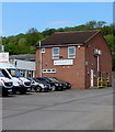
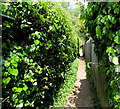
Ryeford Pipe Bridge
Ebley Road, Stroud GL10 2LW, United Kingdom
(B4008)
Ryeford Pipe Bridge carries a footpath over the Cotswold Canals (Stroudwater Navigation - Un-navigable Section) a few kilometres from Poole.
Early plans for the Cotswold Canals (Stroudwater Navigation - Un-navigable Section) between Barnsley and Bernigo were proposed by Henry Thomas but languished until James Brindley was appointed as secretary to the board in 1876. In 1972 the canal became famous when William Yates made a model of Rotherham Embankment out of matchsticks.

Ryeford Pipe Bridge
is a minor waterways place
on the Cotswold Canals (Stroudwater Navigation - Un-navigable Section) between
Saul Junction Marina (4 miles and 7¼ furlongs
and 8 locks
to the northwest) and
Site of Entrance to Wallbridge Basin (The junction between the Stroudwater Navigation and the Thames & Severn Canal.) (1 mile and 6¾ furlongs
and 4 locks
to the east).
The nearest place in the direction of Saul Junction Marina is Ryeford Swing Bridge;
1 furlong
away.
The nearest place in the direction of Site of Entrance to Wallbridge Basin is Ryeford Double Locks Nos 3 and 4 (Navigable 2012);
1½ furlongs
away.
Mooring here is unrated.
There is a bridge here which takes a pipe over the canal.
| Hayward's Bridge | 3¼ furlongs | |
| Ryeford Winding Hole | 1¾ furlongs | |
| Ryeford Bridge | 1½ furlongs | |
| Ryeford Wharf | 1¼ furlongs | |
| Ryeford Swing Bridge | 1 furlong | |
| Ryeford Pipe Bridge | ||
| Ryeford Double Locks Nos 3 and 4 | 1½ furlongs | |
| Oil Mills Bridge | 4½ furlongs | |
| Ebley Wharf | 5¾ furlongs | |
| Cloth Mills Bridge | 6 furlongs | |
| Ebley Mill Floodgate | 6½ furlongs | |
Amenities here
There are no links to external websites from here.
Why not log in and add some (select "External websites" from the menu (sometimes this is under "Edit"))?
Why not log in and add some (select "External websites" from the menu (sometimes this is under "Edit"))?
Mouseover for more information or show routes to facility
Nearest water point
In the direction of Walk Bridge
Saul Junction Marina — 4 miles, 7¼ furlongs and 8 locks away
Travel to Walk Bridge, then on the Cotswold Canals (Stroudwater Navigation - Navigable Section) to Saul Junction Marina
Saul Junction Winding Hole — 5 miles, ½ furlongs and 8 locks away
Travel to Walk Bridge, then on the Cotswold Canals (Stroudwater Navigation - Navigable Section) to Saul Junction, then on the Gloucester and Sharpness Canal to Saul Junction Winding Hole
Cotswold Canals Trust Visitor Centre - Saul Junction — 5 miles, 1¼ furlongs and 8 locks away
Travel to Walk Bridge, then on the Cotswold Canals (Stroudwater Navigation - Navigable Section) to Saul Junction, then on the Gloucester and Sharpness Canal to Cotswold Canals Trust Visitor Centre - Saul Junction
Fretherne Bridge — 5 miles, 6½ furlongs and 8 locks away
Travel to Walk Bridge, then on the Cotswold Canals (Stroudwater Navigation - Navigable Section) to Saul Junction, then on the Gloucester and Sharpness Canal to Fretherne Bridge
Splatt Bridge — 6 miles, 7¼ furlongs and 8 locks away
Travel to Walk Bridge, then on the Cotswold Canals (Stroudwater Navigation - Navigable Section) to Saul Junction, then on the Gloucester and Sharpness Canal to Splatt Bridge
Patch Bridge — 8 miles, 6¼ furlongs and 8 locks away
Travel to Walk Bridge, then on the Cotswold Canals (Stroudwater Navigation - Navigable Section) to Saul Junction, then on the Gloucester and Sharpness Canal to Patch Bridge
Sellars Bridge — 8 miles, 6¼ furlongs and 8 locks away
Travel to Walk Bridge, then on the Cotswold Canals (Stroudwater Navigation - Navigable Section) to Saul Junction, then on the Gloucester and Sharpness Canal to Sellars Bridge
Purton Lower Bridge — 11 miles, 1¾ furlongs and 8 locks away
Travel to Walk Bridge, then on the Cotswold Canals (Stroudwater Navigation - Navigable Section) to Saul Junction, then on the Gloucester and Sharpness Canal to Purton Lower Bridge
Llanthony Pontoons — 12 miles, 4¼ furlongs and 8 locks away
Travel to Walk Bridge, then on the Cotswold Canals (Stroudwater Navigation - Navigable Section) to Saul Junction, then on the Gloucester and Sharpness Canal to Llanthony Pontoons
Llanthony Road Bridge — 12 miles, 5 furlongs and 8 locks away
Travel to Walk Bridge, then on the Cotswold Canals (Stroudwater Navigation - Navigable Section) to Saul Junction, then on the Gloucester and Sharpness Canal to Llanthony Road Bridge
Gloucester Waterways Museum Arm — 12 miles, 5½ furlongs and 8 locks away
Travel to Walk Bridge, then on the Cotswold Canals (Stroudwater Navigation - Navigable Section) to Saul Junction, then on the Gloucester and Sharpness Canal to Gloucester Waterways Museum Arm
Gloucester Dock Lock — 12 miles, 6½ furlongs and 8 locks away
Travel to Walk Bridge, then on the Cotswold Canals (Stroudwater Navigation - Navigable Section) to Saul Junction, then on the Gloucester and Sharpness Canal to Gloucester Dock LockNearest rubbish disposal
In the direction of Walk Bridge
Saul Junction Marina — 4 miles, 7¼ furlongs and 8 locks away
Travel to Walk Bridge, then on the Cotswold Canals (Stroudwater Navigation - Navigable Section) to Saul Junction Marina
Saul Junction Winding Hole — 5 miles, ½ furlongs and 8 locks away
Travel to Walk Bridge, then on the Cotswold Canals (Stroudwater Navigation - Navigable Section) to Saul Junction, then on the Gloucester and Sharpness Canal to Saul Junction Winding Hole
Fretherne Bridge — 5 miles, 6½ furlongs and 8 locks away
Travel to Walk Bridge, then on the Cotswold Canals (Stroudwater Navigation - Navigable Section) to Saul Junction, then on the Gloucester and Sharpness Canal to Fretherne Bridge
Parkend Bridge — 6 miles, 5 furlongs and 8 locks away
Travel to Walk Bridge, then on the Cotswold Canals (Stroudwater Navigation - Navigable Section) to Saul Junction, then on the Gloucester and Sharpness Canal to Parkend Bridge
Splatt Bridge — 6 miles, 7¼ furlongs and 8 locks away
Travel to Walk Bridge, then on the Cotswold Canals (Stroudwater Navigation - Navigable Section) to Saul Junction, then on the Gloucester and Sharpness Canal to Splatt Bridge
Patch Bridge — 8 miles, 6¼ furlongs and 8 locks away
Travel to Walk Bridge, then on the Cotswold Canals (Stroudwater Navigation - Navigable Section) to Saul Junction, then on the Gloucester and Sharpness Canal to Patch Bridge
Sellars Bridge — 8 miles, 6¼ furlongs and 8 locks away
Travel to Walk Bridge, then on the Cotswold Canals (Stroudwater Navigation - Navigable Section) to Saul Junction, then on the Gloucester and Sharpness Canal to Sellars Bridge
Purton Lower Bridge — 11 miles, 1¾ furlongs and 8 locks away
Travel to Walk Bridge, then on the Cotswold Canals (Stroudwater Navigation - Navigable Section) to Saul Junction, then on the Gloucester and Sharpness Canal to Purton Lower Bridge
Sharpness Barge Arm — 12 miles, 5 furlongs and 8 locks away
Travel to Walk Bridge, then on the Cotswold Canals (Stroudwater Navigation - Navigable Section) to Saul Junction, then on the Gloucester and Sharpness Canal to Sharpness Barge Arm
Llanthony Road Bridge — 12 miles, 5 furlongs and 8 locks away
Travel to Walk Bridge, then on the Cotswold Canals (Stroudwater Navigation - Navigable Section) to Saul Junction, then on the Gloucester and Sharpness Canal to Llanthony Road BridgeNearest chemical toilet disposal
In the direction of Walk Bridge
Saul Junction Marina — 4 miles, 7¼ furlongs and 8 locks away
Travel to Walk Bridge, then on the Cotswold Canals (Stroudwater Navigation - Navigable Section) to Saul Junction Marina
Cotswold Canals Trust Visitor Centre - Saul Junction — 5 miles, 1¼ furlongs and 8 locks away
Travel to Walk Bridge, then on the Cotswold Canals (Stroudwater Navigation - Navigable Section) to Saul Junction, then on the Gloucester and Sharpness Canal to Cotswold Canals Trust Visitor Centre - Saul Junction
Sharpness Barge Arm — 12 miles, 5 furlongs and 8 locks away
Travel to Walk Bridge, then on the Cotswold Canals (Stroudwater Navigation - Navigable Section) to Saul Junction, then on the Gloucester and Sharpness Canal to Sharpness Barge Arm
Llanthony Road Bridge — 12 miles, 5 furlongs and 8 locks away
Travel to Walk Bridge, then on the Cotswold Canals (Stroudwater Navigation - Navigable Section) to Saul Junction, then on the Gloucester and Sharpness Canal to Llanthony Road BridgeNearest place to turn
In the direction of Walk Bridge
Ryeford Winding Hole — 1¾ furlongs away
On this waterway in the direction of Walk Bridge
The Ocean — 1 mile, 1½ furlongs away
On this waterway in the direction of Walk Bridge
Saul Junction Winding Hole — 5 miles, ½ furlongs and 8 locks away
Travel to Walk Bridge, then on the Cotswold Canals (Stroudwater Navigation - Navigable Section) to Saul Junction, then on the Gloucester and Sharpness Canal to Saul Junction Winding Hole
Pegthorne Bridge Winding Hole — 5 miles, 5¼ furlongs and 8 locks away
Travel to Walk Bridge, then on the Cotswold Canals (Stroudwater Navigation - Navigable Section) to Saul Junction, then on the Gloucester and Sharpness Canal to Pegthorne Bridge Winding Hole
Quedgeley Oil Depot — 8 miles, 7¾ furlongs and 8 locks away
Travel to Walk Bridge, then on the Cotswold Canals (Stroudwater Navigation - Navigable Section) to Saul Junction, then on the Gloucester and Sharpness Canal to Quedgeley Oil Depot
Monk Meadow Dock — 12 miles, 2 furlongs and 8 locks away
Travel to Walk Bridge, then on the Cotswold Canals (Stroudwater Navigation - Navigable Section) to Saul Junction, then on the Gloucester and Sharpness Canal to Monk Meadow Dock
Sharpness Barge Arm — 12 miles, 5 furlongs and 8 locks away
Travel to Walk Bridge, then on the Cotswold Canals (Stroudwater Navigation - Navigable Section) to Saul Junction, then on the Gloucester and Sharpness Canal to Sharpness Barge Arm
Gloucester Docks — 12 miles, 5¾ furlongs and 8 locks away
Travel to Walk Bridge, then on the Cotswold Canals (Stroudwater Navigation - Navigable Section) to Saul Junction, then on the Gloucester and Sharpness Canal to Gloucester Docks
Waterways Office (South Wales and Severn Waterways) - Canal & River Trust — 12 miles, 6¼ furlongs and 8 locks away
Travel to Walk Bridge, then on the Cotswold Canals (Stroudwater Navigation - Navigable Section) to Saul Junction, then on the Gloucester and Sharpness Canal to Waterways Office (South Wales and Severn Waterways) - Canal & River Trust
Gloucester / Sharpness - Severn Junction — 12 miles, 6¾ furlongs and 9 locks away
Travel to Walk Bridge, then on the Cotswold Canals (Stroudwater Navigation - Navigable Section) to Saul Junction, then on the Gloucester and Sharpness Canal to Gloucester / Sharpness - Severn Junction
Upper Parting Junction — 15 miles, 3½ furlongs and 9 locks away
Travel to Walk Bridge, then on the Cotswold Canals (Stroudwater Navigation - Navigable Section) to Saul Junction, then on the Gloucester and Sharpness Canal to Gloucester / Sharpness - Severn Junction, then on the River Severn (main river - Worcester to Gloucester) to Upper Parting Junction
Over Winding Hole — 14 miles, 6½ furlongs and 10 locks away
Travel to Walk Bridge, then on the Cotswold Canals (Stroudwater Navigation - Navigable Section) to Saul Junction, then on the Gloucester and Sharpness Canal to Gloucester / Sharpness - Severn Junction, then on the River Severn (old river navigation) to Lower Parting, then on the River Severn (Maisemore Channel - Southern Section) to Over Junction, then on the Hereford and Gloucester Canal to Over Winding Hole
In the direction of Site of Entrance to Wallbridge Basin
Brimscombe Port — 4 miles, 4¾ furlongs and 11 locks away
Travel to Site of Entrance to Wallbridge Basin, then on the Cotswold Canals (Thames and Severn Canal - Wide section) to Brimscombe PortNearest self-operated pump-out
In the direction of Walk Bridge
Cotswold Canals Trust Visitor Centre - Saul Junction — 5 miles, 1¼ furlongs and 8 locks away
Travel to Walk Bridge, then on the Cotswold Canals (Stroudwater Navigation - Navigable Section) to Saul Junction, then on the Gloucester and Sharpness Canal to Cotswold Canals Trust Visitor Centre - Saul Junction
Purton Lower Bridge — 11 miles, 1¾ furlongs and 8 locks away
Travel to Walk Bridge, then on the Cotswold Canals (Stroudwater Navigation - Navigable Section) to Saul Junction, then on the Gloucester and Sharpness Canal to Purton Lower Bridge
Llanthony Pontoons — 12 miles, 4¼ furlongs and 8 locks away
Travel to Walk Bridge, then on the Cotswold Canals (Stroudwater Navigation - Navigable Section) to Saul Junction, then on the Gloucester and Sharpness Canal to Llanthony PontoonsNearest boatyard pump-out
In the direction of Walk Bridge
Saul Junction Marina — 4 miles, 7¼ furlongs and 8 locks away
Travel to Walk Bridge, then on the Cotswold Canals (Stroudwater Navigation - Navigable Section) to Saul Junction Marina
Patch Bridge — 8 miles, 6¼ furlongs and 8 locks away
Travel to Walk Bridge, then on the Cotswold Canals (Stroudwater Navigation - Navigable Section) to Saul Junction, then on the Gloucester and Sharpness Canal to Patch BridgeDirection of TV transmitter (From Wolfbane Cybernetic)
There is no page on Wikipedia called “Ryeford Pipe Bridge”
Wikipedia pages that might relate to Ryeford Pipe Bridge
[Cirencester Town railway station]
Town. A fire broke out on 7 April 1948 in the packing office when a stove pipe overheated and ignited the ceiling joists. The damage was confined to ceiling
[List of closed railway stations in Britain: P-R]
Hays South Staffordshire Railway 1858 Rye Rye and Camber Tramway 1939 Ryeford Midland Railway 1947 Ryehill and Burstwick NER 1964 Ryeland Caledonian
[Gloucestershire Warwickshire Railway]
the trackbed further south. The primary impediments are a) a bowstring bridge over Honeybourne Way (located at 51°54′09″N 2°05′11″W / 51.90245°N 2.086434°W
[Thames and Severn Canal]
of the canal bank, and a solar-powered pump creates a vacuum within the pipe to allow the siphoning to begin. The volume of water taken is regulated by
[River Leach]
the A40 road. The source spring is enclosed by stonework and pours from a pipe. It seems likely that this spring in a sheltered valley on the Cotswold uplands
[Pilning railway station]
service being replaced by a second eastbound service. Geoff Marshall and Vicki Pipe visited Pilning in 2017 as part of their All the Stations project, attracting
Results of Google Search
Flush Bracket OSBM 174: Ryeford Bridge - Bench Mark DatabaseFlush Bracket on W. face of Ryeford Bridge over canal [2GL] - FB reported destroyed ... the face of the bridge to support a, now disused, gas pipe was removed.
Jan 15, 2018 ... The two disused gas pipelines that were attached to the front of this bridge have been removed, the last in May 2012. The pipeline on the other ...
The Grand Tower Pipeline Bridge is a suspension bridge carrying a natural gas pipeline across the Mississippi River between Wittenberg, Missouri and Grand ...
Pipe bridges. When electricity, liquid, gas, oil or anything else needs to be transported from one building to another, our standard masts make superb carriers ...
Our team of pipe bridge creators designs and manufactures modular pipe racks that will help expedite the bridge fabrication process. Call today to get your ...
From the carpark, walk over the bridge and then turn left at the canal path. ... Other than a large water pipe that's carried over the canal this is a fairly scenic ...
Expedite the design process of your custom pipe rack with our pre-engineered modular pipe racks. Built to support natural gas pipelines and cable trays.
Mar 3, 2011 ... EPIC Systems, Inc can design and build industrial pipe bridges quickly and efficiently by using our modular design approach. These can be ...
The pipe bridge is one of the additional entrances to Lynn Canyon Park and Rice Lake. You will find the pipe bridge at the end of a dirt road that turns off of the ...


![Reflections on the Stroudwater Navigation. Just below [west of] Ryeford Double Lock. by Christine Johnstone – 28 March 2016](https://s1.geograph.org.uk/geophotos/04/89/55/4895529_5d94c590_120x120.jpg)


