CanalPlanAC

Southam Road Footbridge Arm

 
A423, Cherwell OX16 1TH, United Kingdom
 
Information about the place
Southam Road Footbridge Arm is a minor waterways place on the Oxford Canal (Southern Section - Main Line) between Concorde Avenue Bridge No 165 (1 mile and 1¼ furlongs and 1 lock to the south) and Caves Bridge No 157 (1 mile and 7¾ furlongs and 2 locks to the northeast).
 
 
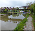
The nearest place in the direction of Concorde Avenue Bridge No 165 is Southam Road Footbridge No 161; a few yards away.
 
The nearest place in the direction of Caves Bridge No 157 is Site of Old Bridge No 161; 2 furlongs away.

Mooring here is unrated.

You can wind here.


Amenities

Amenities here

 Silver Group f Fuels Ltd

Amenities nearby at Southam Road Footbridge No 161

 Hanwell Arms
 Jewson
 
Maps
If you are a user and are logged on, or if you are actively planning a route, a map will be displayed here.
Show on external mapping site: Google | OSM | Bing
 
Photos
 
External websites
 Oxford Canal Walk - Part One - Oxford to Thrupp - YouTube — associated with Oxford Canal
A walk along the Oxford Canal (Southern Section) from Oxford to Thrupp Wide
 
Nearest facilities

Mouseover for more information or show routes to facility

Nearest water point

In the direction of Napton Junction

Cropredy Services3 miles, 2½ furlongs and 3 locks away
On this waterway in the direction of Napton Junction
Cropredy Marina (southern basin)3 miles, 7¼ furlongs and 4 locks away
On this waterway in the direction of Napton Junction
Cropredy Marina (northern basins)3 miles, 7½ furlongs and 4 locks away
On this waterway in the direction of Napton Junction
Fenny Compton Wharf9 miles, 5 furlongs and 12 locks away
On this waterway in the direction of Napton Junction
Marston Doles Water Point17 miles, ¾ furlongs and 12 locks away
On this waterway in the direction of Napton Junction
Water Point at Bottom of Napton Locks19 miles, 1 furlong and 21 locks away
On this waterway in the direction of Napton Junction

In the direction of End of Hythe Bridge Arm

Sovereign Wharf7 furlongs away
On this waterway in the direction of End of Hythe Bridge Arm
Banbury Lock No 291 mile, 1¼ furlongs away
On this waterway in the direction of End of Hythe Bridge Arm
Cherwell Street Facilities1 mile, 1½ furlongs and 1 lock away
On this waterway in the direction of End of Hythe Bridge Arm
Aynho Wharf7 miles, 7 furlongs and 5 locks away
On this waterway in the direction of End of Hythe Bridge Arm
Heyford Wharf13 miles, 7½ furlongs and 8 locks away
On this waterway in the direction of End of Hythe Bridge Arm
Heyford Wharf Bridge No 20613 miles, 7¾ furlongs and 8 locks away
On this waterway in the direction of End of Hythe Bridge Arm

Nearest rubbish disposal

In the direction of Napton Junction

Cropredy Services3 miles, 2½ furlongs and 3 locks away
On this waterway in the direction of Napton Junction
Cropredy Marina (southern basin)3 miles, 7¼ furlongs and 4 locks away
On this waterway in the direction of Napton Junction
Cropredy Marina (northern basins)3 miles, 7½ furlongs and 4 locks away
On this waterway in the direction of Napton Junction
Fenny Compton Marina9 miles, 2¼ furlongs and 12 locks away
On this waterway in the direction of Napton Junction
Napton Sanitary Station19 miles, ¾ furlongs and 21 locks away
On this waterway in the direction of Napton Junction

In the direction of End of Hythe Bridge Arm

Sovereign Wharf7 furlongs away
On this waterway in the direction of End of Hythe Bridge Arm
Cherwell Street Facilities1 mile, 1½ furlongs and 1 lock away
On this waterway in the direction of End of Hythe Bridge Arm
Aynho Wharf7 miles, 7 furlongs and 5 locks away
On this waterway in the direction of End of Hythe Bridge Arm
Heyford Wharf13 miles, 7½ furlongs and 8 locks away
On this waterway in the direction of End of Hythe Bridge Arm
Heyford Wharf Bridge No 20613 miles, 7¾ furlongs and 8 locks away
On this waterway in the direction of End of Hythe Bridge Arm

Nearest chemical toilet disposal

In the direction of Napton Junction

Cropredy Services3 miles, 2½ furlongs and 3 locks away
On this waterway in the direction of Napton Junction
Cropredy Marina (southern basin)3 miles, 7¼ furlongs and 4 locks away
On this waterway in the direction of Napton Junction
Napton Sanitary Station19 miles, ¾ furlongs and 21 locks away
On this waterway in the direction of Napton Junction

In the direction of End of Hythe Bridge Arm

Sovereign Wharf7 furlongs away
On this waterway in the direction of End of Hythe Bridge Arm
Cherwell Street Facilities1 mile, 1½ furlongs and 1 lock away
On this waterway in the direction of End of Hythe Bridge Arm

Nearest place to turn

In the direction of Napton Junction

Cropredy Services3 miles, 2½ furlongs and 3 locks away
On this waterway in the direction of Napton Junction
Cropredy Marina (southern basin)3 miles, 7¼ furlongs and 4 locks away
On this waterway in the direction of Napton Junction
Cropredy Marina (northern basins)3 miles, 7½ furlongs and 4 locks away
On this waterway in the direction of Napton Junction
Clattercote Bridge Winding Hole5 miles, 2½ furlongs and 7 locks away
On this waterway in the direction of Napton Junction
Fenny Compton Marina9 miles, 2¼ furlongs and 12 locks away
On this waterway in the direction of Napton Junction
Fenny Compton Wharf9 miles, 5 furlongs and 12 locks away
On this waterway in the direction of Napton Junction
Marston Doles Top Lock Winding Hole17 miles, 1 furlong and 12 locks away
On this waterway in the direction of Napton Junction
Old Engine House Arm Junction17 miles, 7¾ furlongs and 14 locks away
On this waterway in the direction of Napton Junction

In the direction of End of Hythe Bridge Arm

Southam Road Winding Hole2½ furlongs away
On this waterway in the direction of End of Hythe Bridge Arm
Grimsbury Wharf3¾ furlongs away
On this waterway in the direction of End of Hythe Bridge Arm
Calthorpe Winding Hole1 mile, 7 furlongs and 1 lock away
On this waterway in the direction of End of Hythe Bridge Arm
Twyford Wharf Winding Hole3 miles, 7½ furlongs and 2 locks away
On this waterway in the direction of End of Hythe Bridge Arm
Winding Hole above Nell Bridge Lock6 miles, 4½ furlongs and 3 locks away
On this waterway in the direction of End of Hythe Bridge Arm
Aynho Wharf7 miles, 7 furlongs and 5 locks away
On this waterway in the direction of End of Hythe Bridge Arm
Somerton Deep Lock Winding Hole9 miles, 5¼ furlongs and 5 locks away
On this waterway in the direction of End of Hythe Bridge Arm
Heyford Wharf Winding Hole13 miles, 7¼ furlongs and 8 locks away
On this waterway in the direction of End of Hythe Bridge Arm
Heyford Wharf13 miles, 7½ furlongs and 8 locks away
On this waterway in the direction of End of Hythe Bridge Arm
The Cleeves Winding Hole14 miles, 3¼ furlongs and 8 locks away
On this waterway in the direction of End of Hythe Bridge Arm
Kirtlington Winding Hole17 miles, 1¾ furlongs and 10 locks away
On this waterway in the direction of End of Hythe Bridge Arm
Enslow Winding Hole18 miles, 7¼ furlongs and 11 locks away
On this waterway in the direction of End of Hythe Bridge Arm

Nearest self-operated pump-out

In the direction of Napton Junction

Cropredy Marina (southern basin)3 miles, 7¼ furlongs and 4 locks away
On this waterway in the direction of Napton Junction

Nearest boatyard pump-out

In the direction of Napton Junction

Cropredy Marina (southern basin)3 miles, 7¼ furlongs and 4 locks away
On this waterway in the direction of Napton Junction

In the direction of End of Hythe Bridge Arm

Sovereign Wharf7 furlongs away
On this waterway in the direction of End of Hythe Bridge Arm
Twyford Wharf3 miles, 7¾ furlongs and 2 locks away
On this waterway in the direction of End of Hythe Bridge Arm
Aynho Wharf7 miles, 7 furlongs and 5 locks away
On this waterway in the direction of End of Hythe Bridge Arm
Heyford Wharf13 miles, 7½ furlongs and 8 locks away
On this waterway in the direction of End of Hythe Bridge Arm
Enslow Wharf19 miles, ½ furlongs and 11 locks away
On this waterway in the direction of End of Hythe Bridge Arm
Direction of TV transmitter (From Wolfbane Cybernetic)
 
 
Geograph
 
Wikipedia

There is no page on Wikipedia called “Southam Road Footbridge Arm”

Wikipedia pages that might relate to Southam Road Footbridge Arm
[Stockton, Warwickshire] Census. The village is located just to the east of the A426 road two miles north-east of Southam, and eight miles south-west of Rugby. Stockton's name was
 
Google

Results of Google Search

WIAS Photo Database
0002 Coat of Arms Bridge, Coat of Arms Bridge Road, Coventry 140 SP325767 ... 0008 Mill Road Bridge, Jephson Gardens, Leamington Spa 151 SP322656.
Oxford Canal - Wikipedia
The Oxford Canal is a 78-mile (126 km) narrow canal in central England linking Oxford with ... Brinklow Arm (disused) ... 59, Boughton Road Bridge ... The route between Coventry and Rugby is level, with no locks, apart from the stop lock at theĀ ...
Roger Mayne | Golbourne Road Bridge, London | 1958 | Gitterman ...
Roger Mayne, Golbourne Road Bridge, London, 1958. Vintage gelatin silver print , 14 x 19 5/8 in. (35.6 x 49.9 cm). 1515. Sold. Roger Mayne | Golbourne RoadĀ ...