CanalPlanAC

North Forty Foot Bank Bridge

 
Chapel Hill Bridge, Boston LN4 4ZN, United Kingdom
 
Information about the place
North Forty Foot Bank Bridge is a minor waterways place on the River Witham (Sleaford Navigation(Kyme Eau)-navigable section) between Chapel Hill Junction (Junction with Sleaford Navigation (Kyme Eau)-navigable section ) (1¼ furlongs to the east) and South Kyme (3 miles and 4 furlongs and 1 lock to the southwest).
 
 
The nearest place in the direction of South Kyme is Kyme Eau Flood Lock; ¼ furlongs away.

Mooring here is unrated.

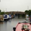
There is a bridge here which takes a minor road over the canal.

Chapel Hill Junction1¼ furlongs
North Forty Foot Bank Bridge
Kyme Eau Flood Lock¼ furlongs
Lower Kyme Lock7¾ furlongs
Winding Hole below Clay Bank Road Bridge2 miles, 6½ furlongs
Clay Bank Road Bridge3 miles, 3¼ furlongs
South Kyme3 miles, 4 furlongs
 
 
Amenities

Amenities here

 Orchard Caravan Park Ltd
 
Maps
If you are a user and are logged on, or if you are actively planning a route, a map will be displayed here.
Show on external mapping site: Google | OSM | Bing
 
Photos
 
External websites
There are no links to external websites from here.
Why not log in and add some (select "External websites" from the menu (sometimes this is under "Edit"))?
 
Nearest facilities

Mouseover for more information or show routes to facility

Nearest chemical toilet disposal

Nearest place to turn

In the direction of Chapel Hill Junction

Chapel Hill Junction1¼ furlongs away
On this waterway in the direction of Chapel Hill Junction Travel to Chapel Hill Junction, then on the River Witham (Lincoln to Boston) to Orchard Caravan and Camping Park Moorings
Dogdyke Visitor Moorings1 mile, ½ furlongs away
Travel to Chapel Hill Junction, then on the River Witham (Lincoln to Boston) to Dogdyke Visitor Moorings
Belle Isle Marina1 mile, 1 furlong away
Travel to Chapel Hill Junction, then on the River Witham (Lincoln to Boston) to Belle Isle Marina
Tattershall Bridge Visitor Moorings2 miles, ¼ furlongs away
Travel to Chapel Hill Junction, then on the River Witham (Lincoln to Boston) to Tattershall Bridge Visitor Moorings
Horncastle Canal Junction2 miles, 5¼ furlongs away
Travel to Chapel Hill Junction, then on the River Witham (Lincoln to Boston) to Horncastle Canal Junction
Langrick Bridge General Store and Marina5 miles, 4¾ furlongs away
Travel to Chapel Hill Junction, then on the River Witham (Lincoln to Boston) to Langrick Bridge General Store and Marina
Kirkstead Bridge Visitor Moorings6 miles, 3¾ furlongs away
Travel to Chapel Hill Junction, then on the River Witham (Lincoln to Boston) to Kirkstead Bridge Visitor Moorings
Anton's Gowt Junction7 miles, 5¼ furlongs away
Travel to Chapel Hill Junction, then on the River Witham (Lincoln to Boston) to Anton's Gowt Junction
Stixwould8 miles, 4¾ furlongs away
Travel to Chapel Hill Junction, then on the River Witham (Lincoln to Boston) to Stixwould
Boston Lock Visitor Moorings9 miles, 5¾ furlongs away
Travel to Chapel Hill Junction, then on the River Witham (Lincoln to Boston) to Boston Lock Visitor Moorings
Boston Motor Yatch Club9 miles, 7 furlongs away
Travel to Chapel Hill Junction, then on the River Witham (Lincoln to Boston) to Boston Motor Yatch Club
Boston Gateway Marina9 miles, 7½ furlongs away
Travel to Chapel Hill Junction, then on the River Witham (Lincoln to Boston) to Boston Gateway Marina
Southrey Visitor Moorings10 miles, 1¾ furlongs away
Travel to Chapel Hill Junction, then on the River Witham (Lincoln to Boston) to Southrey Visitor Moorings
Dunstan Fen Visitor Moorings10 miles, 2 furlongs away
Travel to Chapel Hill Junction, then on the River Witham (Lincoln to Boston) to Dunstan Fen Visitor Moorings
River Witham - Nocton Delph Junction10 miles, 7¾ furlongs away
Travel to Chapel Hill Junction, then on the River Witham (Lincoln to Boston) to River Witham - Nocton Delph Junction
Bardney Village Visitor Moorings13 miles, 2¾ furlongs away
Travel to Chapel Hill Junction, then on the River Witham (Lincoln to Boston) to Bardney Village Visitor Moorings
Bettinson's Bridge Winding Hole13 miles, 4¾ furlongs and 1 lock away
Travel to Chapel Hill Junction, then on the River Witham (Lincoln to Boston) to Anton's Gowt Junction, then on the Witham Navigable Drains (Frith Bank Drain) to Newham Drain - Frith Bank Drain Junction, then on the Witham Navigable Drains (Newham Drain) to Newham Drain - Howbridge Drain - West Fen Drain Junction, then on the Witham Navigable Drains (Howbridge Drain) to Bettinson's Bridge Winding Hole

In the direction of Cobblers Lock

Winding Hole below Clay Bank Road Bridge2 miles, 6½ furlongs and 1 lock away
On this waterway in the direction of Cobblers Lock
Cobblers Lock Winding Hole6 miles, 6¾ furlongs and 1 lock away
On this waterway in the direction of Cobblers Lock

No information

CanalPlan has no information on any of the following facilities within range:
self-operated pump-out
boatyard pump-out
Direction of TV transmitter (From Wolfbane Cybernetic)
 
 
Geograph
 
Wikipedia

There is no page on Wikipedia called “North Forty Foot Bank Bridge”

Wikipedia pages that might relate to North Forty Foot Bank Bridge
[North Forty Foot Bank] The North Forty Foot Bank is a settlement which runs about 6 miles (10 km) along the North Forty Foot Drain, about five to nine miles north-west of Boston [Forty Foot Drain] between them. They are Vermuyden's Drain, South Forty Foot and North Forty Foot. The Forty Foot Drain, also known as Vermuyden's Drain, is an artificial [South Forty-Foot Drain] The South Forty-Foot Drain, also known as the Black Sluice Navigation, is the main channel for the land-drainage of the Black Sluice Level in the Lincolnshire [John A. Roebling Suspension Bridge] district at the foot of the bridge on the Kentucky side is known as Roebling Point. Ramps were constructed leading directly from the bridge to the Dixie [Sleaford Navigation] with the same name on the west bank, Lower Kyme lock is reached, 10.6 miles (17.1 km) from Sleaford. The Twenty Foot Drain and its pumping station join [Holland Fen] consists of: Holland Fen Ferry Corner Plot River Bottom North Forty Foot Bank Hedgehog Bridge Toft Tunnel The church is dedicated to All Saints and was [Manhattan Bridge] nearby Brooklyn Bridge is just slightly further downtown, while the Queensboro and Williamsburg bridges are to the north. The bridge was designed by Leon [Holland Fen with Brothertoft] Pepper Gowt Plot. The population of the civil parish (including North Forty Foot Bank and Shingay) at the 2011 census was 669. The parish of one of 18 [Tacoma Narrows Bridge (1940)] the bridge with a set of eight-foot-deep (2.4 m) plate girders rather than the 25-foot-deep (7.6 m) trusses proposed by the Washington Toll Bridge Authority [Dixon Bridge Disaster] presume in no Eastern one.” The bridge featured five 132 foot (40 m) spans, an 18-foot-wide (5.5 m) roadway with two 5 foot (1.5 m) sidewalks on both sides
 
Google

Results of Google Search

North Forty Foot Bank - Wikipedia
The North Forty Foot Bank is a settlement which runs about 6 miles (10 km) along the North Forty Foot Drain, about five to nine miles north-west of Boston Lincolnshire, England. It begins just south of the parish of Chapel Hill and runs along the drain to Toft Tunnel, just north of Hubberts Bridge.
North Forty Foot Bank, Lincolnshire Genealogy Genealogy ...
Guide to North Forty Foot Bank, Lincolnshire ancestry, family history, and genealogy: ... FORTY-FOOT-BRIDGE, an extra-parochial district, adjoining the parish of ...
Forty Foot Drain - Wikipedia
In the drainage schemes of the Fens of Eastern England, some of the principal drainage channels are each known as the Forty Foot or Forty Foot Drain, the name being qualified when there is a need to distinguish between them. They are Vermuyden's Drain, South Forty Foot and North Forty Foot. ... North Forty Foot Drain from Benton's Bridge.
Hedgehog Bridge Village Sign .North Forty foot Bank Drain Stock ...
Download this stock image: Hedgehog Bridge Village Sign .North Forty foot Bank Drain. - CF0ETG from Alamy's library of millions of high resolution stock photos ...
North Forty Foot Bank - Places | Facebook
Address ... Paul Raymond Smith reviewed North Forty Foot Bank — 5 star .... Tunnel, just north of <a href="/pages/w/190411791000814">Hubberts Bridge</a> .
Category:North Forty Foot Bank - Wikimedia Commons
Jun 4, 2018 ... Media in category "North Forty Foot Bank". The following 7 files are in this category, out of 7 total. HedgehogBridgeSchool.jpg 645 × 467; 99 KB.
North Forty Foot Bank, 978-620-1-26747-3, 6201267476 ...
Jul 11, 2012 ... The North Forty Foot Bank forms the boundary between Harts ... Forty Foot Drain, Boston, Lincolnshire, Lincolnshire, Dogdyke, Hubberts Bridge.
North Forty Foot Bank - WikiVisually
The North Forty Foot Bank is a settlement which runs about 6 miles along the North ... Forty Foot Drain - South Forty Foot Drain from Donington High Bridge.
Sleaford Navigation - Wikiwand
North Forty Foot Bank bridge ... B1395 Clay Bank bridge, South Kyme .... They were built as broad locks, 60 by 15 feet (18.3 by 4.6 m), and the total fall from ...
Larimer County Road 27 should be passable by Dec. 24
Several hundred feet of roadside stream bank stabilization was required along ... 6.1 and 8.0 miles north of CR 38E, concrete box girder bridges needed to be ...