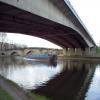
Ferrybridge Bypass Bridge
is a minor waterways place
on the Aire and Calder Navigation (Main Line - Goole to Castleford) between
Bank Dole Junction (Junction of the Aire and Calder Navigation (Selby Section) and the Aire and Calder Navigation (Main Line)) (1 mile and 5½ furlongs
and 1 lock
to the east) and
Castleford Junction (Junction of the Aire and Calder Navigation (Wakefield Section) and the Aire and Calder Navigation (Main Line)) (5 miles and 2½ furlongs
and 2 locks
to the west).
The nearest place in the direction of Bank Dole Junction is Ferrybridge Weir Entrance (Channel leading to the Weir);
¼ furlongs
away.
The nearest place in the direction of Castleford Junction is Old Great North Road Bridge;
½ furlongs
away.
Mooring here is unrated.
There is a bridge here which takes a dual carriageway over the canal.
Forge Hill Lane Bridge | 5¼ furlongs | |
Mill Bridge Wharf | 4 furlongs | |
Ferrybridge Flood Lock No 11 | 1 furlong | |
Ferrybridge Flood Lock Footbridge | ¾ furlongs | |
Ferrybridge Weir Entrance | ¼ furlongs | |
Ferrybridge Bypass Bridge | ||
Old Great North Road Bridge | ½ furlongs | |
Ferrybridge Railway Bridge | 4¾ furlongs | |
Power Station Pipe Bridge | 1 mile | |
Ferrybridge Wharf | 1 mile, 1 furlong | |
A1(M) Motorway Bridge | 1 mile, 5 furlongs |
Amenities here
There are no links to external websites from here.
Why not log in and add some (select "External websites" from the menu (sometimes this is under "Edit"))?
Mouseover for more information or show routes to facility
Nearest water point
In the direction of Castleford Junction
Bulholme Lock No 10 — 4 miles, 5 furlongs away
On this waterway in the direction of Castleford Junction
Castleford Sanitary Station — 5 miles, 1¾ furlongs and 1 lock away
On this waterway in the direction of Castleford Junction
Woodnook Lock No 6 — 7 miles, 4¼ furlongs and 2 locks away
Travel to Castleford Junction, then on the Aire and Calder Navigation (Wakefield Section) to Woodnook Lock No 6
Fairies Hill Moorings — 7 miles, 3 furlongs and 3 locks away
Travel to Castleford Junction, then on the Aire and Calder Navigation (Wakefield Section) to Fairies Hill Lock Junction, then on the Aire and Calder Navigation (Wakefield Section - Fairies Hill Mooring Arm) to Fairies Hill Moorings
Lemonroyd Lock No 7 — 8 miles, 6¼ furlongs and 2 locks away
Travel to Castleford Junction, then on the Aire and Calder Navigation (Main Line - Castleford to Leeds) to Lemonroyd Lock No 7
Lemonroyd Marina — 8 miles, 7¼ furlongs and 3 locks away
Travel to Castleford Junction, then on the Aire and Calder Navigation (Main Line - Castleford to Leeds) to Lemonroyd Marina
King's Road Lock No 3 — 8 miles, 5¾ furlongs and 3 locks away
Travel to Castleford Junction, then on the Aire and Calder Navigation (Wakefield Section) to King's Road Lock No 3
Woodlesford Lock No 5 — 10 miles, 1 furlong and 3 locks away
Travel to Castleford Junction, then on the Aire and Calder Navigation (Main Line - Castleford to Leeds) to Woodlesford Lock No 5
Fishpond Lock No 4 — 10 miles, 7¾ furlongs and 4 locks away
Travel to Castleford Junction, then on the Aire and Calder Navigation (Main Line - Castleford to Leeds) to Fishpond Lock No 4
Stanley Ferry Water Point — 10 miles, 3 furlongs and 5 locks away
Travel to Castleford Junction, then on the Aire and Calder Navigation (Wakefield Section) to Stanley Ferry Water Point
Ramsdens Bridge Sanitary Station — 10 miles, 3¾ furlongs and 5 locks away
Travel to Castleford Junction, then on the Aire and Calder Navigation (Wakefield Section) to Ramsdens Bridge Sanitary Station
In the direction of Ouse - Aire and Calder Junction
Ferrybridge Flood Lock Footbridge — ¾ furlongs away
On this waterway in the direction of Ouse - Aire and Calder Junction
Ferrybridge Flood Lock No 11 — 1 furlong away
On this waterway in the direction of Ouse - Aire and Calder Junction
Bank Dole Lock No 1 — 1 mile, 7¼ furlongs and 1 lock away
Travel to Bank Dole Junction, then on the Aire and Calder Navigation (Selby Section) to Bank Dole Lock No 1
Beal Bridge — 4 miles, 1¾ furlongs and 2 locks away
Travel to Bank Dole Junction, then on the Aire and Calder Navigation (Selby Section) to Beal Bridge
Beal Lock No 2 — 4 miles, 3 furlongs and 2 locks away
Travel to Bank Dole Junction, then on the Aire and Calder Navigation (Selby Section) to Beal Lock No 2
Whitley Lock No 12 — 5 miles, 4¾ furlongs and 1 lock away
On this waterway in the direction of Ouse - Aire and Calder Junction
Pollington Manor Swing Bridge — 9 miles, 3 furlongs and 3 locks away
On this waterway in the direction of Ouse - Aire and Calder Junction
Pollington Visitor Mooring — 9 miles, 3¼ furlongs and 3 locks away
On this waterway in the direction of Ouse - Aire and Calder Junction
Selby Basin — 12 miles, 7¾ furlongs and 4 locks away
Travel to Bank Dole Junction, then on the Aire and Calder Navigation (Selby Section) to Selby BasinNearest rubbish disposal
In the direction of Castleford Junction
Castleford Sanitary Station — 5 miles, 1¾ furlongs and 1 lock away
On this waterway in the direction of Castleford Junction
Lemonroyd Marina — 8 miles, 7¼ furlongs and 3 locks away
Travel to Castleford Junction, then on the Aire and Calder Navigation (Main Line - Castleford to Leeds) to Lemonroyd Marina
Woodlesford Lock No 5 — 10 miles, 1 furlong and 3 locks away
Travel to Castleford Junction, then on the Aire and Calder Navigation (Main Line - Castleford to Leeds) to Woodlesford Lock No 5
Ramsdens Bridge Visitor Moorings — 10 miles, 3¼ furlongs and 5 locks away
Travel to Castleford Junction, then on the Aire and Calder Navigation (Wakefield Section) to Ramsdens Bridge Visitor Moorings
Leeds Sanitary Station — 14 miles, 5½ furlongs and 6 locks away
Travel to Castleford Junction, then on the Aire and Calder Navigation (Main Line - Castleford to Leeds) to Leeds Sanitary Station
Leeds Basin — 15 miles, 4¾ furlongs and 8 locks away
Travel to Castleford Junction, then on the Aire and Calder Navigation (Main Line - Castleford to Leeds) to Leeds Bridge, then on the Leeds and Liverpool Canal (Main Line - Wigan to Leeds) to Leeds Basin
Horbury Basin Residential Moorings & Sanitary Station — 18 miles and 10 locks away
Travel to Castleford Junction, then on the Aire and Calder Navigation (Wakefield Section) to Fall Ing Junction, then on the Calder and Hebble Navigation (Main Line) to Horbury Basin Residential Moorings & Sanitary Station
In the direction of Ouse - Aire and Calder Junction
Whitley Lock No 12 — 5 miles, 4¾ furlongs and 1 lock away
On this waterway in the direction of Ouse - Aire and Calder Junction
Selby Basin — 12 miles, 7¾ furlongs and 4 locks away
Travel to Bank Dole Junction, then on the Aire and Calder Navigation (Selby Section) to Selby Basin
Dutch Riverside — 17 miles, 5¼ furlongs and 3 locks away
On this waterway in the direction of Ouse - Aire and Calder Junction
Goole Marina — 17 miles, 6¾ furlongs and 3 locks away
On this waterway in the direction of Ouse - Aire and Calder Junction
Barnby Dun Lift Bridge — 18 miles, ¼ furlongs and 4 locks away
Travel to Sykehouse Junction, then on the Sheffield and South Yorkshire Navigation (New Junction Canal) to Bramwith Junction, then on the Sheffield and South Yorkshire Navigation (Main Line) to Barnby Dun Lift Bridge
Bramwith Swing Bridge — 17 miles, 4¾ furlongs and 5 locks away
Travel to Sykehouse Junction, then on the Sheffield and South Yorkshire Navigation (New Junction Canal) to Bramwith Junction, then on the Sheffield and South Yorkshire Navigation (Bramwith to Stainforth) to Bramwith Swing BridgeNearest chemical toilet disposal
In the direction of Castleford Junction
Castleford Sanitary Station — 5 miles, 1¾ furlongs and 1 lock away
On this waterway in the direction of Castleford Junction
Fairies Hill Moorings — 7 miles, 3 furlongs and 3 locks away
Travel to Castleford Junction, then on the Aire and Calder Navigation (Wakefield Section) to Fairies Hill Lock Junction, then on the Aire and Calder Navigation (Wakefield Section - Fairies Hill Mooring Arm) to Fairies Hill Moorings
Lemonroyd Marina — 8 miles, 7¼ furlongs and 3 locks away
Travel to Castleford Junction, then on the Aire and Calder Navigation (Main Line - Castleford to Leeds) to Lemonroyd Marina
Ramsdens Bridge Sanitary Station — 10 miles, 3¾ furlongs and 5 locks away
Travel to Castleford Junction, then on the Aire and Calder Navigation (Wakefield Section) to Ramsdens Bridge Sanitary Station
Leeds Sanitary Station — 14 miles, 5½ furlongs and 6 locks away
Travel to Castleford Junction, then on the Aire and Calder Navigation (Main Line - Castleford to Leeds) to Leeds Sanitary Station
Horbury Basin Residential Moorings & Sanitary Station — 18 miles and 10 locks away
Travel to Castleford Junction, then on the Aire and Calder Navigation (Wakefield Section) to Fall Ing Junction, then on the Calder and Hebble Navigation (Main Line) to Horbury Basin Residential Moorings & Sanitary Station
In the direction of Ouse - Aire and Calder Junction
Whitley Lock No 12 — 5 miles, 4¾ furlongs and 1 lock away
On this waterway in the direction of Ouse - Aire and Calder Junction
Selby Basin — 12 miles, 7¾ furlongs and 4 locks away
Travel to Bank Dole Junction, then on the Aire and Calder Navigation (Selby Section) to Selby Basin
Dutch Riverside — 17 miles, 5¼ furlongs and 3 locks away
On this waterway in the direction of Ouse - Aire and Calder Junction
Goole Marina — 17 miles, 6¾ furlongs and 3 locks away
On this waterway in the direction of Ouse - Aire and Calder Junction
Barnby Dun Lift Bridge — 18 miles, ¼ furlongs and 4 locks away
Travel to Sykehouse Junction, then on the Sheffield and South Yorkshire Navigation (New Junction Canal) to Bramwith Junction, then on the Sheffield and South Yorkshire Navigation (Main Line) to Barnby Dun Lift Bridge
Bramwith Swing Bridge — 17 miles, 4¾ furlongs and 5 locks away
Travel to Sykehouse Junction, then on the Sheffield and South Yorkshire Navigation (New Junction Canal) to Bramwith Junction, then on the Sheffield and South Yorkshire Navigation (Bramwith to Stainforth) to Bramwith Swing BridgeNearest place to turn
In the direction of Castleford Junction
Bulholme Lock Weir Exit — 4 miles, 4½ furlongs away
On this waterway in the direction of Castleford Junction
Lemonroyd Lock Weir Exit — 8 miles, 5¼ furlongs and 2 locks away
Travel to Castleford Junction, then on the Aire and Calder Navigation (Main Line - Castleford to Leeds) to Lemonroyd Lock Weir Exit
Fairies Hill Lock Arm — 7 miles, 6 furlongs and 3 locks away
Travel to Castleford Junction, then on the Aire and Calder Navigation (Wakefield Section) to Fairies Hill Lock Arm
Fleet Lane Arm — 9 miles, 1¼ furlongs and 3 locks away
Travel to Castleford Junction, then on the Aire and Calder Navigation (Main Line - Castleford to Leeds) to Fleet Lane Arm
Stanley Ferry Marina — 10 miles, 2¼ furlongs and 5 locks away
Travel to Castleford Junction, then on the Aire and Calder Navigation (Wakefield Section) to Stanley Ferry Marina
Junction with River Aire (Old Channel) South — 13 miles, 3½ furlongs and 5 locks away
Travel to Castleford Junction, then on the Aire and Calder Navigation (Main Line - Castleford to Leeds) to Junction with River Aire (Old Channel) South
Junction with River Aire (Old Channel) North — 14 miles, ¾ furlongs and 6 locks away
Travel to Castleford Junction, then on the Aire and Calder Navigation (Main Line - Castleford to Leeds) to Junction with River Aire (Old Channel) North
Knostrop Flood Lock Weir Entrance — 14 miles, ¾ furlongs and 6 locks away
Travel to Castleford Junction, then on the Aire and Calder Navigation (Main Line - Castleford to Leeds) to Knostrop Flood Lock Weir Entrance
Wakefield Weir Entrance — 13 miles, 2½ furlongs and 7 locks away
Travel to Castleford Junction, then on the Aire and Calder Navigation (Wakefield Section) to Fall Ing Junction, then on the Calder and Hebble Navigation (Main Line) to Wakefield Weir Entrance
Leeds Dock Side Arm — 15 miles and 7 locks away
Travel to Castleford Junction, then on the Aire and Calder Navigation (Main Line - Castleford to Leeds) to Leeds Dock Entrance, then on the Aire and Calder Navigation (Leeds Dock) to Leeds Dock Side Arm
River Aire Junction — 15 miles, 4¼ furlongs and 7 locks away
Travel to Castleford Junction, then on the Aire and Calder Navigation (Main Line - Castleford to Leeds) to Leeds Bridge, then on the Leeds and Liverpool Canal (Main Line - Wigan to Leeds) to River Aire Junction
Leeds Basin — 15 miles, 4¾ furlongs and 8 locks away
Travel to Castleford Junction, then on the Aire and Calder Navigation (Main Line - Castleford to Leeds) to Leeds Bridge, then on the Leeds and Liverpool Canal (Main Line - Wigan to Leeds) to Leeds Basin
Broad Cut Weir Entrance — 15 miles, 7 furlongs and 8 locks away
Travel to Castleford Junction, then on the Aire and Calder Navigation (Wakefield Section) to Fall Ing Junction, then on the Calder and Hebble Navigation (Main Line) to Broad Cut Weir Entrance
Waller Bridge Winding Hole — 16 miles, 1¼ furlongs and 9 locks away
Travel to Castleford Junction, then on the Aire and Calder Navigation (Wakefield Section) to Fall Ing Junction, then on the Calder and Hebble Navigation (Main Line) to Waller Bridge Winding Hole
In the direction of Ouse - Aire and Calder Junction
Bank Dole Lock Junction — 1 mile, 7½ furlongs and 2 locks away
Travel to Bank Dole Junction, then on the Aire and Calder Navigation (Selby Section) to Bank Dole Lock Junction
Beal Lock No 2 Weir Entrance — 4 miles, 2 furlongs and 2 locks away
Travel to Bank Dole Junction, then on the Aire and Calder Navigation (Selby Section) to Beal Lock No 2 Weir Entrance
Haddlesey Junction — 8 miles, 1½ furlongs and 3 locks away
Travel to Bank Dole Junction, then on the Aire and Calder Navigation (Selby Section) to Haddlesey Junction
Selby Basin — 12 miles, 7¾ furlongs and 4 locks away
Travel to Bank Dole Junction, then on the Aire and Calder Navigation (Selby Section) to Selby Basin
Viking Marina — 17 miles, 6 furlongs and 3 locks away
On this waterway in the direction of Ouse - Aire and Calder Junction
Huddle Grounds Winding Hole — 19 miles, 4 furlongs and 5 locks away
Travel to Sykehouse Junction, then on the Sheffield and South Yorkshire Navigation (New Junction Canal) to Bramwith Junction, then on the Sheffield and South Yorkshire Navigation (Bramwith to Stainforth) to Stainforth Junction, then on the Sheffield and South Yorkshire Navigation (Stainforth and Keadby Canal) to Huddle Grounds Winding HoleNearest self-operated pump-out
In the direction of Castleford Junction
Castleford Sanitary Station — 5 miles, 1¾ furlongs and 1 lock away
On this waterway in the direction of Castleford Junction
Ramsdens Bridge Sanitary Station — 10 miles, 3¾ furlongs and 5 locks away
Travel to Castleford Junction, then on the Aire and Calder Navigation (Wakefield Section) to Ramsdens Bridge Sanitary Station
Leeds Sanitary Station — 14 miles, 5½ furlongs and 6 locks away
Travel to Castleford Junction, then on the Aire and Calder Navigation (Main Line - Castleford to Leeds) to Leeds Sanitary StationNearest boatyard pump-out
In the direction of Castleford Junction
Lemonroyd Marina — 8 miles, 7¼ furlongs and 3 locks away
Travel to Castleford Junction, then on the Aire and Calder Navigation (Main Line - Castleford to Leeds) to Lemonroyd Marina
In the direction of Ouse - Aire and Calder Junction
Goole Marina — 17 miles, 6¾ furlongs and 3 locks away
On this waterway in the direction of Ouse - Aire and Calder JunctionDirection of TV transmitter (From Wolfbane Cybernetic)
There is no page on Wikipedia called “Ferrybridge Bypass Bridge”
Wikipedia pages that might relate to Ferrybridge Bypass Bridge
[Knottingley]
invented by a Ferrybridge postmaster. There is a Bagley's Glass gallery in Pontefract Museum. Close to Knottingley is the Ferrybridge Power Station,
[M62 motorway]
the Stretford-Eccles Bypass and beyond, to create a continuous motorway between Liverpool and Ferrybridge (a link between Ferrybridge and Hull was not considered
[River Aire]
Esholt Apperley Bridge Horsforth Kirkstall Leeds city centre Holbeck Knowsthorpe Allerton Bywater Castleford Brotherton Ferrybridge Knottingley Beal
[A roads in Zone 1 of the Great Britain numbering scheme]
of the River Thames, east of the A1 (roads beginning with 1). "Old Stoke Bridge, Ipswich". www.topbond.co.uk. Top Bond. Retrieved 4 September 2019. "A150"
[Selby Canal]
the Aire and Calder Navigation until 1826, when it was bypassed by a new cut from Ferrybridge to Goole. Selby steadily declined after that, although traffic
[A19 road]
point, running west–east: Ferrybridge, Eggborough, and Drax, with its enormous chimney, to the east). Close by is Whitley Bridge and the A19 then meets the
[Aire and Calder Navigation]
Faced with yet another outside scheme which would bypass the navigation from Wakefield to Ferrybridge, the company looked at improvements which would give
[Great North Road (Great Britain)]
Road. Along the route, Doncaster–Selby–York was superseded by Doncaster–Ferrybridge–Wetherby–Boroughbridge–Northallerton–Darlington, the more direct way
[Yorkshire and the Humber]
holding (EPH) since 2014 and was owned by British Energy until 2010; Ferrybridge C closed on 23 March 2016. The distribution area once looked after by
[Balloon loop]
merry-go-round system). Examples include Cottam, Didcot, Drax, Eggborough, Ferrybridge, and Ratcliffe-on-Soar. Also, the Fife Circle line between Edinburgh
Results of Google Search
Bloomington Ferry Bridge - WikipediaThe current bridge and the US 169 Shakopee Bypass were both completed in 1996. The bridge it replaced was designated Hennepin County Road 18 and Scott ...
Title: Knight's Ferry Bridge, Spanning Stanislaus River, bypassed section of Stockton-Sonora Road, Knights Ferry, Stanislaus County, CA; Other Title: National ...
The Wright's Ferry Bridge carries U.S. Route 30 (US 30) over the Susquehanna River between ... commissioned by the Commonwealth of Pennsylvania in the 1960s to relocate US 30 and bypass the river towns of Wrightsville and Columbia .
Title: Knight's Ferry Bridge, Spanning Stanislaus River, bypassed section of Stockton-Sonora Road, Knights Ferry, Stanislaus County, CA; Contributor Names  ...
The construction River Aire Bridge, Ferrybridge began in 1964 under a contact with Martin Cowley for the construction of the Ferrybridge by-pass on the A1 trunk  ...
File:Plans - Knight's Ferry Bridge, Spanning Stanislaus River, bypassed section of Stockton-Sonora Road, Knights Ferry, Stanislaus County, CA HAER CA-314Â ...
Closed to vehicles and bypassed by the modern bridge to the west 1990. Listed in National Register of Historic Places 1996. Keywords. Transportation, Buildings  ...
Ferrybridge Bypass Bridge Stretches across the Aire and Calder Navigation (Aire and Calder Main Line)
Bypassed Pennsylvania through truss bridge over White River on County Line Road (CR 500 East)
Mar 1, 2012 ... Historic Name: Knight's Ferry Bridge. Other Name/Site Number: 2. LOCATION. Street & Number: Spanning Stanislaus River at bypassed ...