CanalPlanAC

Whitley M62 Bridge No 19

 
M62, Whitley DN14 0JP, United Kingdom (M62)
 
Information about the place
Whitley M62 Bridge No 19 is a minor waterways place on the Aire and Calder Navigation (Main Line - Goole to Castleford) between Heck Bridge (With pipe bridge alongside) (1 mile and 4¼ furlongs and 1 lock to the southeast) and Whitley Bridge (4¾ furlongs to the west).
 
 
The nearest place in the direction of Heck Bridge is Whitley Lock No 12; 1 furlong away.
 
The nearest place in the direction of Whitley Bridge is A19 Whitley Bridge ( ); 3 furlongs away.

Mooring here is impossible (it may be physically impossible, forbidden, or allowed only for specific short-term purposes).

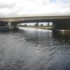
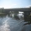
There is a bridge here which takes a motorway over the canal.

Heck Railway Bridge No 202 miles, 2 furlongs
Heck Bridge Marina1 mile, 5½ furlongs
Heck Bridge1 mile, 4¼ furlongs
Whitley Lock Visitor Moorings1½ furlongs
Whitley Lock No 121 furlong
Whitley M62 Bridge No 19
A19 Whitley Bridge3 furlongs
Whitley Pipe Bridge4¼ furlongs
Selby Road Bridge4¾ furlongs
Whitley Bridge4¾ furlongs
Stubbs Pipe Bridge1 mile, 4¾ furlongs
 
 
Amenities

Amenities nearby at A19 Whitley Bridge

 SPAR
 
Maps
If you are a user and are logged on, or if you are actively planning a route, a map will be displayed here.
Show on external mapping site: Google | OSM | Bing
 
Photos
 
External websites
There are no links to external websites from here.
Why not log in and add some (select "External websites" from the menu (sometimes this is under "Edit"))?
 
Nearest facilities

Mouseover for more information or show routes to facility

Nearest water point

In the direction of Castleford Junction

Bank Dole Lock No 14 miles, ¼ furlongs away
Travel to Bank Dole Junction, then on the Aire and Calder Navigation (Selby Section) to Bank Dole Lock No 1
Ferrybridge Flood Lock No 115 miles, 3 furlongs away
On this waterway in the direction of Castleford Junction
Ferrybridge Flood Lock Footbridge5 miles, 3¼ furlongs and 1 lock away
On this waterway in the direction of Castleford Junction
Beal Bridge6 miles, 2¾ furlongs and 1 lock away
Travel to Bank Dole Junction, then on the Aire and Calder Navigation (Selby Section) to Beal Bridge
Beal Lock No 26 miles, 4 furlongs and 1 lock away
Travel to Bank Dole Junction, then on the Aire and Calder Navigation (Selby Section) to Beal Lock No 2
Bulholme Lock No 1010 miles, ¾ furlongs and 1 lock away
On this waterway in the direction of Castleford Junction
Castleford Sanitary Station10 miles, 5½ furlongs and 2 locks away
On this waterway in the direction of Castleford Junction
Woodnook Lock No 613 miles, ¼ furlongs and 3 locks away
Travel to Castleford Junction, then on the Aire and Calder Navigation (Wakefield Section) to Woodnook Lock No 6
Fairies Hill Moorings12 miles, 6¾ furlongs and 4 locks away
Travel to Castleford Junction, then on the Aire and Calder Navigation (Wakefield Section) to Fairies Hill Lock Junction, then on the Aire and Calder Navigation (Wakefield Section - Fairies Hill Mooring Arm) to Fairies Hill Moorings
Lemonroyd Lock No 714 miles, 2 furlongs and 3 locks away
Travel to Castleford Junction, then on the Aire and Calder Navigation (Main Line - Castleford to Leeds) to Lemonroyd Lock No 7
Selby Basin15 miles, 1 furlong and 3 locks away
Travel to Bank Dole Junction, then on the Aire and Calder Navigation (Selby Section) to Selby Basin

In the direction of Ouse - Aire and Calder Junction

Whitley Lock No 121 furlong away
On this waterway in the direction of Ouse - Aire and Calder Junction
Pollington Manor Swing Bridge3 miles, 7 furlongs and 2 locks away
On this waterway in the direction of Ouse - Aire and Calder Junction
Pollington Visitor Mooring3 miles, 7½ furlongs and 2 locks away
On this waterway in the direction of Ouse - Aire and Calder Junction
Dutch Riverside12 miles, 1¼ furlongs and 2 locks away
On this waterway in the direction of Ouse - Aire and Calder Junction
Goole Marina12 miles, 3 furlongs and 2 locks away
On this waterway in the direction of Ouse - Aire and Calder Junction
Bramwith Lock No 1411 miles, 6 furlongs and 3 locks away
Travel to Sykehouse Junction, then on the Sheffield and South Yorkshire Navigation (New Junction Canal) to Bramwith Junction, then on the Sheffield and South Yorkshire Navigation (Bramwith to Stainforth) to Bramwith Lock No 14
Barnby Dun Lift Bridge12 miles, 4½ furlongs and 3 locks away
Travel to Sykehouse Junction, then on the Sheffield and South Yorkshire Navigation (New Junction Canal) to Bramwith Junction, then on the Sheffield and South Yorkshire Navigation (Main Line) to Barnby Dun Lift Bridge
Bramwith Swing Bridge12 miles, 1 furlong and 4 locks away
Travel to Sykehouse Junction, then on the Sheffield and South Yorkshire Navigation (New Junction Canal) to Bramwith Junction, then on the Sheffield and South Yorkshire Navigation (Bramwith to Stainforth) to Bramwith Swing Bridge
Long Sandall Lock No 1314 miles, 5¾ furlongs and 3 locks away
Travel to Sykehouse Junction, then on the Sheffield and South Yorkshire Navigation (New Junction Canal) to Bramwith Junction, then on the Sheffield and South Yorkshire Navigation (Main Line) to Long Sandall Lock No 13

Nearest rubbish disposal

In the direction of Castleford Junction

Castleford Sanitary Station10 miles, 5½ furlongs and 2 locks away
On this waterway in the direction of Castleford Junction
Selby Basin15 miles, 1 furlong and 3 locks away
Travel to Bank Dole Junction, then on the Aire and Calder Navigation (Selby Section) to Selby Basin
Lemonroyd Marina14 miles, 3 furlongs and 4 locks away
Travel to Castleford Junction, then on the Aire and Calder Navigation (Main Line - Castleford to Leeds) to Lemonroyd Marina
Woodlesford Lock No 515 miles, 4¾ furlongs and 4 locks away
Travel to Castleford Junction, then on the Aire and Calder Navigation (Main Line - Castleford to Leeds) to Woodlesford Lock No 5
Ramsdens Bridge Visitor Moorings15 miles, 7¼ furlongs and 6 locks away
Travel to Castleford Junction, then on the Aire and Calder Navigation (Wakefield Section) to Ramsdens Bridge Visitor Moorings

In the direction of Ouse - Aire and Calder Junction

Whitley Lock No 121 furlong away
On this waterway in the direction of Ouse - Aire and Calder Junction
Dutch Riverside12 miles, 1¼ furlongs and 2 locks away
On this waterway in the direction of Ouse - Aire and Calder Junction
Goole Marina12 miles, 3 furlongs and 2 locks away
On this waterway in the direction of Ouse - Aire and Calder Junction
Barnby Dun Lift Bridge12 miles, 4½ furlongs and 3 locks away
Travel to Sykehouse Junction, then on the Sheffield and South Yorkshire Navigation (New Junction Canal) to Bramwith Junction, then on the Sheffield and South Yorkshire Navigation (Main Line) to Barnby Dun Lift Bridge
Bramwith Swing Bridge12 miles, 1 furlong and 4 locks away
Travel to Sykehouse Junction, then on the Sheffield and South Yorkshire Navigation (New Junction Canal) to Bramwith Junction, then on the Sheffield and South Yorkshire Navigation (Bramwith to Stainforth) to Bramwith Swing Bridge
Thorne Visitor Moorings16 miles, 3½ furlongs and 5 locks away
Travel to Sykehouse Junction, then on the Sheffield and South Yorkshire Navigation (New Junction Canal) to Bramwith Junction, then on the Sheffield and South Yorkshire Navigation (Bramwith to Stainforth) to Stainforth Junction, then on the Sheffield and South Yorkshire Navigation (Stainforth and Keadby Canal) to Thorne Visitor Moorings
Doncaster Visitor Pontoon Moorings17 miles, 7¼ furlongs and 4 locks away
Travel to Sykehouse Junction, then on the Sheffield and South Yorkshire Navigation (New Junction Canal) to Bramwith Junction, then on the Sheffield and South Yorkshire Navigation (Main Line) to Doncaster Visitor Pontoon Moorings

Nearest chemical toilet disposal

In the direction of Castleford Junction

Castleford Sanitary Station10 miles, 5½ furlongs and 2 locks away
On this waterway in the direction of Castleford Junction
Fairies Hill Moorings12 miles, 6¾ furlongs and 4 locks away
Travel to Castleford Junction, then on the Aire and Calder Navigation (Wakefield Section) to Fairies Hill Lock Junction, then on the Aire and Calder Navigation (Wakefield Section - Fairies Hill Mooring Arm) to Fairies Hill Moorings
Selby Basin15 miles, 1 furlong and 3 locks away
Travel to Bank Dole Junction, then on the Aire and Calder Navigation (Selby Section) to Selby Basin
Lemonroyd Marina14 miles, 3 furlongs and 4 locks away
Travel to Castleford Junction, then on the Aire and Calder Navigation (Main Line - Castleford to Leeds) to Lemonroyd Marina
Ramsdens Bridge Sanitary Station15 miles, 7½ furlongs and 6 locks away
Travel to Castleford Junction, then on the Aire and Calder Navigation (Wakefield Section) to Ramsdens Bridge Sanitary Station

In the direction of Ouse - Aire and Calder Junction

Whitley Lock No 121 furlong away
On this waterway in the direction of Ouse - Aire and Calder Junction
Dutch Riverside12 miles, 1¼ furlongs and 2 locks away
On this waterway in the direction of Ouse - Aire and Calder Junction
Goole Marina12 miles, 3 furlongs and 2 locks away
On this waterway in the direction of Ouse - Aire and Calder Junction
Barnby Dun Lift Bridge12 miles, 4½ furlongs and 3 locks away
Travel to Sykehouse Junction, then on the Sheffield and South Yorkshire Navigation (New Junction Canal) to Bramwith Junction, then on the Sheffield and South Yorkshire Navigation (Main Line) to Barnby Dun Lift Bridge
Bramwith Swing Bridge12 miles, 1 furlong and 4 locks away
Travel to Sykehouse Junction, then on the Sheffield and South Yorkshire Navigation (New Junction Canal) to Bramwith Junction, then on the Sheffield and South Yorkshire Navigation (Bramwith to Stainforth) to Bramwith Swing Bridge
Thorne Visitor Moorings16 miles, 3½ furlongs and 5 locks away
Travel to Sykehouse Junction, then on the Sheffield and South Yorkshire Navigation (New Junction Canal) to Bramwith Junction, then on the Sheffield and South Yorkshire Navigation (Bramwith to Stainforth) to Stainforth Junction, then on the Sheffield and South Yorkshire Navigation (Stainforth and Keadby Canal) to Thorne Visitor Moorings

Nearest place to turn

In the direction of Castleford Junction

Bank Dole Lock Junction4 miles, ¾ furlongs and 1 lock away
Travel to Bank Dole Junction, then on the Aire and Calder Navigation (Selby Section) to Bank Dole Lock Junction
Beal Lock No 2 Weir Entrance6 miles, 3 furlongs and 1 lock away
Travel to Bank Dole Junction, then on the Aire and Calder Navigation (Selby Section) to Beal Lock No 2 Weir Entrance
Bulholme Lock Weir Exit10 miles, ½ furlongs and 1 lock away
On this waterway in the direction of Castleford Junction
Haddlesey Junction10 miles, 2½ furlongs and 2 locks away
Travel to Bank Dole Junction, then on the Aire and Calder Navigation (Selby Section) to Haddlesey Junction
Lemonroyd Lock Weir Exit14 miles, 1 furlong and 3 locks away
Travel to Castleford Junction, then on the Aire and Calder Navigation (Main Line - Castleford to Leeds) to Lemonroyd Lock Weir Exit
Fairies Hill Lock Arm13 miles, 1¾ furlongs and 4 locks away
Travel to Castleford Junction, then on the Aire and Calder Navigation (Wakefield Section) to Fairies Hill Lock Arm
Selby Basin15 miles, 1 furlong and 3 locks away
Travel to Bank Dole Junction, then on the Aire and Calder Navigation (Selby Section) to Selby Basin
Fleet Lane Arm14 miles, 5 furlongs and 4 locks away
Travel to Castleford Junction, then on the Aire and Calder Navigation (Main Line - Castleford to Leeds) to Fleet Lane Arm
Stanley Ferry Marina15 miles, 6¼ furlongs and 6 locks away
Travel to Castleford Junction, then on the Aire and Calder Navigation (Wakefield Section) to Stanley Ferry Marina
Junction with River Aire (Old Channel) South18 miles, 7¼ furlongs and 6 locks away
Travel to Castleford Junction, then on the Aire and Calder Navigation (Main Line - Castleford to Leeds) to Junction with River Aire (Old Channel) South
Junction with River Aire (Old Channel) North19 miles, 4½ furlongs and 7 locks away
Travel to Castleford Junction, then on the Aire and Calder Navigation (Main Line - Castleford to Leeds) to Junction with River Aire (Old Channel) North
Knostrop Flood Lock Weir Entrance19 miles, 4¾ furlongs and 7 locks away
Travel to Castleford Junction, then on the Aire and Calder Navigation (Main Line - Castleford to Leeds) to Knostrop Flood Lock Weir Entrance
Wakefield Weir Entrance18 miles, 6½ furlongs and 8 locks away
Travel to Castleford Junction, then on the Aire and Calder Navigation (Wakefield Section) to Fall Ing Junction, then on the Calder and Hebble Navigation (Main Line) to Wakefield Weir Entrance

In the direction of Ouse - Aire and Calder Junction

Viking Marina12 miles, 2¼ furlongs and 2 locks away
On this waterway in the direction of Ouse - Aire and Calder Junction
Huddle Grounds Winding Hole14 miles and 4 locks away
Travel to Sykehouse Junction, then on the Sheffield and South Yorkshire Navigation (New Junction Canal) to Bramwith Junction, then on the Sheffield and South Yorkshire Navigation (Bramwith to Stainforth) to Stainforth Junction, then on the Sheffield and South Yorkshire Navigation (Stainforth and Keadby Canal) to Huddle Grounds Winding Hole
Wheatley Hall Road Winding Hole15 miles, 6½ furlongs and 4 locks away
Travel to Sykehouse Junction, then on the Sheffield and South Yorkshire Navigation (New Junction Canal) to Bramwith Junction, then on the Sheffield and South Yorkshire Navigation (Main Line) to Wheatley Hall Road Winding Hole
Gas House Bight17 miles, 5¾ furlongs and 4 locks away
Travel to Sykehouse Junction, then on the Sheffield and South Yorkshire Navigation (New Junction Canal) to Bramwith Junction, then on the Sheffield and South Yorkshire Navigation (Main Line) to Gas House Bight
Doncaster Visitor Pontoon Moorings17 miles, 7¼ furlongs and 4 locks away
Travel to Sykehouse Junction, then on the Sheffield and South Yorkshire Navigation (New Junction Canal) to Bramwith Junction, then on the Sheffield and South Yorkshire Navigation (Main Line) to Doncaster Visitor Pontoon Moorings

Nearest self-operated pump-out

In the direction of Castleford Junction

Castleford Sanitary Station10 miles, 5½ furlongs and 2 locks away
On this waterway in the direction of Castleford Junction
Ramsdens Bridge Sanitary Station15 miles, 7½ furlongs and 6 locks away
Travel to Castleford Junction, then on the Aire and Calder Navigation (Wakefield Section) to Ramsdens Bridge Sanitary Station

In the direction of Ouse - Aire and Calder Junction

Long Sandall Lock No 1314 miles, 5¾ furlongs and 3 locks away
Travel to Sykehouse Junction, then on the Sheffield and South Yorkshire Navigation (New Junction Canal) to Bramwith Junction, then on the Sheffield and South Yorkshire Navigation (Main Line) to Long Sandall Lock No 13
Direction of TV transmitter (From Wolfbane Cybernetic)
 
 
Geograph
 
Wikipedia

There is no page on Wikipedia called “Whitley M62 Bridge”

Wikipedia pages that might relate to Whitley M62 Bridge
[Foudry Brook] and after the bridge, the stream passes between the Green Park Business Park and the Madejski Stadium and football centre west of Whitley, where it provides [Coventry Canal] Polesworth, to Tamworth. At Atherstone a set of 11 locks (Top Lock No. 1 to Atherstone Bottom Lock No. 11) lower the level of the canal 80 feet (24 m) towards [Transport in Reading, Berkshire] are navigable, and the locks of Caversham Lock, Blake's Lock, County Lock, Fobney Lock and Southcote Lock are all within the borough. Today navigation [Reading, Berkshire] Thames and Kennet, it is on the Great Western Main Line railway and the M4 motorway. Reading is 40 miles (64 km) east of Swindon, 25 miles (40 km) south of [Burghfield] annexe attached, in Whitley, South of Kirton's Farm Road, South-West of Reading. Two type 28a anti-tank gun emplacements at Garston Lock, Kennet and Avon [Peterborough railway station] William E. Stephenson 1932 - ???? (formerly station master at Monkseaton, Whitley Bay and Cullercoats) Reginald Repath 1950 - 1956 (afterwards station master [List of deaths in rock and roll (2000s)] Rockabilly Sound, Dies". The New York Times. "Singer/Songwriter Chris Whitley Dies". Billboard. Billboard Magazine news. 2010. Retrieved 20 November [South East England] region's close proximity to London and connections to several national motorways have led to South East England becoming a prosperous economic hub with [List of former Royal Air Force stations] redevelopment, including Omega Business Park and junction 8 of the M62 motorway. RAF Burn AZ England Yorkshire 1942 1945 RAF Bury St Edmunds BU England [Cheshire West and Chester] Under Secretary of State for Transport, confirmed that an upgrade to smart motorway will only take place after 2020. Navigable waterways in the borough include
 
Google

Results of Google Search

Goole to Knottingley (4) - Virtual Journey along the Aire and Calder ...
Whitley Lock, Aire and Calder Navigation ... Whitley Bridge. ... The M62 motorway runs between the waterway and the artificial hill created by the Cridling Stubbs ...
M62 viaduct
M62 viaduct Whitley Lock Motorway Bridge http://en.wikipedia.org/wiki/Template: Aire_and_Calder_Navigation_map.
Aire & Calder Navigation Main Line | Canal maps | Canal & River Trust
Wakefield Branch Bridge 5 Kings Road to Lock 6 Woodnook Lock, including the Arm to Fairies Hill viaduct and offside bank from M62 motorway bridge to Bridge ...
Transport in Reading, Berkshire - Wikipedia
Reading's location in the Thames Valley at the confluence of the River Thames and River Kennet, and on both the Great Western Main Line railway and the M4 motorway, ... The Thames is crossed by both Reading and Caversham road bridges, while several road bridges cross the Kennet. There is a long-running debate ...
Whitley Bridge Market & Carboot Sale - Home | Facebook
Whitley Bridge Market & Carboot Sale, Whitley, Doncaster, United Kingdom. 3586 likes · 139 talking about this · 56 were here. Whitley Bridge Sunday...
Whitley, North Yorkshire - Wikipedia
Whitley is a village in the Selby district of North Yorkshire, England, close to the Aire and Calder Navigation and the M62 motorway. ... The village is served by Whitley Bridge railway station to the north, but only has one train a day eastwards  ...
Whitley Parish Council Whitley Village - Home
Mar 28, 2020 ... Whitley, or Whitley Bridge as it is known locally, can be traced back to ... Whitley is located close to J34 of the M62 motorway, on the A19 eight ...