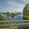
Three Holes
Junction of Sixteen Foot River, Popham's Eau and Middle Level Drain
Main Road, King's Lynn and West Norfolk PE14 9JR, United Kingdom

Three Holes
is a major waterways place
at the junction of
the Middle Level Navigations (Sixteen Foot River)
with
the Middle Level Navigations (Middle Level Main Drain)
and
the Middle Level Navigations (Popham's Eau).
Sixteen Foot Corner (Junction of Forty Foot and Sixteen Foot Rivers.)
is on
the Middle Level Navigations (Forty Foot River - navigable section),
9 miles and 4¾ furlongs
to the southwest.
Mullicourt Aqueduct (Middle Level Main Drain)
is on
the Middle Level Navigations (Middle Level Main Drain),
2 miles
to the northeast.
Old River Nene - Popham's Eau Junction (Junction of Popham's Eau and Old River Nene)
is on
the Middle Level Navigations (Old River Nene),
2 miles and 2½ furlongs
to the west.
The nearest place in the direction of Sixteen Foot Corner is Cotton's Corner Bridge;
6 furlongs
away.
The nearest place in the direction of Mullicourt Aqueduct (Middle Level Main Drain) is Three Holes Bridge;
¼ furlongs
away.
The nearest place in the direction of Old River Nene - Popham's Eau Junction is Sixteen Foot Bank Bridge (Popham's Eau);
3¼ furlongs
away.
Mooring here is unrated.
Middle Level Navigations (Sixteen Foot River) | ||
---|---|---|
Three Holes | ||
Cotton's Corner Bridge | 6 furlongs | |
Euximoor Drove Bridge | 1 mile, 5½ furlongs | |
Crown Road Bridge | 2 miles, ½ furlongs | |
Wheatsheaf Drove Bridge | 2 miles, 7½ furlongs | |
Sixteen Foot Bank Bridge (Christchurch) | 3 miles, 1¾ furlongs | |
Middle Level Navigations (Middle Level Main Drain) | ||
Three Holes | ||
Three Holes Bridge | ¼ furlongs | |
Three Holes Mooring | ½ furlongs | |
Middle Level Main Drain - Old Popham's Eau Junction | 2 furlongs | |
Bardyke Bank Bridge | 6¼ furlongs | |
Pingle Bridge | 1 mile, 3¼ furlongs | |
Middle Level Navigations (Popham's Eau) | ||
Three Holes | ||
Sixteen Foot Bank Bridge (Popham's Eau) | 3¼ furlongs | |
Popham's Eau Field Bridge | 1 mile, 2¾ furlongs | |
Old River Nene - Popham's Eau Junction | 2 miles, 2½ furlongs |
There are no links to external websites from here.
Why not log in and add some (select "External websites" from the menu (sometimes this is under "Edit"))?
Mouseover for more information or show routes to facility
Nearest water point
In the direction of Old River Nene - Popham's Eau Junction
March Boater Services — 6 miles, 3¾ furlongs away
Travel to Old River Nene - Popham's Eau Junction, then on the Middle Level Navigations (Old River Nene) to March Boater Services
Upwell Church Bridge Public Staithe (visitor mooring) — 5 miles, 4½ furlongs and 1 lock away
Travel to Old River Nene - Popham's Eau Junction, then on the Middle Level Navigations (Old River Nene) to Upwell Church Bridge Public Staithe (visitor mooring)
March Marina — 7 miles, 3½ furlongs away
Travel to Old River Nene - Popham's Eau Junction, then on the Middle Level Navigations (Old River Nene) to March Marina
Denver Sluice — 11 miles, 6½ furlongs and 2 locks away
Travel to Old River Nene - Popham's Eau Junction, then on the Middle Level Navigations (Old River Nene) to Outwell - Lance Hunter Rowe Boat Basin, then on the Middle Level Navigations (Well Creek) to Salter's Lode Junction, then on the River Great Ouse (New Bedford River) to Denver Junction, then on the River Great Ouse (Old West River - Large River) to Denver Sluice
Downham Market Road Bridge — 13 miles, 4¼ furlongs and 4 locks away
Travel to Old River Nene - Popham's Eau Junction, then on the Middle Level Navigations (Old River Nene) to Outwell - Lance Hunter Rowe Boat Basin, then on the Middle Level Navigations (Well Creek) to Salter's Lode Junction, then on the River Great Ouse (New Bedford River) to Denver Junction, then on the River Great Ouse (Old West River - Large River) to Old West River - Great Ouse Relief Channel Junction, then on the River Great Ouse (Great Ouse Relief Channel) to Downham Market Road Bridge
Windmill EA Mooring — 14 miles, 6¼ furlongs and 3 locks away
Travel to Old River Nene - Popham's Eau Junction, then on the Middle Level Navigations (Old River Nene) to Outwell - Lance Hunter Rowe Boat Basin, then on the Middle Level Navigations (Well Creek) to Salter's Lode Junction, then on the River Great Ouse (New Bedford River) to Denver Junction, then on the River Great Ouse (Old West River - Large River) to Windmill EA Mooring
West Head Road Bridge — 15 miles, 7½ furlongs and 4 locks away
Travel to Old River Nene - Popham's Eau Junction, then on the Middle Level Navigations (Old River Nene) to Outwell - Lance Hunter Rowe Boat Basin, then on the Middle Level Navigations (Well Creek) to Salter's Lode Junction, then on the River Great Ouse (New Bedford River) to Denver Junction, then on the River Great Ouse (Old West River - Large River) to Old West River - Great Ouse Relief Channel Junction, then on the River Great Ouse (Great Ouse Relief Channel) to West Head Road Bridge
Stowbridge Heron EA Moorings — 15 miles, 7¾ furlongs and 4 locks away
Travel to Old River Nene - Popham's Eau Junction, then on the Middle Level Navigations (Old River Nene) to Outwell - Lance Hunter Rowe Boat Basin, then on the Middle Level Navigations (Well Creek) to Salter's Lode Junction, then on the River Great Ouse (New Bedford River) to Denver Junction, then on the River Great Ouse (Old West River - Large River) to Old West River - Great Ouse Relief Channel Junction, then on the River Great Ouse (Great Ouse Relief Channel) to Stowbridge Heron EA Moorings
Wiggenhall St Mary Magdalen — 18 miles, 4¼ furlongs and 4 locks away
Travel to Old River Nene - Popham's Eau Junction, then on the Middle Level Navigations (Old River Nene) to Outwell - Lance Hunter Rowe Boat Basin, then on the Middle Level Navigations (Well Creek) to Salter's Lode Junction, then on the River Great Ouse (New Bedford River) to Denver Junction, then on the River Great Ouse (Old West River - Large River) to Old West River - Great Ouse Relief Channel Junction, then on the River Great Ouse (Great Ouse Relief Channel) to Wiggenhall St Mary MagdalenNearest rubbish disposal
In the direction of Old River Nene - Popham's Eau Junction
March Boater Services — 6 miles, 3¾ furlongs away
Travel to Old River Nene - Popham's Eau Junction, then on the Middle Level Navigations (Old River Nene) to March Boater Services
Upwell Church Bridge Public Staithe (visitor mooring) — 5 miles, 4½ furlongs and 1 lock away
Travel to Old River Nene - Popham's Eau Junction, then on the Middle Level Navigations (Old River Nene) to Upwell Church Bridge Public Staithe (visitor mooring)Nearest chemical toilet disposal
In the direction of Old River Nene - Popham's Eau Junction
March Boater Services — 6 miles, 3¾ furlongs away
Travel to Old River Nene - Popham's Eau Junction, then on the Middle Level Navigations (Old River Nene) to March Boater Services
March Marina — 7 miles, 3½ furlongs away
Travel to Old River Nene - Popham's Eau Junction, then on the Middle Level Navigations (Old River Nene) to March Marina
Denver Sluice — 11 miles, 6½ furlongs and 2 locks away
Travel to Old River Nene - Popham's Eau Junction, then on the Middle Level Navigations (Old River Nene) to Outwell - Lance Hunter Rowe Boat Basin, then on the Middle Level Navigations (Well Creek) to Salter's Lode Junction, then on the River Great Ouse (New Bedford River) to Denver Junction, then on the River Great Ouse (Old West River - Large River) to Denver SluiceNearest place to turn
In the direction of Old River Nene - Popham's Eau Junction
West End Winding Hole — 7 miles, ¾ furlongs away
Travel to Old River Nene - Popham's Eau Junction, then on the Middle Level Navigations (Old River Nene) to West End Winding Hole
Old River Nene - Whittlesey Dyke Junction — 11 miles, 3¼ furlongs away
Travel to Old River Nene - Popham's Eau Junction, then on the Middle Level Navigations (Old River Nene) to Old River Nene - Whittlesey Dyke Junction
Salter's Lode Junction — 11 miles, 3¼ furlongs and 2 locks away
Travel to Old River Nene - Popham's Eau Junction, then on the Middle Level Navigations (Old River Nene) to Outwell - Lance Hunter Rowe Boat Basin, then on the Middle Level Navigations (Well Creek) to Salter's Lode Junction
Denver Junction — 11 miles, 6¼ furlongs and 2 locks away
Travel to Old River Nene - Popham's Eau Junction, then on the Middle Level Navigations (Old River Nene) to Outwell - Lance Hunter Rowe Boat Basin, then on the Middle Level Navigations (Well Creek) to Salter's Lode Junction, then on the River Great Ouse (New Bedford River) to Denver Junction
Angle Corner — 14 miles, 5¾ furlongs away
Travel to Old River Nene - Popham's Eau Junction, then on the Middle Level Navigations (Old River Nene) to Old River Nene - Twenty Foot River Junction, then on the Middle Level Navigations (Twenty Foot River) to Angle Corner
Old West River - Great Ouse Relief Channel Junction — 11 miles, 7½ furlongs and 3 locks away
Travel to Old River Nene - Popham's Eau Junction, then on the Middle Level Navigations (Old River Nene) to Outwell - Lance Hunter Rowe Boat Basin, then on the Middle Level Navigations (Well Creek) to Salter's Lode Junction, then on the River Great Ouse (New Bedford River) to Denver Junction, then on the River Great Ouse (Old West River - Large River) to Old West River - Great Ouse Relief Channel Junction
Denver Relief Channel Lock Weir Entrance — 12 miles, ¼ furlongs and 3 locks away
Travel to Old River Nene - Popham's Eau Junction, then on the Middle Level Navigations (Old River Nene) to Outwell - Lance Hunter Rowe Boat Basin, then on the Middle Level Navigations (Well Creek) to Salter's Lode Junction, then on the River Great Ouse (New Bedford River) to Denver Junction, then on the River Great Ouse (Old West River - Large River) to Old West River - Great Ouse Relief Channel Junction, then on the River Great Ouse (Great Ouse Relief Channel) to Denver Relief Channel Lock Weir Entrance
Welmore Sluice — 13 miles, 3¾ furlongs and 2 locks away
Travel to Old River Nene - Popham's Eau Junction, then on the Middle Level Navigations (Old River Nene) to Outwell - Lance Hunter Rowe Boat Basin, then on the Middle Level Navigations (Well Creek) to Salter's Lode Junction, then on the River Great Ouse (New Bedford River) to Welmore Sluice
Ashline Winding Hole — 17 miles, 1 furlong and 1 lock away
Travel to Old River Nene - Popham's Eau Junction, then on the Middle Level Navigations (Old River Nene) to Old River Nene - Twenty Foot River Junction, then on the Middle Level Navigations (Twenty Foot River) to Angle Corner, then on the Middle Level Navigations (Whittlesey Dyke) to Ashline Winding Hole
Whittlesey Winding Hole — 17 miles, 6½ furlongs and 1 lock away
Travel to Old River Nene - Popham's Eau Junction, then on the Middle Level Navigations (Old River Nene) to Old River Nene - Twenty Foot River Junction, then on the Middle Level Navigations (Twenty Foot River) to Angle Corner, then on the Middle Level Navigations (Whittlesey Dyke) to Whittlesey Bridge, then on the Middle Level Navigations (King's Dyke) to Whittlesey Winding Hole
Bevill's Leam Pumping Station (northeastern side) — 19 miles, 4¾ furlongs away
Travel to Old River Nene - Popham's Eau Junction, then on the Middle Level Navigations (Old River Nene) to Old River Nene - Twenty Foot River Junction, then on the Middle Level Navigations (Twenty Foot River) to Angle Corner, then on the Middle Level Navigations (Bevill's Leam: Angle Corner to Pumping Station) to Bevill's Leam Pumping Station (northeastern side)
Brandon Creek Junction — 18 miles, 5½ furlongs and 3 locks away
Travel to Old River Nene - Popham's Eau Junction, then on the Middle Level Navigations (Old River Nene) to Outwell - Lance Hunter Rowe Boat Basin, then on the Middle Level Navigations (Well Creek) to Salter's Lode Junction, then on the River Great Ouse (New Bedford River) to Denver Junction, then on the River Great Ouse (Old West River - Large River) to Brandon Creek Junction
In the direction of Mullicourt Aqueduct (Middle Level Main Drain)
Mullicourt Aqueduct Winding Hole — 1 mile, 7½ furlongs away
On the Middle Level Navigations (Middle Level Main Drain) in the direction of Mullicourt Aqueduct (Middle Level Main Drain)
In the direction of Sixteen Foot Corner
Forty Foot River - Old Bedford River Junction — 11 miles, 6½ furlongs and 2 locks away
Travel to Sixteen Foot Corner, then on the Middle Level Navigations (Forty Foot River - navigable section) to Horseway Lock, then on the Middle Level Navigations (Forty Foot River - unnavigable section) to Forty Foot River - Old Bedford River Junction
Mepal Pumping Station — 14 miles, 6½ furlongs and 2 locks away
Travel to Sixteen Foot Corner, then on the Middle Level Navigations (Forty Foot River - navigable section) to Horseway Lock, then on the Middle Level Navigations (Forty Foot River - unnavigable section) to Forty Foot River - Old Bedford River Junction, then on the River Great Ouse (Counter Wash Drain) to Mepal Pumping Station
Bill Fen Marina — 18 miles, 3¾ furlongs away
Travel to Sixteen Foot Corner, then on the Middle Level Navigations (Forty Foot River - navigable section) to Old River Nene - Forty Foot River Junction, then on the Middle Level Navigations (Old River Nene) to Old River Nene - Ramsey High Lode Junction, then on the Middle Level Navigations (Ramsey High Lode) to Bill Fen Marina
Ramsey — 19 miles, 2½ furlongs away
Travel to Sixteen Foot Corner, then on the Middle Level Navigations (Forty Foot River - navigable section) to Old River Nene - Forty Foot River Junction, then on the Middle Level Navigations (Old River Nene) to Old River Nene - Ramsey High Lode Junction, then on the Middle Level Navigations (Ramsey High Lode) to RamseyNearest self-operated pump-out
In the direction of Old River Nene - Popham's Eau Junction
Denver Sluice — 11 miles, 6½ furlongs and 2 locks away
Travel to Old River Nene - Popham's Eau Junction, then on the Middle Level Navigations (Old River Nene) to Outwell - Lance Hunter Rowe Boat Basin, then on the Middle Level Navigations (Well Creek) to Salter's Lode Junction, then on the River Great Ouse (New Bedford River) to Denver Junction, then on the River Great Ouse (Old West River - Large River) to Denver SluiceNearest boatyard pump-out
In the direction of Old River Nene - Popham's Eau Junction
March Marina — 7 miles, 3½ furlongs away
Travel to Old River Nene - Popham's Eau Junction, then on the Middle Level Navigations (Old River Nene) to March Marina
Denver Sluice — 11 miles, 6½ furlongs and 2 locks away
Travel to Old River Nene - Popham's Eau Junction, then on the Middle Level Navigations (Old River Nene) to Outwell - Lance Hunter Rowe Boat Basin, then on the Middle Level Navigations (Well Creek) to Salter's Lode Junction, then on the River Great Ouse (New Bedford River) to Denver Junction, then on the River Great Ouse (Old West River - Large River) to Denver SluiceDirection of TV transmitter (From Wolfbane Cybernetic)
Wikipedia has a page about Three Holes
Three Holes is a hamlet near Upwell in Norfolk, England. Located on the border of Norfolk and Cambridgeshire; the two sides of the river are in separate counties.
Other Wikipedia pages that might relate to Three Holes
[Hole punch]
three-hole standard is widely used. The holes are positioned symmetrically, with the centers 4 1⁄4 inches (108 mm) apart. The diameter of the holes varies
[Hole]
and intentional actions by humans or animals. Holes in the ground that are made intentionally, such as holes made while searching for food, for replanting
[Three-hole pipe]
The three-hole pipe, also commonly known as tabor pipe or galoubet, is a wind instrument designed to be played by one hand, leaving the other hand free
[Three Holes Cross]
2017. "Three Hole Cross". National Heritage List for England. Historic England. 6 June 1969. Retrieved 4 September 2017. Media related to Three Holes Cross
[Black hole]
black holes List of nearest black holes Outline of black holes Sonic black hole Susskind-Hawking battle Timeline of black hole physics White hole The value
[List of Philippine musical instruments]
with 6 holes Tumpong – bamboo flute Bansik - bamboo flute with three holes of the Negrito people in Zambales. 2. Chordophones Bamboo violin – a three-stringed
[Micro black hole]
Micro black holes, also called quantum mechanical black holes or mini black holes, are hypothetical tiny black holes, for which quantum mechanical effects
[White hole]
proposed that these SBHs spawn a supermassive white hole/Big Bang. Like black holes, white holes have properties like mass, charge, and angular momentum
[Par (score)]
require to complete a hole, a round (the sum of the pars of the played holes), or a tournament (the sum of the pars of each round). Holes are generally assigned
Results of Google Search
How many holes does a female body have down there?Oct 28, 2019 ... There are two openings in the vulva — the vaginal opening and the opening to the urethra (the hole you pee out of). The urethral opening is the ...
Three Holes is a hamlet near Upwell in Norfolk, England. Located on the border of Norfolk and Cambridgeshire; the two sides of the river are in separate ...
Jun 23, 2020 ... All three holes-in-one happened on the same hole, the par-3 12th. And they all happened on a pretty famous golf course, 13th Beach Golf Links ...
Jun 8, 2020 ... When Jim Casagrande heard shouts and roars at the eighth hole at the Northampton Country Club, he knew something special had happened: ...
it is a three hole punch that can be adjusted to a multitude of punch locations e.g.. ..want a two hole punch? You can do that. Want to manipulate for an A4, A5 ...
Jun 30, 2020 ... After the damage, he carded a triple bogey 8. Emerson Keith and Heimburg were both able to birdie the eighth hole and gain FOUR strokes on ...
END RESULTS: WHAT HAPPENS NEXT? Three holes in a bottle—the question. To cite this article: David Featonby 2015 Phys. Educ. 50 123.
Apr 29, 2020 ... Louisiana course records three holes-in-one on same hole on the same day. The golfing world is talking about a remarkable feat from a ...
Apr 5, 2013 ... Mike missed out on years of quality time with his wife and daughter, all thanks to three undiagnosed holes in his heart. Plugging the holes is a ...
Sep 12, 2019 ... Scientists grapple with why tiny holes scare some people. Apple CEO Tim Cook unveils ...