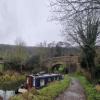
Holcombe Bridge No 181 
Warminster Road, Bathampton BA2 6, United Kingdom
(A36)

Holcombe Bridge No 181
is a minor waterways place
on the Kennet and Avon Canal (Main Line) between
Claverton Pumping Station (2¼ furlongs
to the southeast) and
River Avon Junction (Junction of the River Avon and the Kennet & Avon Canal) (3 miles and 7 furlongs
and 6 locks
to the west).
The nearest place in the direction of Claverton Pumping Station is Claverton Winding Hole;
1¼ furlongs
away.
The nearest place in the direction of River Avon Junction is Claverton Narrows;
4½ furlongs
away.
There is access (suitable for wheels) to the towpath here.
Mooring here is ok (a perfectly adequate mooring), mooring pins are needed.
There is a bridge here which takes a track over the canal.
| Claverton Swing Bridge No 178 | 1 mile, ¾ furlongs | |
| Claverton Visitor Mooring | 1 mile, ¼ furlongs | |
| Claverton Bridge No 180 | 3¼ furlongs | |
| Claverton Pumping Station | 2¼ furlongs | |
| Claverton Winding Hole | 1¼ furlongs | |
| Holcombe Bridge No 181 | ||
| Claverton Narrows | 4½ furlongs | |
| Holcombe Swing Bridge No 182 | 7½ furlongs | |
| Bathampton Winding Hole | 1 mile, 1½ furlongs | |
| Bathampton Bridge Winding Hole | 1 mile, 3¾ furlongs | |
| Bathampton Visitor Mooring (east) | 1 mile, 4 furlongs | |
There are no links to external websites from here.
Why not log in and add some (select "External websites" from the menu (sometimes this is under "Edit"))?
Mouseover for more information or show routes to facility
Nearest water point
In the direction of River Avon Junction
Bathampton Bridge No 183 — 1 mile, 4¼ furlongs away
On this waterway in the direction of River Avon Junction
Bath Top Lock Visitor Moorings — 3 miles, 3 furlongs away
On this waterway in the direction of River Avon Junction
Wessex Water Services — 10 miles, 3¼ furlongs and 9 locks away
Travel to River Avon Junction, then on the River Avon (Kennet and Avon Navigation) to Wessex Water Services
Hanham Lock No 1 — 15 miles, 1½ furlongs and 11 locks away
Travel to River Avon Junction, then on the River Avon (Kennet and Avon Navigation) to Hanham Lock No 1
In the direction of Northcroft Lane Arm
Somerset Coal Canal Junction Services — 1 mile, 4¼ furlongs away
On this waterway in the direction of Northcroft Lane Arm
Avoncliff Aqueduct Visitor Mooring (east) — 4 miles, 3½ furlongs away
On this waterway in the direction of Northcroft Lane Arm
Bradford on Avon Services — 5 miles, 7¼ furlongs and 1 lock away
On this waterway in the direction of Northcroft Lane Arm
Seend Wharf — 13 miles, 7½ furlongs and 5 locks away
On this waterway in the direction of Northcroft Lane Arm
Sells Green Visitor Moorings — 15 miles, 1¾ furlongs and 8 locks away
On this waterway in the direction of Northcroft Lane Arm
Devizes Lock 45 Services — 17 miles, 7¾ furlongs and 31 locks away
On this waterway in the direction of Northcroft Lane Arm
Devizes Wharf — 19 miles and 37 locks away
On this waterway in the direction of Northcroft Lane ArmNearest rubbish disposal
In the direction of River Avon Junction
Abbey View Lock No 11 — 3 miles, 4½ furlongs and 2 locks away
On this waterway in the direction of River Avon Junction
Hanham Lock No 1 — 15 miles, 1½ furlongs and 11 locks away
Travel to River Avon Junction, then on the River Avon (Kennet and Avon Navigation) to Hanham Lock No 1
In the direction of Northcroft Lane Arm
Somerset Coal Canal Junction Services — 1 mile, 4¼ furlongs away
On this waterway in the direction of Northcroft Lane Arm
Bradford on Avon Services — 5 miles, 7¼ furlongs and 1 lock away
On this waterway in the direction of Northcroft Lane Arm
Seend Wharf Bridge No 153 — 14 miles and 5 locks away
On this waterway in the direction of Northcroft Lane Arm
Sells Green Visitor Moorings — 15 miles, 1¾ furlongs and 8 locks away
On this waterway in the direction of Northcroft Lane Arm
Devizes Lock 45 Services — 17 miles, 7¾ furlongs and 31 locks away
On this waterway in the direction of Northcroft Lane Arm
Devizes Wharf — 19 miles and 37 locks away
On this waterway in the direction of Northcroft Lane ArmNearest chemical toilet disposal
In the direction of River Avon Junction
Wessex Water Services — 10 miles, 3¼ furlongs and 9 locks away
Travel to River Avon Junction, then on the River Avon (Kennet and Avon Navigation) to Wessex Water Services
In the direction of Northcroft Lane Arm
Somerset Coal Canal Junction Services — 1 mile, 4¼ furlongs away
On this waterway in the direction of Northcroft Lane Arm
Bradford on Avon Services — 5 miles, 7¼ furlongs and 1 lock away
On this waterway in the direction of Northcroft Lane Arm
Seend Wharf — 13 miles, 7½ furlongs and 5 locks away
On this waterway in the direction of Northcroft Lane Arm
Caen Hill Marina — 16 miles, 1¼ furlongs and 8 locks away
On this waterway in the direction of Northcroft Lane Arm
Devizes Lock 45 Services — 17 miles, 7¾ furlongs and 31 locks away
On this waterway in the direction of Northcroft Lane Arm
Devizes Wharf — 19 miles and 37 locks away
On this waterway in the direction of Northcroft Lane ArmNearest place to turn
In the direction of River Avon Junction
Bathampton Winding Hole — 1 mile, 1½ furlongs away
On this waterway in the direction of River Avon Junction
Bathampton Bridge Winding Hole — 1 mile, 3¾ furlongs away
On this waterway in the direction of River Avon Junction
Sydney Wharf Winding Hole — 3 miles, 1¾ furlongs away
On this waterway in the direction of River Avon Junction
Pulteney Gardens Winding Hole — 3 miles, 4¼ furlongs and 2 locks away
On this waterway in the direction of River Avon Junction
Horseshoe Walk Bridge Winding Hole — 3 miles, 4¾ furlongs and 3 locks away
On this waterway in the direction of River Avon Junction
In the direction of Northcroft Lane Arm
Claverton Winding Hole — 1¼ furlongs away
On this waterway in the direction of Northcroft Lane Arm
Somerset Coal Canal Junction — 1 mile, 4½ furlongs away
On this waterway in the direction of Northcroft Lane Arm
Conkwell Wood Winding Hole — 1 mile, 7 furlongs away
On this waterway in the direction of Northcroft Lane Arm
Brassknocker Basin — 1 mile, 7 furlongs away
Travel to Somerset Coal Canal Junction, then on the Kennet and Avon Canal (Somersetshire Coal Canal) to Brassknocker Basin
Avoncliffe Aqueduct (northern end) — 4 miles, 2 furlongs away
On this waterway in the direction of Northcroft Lane Arm
Avoncliffe Aqueduct (southern end) — 4 miles, 2½ furlongs away
On this waterway in the direction of Northcroft Lane Arm
Bradford on Avon Services — 5 miles, 7¼ furlongs and 1 lock away
On this waterway in the direction of Northcroft Lane Arm
The Old Chandlery Marina — 6 miles, 6¾ furlongs and 1 lock away
On this waterway in the direction of Northcroft Lane Arm
Bradford on Avon Winding Hole — 7 miles, 2½ furlongs and 1 lock away
On this waterway in the direction of Northcroft Lane Arm
Hilperton Wharf — 8 miles, 5 furlongs and 1 lock away
On this waterway in the direction of Northcroft Lane Arm
Hilperton (Staverton) Marina — 8 miles, 5½ furlongs and 1 lock away
On this waterway in the direction of Northcroft Lane Arm
Whaddon Grove Winding Hole — 10 miles, 5¼ furlongs and 1 lock away
On this waterway in the direction of Northcroft Lane Arm
Semington Junction — 11 miles, 5¼ furlongs and 1 lock away
On this waterway in the direction of Northcroft Lane Arm
Seend Wharf — 13 miles, 7½ furlongs and 5 locks away
On this waterway in the direction of Northcroft Lane Arm
Seend Winding Hole — 14 miles, ¾ furlongs and 6 locks away
On this waterway in the direction of Northcroft Lane ArmNearest self-operated pump-out
In the direction of Northcroft Lane Arm
Somerset Coal Canal Junction Services — 1 mile, 4¼ furlongs away
On this waterway in the direction of Northcroft Lane Arm
Bradford on Avon Services — 5 miles, 7¼ furlongs and 1 lock away
On this waterway in the direction of Northcroft Lane Arm
Seend Wharf — 13 miles, 7½ furlongs and 5 locks away
On this waterway in the direction of Northcroft Lane Arm
Devizes Lock 45 Services — 17 miles, 7¾ furlongs and 31 locks away
On this waterway in the direction of Northcroft Lane Arm
Devizes Wharf — 19 miles and 37 locks away
On this waterway in the direction of Northcroft Lane ArmNearest boatyard pump-out
In the direction of Northcroft Lane Arm
Caen Hill Marina — 16 miles, 1¼ furlongs and 8 locks away
On this waterway in the direction of Northcroft Lane ArmDirection of TV transmitter (From Wolfbane Cybernetic)
There is no page on Wikipedia called “Holcombe Bridge”
Wikipedia pages that might relate to Holcombe Bridge
[Bury–Holcombe Brook line]
Bury–Holcombe Brook line was a 3 3⁄4-mile (6.0 km) single-track railway line which ran between Bury Bolton Street railway station and Holcombe Brook
[Holcombe, Somerset]
Holcombe is a small village and civil parish (population 936) in the Mendip local government district of Somerset, England. The parish contains the hamlets
[Green Sergeant's Covered Bridge]
Green Sergeant, the namesake of the bridge. The bridge was constructed in 1872, designed by Charles Ogden Holcombe of Lambertville. After being damaged
[Holcombe Brook railway station]
Holcombe Brook railway station was the terminus of the Bury to Holcombe Brook Line in England and served the village of Holcombe Brook in the Metropolitan
[Greenmount, Greater Manchester]
bridge over the river, a bird sanctuary (Greenmount Wild Bird Sanctuary) and a cricket club all situated along the trail. Brookhouse Farm on Holcombe
[Rucker Park]
Holcombe Rucker Park is a basketball court in Harlem, Manhattan, New York City, at 155th Street and Frederick Douglass Boulevard, just east of the former
[Billie Eilish]
2020. "Vote". Billie Eilish. August 13, 2020. Retrieved October 6, 2020. Holcombe, Madeline (August 20, 2020). "Billie Eilish says to 'vote like our lives
[Lambertville Historic District]
along the canal in 1851. St. John the Evangelist Roman Catholic Church Holcombe House, Washington's Headquarters "National Register Information System"
[Ramsbottom]
Holcombe Brook and Summerseat; to the north by Edenfield, Irwell Vale, Stubbins and the hamlets of Chatterton and Strongstry; to the west by Holcombe
[USS Houston (CA-30)]
News, Virginia, on 7 September 1929, sponsored by Elizabeth Holcombe (daughter of Oscar Holcombe, then-mayor of Houston, Texas), and commissioned on 17 June
Results of Google Search
Studio Movie Grill - Temp. CLOSED - 181 Photos & 475 Reviews ...CLOSED "Update: This will be our new theater, but not for the food. It just wasn't a ... The food is no longer tasty. The new ... 2880 Holcomb Bridge Rd. Alpharetta ...
Thank you! 02-05-2020. good apartments but not that good.
While passengers are not expected to use the fare box at the front of the bus, please be in possession of ... Routes 181 through 200 ... 27 Cheshire Bridge Road
View 30 photos for 515 Holcomb Bridge Rd, Norcross, GA 30071 a 4 bed, 4 bath, 3009 Sq. Ft. single family home built in 2015 that ... Estimated values are not a substitute for professional expertise. ... 05/11/2016, Listed, $535,000, $181, FMLS.
But this by no means suggests that all of the claims that survive this Order will ... Shortly after Pickens began teaching at Holcomb Bridge, she started "hitting, ...
silent on the existence (or not) of such as land bridge (Holcombe and Edgar, ... latter of which provide limited or no habitat for native amphibians and reptiles.
Second – That each road commissioner receive not over $50.00. Third – That we raise $2,500 for new roads. Fourth – That we raise $600.00 bridge funds.
Results 1 - 25 ... 600 Old Holcomb Bridge Rd, Roswell, GA 30076. 1 / 20. 3D Tours ... 8520 S Holcomb Bridge Way, Alpharetta, GA 30022. 1 / 55. 3D Tours. New.
137-20 Custodial Services for Holcomb Bridge Middle School. Due Date and Time: 03/05/2020 2:30 PMÂ ...


![Hardings Bridge [No 181], from the east. An accommodation bridge across the Kennet & Avon Canal. by Christine Johnstone – 02 May 2015](https://s1.geograph.org.uk/geophotos/04/48/21/4482173_32fc6a98_120x120.jpg)


![Boats moored on the Kennet & Avon, east of Bridge 181. As a wide canal, the Kennet & Avon can accommodate both re-purposed boats [like this former lifeboat] and fat narrowboats. by Christine Johnstone – 02 May 2015](https://s1.geograph.org.uk/geophotos/04/48/21/4482169_e1afd8c6_120x120.jpg)


![Kennet and Avon Canal. A straight stretch leading to Harding's Bridge ([[178598]]). See also [[949017]]. by Derek Harper – 01 July 2008](https://s3.geograph.org.uk/photos/94/91/949119_80f2bfcc_120x120.jpg)


![A wide section of the Kennet and Avon Canal. The same view as in [[17914]] with trees that have grown and a space for fishermen on the bank by David Smith – 07 July 2016](https://s0.geograph.org.uk/geophotos/05/04/35/5043576_75f94891_120x120.jpg)


![2009 : River Avon near Claverton, repairing the bank (2). One of the larger blocks of limestone being moved by an excavator. This gives an idea of the scale of the operation.See also: [[1472520]] and [[1472545]] by Maurice Pullin – 05 August 2009](https://s1.geograph.org.uk/geophotos/01/47/25/1472529_a906e600_120x120.jpg)