Farleton Beck Aqueduct No 160
Farleton Aqueduct, Dovehouses Lane, Preston Patrick LA7 7FP, United Kingdom

Farleton Beck Aqueduct No 160
is a minor waterways place
on the Lancaster Canal (Northern Reaches - in water) between
Sellet Hall Bridge No 173 (3 miles and 2 furlongs
to the northwest) and
Tewitfield Marina (5 miles and 6 furlongs
and 8 locks
to the south).
The nearest place in the direction of Sellet Hall Bridge No 173 is Dovehouses Bridge No 161;
1 furlong
away.
The nearest place in the direction of Tewitfield Marina is Atkinsons Bridge No 159;
1½ furlongs
away.
Mooring here is unrated.
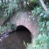
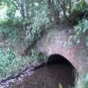
There is a small aqueduct or underbridge here which takes a stream under the canal.
| Millness Bridge Winding Hole | 7 furlongs | |
| Millness (motorway) Culvert No 163A | 6¾ furlongs | |
| Seven Milestone Bridge No 163 | 4¾ furlongs | |
| Moss Side Culvert No 162 | 2½ furlongs | |
| Dovehouses Bridge No 161 | 1 furlong | |
| Farleton Beck Aqueduct No 160 | ||
| Atkinsons Bridge No 159 | 1½ furlongs | |
| Thompsons Bridge No 158 | 2 furlongs | |
| Hodgsons Bridge No 157 | 3¼ furlongs | |
| Farleton Turnpike Bridge No 156 | 4¼ furlongs | |
| Dukes Bridge No 155 | 6 furlongs | |
There are no links to external websites from here.
Why not log in and add some (select "External websites" from the menu (sometimes this is under "Edit"))?
Why not log in and add some (select "External websites" from the menu (sometimes this is under "Edit"))?
Mouseover for more information or show routes to facility
Nearest water point
In the direction of Tewitfield
Tewitfield — 5 miles, 5¼ furlongs and 8 locks away
On this waterway in the direction of Tewitfield
Hest Bank Bridge No 118 — 13 miles, 3 furlongs and 8 locks away
Travel to Tewitfield, then on the Lancaster Canal (Main Line) to Hest Bank Bridge No 118Nearest rubbish disposal
In the direction of Tewitfield
Tewitfield — 5 miles, 5¼ furlongs and 8 locks away
On this waterway in the direction of Tewitfield
Hest Bank Bridge No 118 — 13 miles, 3 furlongs and 8 locks away
Travel to Tewitfield, then on the Lancaster Canal (Main Line) to Hest Bank Bridge No 118Nearest chemical toilet disposal
In the direction of Tewitfield
Tewitfield — 5 miles, 5¼ furlongs and 8 locks away
On this waterway in the direction of Tewitfield
Lundsfield Wharf — 9 miles, 7¾ furlongs and 8 locks away
Travel to Tewitfield, then on the Lancaster Canal (Main Line) to Lundsfield Wharf
Hest Bank Bridge No 118 — 13 miles, 3 furlongs and 8 locks away
Travel to Tewitfield, then on the Lancaster Canal (Main Line) to Hest Bank Bridge No 118Nearest place to turn
In the direction of Stainton Crossing Bridge No 172
Millness Bridge Winding Hole — 7 furlongs away
On this waterway in the direction of Stainton Crossing Bridge No 172
In the direction of Tewitfield
Tewitfield — 5 miles, 5¼ furlongs and 8 locks away
On this waterway in the direction of Tewitfield
Lovers Creek — 7 miles and 8 locks away
Travel to Tewitfield, then on the Lancaster Canal (Main Line) to Lovers Creek
Capernwray Winding Hole — 7 miles, 4¼ furlongs and 8 locks away
Travel to Tewitfield, then on the Lancaster Canal (Main Line) to Capernwray Winding Hole
Lundsfield Wharf — 9 miles, 7¾ furlongs and 8 locks away
Travel to Tewitfield, then on the Lancaster Canal (Main Line) to Lundsfield Wharf
Hest Bank Winding Hole — 13 miles, 1¾ furlongs and 8 locks away
Travel to Tewitfield, then on the Lancaster Canal (Main Line) to Hest Bank Winding Hole
Belmont Bridge Winding Hole — 14 miles, 3½ furlongs and 8 locks away
Travel to Tewitfield, then on the Lancaster Canal (Main Line) to Belmont Bridge Winding Hole
Folly Bridge Winding Hole — 14 miles, 6¾ furlongs and 8 locks away
Travel to Tewitfield, then on the Lancaster Canal (Main Line) to Folly Bridge Winding Hole
Halton Road Winding Hole — 15 miles, 7½ furlongs and 8 locks away
Travel to Tewitfield, then on the Lancaster Canal (Main Line) to Halton Road Winding HoleNo information
CanalPlan has no information on any of the following facilities within range:self-operated pump-out
boatyard pump-out
Direction of TV transmitter (From Wolfbane Cybernetic)
There is no page on Wikipedia called “Farleton Beck Aqueduct”
Wikipedia pages that might relate to Farleton Beck Aqueduct
[Peasey Beck]
original route, and to extract water from Farleton Beck, Stainton Beck and Crooklands Beck (later called Peasey Beck), rather than the River Mint. They bought
[Lancaster Canal]
on the level ground from Preston to Tewitfield, and in 1794 on the Lune Aqueduct, which was built of stone, although Rennie thought brick should have been
[River Lune]
the Bessy Beck (short), the Dry Beck of 4.9 kilometres' (three miles) length at 0.32 miles (0.51 km) from St. Helen's Well, the Sandwath Beck (short) at
[Listed buildings in Beetham]
retrieved 23 December 2016 Historic England, "Aqueduct carrying Kendal/Lancaster Canal over Farleton Beck, Beetham (1312277)", National Heritage List for
[Escowbeck]
and Hornby, near where the Escow Beck from which it takes its name, flows into the River Lune. The name Escow Beck is derived from the Old Norse eski
[Thurland Castle]
mound on a flat plain, with the River Greta on the south side and the Cant beck to the north. A deep circular moat surrounds it. The earliest existing fabric
[Listed buildings in Borwick]
through the parish, and associated with it are five listed bridges and an aqueduct. The other listed buildings include houses, farm buildings, bridges over
[Listed buildings in Lancaster, Lancashire]
Heritage List for England, retrieved 20 May 2015 Historic England, "Newton Beck Culvert, Lancaster (1194908)", National Heritage List for England, retrieved
[Lancaster Priory]
Gressingham Halton-with-Aughton Heaton-with-Oxcliffe Heysham Hornby-with-Farleton Ireby Lancaster Leck Melling-with-Wrayton Middleton Morecambe Nether Kellet
[Over Burrow Roman Fort]
confluence with Leck Beck, to command a crossing over the river. A sort distance to the south the ground falls steeply to Leck Beck and more immediately
Results of Google Search
The Lancaster Canal is a canal in North West England, originally planned to run from ... The canal at Farleton, Cumbria, in the unnavigable northern section. ... In 1791, John Longbotham, Robert Dickinson and Richard Beck resurveyed the .... However, by 1801, no design had even been agreed for the aqueduct over the ...
opposite bank by the combined forces of Farleton Beck and Claughton Beck. ... Farleton Beck and Claughton Beck. Farleton Beck ... the day of the Wray flood, similar but not so extensive damage was ..... the sharpest drop along the whole length of the aqueduct .... over 160 species of moss and liverwort, and past the sites of ...
Aug 14, 2019 ... The final WRMP must be able to demonstrate that it would not cause a deterioration in respect of ...... Lupton (Farleton) Beck river water body.
Oct 8, 2018 ... The above map is for quick reference purposes only and may not be to scale. For a copy of the full scale map, please see the attached PDFÂ ...
Jul 7, 2015 ... Company Reg no. (Thomas Telford Ltd) 2556636. VAT Reg. No: 240877747. Registered charity number 210252. Registered in Scotland ...


