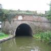
Snarestone Tunnel (northern entrance)
is a minor waterways place
on the Ashby Canal (Main Line) between
Ashby Canal Current Head of Navigation (Just beyond Faulkes circular winding hole) (3¼ furlongs
to the northeast) and
Snarestone Tunnel (southern entrance) (Snarestone village is over the top of the tunnel.) (1¼ furlongs
to the south).
The nearest place in the direction of Ashby Canal Current Head of Navigation is Varnham's Bridge No 60;
¾ furlongs
away.
There is access (suitable for wheels) to the towpath here.
Mooring here is ok (a perfectly adequate mooring).
Snarestone Services | 1¾ furlongs | |
Ashby Canal Association Shop | 1¾ furlongs | |
Turnover Bridge Winding Hole | 1½ furlongs | |
Turnover Bridge No 61 | 1¼ furlongs | |
Varnham's Bridge No 60 | ¾ furlongs | |
Snarestone Tunnel (northern entrance) | ||
Snarestone Tunnel (southern entrance) | 1¼ furlongs | |
Globe Inn | 1¼ furlongs | |
Site of Midland Railway Bridge | 3½ furlongs | |
Pare's Bridge No 59 | 4 furlongs | |
Gopsall Wharf Bridge No 58 | 6¾ furlongs |
Amenities nearby at Snarestone Tunnel (southern entrance)
Mouseover for more information or show routes to facility
Nearest water point
In the direction of Marston Junction
Bosworth Marina & Wharf Winding Hole — 6 miles, 1½ furlongs away
On this waterway in the direction of Marston Junction
Bosworth Wharf Bridge No 42 — 6 miles, 2 furlongs away
On this waterway in the direction of Marston Junction
Sutton Cheney Wharf — 9 miles, 6½ furlongs away
On this waterway in the direction of Marston Junction
Trinity Marina — 15 miles, ½ furlongs away
On this waterway in the direction of Marston Junction
Limekiln Bridge No 15 — 16 miles, ½ furlongs away
On this waterway in the direction of Marston Junction
In the direction of Ashby Canal Current Head of Navigation
Snarestone Services — 1¾ furlongs away
On this waterway in the direction of Ashby Canal Current Head of NavigationNearest rubbish disposal
In the direction of Marston Junction
Bosworth Marina & Wharf Winding Hole — 6 miles, 1½ furlongs away
On this waterway in the direction of Marston Junction
Stoke Golding Wharf — 12 miles, 2¾ furlongs away
On this waterway in the direction of Marston Junction
Trinity Marina — 15 miles, ½ furlongs away
On this waterway in the direction of Marston Junction
In the direction of Ashby Canal Current Head of Navigation
Snarestone Services — 1¾ furlongs away
On this waterway in the direction of Ashby Canal Current Head of NavigationNearest chemical toilet disposal
In the direction of Marston Junction
Bosworth Marina & Wharf Winding Hole — 6 miles, 1½ furlongs away
On this waterway in the direction of Marston Junction
Sutton Cheney Wharf — 9 miles, 6½ furlongs away
On this waterway in the direction of Marston Junction
Trinity Marina — 15 miles, ½ furlongs away
On this waterway in the direction of Marston Junction
In the direction of Ashby Canal Current Head of Navigation
Snarestone Services — 1¾ furlongs away
On this waterway in the direction of Ashby Canal Current Head of NavigationNearest place to turn
In the direction of Marston Junction
Shackerstone Winding Hole — 2 miles, 4½ furlongs away
On this waterway in the direction of Marston Junction
Carlton Bridge Winding Hole — 5 miles, 1¾ furlongs away
On this waterway in the direction of Marston Junction
Bosworth Marina & Wharf Winding Hole — 6 miles, 1½ furlongs away
On this waterway in the direction of Marston Junction
Jackson's Bridge Winding Hole — 6 miles, 4¼ furlongs away
On this waterway in the direction of Marston Junction
Shenton Bend — 8 miles, 3¼ furlongs away
On this waterway in the direction of Marston Junction
Sutton Cheney Wharf — 9 miles, 6½ furlongs away
On this waterway in the direction of Marston Junction
Basin Bridge Winding Hole — 13 miles, ¼ furlongs away
On this waterway in the direction of Marston Junction
Trinity Marina — 15 miles, ½ furlongs away
On this waterway in the direction of Marston Junction
Hinckley Wharf Arm Junction — 15 miles, 4¼ furlongs away
On this waterway in the direction of Marston Junction
In the direction of Ashby Canal Current Head of Navigation
Turnover Bridge Winding Hole — 1½ furlongs away
On this waterway in the direction of Ashby Canal Current Head of Navigation
Faulkes Circular Winding Hole — 3¼ furlongs away
On this waterway in the direction of Ashby Canal Current Head of Navigation
Measham Wharf Branch Junction — 2 miles, 1¼ furlongs away
Travel to Ashby Canal Current Head of Navigation, then on the Ashby Canal (unrestored) to Measham Wharf Branch Junction
Site of Proposed Measham Wharf — 2 miles, 4¼ furlongs away
Travel to Ashby Canal Current Head of Navigation, then on the Ashby Canal (unrestored) to Measham Wharf Branch Junction, then on the Ashby Canal (Measham Wharf Branch, unrestored) to Site of Proposed Measham Wharf
Bath Yard Basin — 5 miles, 7½ furlongs and 1 lock away
Travel to Ashby Canal Current Head of Navigation, then on the Ashby Canal (unrestored) to Brooks Close Terminus, then on the Ashby Canal (restored but unconnected) to Bath Yard BasinNearest self-operated pump-out
In the direction of Marston Junction
Bosworth Marina & Wharf Winding Hole — 6 miles, 1½ furlongs away
On this waterway in the direction of Marston Junction
Trinity Marina — 15 miles, ½ furlongs away
On this waterway in the direction of Marston JunctionNearest boatyard pump-out
In the direction of Marston Junction
Trinity Marina — 15 miles, ½ furlongs away
On this waterway in the direction of Marston JunctionDirection of TV transmitter (From Wolfbane Cybernetic)
There is no page on Wikipedia called “Snarestone Tunnel”
Wikipedia pages that might relate to Snarestone Tunnel
[Snarestone]
Snarestone is a small rural village in North West Leicestershire, England. It lies on the edge of the National Forest and is 5 miles (8 km) from the market
[Ashby Canal]
subsidence, with the result that this section from Moira, southwards to Snarestone, was progressively closed in 1944, 1957 and 1966, leaving 22 miles (35 km)
[Coventry Canal]
mines at Moira; although it is now navigable only for 22 miles (35 km) to Snarestone. From Marston Junction, the Coventry canal runs north-west through Nuneaton
[River Sence]
Shackerstone Station. Northern parts of the canal in the Mease watershed beyond Snarestone were closed during the 20th Century because of mining subsidence. The
Results of Google Search
Sep 18, 2001 ... View Northwards from the Northern Entrance to Snarestone Tunnel. 10. 9. View Northwards towards the Southern Entrance to. 12. Snarestone ...
View Northwards towards the Southern Entrance to 12. Snarestone Tunnel. 10. View Southwards towards the Northern Entrance to 13. Snarestone Tunnel. 11.
May 11, 2016 ... Is the Tunnel in Use?: In Use Which End is this Entrance?: North Date Constructed: 1/1/1797. Length of Tunnel: 250 yards. Construction ...
Harecastle Tunnel is a canal tunnel on the Trent and Mersey Canal in Staffordshire between ... Northern end of Telford's Harecastle Tunnel (left) next to the disused Brindley ... Both entrances are gated and are no longer reachable by boat.
Heritage List Entry Summary for Snarestone Tunnel Entrances. ... District: North West Leicestershire (District Authority). Parish: Snarestone. National Grid ...
From Snarestone to Carlton Bridge, the canal is a Site of Special Scientific Interest, ... the 20th Century, resulting in the closure of the canal's northern reaches. ... of canal reopen beyond Snarestone - where the width of the tunnel illustrates the ...
At the north entrance of the Bramhope Tunnel, a Gothic-style castellated portal was built from sandstone rock. It has three side towers with turrets, and a horseshoe ...