CanalPlanAC

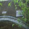
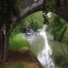
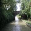
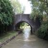
Site of Field Bridge No 130

 
Also known as: Knotts Bridge No 130
Stratford-on-Avon CV47 2XL, United Kingdom
 
Information about the place
Site of Field Bridge No 130 is a minor waterways place on the Oxford Canal (Southern Section - Main Line) between Fenny Compton Wharf (2 miles and 6 furlongs to the southwest) and Old Engine House Arm Junction (5 miles and 4¾ furlongs and 2 locks to the northeast).
 
 
The nearest place in the direction of Fenny Compton Wharf is Griffins Bridge No 131; 3¾ furlongs away.
 
The nearest place in the direction of Old Engine House Arm Junction is Ladder Bridge No 129; 2¾ furlongs away.

There is no access to the towpath here.

Mooring here is unrated.

This is the site of a bridge, the canal may be narrow as a consequence.

Wells Bridge No 1342 miles, ¼ furlongs
Old Town Bridge No 1331 mile, 4 furlongs
Long Spinney Bridge No 1321 mile, ¾ furlongs
Plank Footbridge No 131A5½ furlongs
Griffins Bridge No 1313¾ furlongs
Site of Field Bridge No 130
Ladder Bridge No 1292¾ furlongs
Willisons Bridge No 1285 furlongs
HS2 Construction Bridge5¾ furlongs
Stoneton Bridge No 1271 mile, ½ furlongs
Stoneton Bridge No 1261 mile, 7¼ furlongs
 
 
Amenities
 
Maps
If you are a user and are logged on, or if you are actively planning a route, a map will be displayed here.
Show on external mapping site: Google | OSM | Bing
 
Navigational Notes

This bridge was demolished in the Winter Works Programme 2024 after it became structurally unsound.

 
Photos
 
External websites
 Oxford Canal Walk - Part One - Oxford to Thrupp - YouTube — associated with Oxford Canal
A walk along the Oxford Canal (Southern Section) from Oxford to Thrupp Wide
 
Nearest facilities

Mouseover for more information or show routes to facility

Nearest water point

In the direction of Napton Junction

Marston Doles Water Point4 miles, 5¾ furlongs away
On this waterway in the direction of Napton Junction
Water Point at Bottom of Napton Locks6 miles, 6 furlongs and 9 locks away
On this waterway in the direction of Napton Junction
Wigrams Turn Marina8 miles, 6¼ furlongs and 9 locks away
Travel to Napton Junction, then on the Grand Union Canal (Oxford Canal Section) to Wigrams Turn Marina
Calcutt Top Lock Winding Hole9 miles, 2¼ furlongs and 9 locks away
Travel to Napton Junction, then on the Grand Union Canal (Warwick and Napton Canal) to Calcutt Top Lock Winding Hole
Calcutt Marina9 miles, 4 furlongs and 12 locks away
Travel to Napton Junction, then on the Grand Union Canal (Warwick and Napton Canal) to Calcutt Marina
Braunston Services13 miles, 6½ furlongs and 9 locks away
Travel to Napton Junction, then on the Grand Union Canal (Oxford Canal Section) to Braunston Turn, then on the Oxford Canal (Northern Section - Main Line) to Braunston Services
Braunston Road Bridge No 9113 miles, 7¾ furlongs and 9 locks away
Travel to Napton Junction, then on the Grand Union Canal (Oxford Canal Section) to Braunston Turn, then on the Grand Union Canal (Grand Junction Canal - Main Line - Braunston to Norton) to Braunston Road Bridge No 91
Braunston Stop14 miles, 1 furlong and 9 locks away
Travel to Napton Junction, then on the Grand Union Canal (Oxford Canal Section) to Braunston Turn, then on the Grand Union Canal (Grand Junction Canal - Main Line - Braunston to Norton) to Braunston Stop
Stockton Top Marina11 miles, 5¼ furlongs and 12 locks away
Travel to Napton Junction, then on the Grand Union Canal (Warwick and Napton Canal) to Stockton Top Marina
Dunchurch Pools Marina16 miles, 7¼ furlongs and 9 locks away
Travel to Napton Junction, then on the Grand Union Canal (Oxford Canal Section) to Braunston Turn, then on the Oxford Canal (Northern Section - Main Line) to Dunchurch Pools Marina
The Blue Lias Inn12 miles, 3 furlongs and 20 locks away
Travel to Napton Junction, then on the Grand Union Canal (Warwick and Napton Canal) to The Blue Lias Inn
Kayes Arm Junction12 miles, 3¾ furlongs and 20 locks away
Travel to Napton Junction, then on the Grand Union Canal (Warwick and Napton Canal) to Kayes Arm Junction
Norton Junction Bridge No 118 miles, 2¼ furlongs and 15 locks away
Travel to Napton Junction, then on the Grand Union Canal (Oxford Canal Section) to Braunston Turn, then on the Grand Union Canal (Grand Junction Canal - Main Line - Braunston to Norton) to Norton Junction, then on the Grand Union Canal (Leicester Section - Old Grand Union) to Norton Junction Bridge No 1

In the direction of End of Hythe Bridge Arm

Fenny Compton Wharf2 miles, 6 furlongs away
On this waterway in the direction of End of Hythe Bridge Arm
Cropredy Marina (northern basins)8 miles, 3½ furlongs and 8 locks away
On this waterway in the direction of End of Hythe Bridge Arm
Cropredy Marina (southern basin)8 miles, 4 furlongs and 8 locks away
On this waterway in the direction of End of Hythe Bridge Arm
Cropredy Services9 miles, ½ furlongs and 9 locks away
On this waterway in the direction of End of Hythe Bridge Arm
Sovereign Wharf13 miles, 2¼ furlongs and 12 locks away
On this waterway in the direction of End of Hythe Bridge Arm
Banbury Lock No 2913 miles, 4¼ furlongs and 12 locks away
On this waterway in the direction of End of Hythe Bridge Arm
Cherwell Street Facilities13 miles, 4½ furlongs and 13 locks away
On this waterway in the direction of End of Hythe Bridge Arm

Nearest rubbish disposal

In the direction of Napton Junction

Napton Sanitary Station6 miles, 5¾ furlongs and 9 locks away
On this waterway in the direction of Napton Junction
Wigrams Turn Marina8 miles, 6¼ furlongs and 9 locks away
Travel to Napton Junction, then on the Grand Union Canal (Oxford Canal Section) to Wigrams Turn Marina
Calcutt Marina9 miles, 4 furlongs and 12 locks away
Travel to Napton Junction, then on the Grand Union Canal (Warwick and Napton Canal) to Calcutt Marina
Braunston Services13 miles, 6½ furlongs and 9 locks away
Travel to Napton Junction, then on the Grand Union Canal (Oxford Canal Section) to Braunston Turn, then on the Oxford Canal (Northern Section - Main Line) to Braunston Services
Braunston Stop14 miles, 1 furlong and 9 locks away
Travel to Napton Junction, then on the Grand Union Canal (Oxford Canal Section) to Braunston Turn, then on the Grand Union Canal (Grand Junction Canal - Main Line - Braunston to Norton) to Braunston Stop
Dunchurch Pools Marina16 miles, 7¼ furlongs and 9 locks away
Travel to Napton Junction, then on the Grand Union Canal (Oxford Canal Section) to Braunston Turn, then on the Oxford Canal (Northern Section - Main Line) to Dunchurch Pools Marina
Norton Sanitary Station18 miles, 3½ furlongs and 15 locks away
Travel to Napton Junction, then on the Grand Union Canal (Oxford Canal Section) to Braunston Turn, then on the Grand Union Canal (Grand Junction Canal - Main Line - Braunston to Norton) to Norton Junction, then on the Grand Union Canal (Grand Junction Canal - Main Line - Norton to Gayton) to Norton Sanitary Station
Bascote Bridge No 2713 miles, 5¾ furlongs and 22 locks away
Travel to Napton Junction, then on the Grand Union Canal (Warwick and Napton Canal) to Bascote Bridge No 27
Radford Bottom Lock No 2317 miles, 2¾ furlongs and 31 locks away
Travel to Napton Junction, then on the Grand Union Canal (Warwick and Napton Canal) to Radford Bottom Lock No 23

In the direction of End of Hythe Bridge Arm

Fenny Compton Marina3 miles, ¾ furlongs away
On this waterway in the direction of End of Hythe Bridge Arm
Cropredy Marina (northern basins)8 miles, 3½ furlongs and 8 locks away
On this waterway in the direction of End of Hythe Bridge Arm
Cropredy Marina (southern basin)8 miles, 4 furlongs and 8 locks away
On this waterway in the direction of End of Hythe Bridge Arm
Cropredy Services9 miles, ½ furlongs and 9 locks away
On this waterway in the direction of End of Hythe Bridge Arm
Sovereign Wharf13 miles, 2¼ furlongs and 12 locks away
On this waterway in the direction of End of Hythe Bridge Arm
Cherwell Street Facilities13 miles, 4½ furlongs and 13 locks away
On this waterway in the direction of End of Hythe Bridge Arm

Nearest chemical toilet disposal

In the direction of Napton Junction

Napton Sanitary Station6 miles, 5¾ furlongs and 9 locks away
On this waterway in the direction of Napton Junction
Wigrams Turn Marina8 miles, 6¼ furlongs and 9 locks away
Travel to Napton Junction, then on the Grand Union Canal (Oxford Canal Section) to Wigrams Turn Marina
Calcutt Marina9 miles, 4 furlongs and 12 locks away
Travel to Napton Junction, then on the Grand Union Canal (Warwick and Napton Canal) to Calcutt Marina
Braunston Services13 miles, 6½ furlongs and 9 locks away
Travel to Napton Junction, then on the Grand Union Canal (Oxford Canal Section) to Braunston Turn, then on the Oxford Canal (Northern Section - Main Line) to Braunston Services
Braunston Road Bridge No 9113 miles, 7¾ furlongs and 9 locks away
Travel to Napton Junction, then on the Grand Union Canal (Oxford Canal Section) to Braunston Turn, then on the Grand Union Canal (Grand Junction Canal - Main Line - Braunston to Norton) to Braunston Road Bridge No 91
Dunchurch Pools Marina16 miles, 7¼ furlongs and 9 locks away
Travel to Napton Junction, then on the Grand Union Canal (Oxford Canal Section) to Braunston Turn, then on the Oxford Canal (Northern Section - Main Line) to Dunchurch Pools Marina
Norton Sanitary Station18 miles, 3½ furlongs and 15 locks away
Travel to Napton Junction, then on the Grand Union Canal (Oxford Canal Section) to Braunston Turn, then on the Grand Union Canal (Grand Junction Canal - Main Line - Braunston to Norton) to Norton Junction, then on the Grand Union Canal (Grand Junction Canal - Main Line - Norton to Gayton) to Norton Sanitary Station
Fosse Wharf16 miles, 3¼ furlongs and 29 locks away
Travel to Napton Junction, then on the Grand Union Canal (Warwick and Napton Canal) to Fosse Wharf

In the direction of End of Hythe Bridge Arm

Cropredy Marina (southern basin)8 miles, 4 furlongs and 8 locks away
On this waterway in the direction of End of Hythe Bridge Arm
Cropredy Services9 miles, ½ furlongs and 9 locks away
On this waterway in the direction of End of Hythe Bridge Arm
Sovereign Wharf13 miles, 2¼ furlongs and 12 locks away
On this waterway in the direction of End of Hythe Bridge Arm
Cherwell Street Facilities13 miles, 4½ furlongs and 13 locks away
On this waterway in the direction of End of Hythe Bridge Arm

Nearest place to turn

In the direction of Napton Junction

Marston Doles Top Lock Winding Hole4 miles, 6 furlongs away
On this waterway in the direction of Napton Junction
Old Engine House Arm Junction5 miles, 4¾ furlongs and 2 locks away
On this waterway in the direction of Napton Junction
Old Engine House Winding Hole5 miles, 5½ furlongs and 2 locks away
Travel to Old Engine House Arm Junction, then on the Oxford Canal (Old Engine House Arm) to Old Engine House Winding Hole
Napton Winding Hole6 miles, 7½ furlongs and 9 locks away
On this waterway in the direction of Napton Junction
Bridge Inn Winding Hole7 miles, 7½ furlongs and 9 locks away
On this waterway in the direction of Napton Junction
Napton Marina8 miles, 4½ furlongs and 9 locks away
On this waterway in the direction of Napton Junction
Napton Junction8 miles, 6 furlongs and 9 locks away
On this waterway in the direction of Napton Junction
Calcutt Top Lock Winding Hole9 miles, 2¼ furlongs and 9 locks away
Travel to Napton Junction, then on the Grand Union Canal (Warwick and Napton Canal) to Calcutt Top Lock Winding Hole
Thick Thorne House Winding Hole9 miles, 7¼ furlongs and 9 locks away
Travel to Napton Junction, then on the Grand Union Canal (Oxford Canal Section) to Thick Thorne House Winding Hole
Calcutt Marina9 miles, 4 furlongs and 12 locks away
Travel to Napton Junction, then on the Grand Union Canal (Warwick and Napton Canal) to Calcutt Marina
Ventnor Marina (Sunrise Basin)9 miles, 4¾ furlongs and 12 locks away
Travel to Napton Junction, then on the Grand Union Canal (Warwick and Napton Canal) to Ventnor Marina (Sunrise Basin)
Ventnor Marina (Sunset Basin)9 miles, 7¼ furlongs and 12 locks away
Travel to Napton Junction, then on the Grand Union Canal (Warwick and Napton Canal) to Ventnor Marina (Sunset Basin)
Wolfamcote Winding Hole12 miles, 7¼ furlongs and 9 locks away
Travel to Napton Junction, then on the Grand Union Canal (Oxford Canal Section) to Wolfamcote Winding Hole
Braunston Turn13 miles, 6 furlongs and 9 locks away
Travel to Napton Junction, then on the Grand Union Canal (Oxford Canal Section) to Braunston Turn

In the direction of End of Hythe Bridge Arm

Fenny Compton Wharf2 miles, 6 furlongs away
On this waterway in the direction of End of Hythe Bridge Arm
Fenny Compton Marina3 miles, ¾ furlongs away
On this waterway in the direction of End of Hythe Bridge Arm
Clattercote Bridge Winding Hole7 miles, ¾ furlongs and 5 locks away
On this waterway in the direction of End of Hythe Bridge Arm
Cropredy Marina (northern basins)8 miles, 3½ furlongs and 8 locks away
On this waterway in the direction of End of Hythe Bridge Arm
Cropredy Marina (southern basin)8 miles, 4 furlongs and 8 locks away
On this waterway in the direction of End of Hythe Bridge Arm
Cropredy Services9 miles, ½ furlongs and 9 locks away
On this waterway in the direction of End of Hythe Bridge Arm

Nearest boatyard pump-out

In the direction of Napton Junction

Wigrams Turn Marina8 miles, 6¼ furlongs and 9 locks away
Travel to Napton Junction, then on the Grand Union Canal (Oxford Canal Section) to Wigrams Turn Marina
Calcutt Marina9 miles, 4 furlongs and 12 locks away
Travel to Napton Junction, then on the Grand Union Canal (Warwick and Napton Canal) to Calcutt Marina
Ventnor Marina (Sunrise Basin)9 miles, 4¾ furlongs and 12 locks away
Travel to Napton Junction, then on the Grand Union Canal (Warwick and Napton Canal) to Ventnor Marina (Sunrise Basin)
Stockton Top Marina11 miles, 5¼ furlongs and 12 locks away
Travel to Napton Junction, then on the Grand Union Canal (Warwick and Napton Canal) to Stockton Top Marina
Dunchurch Pools Marina16 miles, 7¼ furlongs and 9 locks away
Travel to Napton Junction, then on the Grand Union Canal (Oxford Canal Section) to Braunston Turn, then on the Oxford Canal (Northern Section - Main Line) to Dunchurch Pools Marina
Barby Moorings18 miles, 4½ furlongs and 9 locks away
Travel to Napton Junction, then on the Grand Union Canal (Oxford Canal Section) to Braunston Turn, then on the Oxford Canal (Northern Section - Main Line) to Barby Moorings
Welton Hythe Marina18 miles, 5½ furlongs and 15 locks away
Travel to Napton Junction, then on the Grand Union Canal (Oxford Canal Section) to Braunston Turn, then on the Grand Union Canal (Grand Junction Canal - Main Line - Braunston to Norton) to Norton Junction, then on the Grand Union Canal (Leicester Section - Old Grand Union) to Welton Hythe Marina
Welton Haven Marina19 miles, 1½ furlongs and 15 locks away
Travel to Napton Junction, then on the Grand Union Canal (Oxford Canal Section) to Braunston Turn, then on the Grand Union Canal (Grand Junction Canal - Main Line - Braunston to Norton) to Norton Junction, then on the Grand Union Canal (Leicester Section - Old Grand Union) to Welton Haven Marina

In the direction of End of Hythe Bridge Arm

Cropredy Marina (southern basin)8 miles, 4 furlongs and 8 locks away
On this waterway in the direction of End of Hythe Bridge Arm
Sovereign Wharf13 miles, 2¼ furlongs and 12 locks away
On this waterway in the direction of End of Hythe Bridge Arm
Twyford Wharf16 miles, 2¾ furlongs and 14 locks away
On this waterway in the direction of End of Hythe Bridge Arm
Direction of TV transmitter (From Wolfbane Cybernetic)
 
 
Geograph
 
Wikipedia

There is no page on Wikipedia called “Site of Field Bridge”

Wikipedia pages that might relate to Site of Field Bridge
[Bailey bridge] A Bailey bridge is a type of portable, pre-fabricated, truss bridge. It was developed in 1940–1941 by the British for military use during the Second World [Hope Memorial Bridge] Ohio. The bridge connects Lorain Avenue on Cleveland's west side and Carnegie Avenue on the east side, terminating just short of Progressive Field. Pairs [London Bridge] 0°05′16″W / 51.50806°N 0.08778°W / 51.50806; -0.08778 Several bridges named London Bridge have spanned the River Thames between the City of London and [Moon bridge] of not using space from the adjoining fields for approaches to the bridge. In formal garden design, a moon bridge is placed so that it is reflected in [Tacoma Narrows Bridge] design allowed the bridge to catch the wind and sway, which ultimately took it down. Its failure also boosted research in the field of bridge aerodynamics and [Adam's Bridge] The lack of comprehensive field studies explains many of the uncertainties regarding the nature and origin of Adam's Bridge. It mostly consists of a series [17 (Parachute) Field Regiment (Zojila & Poongli Bridge)] Regiment was awarded the battle honour “Poongli Bridge”. Operation Pawan The Regiment less 52 Field Battery were part of the Indian Peace Keeping Force [List of longest arch bridge spans] "Fremont Bridge". "Hiroshima Airport Bridge". "Bugrinsky Bridge". "Maocaojie Bridge". "Port Mann Bridge". "Zdakov Bridge". "Yajisha Bridge". "Bridge of the [Snow bridge] A snow bridge is an arc formed by snow across a crevasse, a crack in rock, a creek, or some other opening in terrain. It is typically formed by snow drift [Living root bridge] A living root bridge is a type of simple suspension bridge formed of living plant roots by tree shaping. They are common in the southern part of the Northeast
 
Google

Results of Google Search

22 :: Kennet Avon Canal Newbury to Devizes :: Geograph Britain ...
Allington Bridge No.130: Norton Fields Swing Bridge No.131: ... Canal passes under a bridge which allows a farmer access to fields on either side of the canal.
130 mm towed field gun M1954 (M-46) - Wikipedia
Non-reciprocating sights are standard Soviet pattern, designed for one-man laying. Included are a direct fire anti-tank telescope, a panoramic periscopic indirect- ...
Integrating a Global Positioning System and Accelerometers to ...
During the design phase of a bridge, certain characteristics are assumed, ... as the results from field trials to show the potential applications of such a system.
US 130 over NO.BR. PENNSAUKEN CREEK Camden County, New ...
Scour Critical Bridges: 4: Bridge foundations determined to be stable for calculated scour conditions; field review indicates action is required to protect exposed ...
2016 UNDERWATER BRIDGE INSPECTION REPORT BRIDGE ...
Nov 3, 2016 ... Final Report Date: 5270. CENTER AVE(MSAS130 over RED RIVER; 3RD ST ... The substructure units inspected at Bridge No. ... Field Conn. ID.
International Immigration Offices | USCIS
3 days ago ... June 4 ReopeningBeginning June 4, 2020, certain USCIS field offices and asylum offices will resume non-emergency face-to-face services to ...
Bridge Construction Records and Procedures Manual Volume 2 ...
Bridge Construction Records and Procedures Manual Volume 2 ... Section No. ... 130-9.0, 6/30/2011, CIDH Pile Installation Plan and Concrete Test Batch. 130- 10.0 ... METS Quality Assurance Manual for Field Welding/Non Destructive Testing.
Local scour calculation around bridge pier during flood event ...
Aug 30, 2016 ... In the present study, local scour around bridge pier during flood event ... depth at circular bridge piers.” Journal of Hydraulic Engineering, Vol. 130, No. ... transport during flood events: Laboratory work and field experiments.
WSDOT Forms Management
130-018, WSDOT Crosswalk Classifications (Microsoft Word Version), 05/2018 ... 140-569, Local Agency Bridge Program Quality Assurance Checklist, 10/2015 ... 140-577, No Right-of-Way (ROW) Needed Verification Checklist, 05/2019 ... 350- 130, Field Acceptance/Verification Report (RAM/QPL) (PDF Fill-able), 01/2020.