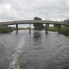
Beal Bridge
is a minor waterways place
on the Aire and Calder Navigation (Selby Section) between
Bank Dole Junction (Junction of the Aire and Calder Navigation (Selby Section) and the Aire and Calder Navigation (Main Line)) (2 miles and 4¼ furlongs
and 1 lock
to the west) and
Haddlesey Junction (Junction of River Aire and Selby Canal) (3 miles and 7¾ furlongs
and 1 lock
to the east).
The nearest place in the direction of Bank Dole Junction is Site of Stocking Lane Pipe Bridge;
2 miles and 1¾ furlongs
away.
The nearest place in the direction of Haddlesey Junction is Beal Lock No 2 Weir Entrance (Channel leading to the Weir);
¼ furlongs
away.
Mooring here is unrated.
Facilities: water point.
There is a bridge here which takes a minor road over the canal.
Bank Dole Junction | 2 miles, 4¼ furlongs | |
Marsh Lane Footbridge | 2 miles, 3¾ furlongs | |
Bank Dole Lock No 1 | 2 miles, 2½ furlongs | |
Bank Dole Lock Junction | 2 miles, 2¼ furlongs | |
Site of Stocking Lane Pipe Bridge | 2 miles, 1¾ furlongs | |
Beal Bridge | ||
Beal Lock No 2 Weir Entrance | ¼ furlongs | |
Beal Lock No 2 | 1¼ furlongs | |
Birkin Wharf | 1 mile, 1 furlong | |
Haddlesey Junction Pipe Bridge | 3 miles, 7½ furlongs | |
Haddlesey Junction | 3 miles, 7¾ furlongs |
Amenities here
There are no links to external websites from here.
Why not log in and add some (select "External websites" from the menu (sometimes this is under "Edit"))?
Mouseover for more information or show routes to facility
Nearest water point
The nearest water point is here. Others are at:
In the direction of Selby Junction (River Ouse)
Beal Lock No 2 — 1¼ furlongs away
On this waterway in the direction of Selby Junction (River Ouse)
Selby Basin — 8 miles, 6 furlongs and 2 locks away
On this waterway in the direction of Selby Junction (River Ouse)
In the direction of Bank Dole Junction
Bank Dole Lock No 1 — 2 miles, 2½ furlongs away
On this waterway in the direction of Bank Dole Junction
Ferrybridge Flood Lock No 11 — 4 miles, ¾ furlongs and 1 lock away
Travel to Bank Dole Junction, then on the Aire and Calder Navigation (Main Line - Goole to Castleford) to Ferrybridge Flood Lock No 11
Ferrybridge Flood Lock Footbridge — 4 miles, 1 furlong and 2 locks away
Travel to Bank Dole Junction, then on the Aire and Calder Navigation (Main Line - Goole to Castleford) to Ferrybridge Flood Lock Footbridge
Whitley Lock No 12 — 6 miles, 3¾ furlongs and 1 lock away
Travel to Bank Dole Junction, then on the Aire and Calder Navigation (Main Line - Goole to Castleford) to Whitley Lock No 12
Bulholme Lock No 10 — 8 miles, 6¾ furlongs and 2 locks away
Travel to Bank Dole Junction, then on the Aire and Calder Navigation (Main Line - Goole to Castleford) to Bulholme Lock No 10
Castleford Sanitary Station — 9 miles, 3½ furlongs and 3 locks away
Travel to Bank Dole Junction, then on the Aire and Calder Navigation (Main Line - Goole to Castleford) to Castleford Sanitary Station
Pollington Manor Swing Bridge — 10 miles, 1¾ furlongs and 3 locks away
Travel to Bank Dole Junction, then on the Aire and Calder Navigation (Main Line - Goole to Castleford) to Pollington Manor Swing Bridge
Pollington Visitor Mooring — 10 miles, 2¼ furlongs and 3 locks away
Travel to Bank Dole Junction, then on the Aire and Calder Navigation (Main Line - Goole to Castleford) to Pollington Visitor Mooring
Woodnook Lock No 6 — 11 miles, 6 furlongs and 4 locks away
Travel to Bank Dole Junction, then on the Aire and Calder Navigation (Main Line - Goole to Castleford) to Castleford Junction, then on the Aire and Calder Navigation (Wakefield Section) to Woodnook Lock No 6
Fairies Hill Moorings — 11 miles, 4¾ furlongs and 5 locks away
Travel to Bank Dole Junction, then on the Aire and Calder Navigation (Main Line - Goole to Castleford) to Castleford Junction, then on the Aire and Calder Navigation (Wakefield Section) to Fairies Hill Lock Junction, then on the Aire and Calder Navigation (Wakefield Section - Fairies Hill Mooring Arm) to Fairies Hill Moorings
Lemonroyd Lock No 7 — 12 miles, 7¾ furlongs and 4 locks away
Travel to Bank Dole Junction, then on the Aire and Calder Navigation (Main Line - Goole to Castleford) to Castleford Junction, then on the Aire and Calder Navigation (Main Line - Castleford to Leeds) to Lemonroyd Lock No 7
Lemonroyd Marina — 13 miles, ¾ furlongs and 5 locks away
Travel to Bank Dole Junction, then on the Aire and Calder Navigation (Main Line - Goole to Castleford) to Castleford Junction, then on the Aire and Calder Navigation (Main Line - Castleford to Leeds) to Lemonroyd Marina
King's Road Lock No 3 — 12 miles, 7½ furlongs and 5 locks away
Travel to Bank Dole Junction, then on the Aire and Calder Navigation (Main Line - Goole to Castleford) to Castleford Junction, then on the Aire and Calder Navigation (Wakefield Section) to King's Road Lock No 3
Woodlesford Lock No 5 — 14 miles, 2½ furlongs and 5 locks away
Travel to Bank Dole Junction, then on the Aire and Calder Navigation (Main Line - Goole to Castleford) to Castleford Junction, then on the Aire and Calder Navigation (Main Line - Castleford to Leeds) to Woodlesford Lock No 5
Fishpond Lock No 4 — 15 miles, 1½ furlongs and 6 locks away
Travel to Bank Dole Junction, then on the Aire and Calder Navigation (Main Line - Goole to Castleford) to Castleford Junction, then on the Aire and Calder Navigation (Main Line - Castleford to Leeds) to Fishpond Lock No 4
Stanley Ferry Water Point — 14 miles, 4¾ furlongs and 7 locks away
Travel to Bank Dole Junction, then on the Aire and Calder Navigation (Main Line - Goole to Castleford) to Castleford Junction, then on the Aire and Calder Navigation (Wakefield Section) to Stanley Ferry Water Point
Ramsdens Bridge Sanitary Station — 14 miles, 5½ furlongs and 7 locks away
Travel to Bank Dole Junction, then on the Aire and Calder Navigation (Main Line - Goole to Castleford) to Castleford Junction, then on the Aire and Calder Navigation (Wakefield Section) to Ramsdens Bridge Sanitary StationNearest rubbish disposal
In the direction of Selby Junction (River Ouse)
Selby Basin — 8 miles, 6 furlongs and 2 locks away
On this waterway in the direction of Selby Junction (River Ouse)
In the direction of Bank Dole Junction
Whitley Lock No 12 — 6 miles, 3¾ furlongs and 1 lock away
Travel to Bank Dole Junction, then on the Aire and Calder Navigation (Main Line - Goole to Castleford) to Whitley Lock No 12
Castleford Sanitary Station — 9 miles, 3½ furlongs and 3 locks away
Travel to Bank Dole Junction, then on the Aire and Calder Navigation (Main Line - Goole to Castleford) to Castleford Sanitary Station
Lemonroyd Marina — 13 miles, ¾ furlongs and 5 locks away
Travel to Bank Dole Junction, then on the Aire and Calder Navigation (Main Line - Goole to Castleford) to Castleford Junction, then on the Aire and Calder Navigation (Main Line - Castleford to Leeds) to Lemonroyd Marina
Woodlesford Lock No 5 — 14 miles, 2½ furlongs and 5 locks away
Travel to Bank Dole Junction, then on the Aire and Calder Navigation (Main Line - Goole to Castleford) to Castleford Junction, then on the Aire and Calder Navigation (Main Line - Castleford to Leeds) to Woodlesford Lock No 5
Ramsdens Bridge Visitor Moorings — 14 miles, 5 furlongs and 7 locks away
Travel to Bank Dole Junction, then on the Aire and Calder Navigation (Main Line - Goole to Castleford) to Castleford Junction, then on the Aire and Calder Navigation (Wakefield Section) to Ramsdens Bridge Visitor Moorings
Dutch Riverside — 18 miles, 4¼ furlongs and 3 locks away
Travel to Bank Dole Junction, then on the Aire and Calder Navigation (Main Line - Goole to Castleford) to Dutch Riverside
Goole Marina — 18 miles, 5¾ furlongs and 3 locks away
Travel to Bank Dole Junction, then on the Aire and Calder Navigation (Main Line - Goole to Castleford) to Goole Marina
Barnby Dun Lift Bridge — 18 miles, 7¼ furlongs and 4 locks away
Travel to Bank Dole Junction, then on the Aire and Calder Navigation (Main Line - Goole to Castleford) to Sykehouse Junction, then on the Sheffield and South Yorkshire Navigation (New Junction Canal) to Bramwith Junction, then on the Sheffield and South Yorkshire Navigation (Main Line) to Barnby Dun Lift Bridge
Bramwith Swing Bridge — 18 miles, 3¾ furlongs and 5 locks away
Travel to Bank Dole Junction, then on the Aire and Calder Navigation (Main Line - Goole to Castleford) to Sykehouse Junction, then on the Sheffield and South Yorkshire Navigation (New Junction Canal) to Bramwith Junction, then on the Sheffield and South Yorkshire Navigation (Bramwith to Stainforth) to Bramwith Swing Bridge
Leeds Sanitary Station — 18 miles, 7¼ furlongs and 8 locks away
Travel to Bank Dole Junction, then on the Aire and Calder Navigation (Main Line - Goole to Castleford) to Castleford Junction, then on the Aire and Calder Navigation (Main Line - Castleford to Leeds) to Leeds Sanitary Station
Leeds Basin — 19 miles, 6½ furlongs and 10 locks away
Travel to Bank Dole Junction, then on the Aire and Calder Navigation (Main Line - Goole to Castleford) to Castleford Junction, then on the Aire and Calder Navigation (Main Line - Castleford to Leeds) to Leeds Bridge, then on the Leeds and Liverpool Canal (Main Line - Wigan to Leeds) to Leeds BasinNearest chemical toilet disposal
In the direction of Selby Junction (River Ouse)
Selby Basin — 8 miles, 6 furlongs and 2 locks away
On this waterway in the direction of Selby Junction (River Ouse)
In the direction of Bank Dole Junction
Whitley Lock No 12 — 6 miles, 3¾ furlongs and 1 lock away
Travel to Bank Dole Junction, then on the Aire and Calder Navigation (Main Line - Goole to Castleford) to Whitley Lock No 12
Castleford Sanitary Station — 9 miles, 3½ furlongs and 3 locks away
Travel to Bank Dole Junction, then on the Aire and Calder Navigation (Main Line - Goole to Castleford) to Castleford Sanitary Station
Fairies Hill Moorings — 11 miles, 4¾ furlongs and 5 locks away
Travel to Bank Dole Junction, then on the Aire and Calder Navigation (Main Line - Goole to Castleford) to Castleford Junction, then on the Aire and Calder Navigation (Wakefield Section) to Fairies Hill Lock Junction, then on the Aire and Calder Navigation (Wakefield Section - Fairies Hill Mooring Arm) to Fairies Hill Moorings
Lemonroyd Marina — 13 miles, ¾ furlongs and 5 locks away
Travel to Bank Dole Junction, then on the Aire and Calder Navigation (Main Line - Goole to Castleford) to Castleford Junction, then on the Aire and Calder Navigation (Main Line - Castleford to Leeds) to Lemonroyd Marina
Ramsdens Bridge Sanitary Station — 14 miles, 5½ furlongs and 7 locks away
Travel to Bank Dole Junction, then on the Aire and Calder Navigation (Main Line - Goole to Castleford) to Castleford Junction, then on the Aire and Calder Navigation (Wakefield Section) to Ramsdens Bridge Sanitary Station
Dutch Riverside — 18 miles, 4¼ furlongs and 3 locks away
Travel to Bank Dole Junction, then on the Aire and Calder Navigation (Main Line - Goole to Castleford) to Dutch Riverside
Goole Marina — 18 miles, 5¾ furlongs and 3 locks away
Travel to Bank Dole Junction, then on the Aire and Calder Navigation (Main Line - Goole to Castleford) to Goole Marina
Barnby Dun Lift Bridge — 18 miles, 7¼ furlongs and 4 locks away
Travel to Bank Dole Junction, then on the Aire and Calder Navigation (Main Line - Goole to Castleford) to Sykehouse Junction, then on the Sheffield and South Yorkshire Navigation (New Junction Canal) to Bramwith Junction, then on the Sheffield and South Yorkshire Navigation (Main Line) to Barnby Dun Lift Bridge
Bramwith Swing Bridge — 18 miles, 3¾ furlongs and 5 locks away
Travel to Bank Dole Junction, then on the Aire and Calder Navigation (Main Line - Goole to Castleford) to Sykehouse Junction, then on the Sheffield and South Yorkshire Navigation (New Junction Canal) to Bramwith Junction, then on the Sheffield and South Yorkshire Navigation (Bramwith to Stainforth) to Bramwith Swing Bridge
Leeds Sanitary Station — 18 miles, 7¼ furlongs and 8 locks away
Travel to Bank Dole Junction, then on the Aire and Calder Navigation (Main Line - Goole to Castleford) to Castleford Junction, then on the Aire and Calder Navigation (Main Line - Castleford to Leeds) to Leeds Sanitary StationNearest place to turn
In the direction of Selby Junction (River Ouse)
Beal Lock No 2 Weir Entrance — ¼ furlongs away
On this waterway in the direction of Selby Junction (River Ouse)
Haddlesey Junction — 3 miles, 7¾ furlongs and 1 lock away
On this waterway in the direction of Selby Junction (River Ouse)
Selby Basin — 8 miles, 6 furlongs and 2 locks away
On this waterway in the direction of Selby Junction (River Ouse)
In the direction of Bank Dole Junction
Bank Dole Lock Junction — 2 miles, 2¼ furlongs away
On this waterway in the direction of Bank Dole Junction
Bulholme Lock Weir Exit — 8 miles, 6¼ furlongs and 2 locks away
Travel to Bank Dole Junction, then on the Aire and Calder Navigation (Main Line - Goole to Castleford) to Bulholme Lock Weir Exit
Lemonroyd Lock Weir Exit — 12 miles, 7 furlongs and 4 locks away
Travel to Bank Dole Junction, then on the Aire and Calder Navigation (Main Line - Goole to Castleford) to Castleford Junction, then on the Aire and Calder Navigation (Main Line - Castleford to Leeds) to Lemonroyd Lock Weir Exit
Fairies Hill Lock Arm — 11 miles, 7¾ furlongs and 5 locks away
Travel to Bank Dole Junction, then on the Aire and Calder Navigation (Main Line - Goole to Castleford) to Castleford Junction, then on the Aire and Calder Navigation (Wakefield Section) to Fairies Hill Lock Arm
Fleet Lane Arm — 13 miles, 3 furlongs and 5 locks away
Travel to Bank Dole Junction, then on the Aire and Calder Navigation (Main Line - Goole to Castleford) to Castleford Junction, then on the Aire and Calder Navigation (Main Line - Castleford to Leeds) to Fleet Lane Arm
Stanley Ferry Marina — 14 miles, 4 furlongs and 7 locks away
Travel to Bank Dole Junction, then on the Aire and Calder Navigation (Main Line - Goole to Castleford) to Castleford Junction, then on the Aire and Calder Navigation (Wakefield Section) to Stanley Ferry Marina
Viking Marina — 18 miles, 5 furlongs and 3 locks away
Travel to Bank Dole Junction, then on the Aire and Calder Navigation (Main Line - Goole to Castleford) to Viking Marina
Junction with River Aire (Old Channel) South — 17 miles, 5¼ furlongs and 7 locks away
Travel to Bank Dole Junction, then on the Aire and Calder Navigation (Main Line - Goole to Castleford) to Castleford Junction, then on the Aire and Calder Navigation (Main Line - Castleford to Leeds) to Junction with River Aire (Old Channel) South
Junction with River Aire (Old Channel) North — 18 miles, 2¼ furlongs and 8 locks away
Travel to Bank Dole Junction, then on the Aire and Calder Navigation (Main Line - Goole to Castleford) to Castleford Junction, then on the Aire and Calder Navigation (Main Line - Castleford to Leeds) to Junction with River Aire (Old Channel) North
Knostrop Flood Lock Weir Entrance — 18 miles, 2½ furlongs and 8 locks away
Travel to Bank Dole Junction, then on the Aire and Calder Navigation (Main Line - Goole to Castleford) to Castleford Junction, then on the Aire and Calder Navigation (Main Line - Castleford to Leeds) to Knostrop Flood Lock Weir Entrance
Wakefield Weir Entrance — 17 miles, 4¼ furlongs and 9 locks away
Travel to Bank Dole Junction, then on the Aire and Calder Navigation (Main Line - Goole to Castleford) to Castleford Junction, then on the Aire and Calder Navigation (Wakefield Section) to Fall Ing Junction, then on the Calder and Hebble Navigation (Main Line) to Wakefield Weir Entrance
Leeds Dock Side Arm — 19 miles, 1½ furlongs and 9 locks away
Travel to Bank Dole Junction, then on the Aire and Calder Navigation (Main Line - Goole to Castleford) to Castleford Junction, then on the Aire and Calder Navigation (Main Line - Castleford to Leeds) to Leeds Dock Entrance, then on the Aire and Calder Navigation (Leeds Dock) to Leeds Dock Side Arm
River Aire Junction — 19 miles, 6 furlongs and 9 locks away
Travel to Bank Dole Junction, then on the Aire and Calder Navigation (Main Line - Goole to Castleford) to Castleford Junction, then on the Aire and Calder Navigation (Main Line - Castleford to Leeds) to Leeds Bridge, then on the Leeds and Liverpool Canal (Main Line - Wigan to Leeds) to River Aire Junction
Leeds Basin — 19 miles, 6½ furlongs and 10 locks away
Travel to Bank Dole Junction, then on the Aire and Calder Navigation (Main Line - Goole to Castleford) to Castleford Junction, then on the Aire and Calder Navigation (Main Line - Castleford to Leeds) to Leeds Bridge, then on the Leeds and Liverpool Canal (Main Line - Wigan to Leeds) to Leeds BasinNearest self-operated pump-out
In the direction of Bank Dole Junction
Castleford Sanitary Station — 9 miles, 3½ furlongs and 3 locks away
Travel to Bank Dole Junction, then on the Aire and Calder Navigation (Main Line - Goole to Castleford) to Castleford Sanitary Station
Ramsdens Bridge Sanitary Station — 14 miles, 5½ furlongs and 7 locks away
Travel to Bank Dole Junction, then on the Aire and Calder Navigation (Main Line - Goole to Castleford) to Castleford Junction, then on the Aire and Calder Navigation (Wakefield Section) to Ramsdens Bridge Sanitary Station
Leeds Sanitary Station — 18 miles, 7¼ furlongs and 8 locks away
Travel to Bank Dole Junction, then on the Aire and Calder Navigation (Main Line - Goole to Castleford) to Castleford Junction, then on the Aire and Calder Navigation (Main Line - Castleford to Leeds) to Leeds Sanitary StationNearest boatyard pump-out
In the direction of Bank Dole Junction
Lemonroyd Marina — 13 miles, ¾ furlongs and 5 locks away
Travel to Bank Dole Junction, then on the Aire and Calder Navigation (Main Line - Goole to Castleford) to Castleford Junction, then on the Aire and Calder Navigation (Main Line - Castleford to Leeds) to Lemonroyd Marina
Goole Marina — 18 miles, 5¾ furlongs and 3 locks away
Travel to Bank Dole Junction, then on the Aire and Calder Navigation (Main Line - Goole to Castleford) to Goole MarinaDirection of TV transmitter (From Wolfbane Cybernetic)
There is no page on Wikipedia called “Beal Bridge”
Wikipedia pages that might relate to Beal Bridge
[Harry Beal]
Harry Beal (August 16, 1930 – January 26, 2021) was the first US Navy Seal. Beal joined the U.S. Navy in 1948, first serving aboard the U.S.S. Shenandoah
[Béal na Bláth]
Béal na Bláth, alternatively Béal na mBláth, Béal na Blá, Bealnablath or Bealnabla, is a small village on the R585 road in County Cork, Ireland. The area
[Beal, California]
railroad route southward to Beal then to Mellen, where from 1889 to May 1890 they built the Red Rock Bridge, a cantilever bridge, on rock foundations, unlike
[List of Chopped episodes (seasons 21–40)]
(eliminated after the appetizer) Ashley Dudley (age: 16), from Hancocks Bridge, NJ (eliminated after the entrée) Jay Ureña (age: 16), from Queens, NY (eliminated
[BeBee]
launched in English, Spanish and Portuguese. In August 2016 beBee was selected by Mind the Bridge and EIT Digital to participate in the "Startup Europe Comes
[List of The Tonight Show Starring Jimmy Fallon episodes (2017)]
Farm Animals performed "Back to You" 720 August 7, 2017 (2017-08-07) Jeff Bridges, Aubrey Plaza The Roots & Bilal Tonight Show Polls; Tonight Show Think
[List of cooperative video games]
PS3 / XB360 TPS 2013 2 Local, Online Split, Full No Artemis: Spaceship Bridge Simulator PC / Android / iOS Space Sim 2010 2-11 LAN Full No Assault Heroes
[List of films with post-credit scenes]
Carlos are seen looking at the Isle of the Lost; then racing across the bridge to their parents. Spider-Man: Far From Home J. Jonah Jameson blames Spider-Man
[List of musicals: A to L]
Brewster's Millions 1935 Film Marr Mackie Mackie Arthur Wimperis The Bridges of Madison County 2014 Broadway Jason Robert Brown Brown Marsha Norman
[List of entertainment events at Madison Square Garden]
Horse Live in A Rusted Out Garage October 15 United States Billy Joel The Bridge Tour October 17 October 18 October 27 United States Lionel Richie Dancing
Results of Google Search
Harry Beal Bridge Project - Home | FacebookHarry Beal Bridge Project. 1016 likes. US Navy Veteran, First S.E.A.L. Harry M. Beal has had multiple brushes with history that are simply amazing. He...
Feb 29, 2020 ... For generations to come, organizers hope those who cross the bridge can read the sign and learn something about Beal's legacy. “I hope people ...
Feb 29, 2020 ... Harry Beal bridge dedication is Saturday. The Southern Alleghenies Planning & Development Commission Rural Planning Organization, the ...
The Hoover Dam Bypass Bridge had been in the works ever since the tragic day of Sept 11, 2001. Since that fateful day, interstate traffic has been greatly ...
Sep 16, 2020 ... Directions to Phillip Beal Bridge (Pensacola) with public transportation. The following transit lines have routes that pass near Phillip Beal Bridge.
The bridge across the Colorado River constructed at Eastbridge station in 1883 was washed out or undermined by the spring flooding of the river in 1884, 1886 ...
Introduced in the Senate on January 18, 2006. Adopted by the General Assembly on February 2, 2006. Summary: Woodrow Beal "Woodie" Chastain Bridge.
Mar 25, 2010 ... ... at South 14th Street and Highway 2 near the Nebraska State Penitentiary and the re-design of the South 14th Street bridge over Beal Slough.
A licensed Real Estate Broker/Agent with decades of investment and real estate experience from bridge lender Beth Beal and her company, B2 Solutions Group, ...
How closely are you following reports about the steps Big Tech and social media companies are taking to prevent widespread questioning of the legitimacy of ...