CanalPlanAC

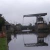
Barnby Dun Lift Bridge

 
Fordstead Lane, Barnby Dun DN3 1EP, United Kingdom
 
Information about the place
Barnby Dun Lift Bridge is a place on the waterways on the Sheffield and South Yorkshire Navigation (Main Line) between Bramwith Junction (Junction of Sheffield and South Yorkshire Navigation main line with New Junction Canal) (1 mile and ½ furlongs to the north) and Conisbrough Viaduct (10 miles and 4¾ furlongs and 3 locks to the southwest).
 
 
The nearest place in the direction of Bramwith Junction is Thorpe Bank Railway Bridge; 4 furlongs away.
 
The nearest place in the direction of Conisbrough Viaduct is Kirk Sandall Pipe Bridge; 1 mile and 1¾ furlongs away.

There is access (suitable for wheels) to the towpath here.

Mooring here is excellent (this is a really good mooring), mooring rings or bollards are available. Mooring is limited to 48 hours. Moor either side of the bridge, 48hrs limit to north of bridge. There are good facilities in the village with a wide towpath. Traffic noise over the bridge at night.

Facilities: chemical toilet disposal, rubbish disposal, showers, toilets, water point, glass recycling, paper recycling, tin can recycling and aluminium can recycling.

There is a lift bridge here. The bridge requires a BW key to operate it.

Bramwith Junction1 mile, ½ furlongs
Broad Ings Lane Bridge5½ furlongs
Thorpe Bank Railway Bridge4 furlongs
Barnby Dun Lift Bridge
Kirk Sandall Pipe Bridge1 mile, 1¾ furlongs
Long Sandall Railway Bridge (74)2 miles
Long Sandall Lock No 132 miles, 1½ furlongs
Wheatley Hall Road Winding Hole3 miles, 2 furlongs
Strawberry Island Boat Club Entrance No 24 miles, 4½ furlongs
 
 
Amenities

Amenities here

 Tates Late Shopper
 Fish & Chips

Amenities nearby at Kirk Sandall Pipe Bridge

 Fish & Chips
 Kirk Sandall Station
 
Maps
If you are a user and are logged on, or if you are actively planning a route, a map will be displayed here.
Show on external mapping site: Google | OSM | Bing
 
Additional information

3 pubs, church, stores, frequent buses to Doncaster.

 
Photos
 
External websites
  S&SY navigation info — associated with Sheffield and South Yorkshire Navigation
Sheffield & South Yorkshire navigation info from IWA
 
Nearest facilities

Mouseover for more information or show routes to facility

Nearest water point

The nearest water point is here. Others are at:

In the direction of Rawmarsh Road Bridge No 39

Long Sandall Lock No 132 miles, 1½ furlongs away
On this waterway in the direction of Rawmarsh Road Bridge No 39
Doncaster Visitor Pontoon Moorings5 miles, 2¾ furlongs and 1 lock away
On this waterway in the direction of Rawmarsh Road Bridge No 39
Doncaster Town Lock No 125 miles, 5 furlongs and 1 lock away
On this waterway in the direction of Rawmarsh Road Bridge No 39
Sprotbrough Lock No 118 miles, 7¼ furlongs and 2 locks away
On this waterway in the direction of Rawmarsh Road Bridge No 39
Mexborough Low Lock No 1012 miles, 2¾ furlongs and 3 locks away
On this waterway in the direction of Rawmarsh Road Bridge No 39
Swinton Lock Activity Centre and CRT Sanitary Station14 miles, 7½ furlongs and 5 locks away
On this waterway in the direction of Rawmarsh Road Bridge No 39
Kilnhurst Flood Lock No 716 miles, 5 furlongs and 6 locks away
On this waterway in the direction of Rawmarsh Road Bridge No 39

In the direction of Bramwith Junction

Bramwith Lock No 141 mile, 2¾ furlongs away
Travel to Bramwith Junction, then on the Sheffield and South Yorkshire Navigation (Bramwith to Stainforth) to Bramwith Lock No 14
Bramwith Swing Bridge1 mile, 5½ furlongs and 1 lock away
Travel to Bramwith Junction, then on the Sheffield and South Yorkshire Navigation (Bramwith to Stainforth) to Bramwith Swing Bridge
Thorne Visitor Moorings6 miles and 2 locks away
Travel to Bramwith Junction, then on the Sheffield and South Yorkshire Navigation (Bramwith to Stainforth) to Stainforth Junction, then on the Sheffield and South Yorkshire Navigation (Stainforth and Keadby Canal) to Thorne Visitor Moorings
Pollington Visitor Mooring8 miles, 5 furlongs and 1 lock away
Travel to Bramwith Junction, then on the Sheffield and South Yorkshire Navigation (New Junction Canal) to Sykehouse Junction, then on the Aire and Calder Navigation (Main Line - Goole to Castleford) to Pollington Visitor Mooring
Pollington Manor Swing Bridge8 miles, 5¼ furlongs and 1 lock away
Travel to Bramwith Junction, then on the Sheffield and South Yorkshire Navigation (New Junction Canal) to Sykehouse Junction, then on the Aire and Calder Navigation (Main Line - Goole to Castleford) to Pollington Manor Swing Bridge
Dutch Riverside12 miles, 6 furlongs and 1 lock away
Travel to Bramwith Junction, then on the Sheffield and South Yorkshire Navigation (New Junction Canal) to Sykehouse Junction, then on the Aire and Calder Navigation (Main Line - Goole to Castleford) to Dutch Riverside
Goole Marina12 miles, 7½ furlongs and 1 lock away
Travel to Bramwith Junction, then on the Sheffield and South Yorkshire Navigation (New Junction Canal) to Sykehouse Junction, then on the Aire and Calder Navigation (Main Line - Goole to Castleford) to Goole Marina
Whitley Lock No 1212 miles, 3½ furlongs and 2 locks away
Travel to Bramwith Junction, then on the Sheffield and South Yorkshire Navigation (New Junction Canal) to Sykehouse Junction, then on the Aire and Calder Navigation (Main Line - Goole to Castleford) to Whitley Lock No 12
Keadby Visitor Moorings15 miles, 6½ furlongs and 2 locks away
Travel to Bramwith Junction, then on the Sheffield and South Yorkshire Navigation (Bramwith to Stainforth) to Stainforth Junction, then on the Sheffield and South Yorkshire Navigation (Stainforth and Keadby Canal) to Keadby Visitor Moorings
Bank Dole Lock No 116 miles, 4¾ furlongs and 3 locks away
Travel to Bramwith Junction, then on the Sheffield and South Yorkshire Navigation (New Junction Canal) to Sykehouse Junction, then on the Aire and Calder Navigation (Main Line - Goole to Castleford) to Bank Dole Junction, then on the Aire and Calder Navigation (Selby Section) to Bank Dole Lock No 1
Ferrybridge Flood Lock No 1117 miles, 7¼ furlongs and 3 locks away
Travel to Bramwith Junction, then on the Sheffield and South Yorkshire Navigation (New Junction Canal) to Sykehouse Junction, then on the Aire and Calder Navigation (Main Line - Goole to Castleford) to Ferrybridge Flood Lock No 11
Ferrybridge Flood Lock Footbridge17 miles, 7½ furlongs and 4 locks away
Travel to Bramwith Junction, then on the Sheffield and South Yorkshire Navigation (New Junction Canal) to Sykehouse Junction, then on the Aire and Calder Navigation (Main Line - Goole to Castleford) to Ferrybridge Flood Lock Footbridge

Nearest rubbish disposal

The nearest rubbish disposal is here. Others are at:

In the direction of Rawmarsh Road Bridge No 39

Doncaster Visitor Pontoon Moorings5 miles, 2¾ furlongs and 1 lock away
On this waterway in the direction of Rawmarsh Road Bridge No 39
Eastwood Lock No 519 miles, 2¾ furlongs and 8 locks away
On this waterway in the direction of Rawmarsh Road Bridge No 39

In the direction of Bramwith Junction

Bramwith Swing Bridge1 mile, 5½ furlongs and 1 lock away
Travel to Bramwith Junction, then on the Sheffield and South Yorkshire Navigation (Bramwith to Stainforth) to Bramwith Swing Bridge
Thorne Visitor Moorings6 miles and 2 locks away
Travel to Bramwith Junction, then on the Sheffield and South Yorkshire Navigation (Bramwith to Stainforth) to Stainforth Junction, then on the Sheffield and South Yorkshire Navigation (Stainforth and Keadby Canal) to Thorne Visitor Moorings
Dutch Riverside12 miles, 6 furlongs and 1 lock away
Travel to Bramwith Junction, then on the Sheffield and South Yorkshire Navigation (New Junction Canal) to Sykehouse Junction, then on the Aire and Calder Navigation (Main Line - Goole to Castleford) to Dutch Riverside
Goole Marina12 miles, 7½ furlongs and 1 lock away
Travel to Bramwith Junction, then on the Sheffield and South Yorkshire Navigation (New Junction Canal) to Sykehouse Junction, then on the Aire and Calder Navigation (Main Line - Goole to Castleford) to Goole Marina
Whitley Lock No 1212 miles, 3½ furlongs and 2 locks away
Travel to Bramwith Junction, then on the Sheffield and South Yorkshire Navigation (New Junction Canal) to Sykehouse Junction, then on the Aire and Calder Navigation (Main Line - Goole to Castleford) to Whitley Lock No 12
Keadby Visitor Moorings15 miles, 6½ furlongs and 2 locks away
Travel to Bramwith Junction, then on the Sheffield and South Yorkshire Navigation (Bramwith to Stainforth) to Stainforth Junction, then on the Sheffield and South Yorkshire Navigation (Stainforth and Keadby Canal) to Keadby Visitor Moorings

Nearest chemical toilet disposal

The nearest chemical toilet disposal is here. Others are at:

In the direction of Rawmarsh Road Bridge No 39

Swinton Lock Activity Centre and CRT Sanitary Station14 miles, 7½ furlongs and 5 locks away
On this waterway in the direction of Rawmarsh Road Bridge No 39
Eastwood Lock No 519 miles, 2¾ furlongs and 8 locks away
On this waterway in the direction of Rawmarsh Road Bridge No 39

In the direction of Bramwith Junction

Bramwith Swing Bridge1 mile, 5½ furlongs and 1 lock away
Travel to Bramwith Junction, then on the Sheffield and South Yorkshire Navigation (Bramwith to Stainforth) to Bramwith Swing Bridge
Thorne Visitor Moorings6 miles and 2 locks away
Travel to Bramwith Junction, then on the Sheffield and South Yorkshire Navigation (Bramwith to Stainforth) to Stainforth Junction, then on the Sheffield and South Yorkshire Navigation (Stainforth and Keadby Canal) to Thorne Visitor Moorings
Dutch Riverside12 miles, 6 furlongs and 1 lock away
Travel to Bramwith Junction, then on the Sheffield and South Yorkshire Navigation (New Junction Canal) to Sykehouse Junction, then on the Aire and Calder Navigation (Main Line - Goole to Castleford) to Dutch Riverside
Goole Marina12 miles, 7½ furlongs and 1 lock away
Travel to Bramwith Junction, then on the Sheffield and South Yorkshire Navigation (New Junction Canal) to Sykehouse Junction, then on the Aire and Calder Navigation (Main Line - Goole to Castleford) to Goole Marina
Whitley Lock No 1212 miles, 3½ furlongs and 2 locks away
Travel to Bramwith Junction, then on the Sheffield and South Yorkshire Navigation (New Junction Canal) to Sykehouse Junction, then on the Aire and Calder Navigation (Main Line - Goole to Castleford) to Whitley Lock No 12
Keadby Visitor Moorings15 miles, 6½ furlongs and 2 locks away
Travel to Bramwith Junction, then on the Sheffield and South Yorkshire Navigation (Bramwith to Stainforth) to Stainforth Junction, then on the Sheffield and South Yorkshire Navigation (Stainforth and Keadby Canal) to Keadby Visitor Moorings

Nearest place to turn

In the direction of Rawmarsh Road Bridge No 39

Wheatley Hall Road Winding Hole3 miles, 2 furlongs and 1 lock away
On this waterway in the direction of Rawmarsh Road Bridge No 39
Gas House Bight5 miles, 1¼ furlongs and 1 lock away
On this waterway in the direction of Rawmarsh Road Bridge No 39
Doncaster Visitor Pontoon Moorings5 miles, 2¾ furlongs and 1 lock away
On this waterway in the direction of Rawmarsh Road Bridge No 39
Sprotbrough Lock Weir Exit8 miles, 6¾ furlongs and 2 locks away
On this waterway in the direction of Rawmarsh Road Bridge No 39
Swinton Road Corner14 miles, 4¼ furlongs and 5 locks away
On this waterway in the direction of Rawmarsh Road Bridge No 39
Swinton Junction15 miles, ¼ furlongs and 6 locks away
On this waterway in the direction of Rawmarsh Road Bridge No 39
Kilnhurst Flood Lock Winding Hole16 miles, 6¾ furlongs and 7 locks away
On this waterway in the direction of Rawmarsh Road Bridge No 39
Sir Frank Price Lock Weir Exit19 miles, 2 furlongs and 8 locks away
On this waterway in the direction of Rawmarsh Road Bridge No 39
Sir Frank Price Lock Arm19 miles, 3¼ furlongs and 9 locks away
On this waterway in the direction of Rawmarsh Road Bridge No 39

In the direction of Bramwith Junction

Huddle Grounds Winding Hole3 miles, 4¾ furlongs and 1 lock away
Travel to Bramwith Junction, then on the Sheffield and South Yorkshire Navigation (Bramwith to Stainforth) to Stainforth Junction, then on the Sheffield and South Yorkshire Navigation (Stainforth and Keadby Canal) to Huddle Grounds Winding Hole
Viking Marina12 miles, 6¾ furlongs and 1 lock away
Travel to Bramwith Junction, then on the Sheffield and South Yorkshire Navigation (New Junction Canal) to Sykehouse Junction, then on the Aire and Calder Navigation (Main Line - Goole to Castleford) to Viking Marina
Bank Dole Lock Junction16 miles, 5 furlongs and 4 locks away
Travel to Bramwith Junction, then on the Sheffield and South Yorkshire Navigation (New Junction Canal) to Sykehouse Junction, then on the Aire and Calder Navigation (Main Line - Goole to Castleford) to Bank Dole Junction, then on the Aire and Calder Navigation (Selby Section) to Bank Dole Lock Junction
Beal Lock No 2 Weir Entrance18 miles, 7½ furlongs and 4 locks away
Travel to Bramwith Junction, then on the Sheffield and South Yorkshire Navigation (New Junction Canal) to Sykehouse Junction, then on the Aire and Calder Navigation (Main Line - Goole to Castleford) to Bank Dole Junction, then on the Aire and Calder Navigation (Selby Section) to Beal Lock No 2 Weir Entrance

Nearest self-operated pump-out

In the direction of Rawmarsh Road Bridge No 39

Long Sandall Lock No 132 miles, 1½ furlongs away
On this waterway in the direction of Rawmarsh Road Bridge No 39
Direction of TV transmitter (From Wolfbane Cybernetic)
 
 
Geograph
 
Wikipedia

There is no page on Wikipedia called “Barnby Dun Lift Bridge”

Wikipedia pages that might relate to Barnby Dun Lift Bridge
[Barnby Dun] Barnby Dun is a village in Doncaster, South Yorkshire, England. Together with Kirk Sandall it forms the civil parish of Barnby Dun with Kirk Sandall. It [River Don Navigation] been built for the use of boaters when the bridge is not staffed. Sykehouse Lift Bridge (downstream of Barnby Dun) was built to the same technical specification [Barnby Dun with Kirk Sandall] Barnby Dun with Kirk Sandall is a civil parish in the Metropolitan Borough of Doncaster in South Yorkshire, England. According to the 2001 census it had [River Don, Yorkshire] River Dun in some stretches) is a river in South Yorkshire and the East Riding of Yorkshire, England. It rises in the Pennines, west of Dunford Bridge, and [Sheffield and South Yorkshire Navigation] and Goole Railway in 1850, to become the South Yorkshire Railway and River Dun Company. This in turn was leased to the Manchester, Sheffield and Lincolnshire
 
Google

Results of Google Search

File:Barnby Dun - lift bridge (Geograph-2421439-by-Dave-Bevis ...
Oct 24, 2016 ... Barnby_Dun_-_lift_bridge_(Geograph-2421439-by-Dave-Bevis)_(cropped).jpg #x200e;( 513 × 385 pixels, file size: 43 KB, MIME type: image/jpeg) ...
Barnby Dun with Kirk Sandall - Wikiwand
Barnby Dun with Kirk Sandall is a civil parish in the Metropolitan Borough of Doncaster in South Yorkshire, England. According to ... Lifting bridge in Barnby Dun.
Barnby Dun lift bridge.. lifts for the Humber Princess | On The Water ...
Explore delticfan's photos on Flickr. delticfan has uploaded 3709 photos to Flickr.
Barnby Dun - Wikipedia
Barnby Dun is a village in Doncaster, South Yorkshire, England. Together with Kirk Sandall it ... Barnby Dun. Barnby Dun with Kirk Sandall - Canal Bridge.jpg. Lifting bridge. Barnby Dun is located in South Yorkshire. Barnby Dun. Location ...
Category:Barnby Dun - Wikimedia Commons
Media in category "Barnby Dun". The following 28 files are in this category, out of 28 total. Barnby Dun - lift bridge (Geograph-2421439-by-Dave-Bevis) ...
Barnby Dun Bridge Delays - Pennine Waterways News
Sep 10, 2012 ... Boaters using the South Yorkshire Navigation face delays at Barnby Dun following a problem with the lift bridge. A lorry has struck one of the ...
Barnby Dun with Kirk Sandall - Wikipedia
Barnby Dun with Kirk Sandall is a civil parish in the Metropolitan Borough of Doncaster in South ... Lifting bridge in Barnby Dun. Barnby Dun with Kirk Sandall is ...
Barnby Dun Bridge Closed (now re ... - Pennine Waterways News
Dec 3, 2009 ... Barnby Dun Lift Bridge on the Sheffield and South Yorkshire Navigation is closed due to a hydraulic failure. The bridge is between Doncaster ...
Barnby Dun lift bridge.. lifts for the Humber Princess | Flickr
Wonderful timing Chris - thanks for adding it to Yorkshire Camera Ramblers - I see it also made it to Explore - truly worthy. Edwin van Tilburg 5y. awesome image ...