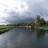
Old Bedford River Sluice
Junction of the River Great Ouse and the Old Bedford River - No Access
A1123, Huntingdonshire PE28 3PT, United Kingdom

Old Bedford River Sluice
is a minor waterways place
on the River Great Ouse (Tidal Section) between
Earith Junction (Junction with Old West River, New Bedford River and the River Great Ouse (Tidal Section)) (2¼ furlongs
to the east) and
Earith (1¾ furlongs
to the west).
Mooring here is unrated.
Earith Junction | 2¼ furlongs | |
Old Bedford River Sluice | ||
Earith | 1¾ furlongs | |
Westview Marina & Leisure Park | 2¾ furlongs | |
Brownshill Staunch Weir Exit | 1 mile, 7 furlongs | |
Brownshill Staunch (Lock) | 1 mile, 7¼ furlongs |
- Great Ouse Navigation | boating, moorings, navigation notices — associated with River Great Ouse
- Information regarding the Great Ouse navigation and tributaries.
- Information for boaters on the River Great Ouse - GOV.UK — associated with River Great Ouse
- River Great Ouse: bridge heights, locks, overhead power lines and facilities.
- Facebook Account — associated with River Great Ouse
- Anglian Waterways Manager Facebook Account
- Facebook Anglian Waterways Page — associated with River Great Ouse
- Facebook Page for Environment Agency Anglian Waterways
Mouseover for more information or show routes to facility
Nearest water point
In the direction of Earith Junction
Fish and Duck Marina Fuel Dock — 11 miles, 6½ furlongs and 1 lock away
Travel to Earith Junction, then on the River Great Ouse (Old West River - Small River) to Fish and Duck Marina Fuel Dock
Fish and Duck Marina — 11 miles, 7¾ furlongs and 1 lock away
Travel to Earith Junction, then on the River Great Ouse (Old West River - Small River) to Pope's Corner, then on the River Cam (Main river - Large River) to Fish and Duck Marina
Reach Lode Sluice — 15 miles, ¾ furlongs and 1 lock away
Travel to Earith Junction, then on the River Great Ouse (Old West River - Small River) to Pope's Corner, then on the River Cam (Main river - Large River) to Cam - Reach Lode Junction, then on the River Cam (Burwell Lode) to Reach Lode Sluice
Willow Walk Visitor Moorings — 15 miles, 5¼ furlongs and 1 lock away
Travel to Earith Junction, then on the River Great Ouse (Old West River - Small River) to Pope's Corner, then on the River Great Ouse (Old West River - Large River) to Willow Walk Visitor Moorings
In the direction of Brownshill Staunch (Lock)
Westview Marina & Leisure Park — 2¾ furlongs away
On this waterway in the direction of Brownshill Staunch (Lock)
Pike and Eel Marina — 3 miles, ¼ furlongs and 1 lock away
Travel to Brownshill Staunch (Lock), then on the River Great Ouse (Canalized Section) to Pike and Eel Marina
Jones Boatyard — 7 miles, ¾ furlongs and 2 locks away
Travel to Brownshill Staunch (Lock), then on the River Great Ouse (Canalized Section) to Jones Boatyard
The Waits Moorings — 7 miles, 5½ furlongs and 2 locks away
Travel to Brownshill Staunch (Lock), then on the River Great Ouse (Canalized Section) to The Waits Moorings Junction, then on the River Great Ouse (Waits Mooring Arm) to The Waits Moorings
Hartford Marina — 11 miles, 2¼ furlongs and 4 locks away
Travel to Brownshill Staunch (Lock), then on the River Great Ouse (Canalized Section) to Hartford Marina
Huntingdon Boathaven Marina — 13 miles, 2 furlongs and 4 locks away
Travel to Brownshill Staunch (Lock), then on the River Great Ouse (Canalized Section) to Huntingdon Boathaven MarinaNearest rubbish disposal
In the direction of Earith Junction
Hermitage Lock — 2¾ furlongs away
Travel to Earith Junction, then on the River Great Ouse (Old West River - Small River) to Hermitage Lock
Willow Walk Visitor Moorings — 15 miles, 5¼ furlongs and 1 lock away
Travel to Earith Junction, then on the River Great Ouse (Old West River - Small River) to Pope's Corner, then on the River Great Ouse (Old West River - Large River) to Willow Walk Visitor Moorings
In the direction of Brownshill Staunch (Lock)
Buckden Marina — 17 miles, ¾ furlongs and 6 locks away
Travel to Brownshill Staunch (Lock), then on the River Great Ouse (Canalized Section) to Buckden MarinaNearest chemical toilet disposal
In the direction of Earith Junction
Fish and Duck Marina — 11 miles, 7¾ furlongs and 1 lock away
Travel to Earith Junction, then on the River Great Ouse (Old West River - Small River) to Pope's Corner, then on the River Cam (Main river - Large River) to Fish and Duck Marina
Willow Walk Visitor Moorings — 15 miles, 5¼ furlongs and 1 lock away
Travel to Earith Junction, then on the River Great Ouse (Old West River - Small River) to Pope's Corner, then on the River Great Ouse (Old West River - Large River) to Willow Walk Visitor Moorings
In the direction of Brownshill Staunch (Lock)
Westview Marina & Leisure Park — 2¾ furlongs away
On this waterway in the direction of Brownshill Staunch (Lock)
Jones Boatyard — 7 miles, ¾ furlongs and 2 locks away
Travel to Brownshill Staunch (Lock), then on the River Great Ouse (Canalized Section) to Jones Boatyard
Hartford Marina — 11 miles, 2¼ furlongs and 4 locks away
Travel to Brownshill Staunch (Lock), then on the River Great Ouse (Canalized Section) to Hartford MarinaNearest place to turn
In the direction of Earith Junction
Pope's Corner — 11 miles, 7 furlongs and 1 lock away
Travel to Earith Junction, then on the River Great Ouse (Old West River - Small River) to Pope's Corner
Fish and Duck Marina — 11 miles, 7¾ furlongs and 1 lock away
Travel to Earith Junction, then on the River Great Ouse (Old West River - Small River) to Pope's Corner, then on the River Cam (Main river - Large River) to Fish and Duck Marina
Great Ouse - Braham Dock Junction — 13 miles, 6½ furlongs and 1 lock away
Travel to Earith Junction, then on the River Great Ouse (Old West River - Small River) to Pope's Corner, then on the River Great Ouse (Old West River - Large River) to Great Ouse - Braham Dock Junction
Willow Walk Winding Hole — 15 miles, 5½ furlongs and 1 lock away
Travel to Earith Junction, then on the River Great Ouse (Old West River - Small River) to Pope's Corner, then on the River Great Ouse (Old West River - Large River) to Willow Walk Winding Hole
Wicken Lode Junction — 15 miles, 3 furlongs and 2 locks away
Travel to Earith Junction, then on the River Great Ouse (Old West River - Small River) to Pope's Corner, then on the River Cam (Main river - Large River) to Cam - Reach Lode Junction, then on the River Cam (Burwell Lode) to Wicken Lode Junction
Welmore Sluice — 18 miles, 6½ furlongs away
Travel to Earith Junction, then on the River Great Ouse (New Bedford River) to Welmore Sluice
In the direction of Brownshill Staunch (Lock)
Westview Marina & Leisure Park — 2¾ furlongs away
On this waterway in the direction of Brownshill Staunch (Lock)
Pike and Eel Marina — 3 miles, ¼ furlongs and 1 lock away
Travel to Brownshill Staunch (Lock), then on the River Great Ouse (Canalized Section) to Pike and Eel Marina
Jones Boatyard — 7 miles, ¾ furlongs and 2 locks away
Travel to Brownshill Staunch (Lock), then on the River Great Ouse (Canalized Section) to Jones Boatyard
The Waits Moorings Junction — 7 miles, 4½ furlongs and 2 locks away
Travel to Brownshill Staunch (Lock), then on the River Great Ouse (Canalized Section) to The Waits Moorings Junction
The Waits Moorings Winding Hole — 7 miles, 6¾ furlongs and 2 locks away
Travel to Brownshill Staunch (Lock), then on the River Great Ouse (Canalized Section) to The Waits Moorings Junction, then on the River Great Ouse (Waits Mooring Arm) to The Waits Moorings Winding Hole
Hemingford Lock Weir Exit No 1 — 8 miles, 5¾ furlongs and 2 locks away
Travel to Brownshill Staunch (Lock), then on the River Great Ouse (Canalized Section) to Hemingford Lock Weir Exit No 1
Hemingford Lock Weir Exit No 2 — 8 miles, 6 furlongs and 2 locks away
Travel to Brownshill Staunch (Lock), then on the River Great Ouse (Canalized Section) to Hemingford Lock Weir Exit No 2
Houghton Lock Weir Exit No 1 — 9 miles, 4¼ furlongs and 3 locks away
Travel to Brownshill Staunch (Lock), then on the River Great Ouse (Canalized Section) to Houghton Lock Weir Exit No 1
Houghton Lock Weir Entrance No 2 — 10 miles, 2½ furlongs and 4 locks away
Travel to Brownshill Staunch (Lock), then on the River Great Ouse (Canalized Section) to Houghton Lock Weir Entrance No 2
Hartford Marina — 11 miles, 2¼ furlongs and 4 locks away
Travel to Brownshill Staunch (Lock), then on the River Great Ouse (Canalized Section) to Hartford Marina
Godmanchester Lock Weir Exit — 13 miles, 4¼ furlongs and 4 locks away
Travel to Brownshill Staunch (Lock), then on the River Great Ouse (Canalized Section) to Godmanchester Lock Weir Exit
Great Ouse - Godmanchester Backwater Junction — 13 miles, 6½ furlongs and 5 locks away
Travel to Brownshill Staunch (Lock), then on the River Great Ouse (Canalized Section) to Great Ouse - Godmanchester Backwater Junction
Godmanchester — 13 miles, 7½ furlongs and 5 locks away
Travel to Brownshill Staunch (Lock), then on the River Great Ouse (Canalized Section) to Great Ouse - Godmanchester Backwater Junction, then on the River Great Ouse (Godmanchester Backwater) to Godmanchester
Brampton Mill Marina — 14 miles, 7 furlongs and 5 locks away
Travel to Brownshill Staunch (Lock), then on the River Great Ouse (Canalized Section) to Brampton Mill MarinaNearest self-operated pump-out
In the direction of Earith Junction
Willow Walk Visitor Moorings — 15 miles, 5¼ furlongs and 1 lock away
Travel to Earith Junction, then on the River Great Ouse (Old West River - Small River) to Pope's Corner, then on the River Great Ouse (Old West River - Large River) to Willow Walk Visitor Moorings
In the direction of Brownshill Staunch (Lock)
Westview Marina & Leisure Park — 2¾ furlongs away
On this waterway in the direction of Brownshill Staunch (Lock)
Hartford Marina — 11 miles, 2¼ furlongs and 4 locks away
Travel to Brownshill Staunch (Lock), then on the River Great Ouse (Canalized Section) to Hartford MarinaNearest boatyard pump-out
In the direction of Earith Junction
Fish and Duck Marina — 11 miles, 7¾ furlongs and 1 lock away
Travel to Earith Junction, then on the River Great Ouse (Old West River - Small River) to Pope's Corner, then on the River Cam (Main river - Large River) to Fish and Duck Marina
In the direction of Brownshill Staunch (Lock)
Buckden Marina Fuel & Pump Out — 17 miles, 2¾ furlongs and 6 locks away
Travel to Brownshill Staunch (Lock), then on the River Great Ouse (Canalized Section) to Buckden Marina Fuel & Pump OutDirection of TV transmitter (From Wolfbane Cybernetic)
There is no page on Wikipedia called “Old Bedford River Sluice”
Wikipedia pages that might relate to Old Bedford River Sluice
[Old Bedford River]
The Old Bedford River is an artificial, partial diversion of the waters of the River Great Ouse in the Fens of Cambridgeshire, England. It was named after
[New Bedford River]
completed in 1652. The Bedford River became known as the Old Bedford River, and the new channel became the New Bedford River. Sluices were built at Earith
[River Great Ouse]
1618, with the construction of sluices and locks. Bedford could be reached by river from 1689. A major feature was the sluice at Denver, which failed in 1713
[Middle Level Navigations]
on Mullicourt Aqueduct. The alternative route via Horseway sluice and the Old Bedford River is unusable, as the lock at Welches Dam was declared unsafe
[River Nene]
Dog-in-a-Doublet. Together with a sluice, this prevented salt water from entering the Thorney River, and the Duke of Bedford had obtained an injunction in
[The Fens]
Parliament that led to the formation of the Black Sluice Commissioners. Many original records of the Bedford Level Corporation, including maps of the Levels
[Earith]
diversion channels of the River Great Ouse, the Old Bedford River and the New Bedford River, leave the river on a course to Denver Sluice near Downham Market
[Bedford Level Corporation]
and install sluices at the mouths of river to hold back the high tides. In particular a straight cut (now known as the Old Bedford River) was made in
[Forty Foot Drain]
Chatteris and Ramsey, the river runs 10 1⁄2 miles (16.9 km), from Wells Bridge, where it joins the old River Nene, to Welches Dam Sluice, where it joins the
[Cornelius Vermuyden]
dredged the New Bedford River (with a large area of wash between it and the Bedford River) and the Forty Foot Drain. He established Denver Sluice to stop tides
Results of Google Search
New Bedford River - WikipediaEarith Sluice. A1123 bridges. Hermitage Lock, Old West River. to Bedford. The New Bedford River, also known as the Hundred Foot Drain because of the distance ...
River levels and flood alerts for the Old Bedford Sluice Salters Lode Monitoring Station, Norfolk.
Earith Sluice. A1123 bridges. Hermitage Lock, Old West River. to Bedford. The Old Bedford River is an artificial, partial diversion of the waters of the River Great Ouse in ...
Jul 4, 2013 ... Anyway, I mustn't get side-tracked – back to Denver Sluices! Denver Sluice is just one of several in the area that make up the Denver Sluice ...
Apr 23, 2020 ... A photograph of the Old Bedford River ... As the boats gradually receded, the sluice gate, the turf-boat and the notice board continued to be ...
English: Sluice on Old Bedford River Looking downstream from Old Bedford Bridge at Welney. Date, 11 February 2008. Source, From geograph.org.uk.
Download this stock image: Wintry dyke near Denver Sluice, Old Bedford River, Norfolk, England, UK - A63GRT from Alamy's library of millions of high resolution ...
Aug 31, 2018 ... Three portable craft were put directly into the Old Bedford River by the sluice gate at Salter's Lode, and so a flotilla of 4 boats set off and ...
More of that later ..... The original sluice here, known as the Bedford Sluice, was opened in 1632 when Vermuyden cut the Bedford River from Earith to re-join the ...
Nov 18, 2016 ... John Revell reverses Olive Emily into and through the Salters Lode sluice gate to join the Old Bedford river. Following on from John Revell's ...