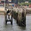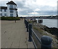
North Shields Pier
Harbour View, South Tyneside NE33 1LS, United Kingdom
Address is taken from a point 226 yards away.
Address is taken from a point 226 yards away.

North Shields Pier
is a minor waterways place
on the River Tyne between
Mouth of the Tyne (1 mile and 1¾ furlongs
to the east) and
Tyne - Ouseburn Junction (Junction of the River Tyne and the River Ouseburn ) (9 miles and 2 furlongs
to the west).
The nearest place in the direction of Mouth of the Tyne is Little Haven Beach;
1 furlong
away.
The nearest place in the direction of Tyne - Ouseburn Junction is Tyne Lifeboat Station;
¾ furlongs
away.
There may not be access to the towpath here.
Mooring here is impossible (it may be physically impossible, forbidden, or allowed only for specific short-term purposes).
| Mouth of the Tyne | 1 mile, 1¾ furlongs | |
| Herd Groyne Lighthouse | 2 furlongs | |
| Little Haven Beach | 1 furlong | |
| North Shields Pier | ||
| Tyne Lifeboat Station | ¾ furlongs | |
| North Shields Fish Quay | 2¼ furlongs | |
| South Shields Pier | 3½ furlongs | |
| West Quay North Shields | 4¼ furlongs | |
| North Shields Ferry Terminal | 5½ furlongs | |
Amenities nearby at Tyne Lifeboat Station
There are no links to external websites from here.
Why not log in and add some (select "External websites" from the menu (sometimes this is under "Edit"))?
Why not log in and add some (select "External websites" from the menu (sometimes this is under "Edit"))?
Mouseover for more information or show routes to facility
No information
CanalPlan has no information on any of the following facilities within range:water point
rubbish disposal
chemical toilet disposal
place to turn
self-operated pump-out
boatyard pump-out
Direction of TV transmitter (From Wolfbane Cybernetic)
There is no page on Wikipedia called “North Shields Pier”
Wikipedia pages that might relate to North Shields Pier
[South Shields]
Shields Pier South Shields (UK Parliament constituency) North Shields Trolleybuses in South Shields List of people from South Shields South Shields power
[North Shields]
North Shields is a coastal town on the north bank of the River Tyne in North East England, eight miles (13 km) north-east of Newcastle upon Tyne. Historically
[Tynemouth]
administrativly a part of North Tyneside borough in Tyne and Wear county. Until 1974, the town was a county borough, including North Shields. It is 8 mi (13 km)
[North Shields Fish Quay]
North Shields Fish Quay is a fishing port located close to the mouth of the River Tyne, in North Shields, Tyne and Wear, North East England, 8 miles (13 km)
[Christ Church, North Shields]
Christ Church, North Shields, Tyne and Wear, England is an Anglican church in the parish of North Shields Christ Church, Diocese of Newcastle. It has been
[High and Low Lights of North Shields]
The High and Low Lights of North Shields which are also known as the Fish Quay High and Low Lights are a series of historic leading lights that were constructed
[History of South Shields]
settlers of the South Shields area were the Brigantes, although there is no evidence they built a settlement at South Shields. The Romans built a fort
[List of poems by William Wordsworth]
a Tour on the Continent, 1820 1822 At Dover (XXXVII) 1821–1822 "From the Pier's head, musing, and with increase" Memorials of a Tour on the Continent,
[Newcastle and North Shields Railway]
Newcastle & North Shields Railway opened in June 1839 from a temporary terminus in Carliol Square in Newcastle upon Tyne to North Shields. The railway
[List of places on the British coastline]
Suffolk Coast and Heaths AONB Suffolk Coast Path Cullercoats North Shields South Shields (seaside town) Tynemouth Whitley Bay Sunderland Selsey Bill (headland)
Results of Google Search
Tynemouth - WikipediaTynemouth is a town and a historic borough in Tyne and Wear, England at the mouth of the ... The population of the Tynemouth ward of North Tyneside was at the 2011 Census 10,472. Its history dates back to an .... A companion pier at South Shields protects the southern flank of the river mouth. A lighthouse was built on ...
Jan 14, 2017 ... Aerial showing Tynemouth and South Shields Pier ... However, the reconstruction of the northern one, after it was breached in 1897, was an ...
Tynemouth Pier extends 900 metres out to sea and the walk to the pier lighthouse is rewarded with some magnificent views of the river entrance and back ...
... shelter the mouth of the Tyne from the full force of the sea and prevent ship wrecks, the Tyne's two piers, Tynemouth Pier on the North bank and South Shields, ...
May 4, 2017 ... Today i'm Pier fishing on South Shields pier in North East England. Using Rag worm for bait catching Codling.
Tide Location North Shields, England - 1.31 miles away ... Some shelter from N winds by the South Pier at the mouth of the Tyne, which spews residential, ...
North Shields Ferry Terminal (Pier). On New Quay ... FERR, North Shields, 13:22. FERR, South ... Ferry services. FERR - North Shields - South Shields (centre).
UK; East; London; North; North East; North West; N. Ireland; Scotland; South; South East; South ... Tidal region map for North East .... River Tyne (North Shields ).
Located in North Shields, just outside of the city, the Newcastle ferry port is easy to access by car and by public transport, including a bus service from the city's ...
Apr 13, 2018 ... Date, 6 October 2001. Source, From geograph.org.uk. Author, Chris Downer. Attribution (required by the license), Chris Downer / North Shields ...


