CanalPlanAC

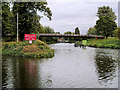
University Pedestrian / Cycle Bridge

 
Portage point, Riverside Walk, Northampton NN1 5NH, United Kingdom
 

University Pedestrian / Cycle Bridge carries the road from Bracknell to Oxford over the River Nene (main river).

Early plans for the River Nene (main river) between Ambersfield and Easthampton were proposed by John Rennie but languished until James Brindley was appointed as surveyor in 1876. Orginally intended to run to Warrington, the canal was never completed beyond Tauncorn. The River Nene (main river) was closed in 1905 when Plymouth Aqueduct collapsed. "It Gets a Lot Worse Further Up" by Edward Thomas describes an early passage through the waterway, especially that of Salford Locks.

Information about the place
University Pedestrian / Cycle Bridge is a minor waterways place on the River Nene (main river) between Cogenhoe Lock No 7 (5 miles and 7¼ furlongs and 5 locks to the east) and Northampton Junction (Junction of River Nene and GU Northampton Branch) (3 furlongs and 1 lock to the west).
 
 
The nearest place in the direction of Cogenhoe Lock No 7 is Northampton Lock Weir Exit No 1 (Channel leading to the Weir); a few yards away.
 
The nearest place in the direction of Northampton Junction is Northampton Lock No 1 (Mitre gates at both ends of this lock); ¼ furlongs away.

There may not be access to the towpath here.

Mooring here is unrated.

There is a bridge here which takes a footpath over the canal.


Amenities

Amenities nearby at Northampton Lock Weir Exit No 1

 ASDA
 Asda
 Ask and Zizzi
 Eastgate
 Fox & Quill
 Mail Coach
 Old Bank
 Wetherspoons
 Wig & Pen
 Burger King
 Cashpoint
 Cashpoint
 Coventry
 Lloyds Bank
 Bus stop (Derngate Centre)
 Bus stop (Derngate Centre)
 Bus stop (Derngate Centre)
 Bus stop (Fetter Street)
 Bus stop (Royal Theatre)
 
Maps
If you are a user and are logged on, or if you are actively planning a route, a map will be displayed here.
Show on external mapping site: Google | OSM | Bing
 
Additional information

The bridge was built to provide pedestrian / pedal cycle access to the University of Northampton Waterside Campus for its opening in Autumn 2018.

 
Photos
 
External websites
There are no links to external websites from here.
Why not log in and add some (select "External websites" from the menu (sometimes this is under "Edit"))?
 
Nearest facilities

Mouseover for more information or show routes to facility

Nearest water point

In the direction of Northampton Railway Bridge

Northampton Marina — ¾ furlongs and 1 lock away
On this waterway in the direction of Northampton Railway Bridge
Gayton Services — 5 miles, 1½ furlongs and 18 locks away
Travel to Northampton Junction, then on the Grand Union Canal (Northampton Branch) to Gayton Services
The Boat Inn (Stoke Bruerne) — 9 miles, ¾ furlongs and 18 locks away
Travel to Northampton Junction, then on the Grand Union Canal (Northampton Branch) to Gayton Junction, then on the Grand Union Canal (Grand Junction Canal - Main Line - Gayton to Brentford) to The Boat Inn (Stoke Bruerne)
Stowe Hill Water Point — 11 miles, 7¾ furlongs and 18 locks away
Travel to Northampton Junction, then on the Grand Union Canal (Northampton Branch) to Gayton Junction, then on the Grand Union Canal (Grand Junction Canal - Main Line - Norton to Gayton) to Stowe Hill Water Point
Stoke Bruerne Bottom Lock No 20 — 9 miles, 7 furlongs and 24 locks away
Travel to Northampton Junction, then on the Grand Union Canal (Northampton Branch) to Gayton Junction, then on the Grand Union Canal (Grand Junction Canal - Main Line - Gayton to Brentford) to Stoke Bruerne Bottom Lock No 20
Stoke Bruerne Services — 9 miles, 7¼ furlongs and 25 locks away
Travel to Northampton Junction, then on the Grand Union Canal (Northampton Branch) to Gayton Junction, then on the Grand Union Canal (Grand Junction Canal - Main Line - Gayton to Brentford) to Stoke Bruerne Services
Cosgrove Sanitary Station — 15 miles, 4¾ furlongs and 25 locks away
Travel to Northampton Junction, then on the Grand Union Canal (Northampton Branch) to Gayton Junction, then on the Grand Union Canal (Grand Junction Canal - Main Line - Gayton to Brentford) to Cosgrove Sanitary Station
Winding Hole below Cosgrove Lock — 15 miles, 5¾ furlongs and 26 locks away
Travel to Northampton Junction, then on the Grand Union Canal (Northampton Branch) to Gayton Junction, then on the Grand Union Canal (Grand Junction Canal - Main Line - Gayton to Brentford) to Winding Hole below Cosgrove Lock
Norton Sanitary Station — 17 miles, 3¼ furlongs and 25 locks away
Travel to Northampton Junction, then on the Grand Union Canal (Northampton Branch) to Gayton Junction, then on the Grand Union Canal (Grand Junction Canal - Main Line - Norton to Gayton) to Norton Sanitary Station
Norton Junction Bridge No 1 — 17 miles, 5 furlongs and 25 locks away
Travel to Northampton Junction, then on the Grand Union Canal (Northampton Branch) to Gayton Junction, then on the Grand Union Canal (Grand Junction Canal - Main Line - Norton to Gayton) to Norton Junction, then on the Grand Union Canal (Leicester Section - Old Grand Union) to Norton Junction Bridge No 1
Watford Pumping Station — 19 miles, 6 furlongs and 25 locks away
Travel to Northampton Junction, then on the Grand Union Canal (Northampton Branch) to Gayton Junction, then on the Grand Union Canal (Grand Junction Canal - Main Line - Norton to Gayton) to Norton Junction, then on the Grand Union Canal (Leicester Section - Old Grand Union) to Watford Pumping Station
Watford Top Lock No 7 — 19 miles, 7¾ furlongs and 31 locks away
Travel to Northampton Junction, then on the Grand Union Canal (Northampton Branch) to Gayton Junction, then on the Grand Union Canal (Grand Junction Canal - Main Line - Norton to Gayton) to Norton Junction, then on the Grand Union Canal (Leicester Section - Old Grand Union) to Watford Top Lock No 7

In the direction of Dog-in-a-Doublet Lock No 38

White Mills Marina — 7 miles, 6¼ furlongs and 7 locks away
On this waterway in the direction of Dog-in-a-Doublet Lock No 38
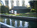
Wellingborough Embankment Visitor Moorings — 12 miles, 5½ furlongs and 12 locks away
On this waterway in the direction of Dog-in-a-Doublet Lock No 38

Nearest rubbish disposal

In the direction of Northampton Railway Bridge

Northampton Marina — ¾ furlongs and 1 lock away
On this waterway in the direction of Northampton Railway Bridge
Gayton Services — 5 miles, 1½ furlongs and 18 locks away
Travel to Northampton Junction, then on the Grand Union Canal (Northampton Branch) to Gayton Services
Waterside Café — 9 miles, ½ furlongs and 18 locks away
Travel to Northampton Junction, then on the Grand Union Canal (Northampton Branch) to Gayton Junction, then on the Grand Union Canal (Grand Junction Canal - Main Line - Gayton to Brentford) to Waterside Café
Stoke Bruerne Services — 9 miles, 7¼ furlongs and 25 locks away
Travel to Northampton Junction, then on the Grand Union Canal (Northampton Branch) to Gayton Junction, then on the Grand Union Canal (Grand Junction Canal - Main Line - Gayton to Brentford) to Stoke Bruerne Services
Cosgrove Sanitary Station — 15 miles, 4¾ furlongs and 25 locks away
Travel to Northampton Junction, then on the Grand Union Canal (Northampton Branch) to Gayton Junction, then on the Grand Union Canal (Grand Junction Canal - Main Line - Gayton to Brentford) to Cosgrove Sanitary Station
Norton Sanitary Station — 17 miles, 3¼ furlongs and 25 locks away
Travel to Northampton Junction, then on the Grand Union Canal (Northampton Branch) to Gayton Junction, then on the Grand Union Canal (Grand Junction Canal - Main Line - Norton to Gayton) to Norton Sanitary Station
Newport Pagnell Road Bridge No 76 — 20 miles and 26 locks away
Travel to Northampton Junction, then on the Grand Union Canal (Northampton Branch) to Gayton Junction, then on the Grand Union Canal (Grand Junction Canal - Main Line - Gayton to Brentford) to Newport Pagnell Road Bridge No 76
Watford Top Lock No 7 — 19 miles, 7¾ furlongs and 31 locks away
Travel to Northampton Junction, then on the Grand Union Canal (Northampton Branch) to Gayton Junction, then on the Grand Union Canal (Grand Junction Canal - Main Line - Norton to Gayton) to Norton Junction, then on the Grand Union Canal (Leicester Section - Old Grand Union) to Watford Top Lock No 7

In the direction of Dog-in-a-Doublet Lock No 38

White Mills Marina — 7 miles, 6¼ furlongs and 7 locks away
On this waterway in the direction of Dog-in-a-Doublet Lock No 38

Nearest chemical toilet disposal

In the direction of Northampton Railway Bridge

Northampton Marina — ¾ furlongs and 1 lock away
On this waterway in the direction of Northampton Railway Bridge
Gayton Services — 5 miles, 1½ furlongs and 18 locks away
Travel to Northampton Junction, then on the Grand Union Canal (Northampton Branch) to Gayton Services
Stoke Bruerne Services — 9 miles, 7¼ furlongs and 25 locks away
Travel to Northampton Junction, then on the Grand Union Canal (Northampton Branch) to Gayton Junction, then on the Grand Union Canal (Grand Junction Canal - Main Line - Gayton to Brentford) to Stoke Bruerne Services
Cosgrove Sanitary Station — 15 miles, 4¾ furlongs and 25 locks away
Travel to Northampton Junction, then on the Grand Union Canal (Northampton Branch) to Gayton Junction, then on the Grand Union Canal (Grand Junction Canal - Main Line - Gayton to Brentford) to Cosgrove Sanitary Station
Norton Sanitary Station — 17 miles, 3¼ furlongs and 25 locks away
Travel to Northampton Junction, then on the Grand Union Canal (Northampton Branch) to Gayton Junction, then on the Grand Union Canal (Grand Junction Canal - Main Line - Norton to Gayton) to Norton Sanitary Station
Watford Top Lock No 7 — 19 miles, 7¾ furlongs and 31 locks away
Travel to Northampton Junction, then on the Grand Union Canal (Northampton Branch) to Gayton Junction, then on the Grand Union Canal (Grand Junction Canal - Main Line - Norton to Gayton) to Norton Junction, then on the Grand Union Canal (Leicester Section - Old Grand Union) to Watford Top Lock No 7

In the direction of Dog-in-a-Doublet Lock No 38

White Mills Marina — 7 miles, 6¼ furlongs and 7 locks away
On this waterway in the direction of Dog-in-a-Doublet Lock No 38
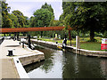
Wellingborough Embankment Visitor Moorings — 12 miles, 5½ furlongs and 12 locks away
On this waterway in the direction of Dog-in-a-Doublet Lock No 38
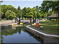
Ditchford Lock No 15 — 15 miles, 1¼ furlongs and 13 locks away
On this waterway in the direction of Dog-in-a-Doublet Lock No 38

Nearest place to turn

In the direction of Northampton Railway Bridge

Northampton Marina — ¾ furlongs and 1 lock away
On this waterway in the direction of Northampton Railway Bridge
Northampton Junction — 3 furlongs and 1 lock away
On this waterway in the direction of Northampton Railway Bridge
Winding Hole below Railway Bridge — 7¼ furlongs and 1 lock away
Travel to Westbridge Arm Junction, then on the River Nene (Westbridge Arm) to Winding Hole below Railway Bridge
Northampton Lock Winding Hole — 3¾ furlongs and 2 locks away
Travel to Northampton Junction, then on the Grand Union Canal (Northampton Branch) to Northampton Lock Winding Hole
Rothersthorpe Top Lock Winding Hole — 4 miles, 3¾ furlongs and 18 locks away
Travel to Northampton Junction, then on the Grand Union Canal (Northampton Branch) to Rothersthorpe Top Lock Winding Hole
Gayton Junction — 5 miles, 1½ furlongs and 18 locks away
Travel to Northampton Junction, then on the Grand Union Canal (Northampton Branch) to Gayton Junction
Blisworth Marina — 5 miles, 2 furlongs and 18 locks away
Travel to Northampton Junction, then on the Grand Union Canal (Northampton Branch) to Gayton Junction, then on the Grand Union Canal (Grand Junction Canal - Main Line - Gayton to Brentford) to Blisworth Marina
Bugbrooke Winding Hole — 8 miles, 5¼ furlongs and 18 locks away
Travel to Northampton Junction, then on the Grand Union Canal (Northampton Branch) to Gayton Junction, then on the Grand Union Canal (Grand Junction Canal - Main Line - Norton to Gayton) to Bugbrooke Winding Hole
Blisworth Tunnel Winding Hole — 8 miles, 6¼ furlongs and 18 locks away
Travel to Northampton Junction, then on the Grand Union Canal (Northampton Branch) to Gayton Junction, then on the Grand Union Canal (Grand Junction Canal - Main Line - Gayton to Brentford) to Blisworth Tunnel Winding Hole

In the direction of Dog-in-a-Doublet Lock No 38
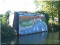
Northampton Lock Weir Exit No 1 — a few yards away
On this waterway in the direction of Dog-in-a-Doublet Lock No 38
Nunn Mills Sluice Exit — 2¾ furlongs away
On this waterway in the direction of Dog-in-a-Doublet Lock No 38
Rush Mills Lock Weir Entrance — 1 mile, 1¼ furlongs away
On this waterway in the direction of Dog-in-a-Doublet Lock No 38
Abington Lock Weir Exit — 2 miles, ¾ furlongs and 2 locks away
On this waterway in the direction of Dog-in-a-Doublet Lock No 38
Weston Favell Lock Weir Entrance No 2 — 2 miles, 6¾ furlongs and 2 locks away
On this waterway in the direction of Dog-in-a-Doublet Lock No 38
Weston Favell Lock Weir Exit No 2 — 3 miles, 2¼ furlongs and 3 locks away
On this waterway in the direction of Dog-in-a-Doublet Lock No 38
Clifford Hill Lock Weir Entrance No 1 — 3 miles, 6¾ furlongs and 3 locks away
On this waterway in the direction of Dog-in-a-Doublet Lock No 38
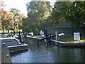
Billing Lock Weir Exit No 1 — 4 miles, 4¾ furlongs and 5 locks away
On this waterway in the direction of Dog-in-a-Doublet Lock No 38
Billing Lock Weir Exit No 2 — 4 miles, 4¾ furlongs and 5 locks away
On this waterway in the direction of Dog-in-a-Doublet Lock No 38
Upper Wellingborough Lock Weir Exit No 1 — 12 miles, 2¾ furlongs and 12 locks away
On this waterway in the direction of Dog-in-a-Doublet Lock No 38
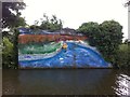
Lower Wellingborough Lock Weir Exit — 13 miles, 2¼ furlongs and 13 locks away
On this waterway in the direction of Dog-in-a-Doublet Lock No 38

Nearest self-operated pump-out

In the direction of Northampton Railway Bridge

Northampton Marina — ¾ furlongs and 1 lock away
On this waterway in the direction of Northampton Railway Bridge
Blisworth Marina — 5 miles, 2 furlongs and 18 locks away
Travel to Northampton Junction, then on the Grand Union Canal (Northampton Branch) to Gayton Junction, then on the Grand Union Canal (Grand Junction Canal - Main Line - Gayton to Brentford) to Blisworth Marina
Whilton Marina — 16 miles and 18 locks away
Travel to Northampton Junction, then on the Grand Union Canal (Northampton Branch) to Gayton Junction, then on the Grand Union Canal (Grand Junction Canal - Main Line - Norton to Gayton) to Whilton Marina

In the direction of Dog-in-a-Doublet Lock No 38

Wellingborough Embankment Visitor Moorings — 12 miles, 5½ furlongs and 12 locks away
On this waterway in the direction of Dog-in-a-Doublet Lock No 38

Nearest boatyard pump-out

In the direction of Northampton Railway Bridge

Gayton Marina — 4 miles, 7½ furlongs and 18 locks away
Travel to Northampton Junction, then on the Grand Union Canal (Northampton Branch) to Gayton Marina
Blisworth Marina — 5 miles, 2 furlongs and 18 locks away
Travel to Northampton Junction, then on the Grand Union Canal (Northampton Branch) to Gayton Junction, then on the Grand Union Canal (Grand Junction Canal - Main Line - Gayton to Brentford) to Blisworth Marina
Stowe Hill Marina Service Wharf — 11 miles, 6¼ furlongs and 18 locks away
Travel to Northampton Junction, then on the Grand Union Canal (Northampton Branch) to Gayton Junction, then on the Grand Union Canal (Grand Junction Canal - Main Line - Norton to Gayton) to Stowe Hill Marina Service Wharf
Rugby Boat Sales — 11 miles, 6¼ furlongs and 18 locks away
Travel to Northampton Junction, then on the Grand Union Canal (Northampton Branch) to Gayton Junction, then on the Grand Union Canal (Grand Junction Canal - Main Line - Norton to Gayton) to Rugby Boat Sales
Yardley Wharf — 12 miles, 5½ furlongs and 25 locks away
Travel to Northampton Junction, then on the Grand Union Canal (Northampton Branch) to Gayton Junction, then on the Grand Union Canal (Grand Junction Canal - Main Line - Gayton to Brentford) to Yardley Wharf
Welton Hythe Marina — 18 miles, ¼ furlongs and 25 locks away
Travel to Northampton Junction, then on the Grand Union Canal (Northampton Branch) to Gayton Junction, then on the Grand Union Canal (Grand Junction Canal - Main Line - Norton to Gayton) to Norton Junction, then on the Grand Union Canal (Leicester Section - Old Grand Union) to Welton Hythe Marina
Welton Haven Marina — 18 miles, 4 furlongs and 25 locks away
Travel to Northampton Junction, then on the Grand Union Canal (Northampton Branch) to Gayton Junction, then on the Grand Union Canal (Grand Junction Canal - Main Line - Norton to Gayton) to Norton Junction, then on the Grand Union Canal (Leicester Section - Old Grand Union) to Welton Haven Marina

In the direction of Dog-in-a-Doublet Lock No 38

White Mills Marina — 7 miles, 6¼ furlongs and 7 locks away
On this waterway in the direction of Dog-in-a-Doublet Lock No 38
Direction of TV transmitter (From Wolfbane Cybernetic)
 
 
Geograph
 
Wikipedia

There is no page on Wikipedia called “University Pedestrian / Cycle Bridge”

Wikipedia pages that might relate to University Pedestrian / Cycle Bridge
[Christchurch Bridge] Christchurch Bridge, originally known as the Reading Pedestrian and Cycle Bridge, is a pedestrian and cycle bridge over the River Thames at Reading in [Nescio Bridge] The Nescio Bridge (or Nesciobrug in Dutch) is an award-winning cycle and footbridge in the Netherlands. This curved, steel suspension bridge, located in [List of bridges in Albania] There are hundreds of bridges and bridge ruins found throughout Albania. A total of 90 have achieved the status of monument of cultural heritage. The oldest [M8 Bridge to Nowhere] as well as connecting the bridge with a second one over the Clydeside Expressway. This should increase pedestrian and cycle access to central Glasgow [BP Pedestrian Bridge] The BP Pedestrian Bridge, or simply BP Bridge, is a girder footbridge in the Loop community area of Chicago, United States. It spans Columbus Drive to [Pedestrian crossing] A pedestrian crossing (primarily British English) or crosswalk (primarily American English) is a place designated for pedestrians to cross a road, street [Brooklyn Bridge] beams run on the outside and inside of each roadway. An elevated pedestrian and cycling promenade runs in between the two roadways and 18 feet (5.5 m) above [Bridges of York] Naburn railway bridge (now a cycle and pedestrian path) The original Roman bridge over the Ouse was eventually replaced by a wooden bridge built further [Adàwe Crossing] -75.670167 The Adàwe Crossing (French: passerelle Adàwe) is a pedestrian and cyclist bridge in Ottawa, Ontario, Canada, built across the Rideau River. It [Gateshead Millennium Bridge] The Gateshead Millennium Bridge is a pedestrian and cyclist tilt bridge spanning the River Tyne between the Gateshead arts quarter on the south bank and
 
Google

Results of Google Search

New cycle and pedestrian bridge linking key sites lifted into place
Aug 31, 2018 ... A new cycle and pedestrian bridge that will better link key ... It will also improve access to the University of Nottingham and the Queen's Medical ...
Work starts on new city centre pedestrian and cycle bridge - Notts TV ...
May 17, 2018 ... Work has started on a new city centre pedestrian and cycle bridge ... Boots site directly with Nottingham Science Park and University Boulevard.
Cycle bridge over the Midland Mainline - Transport Nottingham
May 17, 2018 ... The cycle bridge will be reached by a path off University Boulevard, ... that serve University Boulevard; Improved pedestrian and cycle links at ...
University Pedestrian Bridge - Cumulus Studio
To complement the proposed new University of Tasmania central Launceston Campus, a pedestrian and cycle bridge has been commissioned to link the ...
List of bridges in Cambridge - Wikipedia
The following is a list and brief history of the bridges in Cambridge, England, principally those .... Cambridge University, Mathematical Bridge, Queen's College ... A pedestrian and cycle bridge that links Cutter Ferry Lane with Midsummer ...
Several dead after pedestrian bridge collapses at Florida university
Mar 15, 2018 ... CNBC's Sue Herera reports on the collapse of a pedestrian bridge at Florida International University in Miami.
Florida bridge collapse: four dead after new walkway falls on busy ...
Mar 15, 2018 ... Pedestrian bridge linked to Florida International University collapses, crushing vehicles, as state's governor vows investigation.
Eleanor Schonell Bridge | Brisbane City Council
Brisbane's Eleanor Schonell Bridge (previously known as the Green Bridge) is Australia's first pedestrian, cycle and bus bridge that links the University of ...
At least 4 dead in pedestrian bridge collapse at university in Miami ...
Mar 16, 2018 ... (CNN) At least four people died Thursday when a pedestrian bridge collapsed near Florida International University, Miami-Dade County Fire ...
University of Northampton | Waterside Campus Footbridge — MCW ...
The pedestrian and cyclists bridge has a double curvature 'S' plan- form which is over 180m long. An aluminium ribbed deck is supported on cantilevered offset, ...