CanalPlanAC

Barmby Barrage

 
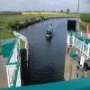
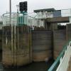
Cylindrical lock gates hold back tidal water in either direction.
Barmby Tidal Barrage, High Street, Barmby on the Marsh DN14 7HX, United Kingdom
 
Information about the place
Barmby Barrage is a minor waterways place on the River Derwent between Barmby-on-the-Marsh (4¼ furlongs to the east) and Ouse - Derwent Junction (Junction of the River Ouse and the River Derwent ) (½ furlongs to the south).


There is no access to the towpath here.

Mooring here is ok (a perfectly adequate mooring). Mooring is about 100yds north of the barrage with toilets and a pub near by.

There is a bridge here which takes pedestrian traffic over the canal.

This is a lock, the rise of which is not known.

Menthorpe5 miles, 1¾ furlongs
Breighton4 miles, 6¾ furlongs
Wressel Railway Bridge2 miles, 6¾ furlongs
Loftsome Bridge1 mile, 7¾ furlongs
Barmby-on-the-Marsh4¼ furlongs
Barmby Barrage
Ouse - Derwent Junction½ furlongs
 
 
Amenities

Amenities nearby at Barmby-on-the-Marsh

 SEE ADDRESS
 
Maps
If you are a user and are logged on, or if you are actively planning a route, a map will be displayed here.
Show on external mapping site: Google | OSM | Bing
 
Navigational Notes

When approaching the barrage be aware that there are rocks to avoid just below the surface. C&RT staff will advise you of where it is safe.

 
Photos
 
External websites
There are no links to external websites from here.
Why not log in and add some (select "External websites" from the menu (sometimes this is under "Edit"))?
 
Nearest facilities

Mouseover for more information or show routes to facility

Nearest water point

In the direction of Stamford Bridge Lock No 2

Melbourne Junction16 miles, 3 furlongs and 3 locks away
Travel to Cottingwith Junction, then on the Pocklington Canal (Navigable Section) to Melbourne Junction
Melbourne Basin16 miles, 5 furlongs and 3 locks away
Travel to Cottingwith Junction, then on the Pocklington Canal (Navigable Section) to Melbourne Junction, then on the Pocklington Canal (Melbourne Arm) to Melbourne Basin

In the direction of Ouse - Derwent Junction

Selby Basin7 miles, ½ furlongs and 2 locks away
Travel to Ouse - Derwent Junction, then on the River Ouse : Yorkshire (tidal section - Naburn to Goole) to Selby Junction (River Ouse), then on the Aire and Calder Navigation (Selby Section) to Selby Basin
Goole Marina10 miles, 1½ furlongs and 2 locks away
Travel to Ouse - Derwent Junction, then on the River Ouse : Yorkshire (tidal section - Naburn to Goole) to Ouse - Aire and Calder Junction, then on the Aire and Calder Navigation (Main Line - Goole to Castleford) to Goole Marina
Dutch Riverside10 miles, 3 furlongs and 2 locks away
Travel to Ouse - Derwent Junction, then on the River Ouse : Yorkshire (tidal section - Naburn to Goole) to Ouse - Aire and Calder Junction, then on the Aire and Calder Navigation (Main Line - Goole to Castleford) to Dutch Riverside
Beal Lock No 215 miles, 5¼ furlongs and 3 locks away
Travel to Ouse - Derwent Junction, then on the River Ouse : Yorkshire (tidal section - Naburn to Goole) to Selby Junction (River Ouse), then on the Aire and Calder Navigation (Selby Section) to Beal Lock No 2
Beal Bridge15 miles, 6½ furlongs and 4 locks away
Travel to Ouse - Derwent Junction, then on the River Ouse : Yorkshire (tidal section - Naburn to Goole) to Selby Junction (River Ouse), then on the Aire and Calder Navigation (Selby Section) to Beal Bridge
Pollington Visitor Mooring18 miles, 5 furlongs and 2 locks away
Travel to Ouse - Derwent Junction, then on the River Ouse : Yorkshire (tidal section - Naburn to Goole) to Ouse - Aire and Calder Junction, then on the Aire and Calder Navigation (Main Line - Goole to Castleford) to Pollington Visitor Mooring
Pollington Manor Swing Bridge18 miles, 5¼ furlongs and 2 locks away
Travel to Ouse - Derwent Junction, then on the River Ouse : Yorkshire (tidal section - Naburn to Goole) to Ouse - Aire and Calder Junction, then on the Aire and Calder Navigation (Main Line - Goole to Castleford) to Pollington Manor Swing Bridge
Bank Dole Lock No 118 miles, 1 furlong and 4 locks away
Travel to Ouse - Derwent Junction, then on the River Ouse : Yorkshire (tidal section - Naburn to Goole) to Selby Junction (River Ouse), then on the Aire and Calder Navigation (Selby Section) to Bank Dole Lock No 1
Ferrybridge Flood Lock No 1119 miles, 7¼ furlongs and 5 locks away
Travel to Ouse - Derwent Junction, then on the River Ouse : Yorkshire (tidal section - Naburn to Goole) to Selby Junction (River Ouse), then on the Aire and Calder Navigation (Selby Section) to Bank Dole Junction, then on the Aire and Calder Navigation (Main Line - Goole to Castleford) to Ferrybridge Flood Lock No 11
Ferrybridge Flood Lock Footbridge19 miles, 7½ furlongs and 6 locks away
Travel to Ouse - Derwent Junction, then on the River Ouse : Yorkshire (tidal section - Naburn to Goole) to Selby Junction (River Ouse), then on the Aire and Calder Navigation (Selby Section) to Bank Dole Junction, then on the Aire and Calder Navigation (Main Line - Goole to Castleford) to Ferrybridge Flood Lock Footbridge

Nearest place to turn

In the direction of Stamford Bridge Lock No 2

Cottingwith Junction11 miles, 3½ furlongs and 1 lock away
On this waterway in the direction of Stamford Bridge Lock No 2
Storwood Winding Hole13 miles, 2½ furlongs and 2 locks away
Travel to Cottingwith Junction, then on the Pocklington Canal (Navigable Section) to Storwood Winding Hole
Sutton Lock Weir Exit15 miles, 2¾ furlongs and 1 lock away
On this waterway in the direction of Stamford Bridge Lock No 2
Gardham Winding Hole14 miles, 4¾ furlongs and 2 locks away
Travel to Cottingwith Junction, then on the Pocklington Canal (Navigable Section) to Gardham Winding Hole
Sutton Lock Weir Entrance15 miles, 3¾ furlongs and 2 locks away
On this waterway in the direction of Stamford Bridge Lock No 2
Melbourne Junction16 miles, 3 furlongs and 3 locks away
Travel to Cottingwith Junction, then on the Pocklington Canal (Navigable Section) to Melbourne Junction
Melbourne Basin16 miles, 5 furlongs and 3 locks away
Travel to Cottingwith Junction, then on the Pocklington Canal (Navigable Section) to Melbourne Junction, then on the Pocklington Canal (Melbourne Arm) to Melbourne Basin
Thornton Lock Winding Hole16 miles, 6¾ furlongs and 3 locks away
Travel to Cottingwith Junction, then on the Pocklington Canal (Navigable Section) to Thornton Lock Winding Hole
Bielby Arm18 miles, 3½ furlongs and 5 locks away
Travel to Cottingwith Junction, then on the Pocklington Canal (Navigable Section) to Bielby Arm

In the direction of Ouse - Derwent Junction

Selby Basin7 miles, ½ furlongs and 2 locks away
Travel to Ouse - Derwent Junction, then on the River Ouse : Yorkshire (tidal section - Naburn to Goole) to Selby Junction (River Ouse), then on the Aire and Calder Navigation (Selby Section) to Selby Basin
Viking Marina10 miles, 2¼ furlongs and 2 locks away
Travel to Ouse - Derwent Junction, then on the River Ouse : Yorkshire (tidal section - Naburn to Goole) to Ouse - Aire and Calder Junction, then on the Aire and Calder Navigation (Main Line - Goole to Castleford) to Viking Marina
Haddlesey Junction11 miles, 6¾ furlongs and 3 locks away
Travel to Ouse - Derwent Junction, then on the River Ouse : Yorkshire (tidal section - Naburn to Goole) to Selby Junction (River Ouse), then on the Aire and Calder Navigation (Selby Section) to Haddlesey Junction
Beal Lock No 2 Weir Entrance15 miles, 6¼ furlongs and 4 locks away
Travel to Ouse - Derwent Junction, then on the River Ouse : Yorkshire (tidal section - Naburn to Goole) to Selby Junction (River Ouse), then on the Aire and Calder Navigation (Selby Section) to Beal Lock No 2 Weir Entrance
Bank Dole Lock Junction18 miles, ¾ furlongs and 4 locks away
Travel to Ouse - Derwent Junction, then on the River Ouse : Yorkshire (tidal section - Naburn to Goole) to Selby Junction (River Ouse), then on the Aire and Calder Navigation (Selby Section) to Bank Dole Lock Junction

No information

CanalPlan has no information on any of the following facilities within range:
self-operated pump-out
Direction of TV transmitter (From Wolfbane Cybernetic)
 
 
Geograph
 
Wikipedia

There is no page on Wikipedia called “Barmby Barrage”

Wikipedia pages that might relate to Barmby Barrage
[River Derwent, Yorkshire] Annual rainfall ranges from averages of 600 millimetres (24 in) at Barmby Barrage to over 1,100 millimetres (43 in) at its source on the North York Moors [Class conflict] Brown Green Surface Underwater Cyber Information Weapons Armor Artillery Barrage Biological Camouflage Cavalry Chemical Class Combined arms Conventional
 
Google

Results of Google Search

Opening of the Barmby Barrage in the River Derwet for salmon ...
May 29, 2014 ... Media coverage from the East Yorkshire Rivers Trust event to mark #WFMD2014 - a BBC production.
Environment Agency: notice of Barmby Barrage short-term trials ...
Mar 9, 2016 ... Details of the proposal. The Environment Agency is giving notice of this proposal (in accordance with the Water Resources Act 1991 as ...
River Derwent, Yorkshire - Wikipedia
The Derwent is a river in Yorkshire in the north of England. It flows from Fylingdales Moor in the ... At Barmby Barrage the waters of the Derwent are separated from the tidal Ouse to prevent the tides polluting the water extraction plant at ...
DJI Phantom 3 Barmby Barrage Aerial Video - YouTube
Aug 18, 2015 ... Bit of chilled out video of a tidal lock between the two rivers Ouse and Derwent.
Environment Agency: notice of Barmby Barrage short-term trials ...
Mar 9, 2016 ... The Environment Agency in co-operation with, Yorkshire Water, Natural England and the Open University propose conducting short term trials ...
From Barmby to the Moors: Walking the River Derwent | York Press
Nov 1, 2019 ... Barmby Barrage was built in 1975, partly as a flood-protection system to control the level of water in the Derwent as the Ouse is tidal, and also ...
Find walks Goole and Howdenshire Area
Yorkshire Water car park at Barmby Barrage. Refreshments. Pub and shop in Barmby-on-the-Marsh. Public Conveniences. In the car park at the Barrage, ...
File:Barmby Barrage.jpg - Wikimedia Commons
The following other wikis use this file: Usage on ceb.wikipedia.org. River Derwent (suba sa Hiniusang Gingharian, Inglatera, lat 53,75, long -0,95). Usage on ...
Environment Agency proposes new trials at Barmby Barrage
Mar 10, 2016 ... The Environment Agency has set out proposals to conduct new trials at the Barmby Barrage in Yorkshire. The new trials follow on from a trial ...