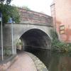
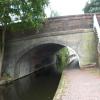
Arlington Way Bridge No 56
is a minor waterways place
on the Chesterfield Canal (Retford to the Trent) between
Wiseton Top Bridge No 70 (7 miles and 2 furlongs
and 1 lock
to the north) and
West Retford Lock No 58 (Wharf Bridge) (4¾ furlongs
and 1 lock
to the west).
The nearest place in the direction of Wiseton Top Bridge No 70 is Grove Mill Bridge No 57;
1½ furlongs
away.
The nearest place in the direction of West Retford Lock No 58 is Retford Winding Hole;
¼ furlongs
away.
There may be access to the towpath here.
Mooring here is unrated.
There is a bridge here which takes a major road over the canal.
Whitsunday Pie Lock No 60 | 1 mile, 2 furlongs | |
Hop Pole Bridge No 59 | 7¾ furlongs | |
Leverton Road Bridge No 58 | 4¾ furlongs | |
Grove Mill Bridge Winding Hole | 1½ furlongs | |
Grove Mill Bridge No 57 | 1½ furlongs | |
Arlington Way Bridge No 56 | ||
Retford Winding Hole | ¼ furlongs | |
Carolgate Bridge No 56A | ¾ furlongs | |
Carolgate Wharf | 1 furlong | |
Retford Lock No 59 | 1½ furlongs | |
Retford Wharf Road | 1¾ furlongs |
There are no links to external websites from here.
Why not log in and add some (select "External websites" from the menu (sometimes this is under "Edit"))?
Mouseover for more information or show routes to facility
Nearest water point
In the direction of West Retford Lock No 58
Forest Middle Top Lock No 55 — 3 miles, 2 furlongs and 4 locks away
Travel to West Retford Lock No 58, then on the Chesterfield Canal (Norwood to Retford) to Forest Middle Top Lock No 55
Forest Middle Top Water Point — 3 miles, 2¼ furlongs and 5 locks away
Travel to West Retford Lock No 58, then on the Chesterfield Canal (Norwood to Retford) to Forest Middle Top Water Point
Shireoaks Marina — 12 miles, 5¾ furlongs and 18 locks away
Travel to West Retford Lock No 58, then on the Chesterfield Canal (Norwood to Retford) to Shireoaks Marina
In the direction of Chesterfield Canal - River Trent Junction
Hop Pole Bridge No 59 — 7¾ furlongs away
On this waterway in the direction of Chesterfield Canal - River Trent Junction
Clayworth CRT Boaters Facilities — 5 miles, 2¾ furlongs and 1 lock away
On this waterway in the direction of Chesterfield Canal - River Trent Junction
West Stockwith Basin — 14 miles, 7½ furlongs and 5 locks away
On this waterway in the direction of Chesterfield Canal - River Trent JunctionNearest rubbish disposal
In the direction of West Retford Lock No 58
Forest Middle Top Lock No 55 — 3 miles, 2 furlongs and 4 locks away
Travel to West Retford Lock No 58, then on the Chesterfield Canal (Norwood to Retford) to Forest Middle Top Lock No 55
Shireoaks Marina — 12 miles, 5¾ furlongs and 18 locks away
Travel to West Retford Lock No 58, then on the Chesterfield Canal (Norwood to Retford) to Shireoaks Marina
In the direction of Chesterfield Canal - River Trent Junction
Clayworth CRT Boaters Facilities — 5 miles, 2¾ furlongs and 1 lock away
On this waterway in the direction of Chesterfield Canal - River Trent Junction
West Stockwith Basin — 14 miles, 7½ furlongs and 5 locks away
On this waterway in the direction of Chesterfield Canal - River Trent JunctionNearest chemical toilet disposal
In the direction of West Retford Lock No 58
Forest Middle Top Lock No 55 — 3 miles, 2 furlongs and 4 locks away
Travel to West Retford Lock No 58, then on the Chesterfield Canal (Norwood to Retford) to Forest Middle Top Lock No 55
Cuckoo Wharf Elsan — 10 miles, 4 furlongs and 9 locks away
Travel to West Retford Lock No 58, then on the Chesterfield Canal (Norwood to Retford) to Cuckoo Wharf Elsan
Shireoaks Marina — 12 miles, 5¾ furlongs and 18 locks away
Travel to West Retford Lock No 58, then on the Chesterfield Canal (Norwood to Retford) to Shireoaks Marina
In the direction of Chesterfield Canal - River Trent Junction
Clayworth CRT Boaters Facilities — 5 miles, 2¾ furlongs and 1 lock away
On this waterway in the direction of Chesterfield Canal - River Trent Junction
West Stockwith Basin — 14 miles, 7½ furlongs and 5 locks away
On this waterway in the direction of Chesterfield Canal - River Trent JunctionNearest place to turn
In the direction of West Retford Lock No 58
Retford Winding Hole — ¼ furlongs away
On this waterway in the direction of West Retford Lock No 58
Babworth Winding Hole — 1 mile, 4¼ furlongs and 2 locks away
Travel to West Retford Lock No 58, then on the Chesterfield Canal (Norwood to Retford) to Babworth Winding Hole
Forest Top Lock Winding Hole — 3 miles, 4¾ furlongs and 5 locks away
Travel to West Retford Lock No 58, then on the Chesterfield Canal (Norwood to Retford) to Forest Top Lock Winding Hole
Ranby Bridge Winding Hole — 5 miles, 6¾ furlongs and 6 locks away
Travel to West Retford Lock No 58, then on the Chesterfield Canal (Norwood to Retford) to Ranby Bridge Winding Hole
High Hoe Road Bridge Winding Hole — 9 miles, 6¾ furlongs and 8 locks away
Travel to West Retford Lock No 58, then on the Chesterfield Canal (Norwood to Retford) to High Hoe Road Bridge Winding Hole
Morse Lock Winding Hole — 10 miles, 6¾ furlongs and 10 locks away
Travel to West Retford Lock No 58, then on the Chesterfield Canal (Norwood to Retford) to Morse Lock Winding Hole
Junction with former Lady Lee Arm — 11 miles, 3 furlongs and 11 locks away
Travel to West Retford Lock No 58, then on the Chesterfield Canal (Norwood to Retford) to Junction with former Lady Lee Arm
Shireoaks Marina — 12 miles, 5¾ furlongs and 18 locks away
Travel to West Retford Lock No 58, then on the Chesterfield Canal (Norwood to Retford) to Shireoaks Marina
Little Lane Bridge Winding Hole — 13 miles, 5½ furlongs and 26 locks away
Travel to West Retford Lock No 58, then on the Chesterfield Canal (Norwood to Retford) to Little Lane Bridge Winding Hole
Manor Road Winding Hole — 16 miles, 2¼ furlongs and 41 locks away
Travel to West Retford Lock No 58, then on the Chesterfield Canal (Norwood to Retford) to Manor Road Winding Hole
Kiveton Waters Marina — 17 miles, ¾ furlongs and 44 locks away
Travel to West Retford Lock No 58, then on the Chesterfield Canal (Norwood to Retford) to Norwood Tunnel (eastern entrance), then on the Chesterfield Canal (Unnavigable section) to Kiveton Waters Marina
Norwood Winding Hole — 18 miles, 4¾ furlongs and 67 locks away
Travel to West Retford Lock No 58, then on the Chesterfield Canal (Norwood to Retford) to Norwood Tunnel (eastern entrance), then on the Chesterfield Canal (Unnavigable section) to Norwood Winding Hole
In the direction of Chesterfield Canal - River Trent Junction
Grove Mill Bridge Winding Hole — 1½ furlongs away
On this waterway in the direction of Chesterfield Canal - River Trent Junction
Main Street Winding Hole — 3 miles, 5¼ furlongs and 1 lock away
On this waterway in the direction of Chesterfield Canal - River Trent Junction
Clayworth Top Bridge Winding Hole — 5 miles, 3¼ furlongs and 1 lock away
On this waterway in the direction of Chesterfield Canal - River Trent Junction
Otter's Bridge Winding Hole — 6 miles and 1 lock away
On this waterway in the direction of Chesterfield Canal - River Trent Junction
Drakeholes Visitor Moorings — 8 miles, 3¼ furlongs and 1 lock away
On this waterway in the direction of Chesterfield Canal - River Trent Junction
Drakeholes Tunnel (southern entrance) — 8 miles, 3¾ furlongs and 1 lock away
On this waterway in the direction of Chesterfield Canal - River Trent Junction
Manor Farm Winding Hole — 12 miles, 3¼ furlongs and 3 locks away
On this waterway in the direction of Chesterfield Canal - River Trent Junction
West Stockwith Basin — 14 miles, 7½ furlongs and 5 locks away
On this waterway in the direction of Chesterfield Canal - River Trent JunctionNo information
CanalPlan has no information on any of the following facilities within range:self-operated pump-out
boatyard pump-out
Direction of TV transmitter (From Wolfbane Cybernetic)
There is no page on Wikipedia called “Arlington Way Bridge”
Wikipedia pages that might relate to Arlington Way Bridge
[Arlington Memorial Bridge]
The Arlington Memorial Bridge is a Neoclassical masonry, steel, and stone arch bridge with a central bascule (or drawbridge) that crosses the Potomac
[Construction of the Virginia approaches to Arlington Memorial Bridge]
approaches to Arlington Memorial Bridge was a 16-year road construction project to connect Arlington Memorial Bridge with roads in Arlington County, Virginia
[Construction of Arlington Memorial Bridge]
Arlington Memorial Bridge was a seven-year construction project in Washington, D.C., in the United States to construct the Arlington Memorial Bridge across
[Arlington National Cemetery]
The Cemetery, along with Arlington House, Memorial Drive, the Hemicycle, and Arlington Memorial Bridge, form the Arlington National Cemetery Historic
[Washington Boulevard (Arlington)]
providing a connection between SR 27 and the Arlington Memorial Bridge. Washington Boulevard begins as a one-way residential street heading westbound in East
[14th Street bridges]
The 14th Street bridges refers to the three bridges near each other that cross the Potomac River, connecting Arlington, Virginia and Washington, D.C..
[Arlington (Jacksonville)]
the American Civil War these gave way to residential developments, which were gradually absorbed into the Arlington community as it grew. Completed in
[Rosslyn, Virginia]
of the Arlington Memorial Bridge, which crosses the Potomac into Washington.[citation needed] The following media feature Rosslyn in some way, usually
[Columbia Island (District of Columbia)]
Congress authorized the Arlington Memorial Bridge Commission (AMBC) to hold a design competition for the proposed Arlington Memorial Bridge. It awarded the design
[Jason R. Workman Memorial Bridge]
August 6, 2011, on its way to aid in an intense firefight, in the war in Afghanistan. Workman's remains were buried in Arlington National Cemetery. He
Results of Google Search
Arlington Road (1999) - Rotten TomatoesJul 9, 1999 ... No Score Yet · Elementary .... Fresh: 56 .... Arlington Road is a movie trying so hard for intelligence, quality and deeper ... An enjoyable performance by Jeff Bridges and overall an enjoyable Conspiracy/Political Thriller.
Aug 11, 2016 ... As the Arlington Memorial Bridge becomes weaker with each truck and bus ... Traffic makes its way across the Memorial Bridge connecting Arlington and ... had to find a route that did not include the Arlington Memorial Bridge.
Arlington Hotels with Balconies: Browse our selection of over 103 hotels in Arlington. Conveniently book with Expedia ... Walking distance across bridge to Georgetown (about 20 min.). .... 2800 South Potomac Ave, Arlington .... Wonderful Hotel & Stay My husband & I had a wonderful stay here with NO hassel parking! May 9Â ...
Road closed, accident - Road closed due to accident on Veterans Memorial Pkwy both .... Started: 5:56 AM 6/18/2018 | Expires: 12:59 AM 12/22/2018 ... Intermittent Lane Closures, bridge Maintenance Work - Intermittent lane closures due to .... lane closures due to construction work on Arlington Ave both ways at 32nd St.
Arlington Family Hotels: Browse our selection of over 103 hotels in Arlington. Conveniently book ... Walking distance across bridge to Georgetown (about 20 min.). ... Some Kitchen equipment need to be added There is no knife and kettle in the kitchen, they are basic kitchen equipment. ... 1211 North Glebe Road, Arlington.
Boulevard or Arlington Road to cross the ... off road collisions (56 crashes). .... Since the Mathews Bridge does not provide shoulders sufficient to remove a.
The construction of the Virginia approaches to Arlington Memorial Bridge was a 16-year road .... Arlington County itself took no action on any bridge approaches until January 1931, when it began tentatively surveying potential routes.
Inactive Road Work. Message Sign. Travel Time Sign. High Priority Incidents. Other Incidents. Rest Areas. Open Bridges. Special Events. Weather Closures.
Interstate 90 (I-90) in the U.S. state of Illinois runs roughly northwest-to-southeast through the ... At the Rockton Road exit, I-39/I-90 becomes the Jane Addams Memorial Tollway. ... However, the city could build toll bridges, and it was found that there was no limit to the .... county line, 55.95, 90.04, 56, IL 25 (Dundee Avenue).
Sep 29, 2017 ... Traveling on the Interstate? Check the list below. Exit No. ... 60, Route 123 / Chain Bridge Road, Fairfax County. 62, Route 243 / Nutley Street ... 71, Route 120 / 337 Glebe Road / Fairfax Drive, Arlington County. 72, Route 29Â ...