Centenary Way (north) Bridge (32A)
Inner Link Road Bridge
Centenary Way, Rotherham S60 1RD, United Kingdom
(A630)

Centenary Way (north) Bridge (32A)
is a minor waterways place
on the Sheffield and South Yorkshire Navigation (Sheffield Canal) between
Rawmarsh Road Bridge No 39 (5 furlongs
to the northeast) and
Sheffield Terminal Warehouse (6 miles and 3¼ furlongs
and 15 locks
to the southwest).
The nearest place in the direction of Rawmarsh Road Bridge No 39 is Greasbrough Road Bridge;
1¼ furlongs
away.
The nearest place in the direction of Sheffield Terminal Warehouse is Bridge Street Bridge (Rotherham);
½ furlongs
away.
Mooring here is unrated.
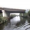
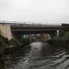
There is a bridge here which takes a dual carriageway over the canal.
Rawmarsh Road Bridge No 39 | 5 furlongs | |
Rawmarsh Road Winding Hole | 4½ furlongs | |
Northfield Road Pipe Bridges | 2½ furlongs | |
Greasbrough Road Pipe Bridge | 1½ furlongs | |
Greasbrough Road Bridge | 1¼ furlongs | |
Centenary Way (north) Bridge (32A) | ||
Bridge Street Bridge (Rotherham) | ½ furlongs | |
Bridge Street Pipe Bridges (Rotherham) | ¾ furlongs | |
Central Road Winding Hole | 1½ furlongs | |
Rotherham Lock No 4 | 1¾ furlongs | |
Rotherham Town Centre Visitor Moorings | 2 furlongs |
Amenities here
Amenities nearby at Greasbrough Road Bridge
Amenities nearby at Bridge Street Bridge (Rotherham)
- S&SY navigation info — associated with Sheffield and South Yorkshire Navigation
- Sheffield & South Yorkshire navigation info from IWA
Mouseover for more information or show routes to facility
Nearest water point
In the direction of Rawmarsh Road Bridge No 39
Eastwood Lock No 5 — 1 mile, 2 furlongs away
Travel to Rawmarsh Road Bridge No 39, then on the Sheffield and South Yorkshire Navigation (Main Line) to Eastwood Lock No 5
Kilnhurst Flood Lock No 7 — 3 miles, 7½ furlongs and 2 locks away
Travel to Rawmarsh Road Bridge No 39, then on the Sheffield and South Yorkshire Navigation (Main Line) to Kilnhurst Flood Lock No 7
Swinton Lock Activity Centre and CRT Sanitary Station — 5 miles, 5 furlongs and 4 locks away
Travel to Rawmarsh Road Bridge No 39, then on the Sheffield and South Yorkshire Navigation (Main Line) to Swinton Lock Activity Centre and CRT Sanitary Station
Mexborough Low Lock No 10 — 8 miles, 1¾ furlongs and 5 locks away
Travel to Rawmarsh Road Bridge No 39, then on the Sheffield and South Yorkshire Navigation (Main Line) to Mexborough Low Lock No 10
Sprotbrough Lock No 11 — 11 miles, 5¼ furlongs and 6 locks away
Travel to Rawmarsh Road Bridge No 39, then on the Sheffield and South Yorkshire Navigation (Main Line) to Sprotbrough Lock No 11
Doncaster Town Lock No 12 — 14 miles, 7½ furlongs and 7 locks away
Travel to Rawmarsh Road Bridge No 39, then on the Sheffield and South Yorkshire Navigation (Main Line) to Doncaster Town Lock No 12
Doncaster Visitor Pontoon Moorings — 15 miles, 1¾ furlongs and 8 locks away
Travel to Rawmarsh Road Bridge No 39, then on the Sheffield and South Yorkshire Navigation (Main Line) to Doncaster Visitor Pontoon Moorings
Long Sandall Lock No 13 — 18 miles, 3¼ furlongs and 8 locks away
Travel to Rawmarsh Road Bridge No 39, then on the Sheffield and South Yorkshire Navigation (Main Line) to Long Sandall Lock No 13
In the direction of Sheffield Terminal Warehouse
Victoria Quays — 6 miles, 3 furlongs and 15 locks away
On this waterway in the direction of Sheffield Terminal WarehouseNearest rubbish disposal
In the direction of Rawmarsh Road Bridge No 39
Eastwood Lock No 5 — 1 mile, 2 furlongs away
Travel to Rawmarsh Road Bridge No 39, then on the Sheffield and South Yorkshire Navigation (Main Line) to Eastwood Lock No 5
Doncaster Visitor Pontoon Moorings — 15 miles, 1¾ furlongs and 8 locks away
Travel to Rawmarsh Road Bridge No 39, then on the Sheffield and South Yorkshire Navigation (Main Line) to Doncaster Visitor Pontoon Moorings
In the direction of Sheffield Terminal Warehouse
Tinsley CRT facilities — 3 miles, 5¼ furlongs and 14 locks away
On this waterway in the direction of Sheffield Terminal Warehouse
Victoria Quays — 6 miles, 3 furlongs and 15 locks away
On this waterway in the direction of Sheffield Terminal WarehouseNearest chemical toilet disposal
In the direction of Rawmarsh Road Bridge No 39
Eastwood Lock No 5 — 1 mile, 2 furlongs away
Travel to Rawmarsh Road Bridge No 39, then on the Sheffield and South Yorkshire Navigation (Main Line) to Eastwood Lock No 5
Swinton Lock Activity Centre and CRT Sanitary Station — 5 miles, 5 furlongs and 4 locks away
Travel to Rawmarsh Road Bridge No 39, then on the Sheffield and South Yorkshire Navigation (Main Line) to Swinton Lock Activity Centre and CRT Sanitary Station
In the direction of Sheffield Terminal Warehouse
Tinsley CRT facilities — 3 miles, 5¼ furlongs and 14 locks away
On this waterway in the direction of Sheffield Terminal Warehouse
Victoria Quays — 6 miles, 3 furlongs and 15 locks away
On this waterway in the direction of Sheffield Terminal WarehouseNearest place to turn
In the direction of Rawmarsh Road Bridge No 39
Rawmarsh Road Winding Hole — 4½ furlongs away
On this waterway in the direction of Rawmarsh Road Bridge No 39
Sir Frank Price Lock Arm — 1 mile, 1¼ furlongs away
Travel to Rawmarsh Road Bridge No 39, then on the Sheffield and South Yorkshire Navigation (Main Line) to Sir Frank Price Lock Arm
Sir Frank Price Lock Weir Exit — 1 mile, 2½ furlongs and 1 lock away
Travel to Rawmarsh Road Bridge No 39, then on the Sheffield and South Yorkshire Navigation (Main Line) to Sir Frank Price Lock Weir Exit
Kilnhurst Flood Lock Winding Hole — 3 miles, 5¾ furlongs and 2 locks away
Travel to Rawmarsh Road Bridge No 39, then on the Sheffield and South Yorkshire Navigation (Main Line) to Kilnhurst Flood Lock Winding Hole
Swinton Junction — 5 miles, 4¼ furlongs and 3 locks away
Travel to Rawmarsh Road Bridge No 39, then on the Sheffield and South Yorkshire Navigation (Main Line) to Swinton Junction
Swinton Road Corner — 6 miles, ¼ furlongs and 4 locks away
Travel to Rawmarsh Road Bridge No 39, then on the Sheffield and South Yorkshire Navigation (Main Line) to Swinton Road Corner
Sprotbrough Lock Weir Exit — 11 miles, 5¾ furlongs and 7 locks away
Travel to Rawmarsh Road Bridge No 39, then on the Sheffield and South Yorkshire Navigation (Main Line) to Sprotbrough Lock Weir Exit
Doncaster Visitor Pontoon Moorings — 15 miles, 1¾ furlongs and 8 locks away
Travel to Rawmarsh Road Bridge No 39, then on the Sheffield and South Yorkshire Navigation (Main Line) to Doncaster Visitor Pontoon Moorings
Gas House Bight — 15 miles, 3¼ furlongs and 8 locks away
Travel to Rawmarsh Road Bridge No 39, then on the Sheffield and South Yorkshire Navigation (Main Line) to Gas House Bight
Wheatley Hall Road Winding Hole — 17 miles, 2½ furlongs and 8 locks away
Travel to Rawmarsh Road Bridge No 39, then on the Sheffield and South Yorkshire Navigation (Main Line) to Wheatley Hall Road Winding Hole
In the direction of Sheffield Terminal Warehouse
Central Road Winding Hole — 1½ furlongs away
On this waterway in the direction of Sheffield Terminal Warehouse
Main Street Junction — 2¼ furlongs and 1 lock away
On this waterway in the direction of Sheffield Terminal Warehouse
Rotherham Junction — 4 furlongs and 1 lock away
On this waterway in the direction of Sheffield Terminal Warehouse
Tinsley Lower Flight Weir Exit — 2 miles, 4 furlongs and 4 locks away
On this waterway in the direction of Sheffield Terminal Warehouse
Don Valley Stadium Visitor Moorings — 4 miles, 4½ furlongs and 15 locks away
On this waterway in the direction of Sheffield Terminal Warehouse
Shirland Road Bridge Winding Hole — 4 miles, 7 furlongs and 15 locks away
On this waterway in the direction of Sheffield Terminal Warehouse
Victoria Quays — 6 miles, 3 furlongs and 15 locks away
On this waterway in the direction of Sheffield Terminal Warehouse
Sheffield Terminal Warehouse — 6 miles, 3¼ furlongs and 15 locks away
On this waterway in the direction of Sheffield Terminal WarehouseNearest self-operated pump-out
In the direction of Rawmarsh Road Bridge No 39
Long Sandall Lock No 13 — 18 miles, 3¼ furlongs and 8 locks away
Travel to Rawmarsh Road Bridge No 39, then on the Sheffield and South Yorkshire Navigation (Main Line) to Long Sandall Lock No 13No information
CanalPlan has no information on any of the following facilities within range:boatyard pump-out
Direction of TV transmitter (From Wolfbane Cybernetic)
There is no page on Wikipedia called “Centenary Way (north) Bridge”
Wikipedia pages that might relate to Centenary Way (north) Bridge
[Bridges over the Brisbane River]
Australia, is crossed by fifteen major bridges, from the Sir Leo Hielscher Bridges downstream to the Centenary upstream. The river meanders through an
[River Don Navigation]
here to Conisbrough, the only way to see the navigation is from a boat or from one of the bridges which cross it. To the north of the cut are the remains
[Coventry Way]
Baptist. North of Brinklow, the Coventry Way crosses Smite Brook and reaches the Oxford Canal at Grimes Bridge, where it also crosses the Centenary Way. It
[Northbridge, New South Wales]
celebrated its centenary in 2013. Northbridge took its name from its location, north of a sandstone suspension bridge built in 1892. The bridge was constructed
[Derwent Valley Heritage Way]
Charlie Walk, Centenary Way (Derbyshire), High Peak Trail, Midshires Way. The official guide book is 'The Derwent Valley Heritage Way' published by Bannister
[Tees Transporter Bridge]
Transporter Bridge received a £2.6 million Heritage Lottery Fund award for improvement and renovation work to mark the Bridge's centenary. The improvement
[Jindalee, Queensland]
enters the suburb from the north (Kenmore), crossing the river on the Centenary Bridge (27°31′40″S 152°56′49″E / 27.5278°S 152.9470°E / -27.5278; 152.9470)
[Sutton Bridge Power Station]
south-east of Lincolnshire in South Holland, England. It is situated on Centenary Way close to the River Nene. It is a major landmark on the Lincolnshire
[Ebor Way]
Oswaldkirk, Cawton and Hovingham to Terrington. Here it is joined by the Centenary Way, which follows a broadly similar route to York, although the two diverge
[Centenary Square]
Centenary Square is a public square on the north side of Broad Street in Birmingham, England, named in 1989 to commemorate the centenary of Birmingham
Results of Google Search
Tesco Extra Burnley Centenary Way ... BB10 2TQ 1 x 7kW 32A Type 2 Mennekes EV Charge.Online ... Bridge Street Accrington ... Region: North West. Country: ...
Oct 1, 2015 ... Near Kleiber's Place, Centenary, NY. 31 (FF). MAP 6, M-9 ... 32a. Unknown Local Cemetery. On Long Clove Road, near Pye's Saw Mill. Long Clove Rd ... Directly North of Van Houten Plot on Ridge Road. William and Julia ...
At the roundabout take the third exit onto Centenary Way/A682. 0.5 mi. 4. At the roundabout ... Take exit 32A onto A1(M)/E15 toward The South. 0.3 mi. 22. Keep right at ... Take the exit onto Great North Road/A638 toward Doncaster. 0.3 mi. 25. ... At the roundabout take the second exit onto New Bridge Road/A19. 381 ft. 28.
Jul 22, 2020 ... Administrative boundaries, region maps and state road network of Queensland map. ... North Queensland Region map (PDF, 3.54 MB) ...
Bus Bridge Between College Greens and Power Inn Stations on Saturday Morning. Due to a scheduled track inspection, a Bus Bridge will be in place on the ...