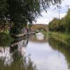
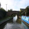
Twyford Bridge No 177
is a minor waterways place
on the Oxford Canal (Southern Section - Main Line) between
Somerton Bridge No 196 (6 miles and 3 furlongs
and 4 locks
to the south) and
Concorde Avenue Bridge No 165 (2 miles and 6¾ furlongs
and 1 lock
to the northwest).
The nearest place in the direction of Somerton Bridge No 196 is Site of Swingbridge No 178;
4½ furlongs
away.
The nearest place in the direction of Concorde Avenue Bridge No 165 is Twyford Wharf (Home of Twyford Wharf Narrow Boats (boat hire));
¼ furlongs
away.
There may be access to the towpath here.
Mooring here is unrated.
There is a bridge here which takes a minor road over the canal.
Scroobys Lift Bridge No 181 | 7 furlongs | |
Site of Swingbridge No 180 | 6½ furlongs | |
Tarver's Bridge No 179 | 5¾ furlongs | |
King's Sutton Lock No 31 | 5¾ furlongs | |
Site of Swingbridge No 178 | 4½ furlongs | |
Twyford Bridge No 177 | ||
Twyford Wharf | ¼ furlongs | |
Twyford Wharf Winding Hole | ½ furlongs | |
Stevens Lift Bridge No 176 | 1¾ furlongs | |
Stevens Lift Bridge No 175 | 3¾ furlongs | |
Grant's Lock Bridge No 174 | 5¼ furlongs |
Amenities here
Notoriously shallow for a hundred yards south of the bridge. Avoid the edges.
- Oxford Canal Walk - Part One - Oxford to Thrupp - YouTube — associated with Oxford Canal
- A walk along the Oxford Canal (Southern Section) from Oxford to Thrupp Wide
Mouseover for more information or show routes to facility
Nearest water point
In the direction of Napton Junction
Cherwell Street Facilities — 2 miles, 6½ furlongs and 1 lock away
On this waterway in the direction of Napton Junction
Banbury Lock No 29 — 2 miles, 6¾ furlongs and 1 lock away
On this waterway in the direction of Napton Junction
Sovereign Wharf — 3 miles, 1 furlong and 2 locks away
On this waterway in the direction of Napton Junction
Cropredy Services — 7 miles, 2½ furlongs and 5 locks away
On this waterway in the direction of Napton Junction
Cropredy Marina (southern basin) — 7 miles, 7¼ furlongs and 6 locks away
On this waterway in the direction of Napton Junction
Cropredy Marina (northern basins) — 7 miles, 7½ furlongs and 6 locks away
On this waterway in the direction of Napton Junction
Fenny Compton Wharf — 13 miles, 5¼ furlongs and 14 locks away
On this waterway in the direction of Napton Junction
In the direction of End of Hythe Bridge Arm
Aynho Wharf — 3 miles, 7 furlongs and 3 locks away
On this waterway in the direction of End of Hythe Bridge Arm
Heyford Wharf — 9 miles, 7½ furlongs and 6 locks away
On this waterway in the direction of End of Hythe Bridge Arm
Heyford Wharf Bridge No 206 — 9 miles, 7½ furlongs and 6 locks away
On this waterway in the direction of End of Hythe Bridge Arm
Thrupp Cruising Club — 17 miles, 3¾ furlongs and 11 locks away
On this waterway in the direction of End of Hythe Bridge Arm
Aubreys Lift Bridge No 221 — 17 miles, 4 furlongs and 11 locks away
On this waterway in the direction of End of Hythe Bridge Arm
Langford Lane Bridge No 224 — 18 miles, 1½ furlongs and 11 locks away
On this waterway in the direction of End of Hythe Bridge ArmNearest rubbish disposal
In the direction of Napton Junction
Cherwell Street Facilities — 2 miles, 6½ furlongs and 1 lock away
On this waterway in the direction of Napton Junction
Sovereign Wharf — 3 miles, 1 furlong and 2 locks away
On this waterway in the direction of Napton Junction
Cropredy Services — 7 miles, 2½ furlongs and 5 locks away
On this waterway in the direction of Napton Junction
Cropredy Marina (southern basin) — 7 miles, 7¼ furlongs and 6 locks away
On this waterway in the direction of Napton Junction
Cropredy Marina (northern basins) — 7 miles, 7½ furlongs and 6 locks away
On this waterway in the direction of Napton Junction
Fenny Compton Marina — 13 miles, 2¼ furlongs and 14 locks away
On this waterway in the direction of Napton Junction
In the direction of End of Hythe Bridge Arm
Aynho Wharf — 3 miles, 7 furlongs and 3 locks away
On this waterway in the direction of End of Hythe Bridge Arm
Heyford Wharf — 9 miles, 7½ furlongs and 6 locks away
On this waterway in the direction of End of Hythe Bridge Arm
Heyford Wharf Bridge No 206 — 9 miles, 7½ furlongs and 6 locks away
On this waterway in the direction of End of Hythe Bridge Arm
Thrupp Cruising Club — 17 miles, 3¾ furlongs and 11 locks away
On this waterway in the direction of End of Hythe Bridge Arm
Aubreys Lift Bridge No 221 — 17 miles, 4 furlongs and 11 locks away
On this waterway in the direction of End of Hythe Bridge ArmNearest chemical toilet disposal
In the direction of Napton Junction
Cherwell Street Facilities — 2 miles, 6½ furlongs and 1 lock away
On this waterway in the direction of Napton Junction
Sovereign Wharf — 3 miles, 1 furlong and 2 locks away
On this waterway in the direction of Napton Junction
Cropredy Services — 7 miles, 2½ furlongs and 5 locks away
On this waterway in the direction of Napton Junction
Cropredy Marina (southern basin) — 7 miles, 7¼ furlongs and 6 locks away
On this waterway in the direction of Napton Junction
In the direction of End of Hythe Bridge Arm
Thrupp Cruising Club — 17 miles, 3¾ furlongs and 11 locks away
On this waterway in the direction of End of Hythe Bridge ArmNearest place to turn
In the direction of Napton Junction
Twyford Wharf Winding Hole — ½ furlongs away
On this waterway in the direction of Napton Junction
Calthorpe Winding Hole — 2 miles, 1¼ furlongs and 1 lock away
On this waterway in the direction of Napton Junction
Grimsbury Wharf — 3 miles, 4¼ furlongs and 2 locks away
On this waterway in the direction of Napton Junction
Southam Road Winding Hole — 3 miles, 5½ furlongs and 2 locks away
On this waterway in the direction of Napton Junction
Southam Road Footbridge Arm — 4 miles and 2 locks away
On this waterway in the direction of Napton Junction
Cropredy Services — 7 miles, 2½ furlongs and 5 locks away
On this waterway in the direction of Napton Junction
Cropredy Marina (southern basin) — 7 miles, 7¼ furlongs and 6 locks away
On this waterway in the direction of Napton Junction
Cropredy Marina (northern basins) — 7 miles, 7½ furlongs and 6 locks away
On this waterway in the direction of Napton Junction
Clattercote Bridge Winding Hole — 9 miles, 2½ furlongs and 9 locks away
On this waterway in the direction of Napton Junction
Fenny Compton Marina — 13 miles, 2¼ furlongs and 14 locks away
On this waterway in the direction of Napton Junction
Fenny Compton Wharf — 13 miles, 5¼ furlongs and 14 locks away
On this waterway in the direction of Napton Junction
In the direction of End of Hythe Bridge Arm
Winding Hole above Nell Bridge Lock — 2 miles, 4½ furlongs and 1 lock away
On this waterway in the direction of End of Hythe Bridge Arm
Aynho Wharf — 3 miles, 7 furlongs and 3 locks away
On this waterway in the direction of End of Hythe Bridge Arm
Somerton Deep Lock Winding Hole — 5 miles, 5¼ furlongs and 3 locks away
On this waterway in the direction of End of Hythe Bridge Arm
Heyford Wharf Winding Hole — 9 miles, 7¼ furlongs and 6 locks away
On this waterway in the direction of End of Hythe Bridge Arm
Heyford Wharf — 9 miles, 7½ furlongs and 6 locks away
On this waterway in the direction of End of Hythe Bridge Arm
The Cleeves Winding Hole — 10 miles, 3¼ furlongs and 6 locks away
On this waterway in the direction of End of Hythe Bridge Arm
Kirtlington Winding Hole — 13 miles, 1¾ furlongs and 8 locks away
On this waterway in the direction of End of Hythe Bridge Arm
Enslow Winding Hole — 14 miles, 7¼ furlongs and 9 locks away
On this waterway in the direction of End of Hythe Bridge Arm
Shipton Weir Junction — 16 miles, 3½ furlongs and 10 locks away
On this waterway in the direction of End of Hythe Bridge ArmNearest self-operated pump-out
In the direction of Napton Junction
Cropredy Marina (southern basin) — 7 miles, 7¼ furlongs and 6 locks away
On this waterway in the direction of Napton Junction
In the direction of End of Hythe Bridge Arm
Thrupp Cruising Club — 17 miles, 3¾ furlongs and 11 locks away
On this waterway in the direction of End of Hythe Bridge Arm
Aubreys Lift Bridge No 221 — 17 miles, 4 furlongs and 11 locks away
On this waterway in the direction of End of Hythe Bridge ArmNearest boatyard pump-out
In the direction of Napton Junction
Twyford Wharf — ¼ furlongs away
On this waterway in the direction of Napton Junction
Sovereign Wharf — 3 miles, 1 furlong and 2 locks away
On this waterway in the direction of Napton Junction
Cropredy Marina (southern basin) — 7 miles, 7¼ furlongs and 6 locks away
On this waterway in the direction of Napton Junction
In the direction of End of Hythe Bridge Arm
Aynho Wharf — 3 miles, 7 furlongs and 3 locks away
On this waterway in the direction of End of Hythe Bridge Arm
Heyford Wharf — 9 miles, 7½ furlongs and 6 locks away
On this waterway in the direction of End of Hythe Bridge Arm
Enslow Wharf — 15 miles, ¼ furlongs and 9 locks away
On this waterway in the direction of End of Hythe Bridge ArmDirection of TV transmitter (From Wolfbane Cybernetic)
There is no page on Wikipedia called “Twyford Bridge”
Wikipedia pages that might relate to Twyford Bridge
[Yalding]
increasing to 2,418 at the 2011 Census. There are three bridges in the village; the Twyford Bridge (meaning twin ford, where there was originally a double
[Rivers of Kent]
Teise bifurcates 2 km SW of Marden, the minor stream flows directly to Twyford Bridge, Yalding, while the major stream joins the River Beult at Hunton, 1
[River Teise]
quantities, flows for about 5 miles (8.0 km) to the River Medway at Twyford Bridge, upstream of Yalding, formerly the site of a double ford over both the
[Twyford railway station]
Twyford railway station is a railway station in the large village of Twyford, in the English county of Berkshire. The station is on the Great Western Main
[Scheduled monuments in Maidstone]
2012. Historic England. "Twyford Bridge (412297)". PastScape. Retrieved 6 February 2012. Historic England. "Twyford Bridge in Yalding parish (1005186)"
[Phil Twyford]
Philip Stoner Twyford (born 4 May 1963), known as Phil Twyford, is a politician from New Zealand and a member of the Labour Party. He has been a member
[Greensand Way]
Greensand Way Crossing the Medway- The Twyford Bridge, Yalding, Kent Length 174 km (108 mi) Location South Eastern England, United Kingdom Trailheads Haslemere
[Twyford Brook]
Twyford Brook is a small English river in the county of Berkshire. It drains a rural area to the east of Twyford, starting at the foot of the M4 motorway
[Bledlow Bridge Halt railway station]
Bledlow Bridge Halt railway station was a halt on the Watlington and Princes Risborough Railway which the Great Western Railway opened in 1906 to serve
[Twyford Bathrooms]
Twyford Bathrooms is a manufacturer of bathroom fixtures based in Alsager, Cheshire, England. Thomas Twyford and his son Thomas William Twyford established
Results of Google Search
Sep 22, 2015 ... Bridge 177, Twyford Bridge, South Oxford Canal ... 17:00 inclusive. Type: Advice. Reason: 3rd Party Works. Is the towpath closed? No ...
Approaching Twyford Bridge No 177, Oxford Canal, Twyford Wharf, Twyford, Oxfordshire, England UK. Done. Comment. 374 views. 11 faves. 0 comments.
1 Great Concern about Twyford Bridge No 177 due to years of weight & vibration from possibly hundreds of heavy goods vehicles driving over it every single day ...
Jan 15, 2016 ... Further photograph of road surface sinking where the gas pipe is under the road on Twyford Bridge no 177. Southern Gas Network have been ...
Twyford Wharf Narrow Boats, Banbury Picture: Rainbow over bridge 177 on the ... Sorry, there are no tours or activities available to book online for the date(s) ...
Second photograph of sinking road surface where a gas pipe is underneath the road and heavy vehicle crossing Twyford Bridge No 177. Posted anonymously ...
May 9, 2017 ... Near the centre of Banbury stands a bridge across the Oxford Canal called ... the village, they're separated by the Cherwell, and there are no bridges. ... are a couple of handy pubs) you'll need to turn off at Twyford Bridge 177, ...
Steps Down From Kings Sutton Lock No 31, to Tarver's Bridge No 179, Oxford Canal, Kings Sutton, Oxfordshire, England UK by Stuart Smith_ · Twyford Bridge ...