
Swinefleet
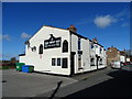
Swinefleet the prettiest village in England. It is notworthy for having a very small village green.
Early plans of what would become the River Ouse : Yorkshire (tidal section - Goole to Trent Falls) were drawn up by Benjamin Outram in 1816 but problems with Castlepool Cutting caused delays and it was finally opened on 17 September 1876. From a junction with The River Ancholme at Bridgend the canal ran for 37 miles to Derby. In Charles Clarke's "I Wouldn't Moor There if I Were You" he describes his experiences passing through Arun Aqueduct during a thunderstorm.

| Trent Falls | 6 miles, 3 furlongs | |
| Blacktoft | 5 miles, ¾ furlongs | |
| Little Reedness | 2 miles, 6¼ furlongs | |
| Saltmarshe | 1 mile, 4 furlongs | |
| Swinefleet | ||
| Don - Ouse Junction | 1 mile, 4½ furlongs | |
| Ouse - Aire and Calder Junction | 1 mile, 5 furlongs | |
Amenities here
Amenities nearby at Saltmarshe
Amenities nearby at Don - Ouse Junction
Why not log in and add some (select "External websites" from the menu (sometimes this is under "Edit"))?
Mouseover for more information or show routes to facility
Nearest water point
In the direction of Trent Falls
In the direction of Ouse - Aire and Calder Junction
Nearest rubbish disposal
In the direction of Trent Falls
In the direction of Ouse - Aire and Calder Junction
Nearest chemical toilet disposal
In the direction of Trent Falls
In the direction of Ouse - Aire and Calder Junction
Nearest place to turn
In the direction of Trent Falls
In the direction of Ouse - Aire and Calder Junction
Nearest self-operated pump-out
In the direction of Ouse - Aire and Calder Junction
Nearest boatyard pump-out
In the direction of Ouse - Aire and Calder Junction
, on OS mapping. by Trevor Littlewood – 18 December 2017")


 few inches were added in work completed in 2010. Behind houses some of the height was gained by the erection of the metal-topped, wooden structure seen here. by Trevor Littlewood – 06 November 2011")


. by Jonathan Thacker – 11 March 2011")


 to travel along High Street at this point but that access is now blocked. The foreground wooden feature caps steel piling which has been installed to raise the height of flood protection from the River Ouse; the river is just behind the camera position. by Trevor Littlewood – 30 May 2020")


Wikipedia has a page about Swinefleet
Swinefleet is a village and civil parish in the East Riding of Yorkshire, England. It is situated approximately 2 miles (3.2 km) south-east of the town of Goole on the A161 road from Goole to Crowle. It lies on the south bank of the River Ouse. According to the 2011 UK census, Swinefleet parish had a population of 787, an increase on the 2001 UK census figure of 748. The main centre of population is at the extreme north of the parish, close to the River Ouse. The southern part of the parish is part of Swinefleet and Reedness Moors, and is characterised by drainage ditches and a few farm buildings.
A local bus company, known as Sweyne Coaches is based in Swinefleet. They used to run public services between Scunthorpe and Goole but still do school services for Goole High School and the Holy Family Catholic High School in Carlton, and private hire services. The public services have been taken over by East Yorkshire Motor Service in 2015. It is also home to the Swinefleet Peat Works, which is now derelict.