CanalPlanAC

Rotherham Junction

 
River Rother Junction
Ben Bennett Family (East) Stand, Don Street, Rotherham S95 1AD, United Kingdom
 
Information about the place
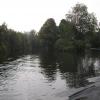
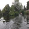
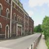
Rotherham Junction is a place on the waterways on the Sheffield and South Yorkshire Navigation (Sheffield Canal) between Rawmarsh Road Bridge No 39 (1 mile and 1 furlong and 1 lock to the northeast) and Sheffield Terminal Warehouse (5 miles and 7¼ furlongs and 14 locks to the southwest).
 
 
The nearest place in the direction of Rawmarsh Road Bridge No 39 is Main Street Bridge; 1½ furlongs away.
 
The nearest place in the direction of Sheffield Terminal Warehouse is Centenary Way (south) Bridge; 1½ furlongs away.

Mooring here is unrated.

You can wind here.


Amenities

Amenities here

 Job Lot
 Brentwood Hotel

Amenities nearby at Main Street Bridge

 Costcutter
 Rotherham
 SEE ADDRESS
 Wetherspoons
 Wetherspoons
 Cashpoint
 Murco
 Rotherham, Jolly Miller FS
 Rotherham Central Station
 
Maps
If you are a user and are logged on, or if you are actively planning a route, a map will be displayed here.
Show on external mapping site: Google | OSM | Bing
 
Photos
 
External websites
  S&SY navigation info — associated with Sheffield and South Yorkshire Navigation
Sheffield & South Yorkshire navigation info from IWA
 
Nearest facilities

Mouseover for more information or show routes to facility

Nearest water point

In the direction of Rawmarsh Road Bridge No 39

Eastwood Lock No 51 mile, 6 furlongs and 1 lock away
Travel to Rawmarsh Road Bridge No 39, then on the Sheffield and South Yorkshire Navigation (Main Line) to Eastwood Lock No 5
Kilnhurst Flood Lock No 74 miles, 3½ furlongs and 3 locks away
Travel to Rawmarsh Road Bridge No 39, then on the Sheffield and South Yorkshire Navigation (Main Line) to Kilnhurst Flood Lock No 7
Swinton Lock Activity Centre and CRT Sanitary Station6 miles, 1 furlong and 5 locks away
Travel to Rawmarsh Road Bridge No 39, then on the Sheffield and South Yorkshire Navigation (Main Line) to Swinton Lock Activity Centre and CRT Sanitary Station
Mexborough Low Lock No 108 miles, 5¾ furlongs and 6 locks away
Travel to Rawmarsh Road Bridge No 39, then on the Sheffield and South Yorkshire Navigation (Main Line) to Mexborough Low Lock No 10
Sprotbrough Lock No 1112 miles, 1¼ furlongs and 7 locks away
Travel to Rawmarsh Road Bridge No 39, then on the Sheffield and South Yorkshire Navigation (Main Line) to Sprotbrough Lock No 11
Doncaster Town Lock No 1215 miles, 3½ furlongs and 8 locks away
Travel to Rawmarsh Road Bridge No 39, then on the Sheffield and South Yorkshire Navigation (Main Line) to Doncaster Town Lock No 12
Doncaster Visitor Pontoon Moorings15 miles, 5¾ furlongs and 9 locks away
Travel to Rawmarsh Road Bridge No 39, then on the Sheffield and South Yorkshire Navigation (Main Line) to Doncaster Visitor Pontoon Moorings
Long Sandall Lock No 1318 miles, 7¼ furlongs and 9 locks away
Travel to Rawmarsh Road Bridge No 39, then on the Sheffield and South Yorkshire Navigation (Main Line) to Long Sandall Lock No 13

In the direction of Sheffield Terminal Warehouse

Victoria Quays5 miles, 7 furlongs and 14 locks away
On this waterway in the direction of Sheffield Terminal Warehouse

Nearest rubbish disposal

In the direction of Rawmarsh Road Bridge No 39

Eastwood Lock No 51 mile, 6 furlongs and 1 lock away
Travel to Rawmarsh Road Bridge No 39, then on the Sheffield and South Yorkshire Navigation (Main Line) to Eastwood Lock No 5
Doncaster Visitor Pontoon Moorings15 miles, 5¾ furlongs and 9 locks away
Travel to Rawmarsh Road Bridge No 39, then on the Sheffield and South Yorkshire Navigation (Main Line) to Doncaster Visitor Pontoon Moorings

In the direction of Sheffield Terminal Warehouse

Tinsley CRT facilities3 miles, 1¼ furlongs and 13 locks away
On this waterway in the direction of Sheffield Terminal Warehouse
Victoria Quays5 miles, 7 furlongs and 14 locks away
On this waterway in the direction of Sheffield Terminal Warehouse

Nearest chemical toilet disposal

In the direction of Rawmarsh Road Bridge No 39

Eastwood Lock No 51 mile, 6 furlongs and 1 lock away
Travel to Rawmarsh Road Bridge No 39, then on the Sheffield and South Yorkshire Navigation (Main Line) to Eastwood Lock No 5
Swinton Lock Activity Centre and CRT Sanitary Station6 miles, 1 furlong and 5 locks away
Travel to Rawmarsh Road Bridge No 39, then on the Sheffield and South Yorkshire Navigation (Main Line) to Swinton Lock Activity Centre and CRT Sanitary Station

In the direction of Sheffield Terminal Warehouse

Tinsley CRT facilities3 miles, 1¼ furlongs and 13 locks away
On this waterway in the direction of Sheffield Terminal Warehouse
Victoria Quays5 miles, 7 furlongs and 14 locks away
On this waterway in the direction of Sheffield Terminal Warehouse

Nearest place to turn

In the direction of Rawmarsh Road Bridge No 39

Main Street Junction1¾ furlongs away
On this waterway in the direction of Rawmarsh Road Bridge No 39
Central Road Winding Hole2½ furlongs and 1 lock away
On this waterway in the direction of Rawmarsh Road Bridge No 39
Rawmarsh Road Winding Hole1 mile, ½ furlongs and 1 lock away
On this waterway in the direction of Rawmarsh Road Bridge No 39
Sir Frank Price Lock Arm1 mile, 5¼ furlongs and 1 lock away
Travel to Rawmarsh Road Bridge No 39, then on the Sheffield and South Yorkshire Navigation (Main Line) to Sir Frank Price Lock Arm
Sir Frank Price Lock Weir Exit1 mile, 6½ furlongs and 2 locks away
Travel to Rawmarsh Road Bridge No 39, then on the Sheffield and South Yorkshire Navigation (Main Line) to Sir Frank Price Lock Weir Exit
Kilnhurst Flood Lock Winding Hole4 miles, 1¾ furlongs and 3 locks away
Travel to Rawmarsh Road Bridge No 39, then on the Sheffield and South Yorkshire Navigation (Main Line) to Kilnhurst Flood Lock Winding Hole
Swinton Junction6 miles, ¼ furlongs and 4 locks away
Travel to Rawmarsh Road Bridge No 39, then on the Sheffield and South Yorkshire Navigation (Main Line) to Swinton Junction
Swinton Road Corner6 miles, 4¼ furlongs and 5 locks away
Travel to Rawmarsh Road Bridge No 39, then on the Sheffield and South Yorkshire Navigation (Main Line) to Swinton Road Corner
Sprotbrough Lock Weir Exit12 miles, 1¾ furlongs and 8 locks away
Travel to Rawmarsh Road Bridge No 39, then on the Sheffield and South Yorkshire Navigation (Main Line) to Sprotbrough Lock Weir Exit
Doncaster Visitor Pontoon Moorings15 miles, 5¾ furlongs and 9 locks away
Travel to Rawmarsh Road Bridge No 39, then on the Sheffield and South Yorkshire Navigation (Main Line) to Doncaster Visitor Pontoon Moorings
Gas House Bight15 miles, 7¼ furlongs and 9 locks away
Travel to Rawmarsh Road Bridge No 39, then on the Sheffield and South Yorkshire Navigation (Main Line) to Gas House Bight
Wheatley Hall Road Winding Hole17 miles, 6½ furlongs and 9 locks away
Travel to Rawmarsh Road Bridge No 39, then on the Sheffield and South Yorkshire Navigation (Main Line) to Wheatley Hall Road Winding Hole

In the direction of Sheffield Terminal Warehouse

Tinsley Lower Flight Weir Exit2 miles and 3 locks away
On this waterway in the direction of Sheffield Terminal Warehouse
Don Valley Stadium Visitor Moorings4 miles, ½ furlongs and 14 locks away
On this waterway in the direction of Sheffield Terminal Warehouse
Shirland Road Bridge Winding Hole4 miles, 3 furlongs and 14 locks away
On this waterway in the direction of Sheffield Terminal Warehouse
Victoria Quays5 miles, 7 furlongs and 14 locks away
On this waterway in the direction of Sheffield Terminal Warehouse
Sheffield Terminal Warehouse5 miles, 7¼ furlongs and 14 locks away
On this waterway in the direction of Sheffield Terminal Warehouse

Nearest self-operated pump-out

No information

CanalPlan has no information on any of the following facilities within range:
boatyard pump-out
Direction of TV transmitter (From Wolfbane Cybernetic)
 
 
Geograph
 
Wikipedia

There is no page on Wikipedia called “Rotherham Junction”

Wikipedia pages that might relate to Rotherham Junction
[Rotherham] Rotherham (/ˈrɒðərəm/ (listen)) is a large minster town in South Yorkshire, England which along with its nearby settlements form the Metropolitan Borough [Rotherham Central station] Rotherham Central railway station is in Rotherham, South Yorkshire, England. The station was originally named "Rotherham", becoming "Rotherham and Masborough" [Woodburn Junction] to Rotherham, opening on 1 August 1864. Traffic from the South Yorkshire Railway's Barnsley line joined the Rotherham line at Tinsley South Junction and [Bramley, Rotherham] Metropolitan Borough of Rotherham in South Yorkshire, England. The village is situated approximately 4 miles (6 km) from central Rotherham and 8 miles (13 km) [North Midland Railway] its line from Derby to Rotherham (Masbrough) and Leeds in 1840. At Derby, it connected with the Birmingham and Derby Junction Railway and the Midland [Rotherham Masborough railway station] Rotherham Masborough railway station was the main railway station for Rotherham, South Yorkshire, England from the 1840s until 1987, when most trains [Rotherham Road railway station] Rotherham Road railway station, named Park Gate until 1 November 1895, was a railway station situated in Rotherham, South Yorkshire, England. It was built [Dearne Valley line] Leaving Rotherham Central we take the "Holmes Chord", a single line to Holmes Junction where we take to the rails of the Sheffield & Rotherham company [M18 motorway (Great Britain)] east/south west direction from junction 32 of the M1 motorway to junction 35 of the M62 motorway. It passes east of Rotherham, southeast of Doncaster and [Sheffield, Rotherham, Barnsley, Wakefield, Huddersfield and Goole Railway] begin from junctions with the Sheffield and Rotherham Railway near Brightside and Kimberworth roughly halfway between Sheffield and Rotherham, past Ecclesfield
 
Google