CanalPlanAC

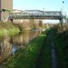
Colne Bridge Second Pipe Bridge

 
Riverside Way, Kirklees HD2 1UT, United Kingdom
 
Information about the place
Colne Bridge Second Pipe Bridge is a minor waterways place on the Huddersfield Broad Canal between Cooper Bridge Junction (Junction of the Huddersfield Broad Canal and the Calder and Hebble Navigation) (4¾ furlongs and 2 locks to the north) and Turnbridge Lifting Bridge No17 (2 miles and 3¼ furlongs and 7 locks to the southwest).
 
 
The nearest place in the direction of Cooper Bridge Junction is Colne Bridge First Pipe Bridge; 1 furlong away.
 
The nearest place in the direction of Turnbridge Lifting Bridge No17 is Colne Bridge Third Pipe Bridge; ¾ furlongs away.

Mooring here is unrated.

There is a bridge here which takes a pipe over the canal.


Amenities
 
Maps
If you are a user and are logged on, or if you are actively planning a route, a map will be displayed here.
Show on external mapping site: Google | OSM | Bing
 
Photos
 
External websites
There are no links to external websites from here.
Why not log in and add some (select "External websites" from the menu (sometimes this is under "Edit"))?
 
Nearest facilities

Mouseover for more information or show routes to facility

Nearest water point

In the direction of Cooper Bridge Junction

Shepley Bridge Sanitary Station3 miles, 5¼ furlongs and 4 locks away
Travel to Cooper Bridge Junction, then on the Calder and Hebble Navigation (Main Line) to Shepley Bridge Sanitary Station
Brighouse Basin2 miles, 7 furlongs and 6 locks away
Travel to Cooper Bridge Junction, then on the Calder and Hebble Navigation (Main Line) to Brighouse Basin
Salterhebble Sanitary Station7 miles, 1 furlong and 15 locks away
Travel to Cooper Bridge Junction, then on the Calder and Hebble Navigation (Main Line) to Salterhebble Sanitary Station
Broad Cut Low Lock No 310 miles, 2¼ furlongs and 12 locks away
Travel to Cooper Bridge Junction, then on the Calder and Hebble Navigation (Main Line) to Broad Cut Low Lock No 3
Salterhebble Junction7 miles, 1½ furlongs and 16 locks away
Travel to Cooper Bridge Junction, then on the Calder and Hebble Navigation (Main Line) to Salterhebble Junction
Sowerby Bridge Basin9 miles, 3¼ furlongs and 16 locks away
Travel to Cooper Bridge Junction, then on the Calder and Hebble Navigation (Main Line) to Salterhebble Junction, then on the Calder and Hebble Navigation (Main Line) to Sowerby Bridge Basin
Ramsdens Bridge Sanitary Station15 miles, 6 furlongs and 16 locks away
Travel to Cooper Bridge Junction, then on the Calder and Hebble Navigation (Main Line) to Fall Ing Junction, then on the Aire and Calder Navigation (Wakefield Section) to Ramsdens Bridge Sanitary Station
Stanley Ferry Water Point15 miles, 6¾ furlongs and 16 locks away
Travel to Cooper Bridge Junction, then on the Calder and Hebble Navigation (Main Line) to Fall Ing Junction, then on the Aire and Calder Navigation (Wakefield Section) to Stanley Ferry Water Point
King's Road Lock No 317 miles, 3¾ furlongs and 17 locks away
Travel to Cooper Bridge Junction, then on the Calder and Hebble Navigation (Main Line) to Fall Ing Junction, then on the Aire and Calder Navigation (Wakefield Section) to King's Road Lock No 3
Woodnook Lock No 618 miles, 5¼ furlongs and 18 locks away
Travel to Cooper Bridge Junction, then on the Calder and Hebble Navigation (Main Line) to Fall Ing Junction, then on the Aire and Calder Navigation (Wakefield Section) to Woodnook Lock No 6
Hebden Bridge Services14 miles, 6¾ furlongs and 23 locks away
Travel to Cooper Bridge Junction, then on the Calder and Hebble Navigation (Main Line) to Salterhebble Junction, then on the Calder and Hebble Navigation (Main Line) to Sowerby Bridge Junction, then on the Rochdale Canal to Hebden Bridge Services
Fairies Hill Moorings19 miles, ¾ furlongs and 20 locks away
Travel to Cooper Bridge Junction, then on the Calder and Hebble Navigation (Main Line) to Fall Ing Junction, then on the Aire and Calder Navigation (Wakefield Section) to Fairies Hill Lock Junction, then on the Aire and Calder Navigation (Wakefield Section - Fairies Hill Mooring Arm) to Fairies Hill Moorings
Baltimore Marina18 miles, 6 furlongs and 32 locks away
Travel to Cooper Bridge Junction, then on the Calder and Hebble Navigation (Main Line) to Salterhebble Junction, then on the Calder and Hebble Navigation (Main Line) to Sowerby Bridge Junction, then on the Rochdale Canal to Baltimore Marina
Fielden Wharf & Services19 miles, 1¼ furlongs and 33 locks away
Travel to Cooper Bridge Junction, then on the Calder and Hebble Navigation (Main Line) to Salterhebble Junction, then on the Calder and Hebble Navigation (Main Line) to Sowerby Bridge Junction, then on the Rochdale Canal to Fielden Wharf & Services

In the direction of Aspley Basin (Huddersfield)

Aspley Basin (Huddersfield)2 miles, 7¼ furlongs and 7 locks away
On this waterway in the direction of Aspley Basin (Huddersfield)
Waterside Lock No 21E7 miles, 5 furlongs and 27 locks away
Travel to Aspley Basin (Huddersfield), then on the Huddersfield Narrow Canal to Waterside Lock No 21E
Slaithwaite Winding Hole7 miles, 5½ furlongs and 28 locks away
Travel to Aspley Basin (Huddersfield), then on the Huddersfield Narrow Canal to Slaithwaite Winding Hole
Standedge Tunnel (eastern entrance)11 miles, ½ furlongs and 49 locks away
Travel to Aspley Basin (Huddersfield), then on the Huddersfield Narrow Canal to Standedge Tunnel (eastern entrance)
Standedge Tunnel (western entrance)14 miles, 2½ furlongs and 49 locks away
Travel to Aspley Basin (Huddersfield), then on the Huddersfield Narrow Canal to Standedge Tunnel (western entrance)
Wool Road Bridge No 7016 miles, 2¼ furlongs and 58 locks away
Travel to Aspley Basin (Huddersfield), then on the Huddersfield Narrow Canal to Wool Road Bridge No 70

Nearest rubbish disposal

In the direction of Cooper Bridge Junction

Shepley Bridge Sanitary Station3 miles, 5¼ furlongs and 4 locks away
Travel to Cooper Bridge Junction, then on the Calder and Hebble Navigation (Main Line) to Shepley Bridge Sanitary Station
Brighouse Lower Basin Visitor Moorings2 miles, 6¾ furlongs and 5 locks away
Travel to Cooper Bridge Junction, then on the Calder and Hebble Navigation (Main Line) to Brighouse Lower Basin Visitor Moorings
Horbury Basin Residential Moorings & Sanitary Station8 miles, 1¾ furlongs and 11 locks away
Travel to Cooper Bridge Junction, then on the Calder and Hebble Navigation (Main Line) to Horbury Basin Residential Moorings & Sanitary Station
Salterhebble Sanitary Station7 miles, 1 furlong and 15 locks away
Travel to Cooper Bridge Junction, then on the Calder and Hebble Navigation (Main Line) to Salterhebble Sanitary Station
Sowerby Bridge Basin9 miles, 3¼ furlongs and 16 locks away
Travel to Cooper Bridge Junction, then on the Calder and Hebble Navigation (Main Line) to Salterhebble Junction, then on the Calder and Hebble Navigation (Main Line) to Sowerby Bridge Basin
Ramsdens Bridge Visitor Moorings15 miles, 6¼ furlongs and 16 locks away
Travel to Cooper Bridge Junction, then on the Calder and Hebble Navigation (Main Line) to Fall Ing Junction, then on the Aire and Calder Navigation (Wakefield Section) to Ramsdens Bridge Visitor Moorings
Hebden Bridge Services14 miles, 6¾ furlongs and 23 locks away
Travel to Cooper Bridge Junction, then on the Calder and Hebble Navigation (Main Line) to Salterhebble Junction, then on the Calder and Hebble Navigation (Main Line) to Sowerby Bridge Junction, then on the Rochdale Canal to Hebden Bridge Services
Fielden Wharf & Services19 miles, 1¼ furlongs and 33 locks away
Travel to Cooper Bridge Junction, then on the Calder and Hebble Navigation (Main Line) to Salterhebble Junction, then on the Calder and Hebble Navigation (Main Line) to Sowerby Bridge Junction, then on the Rochdale Canal to Fielden Wharf & Services

In the direction of Aspley Basin (Huddersfield)

Aspley Basin (Huddersfield)2 miles, 7¼ furlongs and 7 locks away
On this waterway in the direction of Aspley Basin (Huddersfield)
Pickle Lock No 22E7 miles, 6¼ furlongs and 28 locks away
Travel to Aspley Basin (Huddersfield), then on the Huddersfield Narrow Canal to Pickle Lock No 22E
Wool Road Visitor Mooring16 miles, 2½ furlongs and 58 locks away
Travel to Aspley Basin (Huddersfield), then on the Huddersfield Narrow Canal to Wool Road Visitor Mooring

Nearest chemical toilet disposal

In the direction of Cooper Bridge Junction

Shepley Bridge Sanitary Station3 miles, 5¼ furlongs and 4 locks away
Travel to Cooper Bridge Junction, then on the Calder and Hebble Navigation (Main Line) to Shepley Bridge Sanitary Station
Brighouse Basin2 miles, 7 furlongs and 6 locks away
Travel to Cooper Bridge Junction, then on the Calder and Hebble Navigation (Main Line) to Brighouse Basin
Savile Town Wharf and Basin (Dewsbury)7 miles, ¾ furlongs and 8 locks away
Travel to Cooper Bridge Junction, then on the Calder and Hebble Navigation (Main Line) to Dewsbury Arm Junction, then on the Calder and Hebble Navigation (Dewsbury Old Cut) to Savile Town Wharf and Basin (Dewsbury)
Horbury Basin Residential Moorings & Sanitary Station8 miles, 1¾ furlongs and 11 locks away
Travel to Cooper Bridge Junction, then on the Calder and Hebble Navigation (Main Line) to Horbury Basin Residential Moorings & Sanitary Station
Salterhebble Sanitary Station7 miles, 1 furlong and 15 locks away
Travel to Cooper Bridge Junction, then on the Calder and Hebble Navigation (Main Line) to Salterhebble Sanitary Station
Sowerby Bridge Basin9 miles, 3¼ furlongs and 16 locks away
Travel to Cooper Bridge Junction, then on the Calder and Hebble Navigation (Main Line) to Salterhebble Junction, then on the Calder and Hebble Navigation (Main Line) to Sowerby Bridge Basin
Ramsdens Bridge Sanitary Station15 miles, 6 furlongs and 16 locks away
Travel to Cooper Bridge Junction, then on the Calder and Hebble Navigation (Main Line) to Fall Ing Junction, then on the Aire and Calder Navigation (Wakefield Section) to Ramsdens Bridge Sanitary Station
Hebden Bridge Services14 miles, 6¾ furlongs and 23 locks away
Travel to Cooper Bridge Junction, then on the Calder and Hebble Navigation (Main Line) to Salterhebble Junction, then on the Calder and Hebble Navigation (Main Line) to Sowerby Bridge Junction, then on the Rochdale Canal to Hebden Bridge Services
Fairies Hill Moorings19 miles, ¾ furlongs and 20 locks away
Travel to Cooper Bridge Junction, then on the Calder and Hebble Navigation (Main Line) to Fall Ing Junction, then on the Aire and Calder Navigation (Wakefield Section) to Fairies Hill Lock Junction, then on the Aire and Calder Navigation (Wakefield Section - Fairies Hill Mooring Arm) to Fairies Hill Moorings
Baltimore Marina18 miles, 6 furlongs and 32 locks away
Travel to Cooper Bridge Junction, then on the Calder and Hebble Navigation (Main Line) to Salterhebble Junction, then on the Calder and Hebble Navigation (Main Line) to Sowerby Bridge Junction, then on the Rochdale Canal to Baltimore Marina

In the direction of Aspley Basin (Huddersfield)

Aspley Basin (Huddersfield)2 miles, 7¼ furlongs and 7 locks away
On this waterway in the direction of Aspley Basin (Huddersfield)
Waterside Lock No 21E7 miles, 5 furlongs and 27 locks away
Travel to Aspley Basin (Huddersfield), then on the Huddersfield Narrow Canal to Waterside Lock No 21E
Pickle Lock No 22E7 miles, 6¼ furlongs and 28 locks away
Travel to Aspley Basin (Huddersfield), then on the Huddersfield Narrow Canal to Pickle Lock No 22E
Wool Road Bridge No 7016 miles, 2¼ furlongs and 58 locks away
Travel to Aspley Basin (Huddersfield), then on the Huddersfield Narrow Canal to Wool Road Bridge No 70

Nearest place to turn

In the direction of Cooper Bridge Junction

Cooper Bridge Junction4¾ furlongs and 2 locks away
On this waterway in the direction of Cooper Bridge Junction
Battye Weir Entrance1 mile, 1¾ furlongs and 3 locks away
Travel to Cooper Bridge Junction, then on the Calder and Hebble Navigation (Main Line) to Battye Weir Entrance
Shepley Bridge Marina3 miles, 5½ furlongs and 4 locks away
Travel to Cooper Bridge Junction, then on the Calder and Hebble Navigation (Main Line) to Shepley Bridge Marina
Brighouse Basin2 miles, 7 furlongs and 6 locks away
Travel to Cooper Bridge Junction, then on the Calder and Hebble Navigation (Main Line) to Brighouse Basin
Ganny Winding Hole3 miles, 4½ furlongs and 7 locks away
Travel to Cooper Bridge Junction, then on the Calder and Hebble Navigation (Main Line) to Ganny Winding Hole
Dewsbury Arm Junction6 miles, ¾ furlongs and 8 locks away
Travel to Cooper Bridge Junction, then on the Calder and Hebble Navigation (Main Line) to Dewsbury Arm Junction
Savile Town Wharf and Basin (Dewsbury)7 miles, ¾ furlongs and 8 locks away
Travel to Cooper Bridge Junction, then on the Calder and Hebble Navigation (Main Line) to Dewsbury Arm Junction, then on the Calder and Hebble Navigation (Dewsbury Old Cut) to Savile Town Wharf and Basin (Dewsbury)
Horbury Basin Residential Moorings & Sanitary Station8 miles, 1¾ furlongs and 11 locks away
Travel to Cooper Bridge Junction, then on the Calder and Hebble Navigation (Main Line) to Horbury Basin Residential Moorings & Sanitary Station
Salterhebble Wharf7 miles, ½ furlongs and 14 locks away
Travel to Cooper Bridge Junction, then on the Calder and Hebble Navigation (Main Line) to Salterhebble Wharf
Salterhebble Bottom Basin Visitor Moorings7 miles, ½ furlongs and 14 locks away
Travel to Cooper Bridge Junction, then on the Calder and Hebble Navigation (Main Line) to Salterhebble Bottom Basin Visitor Moorings
Salterhebble Sanitary Station7 miles, 1 furlong and 15 locks away
Travel to Cooper Bridge Junction, then on the Calder and Hebble Navigation (Main Line) to Salterhebble Sanitary Station
Waller Bridge Winding Hole10 miles, ½ furlongs and 12 locks away
Travel to Cooper Bridge Junction, then on the Calder and Hebble Navigation (Main Line) to Waller Bridge Winding Hole
Broad Cut Weir Entrance10 miles, 2½ furlongs and 13 locks away
Travel to Cooper Bridge Junction, then on the Calder and Hebble Navigation (Main Line) to Broad Cut Weir Entrance
Salterhebble Basin7 miles, 5½ furlongs and 16 locks away
Travel to Cooper Bridge Junction, then on the Calder and Hebble Navigation (Main Line) to Salterhebble Junction, then on the Calder and Hebble Navigation (Halifax Branch) to Salterhebble Basin

In the direction of Aspley Basin (Huddersfield)

Deighton Road Bridge Winding Hole5¼ furlongs and 2 locks away
On this waterway in the direction of Aspley Basin (Huddersfield)
New Road Winding Hole1 mile, 7 furlongs and 7 locks away
On this waterway in the direction of Aspley Basin (Huddersfield)
Anchor Street Winding Hole2 miles, 2½ furlongs and 7 locks away
On this waterway in the direction of Aspley Basin (Huddersfield)
Aspley Basin (Huddersfield)2 miles, 7¼ furlongs and 7 locks away
On this waterway in the direction of Aspley Basin (Huddersfield)
University Arm3 miles and 7 locks away
Travel to Aspley Basin (Huddersfield), then on the Huddersfield Narrow Canal to University Arm
Isis Lock Winding Hole5 miles, ¾ furlongs and 15 locks away
Travel to Aspley Basin (Huddersfield), then on the Huddersfield Narrow Canal to Isis Lock Winding Hole

Nearest boatyard pump-out

In the direction of Cooper Bridge Junction

Shepley Bridge Marina3 miles, 5½ furlongs and 4 locks away
Travel to Cooper Bridge Junction, then on the Calder and Hebble Navigation (Main Line) to Shepley Bridge Marina
Sowerby Bridge Basin9 miles, 3¼ furlongs and 16 locks away
Travel to Cooper Bridge Junction, then on the Calder and Hebble Navigation (Main Line) to Salterhebble Junction, then on the Calder and Hebble Navigation (Main Line) to Sowerby Bridge Basin
Pickwell and Arnold Boatyard17 miles, 4½ furlongs and 29 locks away
Travel to Cooper Bridge Junction, then on the Calder and Hebble Navigation (Main Line) to Salterhebble Junction, then on the Calder and Hebble Navigation (Main Line) to Sowerby Bridge Junction, then on the Rochdale Canal to Pickwell and Arnold Boatyard

In the direction of Aspley Basin (Huddersfield)

Aspley Basin (Huddersfield)2 miles, 7¼ furlongs and 7 locks away
On this waterway in the direction of Aspley Basin (Huddersfield)
Direction of TV transmitter (From Wolfbane Cybernetic)
 
 
Geograph
 
Wikipedia

There is no page on Wikipedia called “Colne Bridge Second Pipe Bridge”

Wikipedia pages that might relate to Colne Bridge Second Pipe Bridge
[River Don, Yorkshire] Abyssinia Bridge crossed the river at the same place as the current Amberley Street footbridge. There are three bridges (two road and one pipe) in that [List of bridges in the United Kingdom] Bridges in the United Kingdom is a link page for any road bridges or footbridges in the United Kingdom. Railway bridges are listed under: List of railway [River Crane, London] diverted into the Crane. A two-metre inter-pipe valve jammed shut on Saturday morning at Cranford Bridge on the A4 Bath Road while Thames Water engineers [Edwin Manton] the affairs of the gallery well into his 90s. Sir Edwin was born in Earls Colne, Essex, 20 miles from Constable's birthplace. Shortly after his birth, the [London water supply infrastructure] Company's Act which allowed them to supply water via the canal from the Colne and/or the River Brent namely the Brent Reservoir. It was thought these [All the Stations] series published on YouTube, which sees couple Geoff Marshall and Vicki Pipe visit all 2,563 stations on Great Britain's National Rail rail network, and [Cornwall Minerals Railway] remaining locomotives to the Lynn and Fakenham Railway, in Norfolk, and Colne Valley and Halstead Railway (Essex) as surplus to requirements. The retained [List of closed railway lines in the United Kingdom] walking route, and in part by the A33 road Colne Valley and Halstead Railway CV&HR Chappel & Wakes Colne to Haverhill 30 December 1961 (to passengers) [Sea Cut (Scalby Beck)] 1799, a canalised beck was cut between Everley and Newby Bridge (the present day A171 road bridge that spans the beck between Newby and Scalby). The Sea [List of unused railways] Railway at Keighley to the West Lancashire Railway at Preston, Lancashire via Colne, with connections to Southport and, via the Liverpool, Southport and Preston
 
Google

Results of Google Search

List of bridges in the United Kingdom - Wikipedia
Bridges in the United Kingdom is a link page for any road bridges or footbridges in the United ... 1998, High level footbridge. Southwark Bridge · City of London and Southwark, 1921, II. Tower Bridge · Tower Hamlets and Southwark, 1894, I, Bascule bridge.
River Don Navigation - Wikipedia
The River Don Navigation was the result of early efforts to make the River Don in South ... Continued expansion of the works required a second bridge to be ... A pipe bridge high above both the Navigation and the River once carry waste from  ...
Piercebridge Pipe Bridge
This is the second pipe bridge on the Tees and was built in 1936 for the Tees Valley and Cleveland Water Board. It is situated about half a mile upstream from  ...
List of crossings of the River Trent - Wikipedia
This is a list of crossings of the River Trent, a major river flowing through the Midlands of England. The table lists crossings that have been identified downstream from the River Sow confluence, the first major tributary on the river. Starting at Essex Bridge it includes ferries; road, rail, foot and pipe bridges ... Railway, Grade II Bascule bridge King George V Bridge.
Ijburg Bridge 1 – Projects – Grimshaw Architects
A second smaller bridge between two islands adopts the same material language but with a different configuration. The bridge system has sufficient flexibility to ...
Category:Bridges in Lancashire - Wikimedia Commons
Grade II listed bridges in Lancashire#x200e; (9 C, 184 F) ... Bridge and pipe over Tinker Brook - geograph.org.uk - 1263372.jpg 640 × 480; 137 KB. Bridge At ... Primmit Bridge over Colne Water - geograph.org.uk - 1561035.jpg 480 × 640; 55 KB.