CanalPlanAC

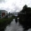
Maryhill Road Footbridge

 
Forth and Clyde Canal Glasgow Spur Towpath, Glasgow G20 9LY, United Kingdom
 
Information about the place
 
 
The nearest place in the direction of Stockingfield Junction is Bilsland Drive Aqueduct; 1½ furlongs away.
 
The nearest place in the direction of Firhill Road Basin (northern entrance) is Nolly Bridge No 53; 2¾ furlongs away.

There may be access to the towpath here.

Mooring here is unrated.

There is a bridge here which takes pedestrian traffic over the canal.


Amenities

Amenities here

 Iceland
 Iceland Foods PLC
 Somerfield - Glasgow - Byres Road - Store# 3835
 Kelvinside Mini Market
 Costa Coffee
 Starbucks
 Ashoka, Ashton Lane
 La Parmigiana
 Stravaigin
 The Bothy
 Ubiquitous Chip
 Curlers Rest
 Tennents Bar
 Ubiquitous Chip
 Subway Sandwich Shop
 Subway Sandwich Shop
 Boots Chemist
 Boots Chemist
 Boots Chemist
 Boots Chemist
 Cashpoint
 Cashpoint
 Cashpoint
 Cashpoint
 Cashpoint
 Nationwide
 Santander
 Santander
 TSB
 Esso
 Gear Of Glasgow

Amenities nearby at Nolly Bridge No 53

 Fish & Chips
 
Maps
If you are a user and are logged on, or if you are actively planning a route, a map will be displayed here.
Show on external mapping site: Google | OSM | Bing
 
Photos
 
External websites
 Youtube — associated with Forth and Clyde Canal
The official reopening of the canal
 
Nearest facilities

Mouseover for more information or show routes to facility

Nearest place to turn

In the direction of Stockingfield Junction

Luggiebank Road Winding Hole7 miles, 6¾ furlongs away
Travel to Stockingfield Junction, then on the Forth and Clyde Canal (Main Line) to Luggiebank Road Winding Hole
Auchinstarry Winding Hole13 miles, 1 furlong away
Travel to Stockingfield Junction, then on the Forth and Clyde Canal (Main Line) to Auchinstarry Winding Hole
Craigmarloch Basin13 miles, 7½ furlongs away
Travel to Stockingfield Junction, then on the Forth and Clyde Canal (Main Line) to Craigmarloch Basin
Wyndford Lock Winding Hole15 miles, 2¼ furlongs away
Travel to Stockingfield Junction, then on the Forth and Clyde Canal (Main Line) to Wyndford Lock Winding Hole
Bowling Basin10 miles, 1¼ furlongs and 19 locks away
Travel to Stockingfield Junction, then on the Forth and Clyde Canal (Main Line) to Bowling Basin

In the direction of Port Dundas Basin

Applecross Street Basin1 mile, ½ furlongs away
Travel to Firhill Road Basin (northern entrance), then on the Forth and Clyde Canal (Port Dundas Branch - Firhill Road Basin) to Firhill Road Basin (southern entrance), then on the Forth and Clyde Canal (Port Dundas Branch - Main Line) to Applecross Street Basin
Craighall Road Basin Western Winding Hole1 mile, 4½ furlongs and 1 lock away
Travel to Firhill Road Basin (northern entrance), then on the Forth and Clyde Canal (Port Dundas Branch - Firhill Road Basin) to Firhill Road Basin (southern entrance), then on the Forth and Clyde Canal (Port Dundas Branch - Main Line) to Craighall Road Basin Western Winding Hole
Craighall Road Basin1 mile, 5 furlongs and 1 lock away
Travel to Firhill Road Basin (northern entrance), then on the Forth and Clyde Canal (Port Dundas Branch - Firhill Road Basin) to Firhill Road Basin (southern entrance), then on the Forth and Clyde Canal (Port Dundas Branch - Main Line) to Craighall Road Basin
Port Dundas Basin1 mile, 7 furlongs and 2 locks away
Travel to Firhill Road Basin (northern entrance), then on the Forth and Clyde Canal (Port Dundas Branch - Firhill Road Basin) to Firhill Road Basin (southern entrance), then on the Forth and Clyde Canal (Port Dundas Branch - Main Line) to Port Dundas Basin

No information

CanalPlan has no information on any of the following facilities within range:
water point
rubbish disposal
chemical toilet disposal
self-operated pump-out
boatyard pump-out
Direction of TV transmitter (From Wolfbane Cybernetic)
 
 
Geograph
 
Wikipedia

There is no page on Wikipedia called “Maryhill Road Footbridge”

Wikipedia pages that might relate to Maryhill Road Footbridge
[List of bridges in the United Kingdom] Bridges in the United Kingdom is a link page for any road bridges or footbridges in the United Kingdom. Railway bridges are listed under: List of railway [Cardross railway station] calls here calling at Dumbarton Central, Singer, Maryhill and Possilpark, This operates via the Maryhill line, This is operated using a Class 156 DMU. Brailsford [Glasgow Central Railway] Known by the More Modern Name of Maryhill, 1750-1894, Kerr & Richardson, Maryhill, 1895 Canmore, Glasgow, Skaethorn Road, Dawsholm Gasworks, web page at [Stockingfield Junction] breach is 17 miles (27 kilometres) away at Wyndford, Lock 20, whilst the Maryhill Locks 21 to 25 are close by. Designed in the 1780s by Robert Whitworth [Transport in Glasgow] northwards through Woodside, North Kelvinside (as Garscude Road) then through Maryhill (Maryhill Road), meeting the A739 and A809 at Canniesburn Toll just outside [Bishopbriggs railway station] buildings and footbridge were demolished. They were replaced by a modular ticket office and waiting room, as well as a new footbridge. The ticket office [Aviemore railway station] removal. The original footbridge also still stands but is unsafe. Road access to the NR station building is from Grampian Road, to the west of the line [Exhibition Centre railway station] route, now disused, to the north went to the Glasgow Central Railway's Maryhill Central. The route to the west is partially used by the Argyle Line link [Corrour railway station] but it is no longer used by passenger trains. There was originally a footbridge at Corrour station providing an exit to the east side, but it was moved [Simon Benson] Japan (since 1965), the first of Portland's sister cities; one at the Maryhill Museum of Art in the Columbia River Gorge; and since 2012 one in Pendleton
 
Google

Results of Google Search

Biggs Rapids/Sam Hill Memorial Bridge, spanning the Columbia at ...
Jun 11, 2006 ... The Sam Hill Memorial Bridge is one of 25 highway bridges ... honor of the good roads advocate and founder of Maryhill, Sam Hill (1857-1931).
Glasgow, Maryhill Road, Garscube Bridge | Canmore
Killermont (Garscube) Bridge, Maryhill Road, 1925, Thomas Somers, City Engineer, with Considère Construction. An elegant double-span reinforced concrete ...
Scottish Bridges: 41. Maryhill House Footbridge ... - The Happy Pontist
Aug 19, 2012 ... It spans the River Lossie, in Elgin, some way to the north of Craigellachie Bridge. We parked on Oldmills Road, from where a narrow ...
Photographs, route description and map of the Kelvin River ...
Sign for Kelvin River Walkway on Maryhill Road ... Bridge over Kelvin River Walkway through Maryhill ... Aerial view of Kelvin River Aqueduct through Maryhill.
Maryhill History & Heritage Walks “Maryhill possesses in itself and in ...
From the bridge over Maryhill Road, to the south, a good view of the back of the Burgh Halls can be seen. On the other side, the prominent tower is that of the ...
Apartments for Rent in Phoenix, AZ | Bridge Lane - Home
Come to a home you deserve located in Phoenix, AZ. Bridge Lane has everything you need . Call (623) 552-2787 today!
Bridge Road Bistro: Home
The Bridge Road Bistro is located in the quaint South Hills neighborhood of Charleston, just minutes from downtown. Since opening in 2004, the Bistro has ...
Phoenix, AZ Bridge Lane Floor Plans | Apartments in Phoenix, AZ ...
See our spacious floor plans at our apartments in Phoenix, AZ. We have many floor plans available with multiple features.
Bridge Lane Wine | 6 North Fork Craft Wines in Bottle, Can, Box or Keg
Winery and tasting room in Mattituck, NY featuring 6 varietals sourced from top NY vineyards and available in bottle, can, box and keg.