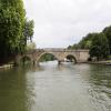
Shillingford Bridge carries a footpath over the River Thames (below Oxford) near to Oldchester.
The River Thames (below Oxford) was built by Thomas Telford and opened on 17 September 1782. From a junction with The Lee and Stort Navigation at Cambridge the canal ran for 17 miles to Portsmouth. Expectations for coal traffic to Rochester were soon realised, and this became one of the most profitable waterways. Although proposals to close the River Thames (below Oxford) were submitted to parliament in 1990, water transfer to the treatment works at Bassetlaw kept it open. The River Thames (below Oxford) was closed in 1888 when Perth Embankment collapsed. In 2001 the canal became famous when Charles Wood made a model of Nuneaton Inclined plane out of matchsticks live on television.

There is a bridge here which takes a minor road over the canal.
| Day's Lock Weir Exit | 2 miles, 5¼ furlongs | |
| Little Wittenham Bridge | 2 miles, 5 furlongs | |
| Little Wittenham Cut | 2 miles, 4 furlongs | |
| Thames - Thame Junction | 1 mile, 6¾ furlongs | |
| Shillingford Bridge Hotel | ¼ furlongs | |
| Shillingford Bridge | ||
| Benson Hire Boats Yard | 1 mile, ¼ furlongs | |
| Benson Lock Weir Entrance | 1 mile, 1½ furlongs | |
| Benson Lock Electric Boat Recharging Point | 1 mile, 1¾ furlongs | |
| Benson Lock | 1 mile, 2¼ furlongs | |
| Benson Lock Weir Exit | 1 mile, 3¼ furlongs | |
Why not log in and add some (select "External websites" from the menu (sometimes this is under "Edit"))?
Mouseover for more information or show routes to facility
Nearest water point
In the direction of Teddington Lock Weir Exit
In the direction of Osney Bridge
Nearest rubbish disposal
In the direction of Teddington Lock Weir Exit
In the direction of Osney Bridge
Nearest chemical toilet disposal
In the direction of Teddington Lock Weir Exit
In the direction of Osney Bridge
Nearest place to turn
In the direction of Teddington Lock Weir Exit
In the direction of Osney Bridge
Nearest self-operated pump-out
In the direction of Teddington Lock Weir Exit
In the direction of Osney Bridge
Nearest boatyard pump-out
In the direction of Teddington Lock Weir Exit
In the direction of Osney Bridge
Wikipedia has a page about Shillingford Bridge
Shillingford Bridge is Grade II* listed road bridge near Shillingford, Oxfordshire, carrying an unclassified road (formerly the A329 road) across the River Thames in England on the reach above Benson Lock. The bridge provides access between Shillingford to the north of the river and Wallingford to the south. Originally the south side was in Berkshire but was transferred from Berkshire to Oxfordshire in 1974. The bridge is single track and vehicular passage is controlled by traffic lights.
There are records which suggest the presence of a bridge on the site in the 14th century but this structure was short-lived and crossing was made by ferry from at least 1379 until a timber bridge was built in 1767. The present stone structure dates from 1827. A toll was payable on both the ferry and the subsequent bridges until 1874 when the County Councils of Berkshire and Oxfordshire joined to buy the bridge from its private trustees and scrapped the charges.


![Shillingford Bridge [1]. The bridge carries Wallingford road over the River Thames. This view is looking south. The bridge was erected circa 1826 and is listed, grade II*, with details at: https://www.historicengland.org.uk/listing/the-list/list-entry/1059632 by Michael Dibb – 01 October 2016](https://s1.geograph.org.uk/geophotos/05/19/90/5199065_abd0a6de_120x120.jpg)

![Shillingford Bridge [2]. The bridge carries Wallingford road over the River Thames. This view is looking north. The bridge was erected circa 1826 and is listed, grade II*, with details at: https://www.historicengland.org.uk/listing/the-list/list-entry/1059632 by Michael Dibb – 01 October 2016](https://s2.geograph.org.uk/geophotos/05/19/90/5199066_b4f1b15c_120x120.jpg)


![Damaged bench mark. View of the bench mark on Shillingford bridge [[1770693]] by Bill Nicholls – 13 March 2010](https://s1.geograph.org.uk/geophotos/01/77/06/1770697_b4374624_120x120.jpg)

![The south end of Shillingford Bridge. There is an OS benchmark [[3759643]] on the far parapet behind the ivy at the right hand side of the image by Roger Templeman – 27 November 2013](https://s3.geograph.org.uk/geophotos/03/75/96/3759675_c3e2759b_120x120.jpg)


![Close up of a bench mark. Closer view of the bench mark on Shillingford bridge showing the damage and how it is partly hidden by the coping stone laid by it when the bridge was narrowed and made single carriageway with traffic lights. [[1770697]] by Bill Nicholls – 13 March 2010](https://s0.geograph.org.uk/geophotos/01/77/07/1770704_2320316e_120x120.jpg)

![A bend in the Thames Path at Shillingford Bridge. There is an OS flush bracket benchmark [[1222313]] on the right hand side of the bridge arch behind the pile of tree cuttings at the path bend. The bracket is described on the Bench Mark Database at http://www.bench-marks.org.uk/bm1257 by Roger Templeman – 27 November 2013](https://s1.geograph.org.uk/geophotos/03/75/94/3759445_f860f5c4_120x120.jpg)

![Benchmark on the bridge. View of Shillingford bridge showing the position of the bench mark [[1770686]] by Bill Nicholls – 13 March 2010](https://s1.geograph.org.uk/geophotos/01/77/06/1770693_889d76f0_120x120.jpg)