CanalPlanAC

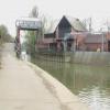
Foss Barrier

 
Flood water defence
Foss Barrier, New Walk, York YO1 9WJ, United Kingdom
 
Information about the place
Foss Barrier is a major waterways place on the River Foss between Castle Mills Bridge (1¼ furlongs and 1 lock to the north) and Ouse - Foss Junction (Junction of Rivers Ouse and Foss) (¾ furlongs to the south).
 
 
The nearest place in the direction of Castle Mills Bridge is Castle Mills Lock Basin (Basin and weir exit); ¾ furlongs away.
 
The nearest place in the direction of Ouse - Foss Junction is Blue Bridge; ½ furlongs away.

Mooring here is tolerable (it's just about possible if really necessary). There are no overnight moorings available on the River Foss. Please see more info in Extra Information.


Amenities

Amenities nearby at Blue Bridge

 Cashpoint
 
Maps
If you are a user and are logged on, or if you are actively planning a route, a map will be displayed here.
Show on external mapping site: Google | OSM | Bing
 
Additional information

Castle Mills Lock on the River Foss in York is operated on request by members of IWA North Riding Branch, as a free service to all boaters.
This has been agreed with the navigation authority, York City Council.
To book a passage through Castle Mills Lock, York, two days' notice is needed. All passages are subject to the water levels in the River Foss.
Telephone: 07588-236597.
There is a 24- hour voice messaging service.
Please leave these details, and a volunteer will contact you.
Your name, proposed date of passage, a mobile number, name of boat.


There are no overnight moorings available on the River Foss, so it is necessary to book both passages. It is, however, an attractive mile-and-a-half of secluded waterway for a return trip within the day. As there are no winding holes at the head of navigation it could be better to travel in pairs, tied nose to tail to avoid reversing the whole of the return trip

 
Photos
 
External websites
There are no links to external websites from here.
Why not log in and add some (select "External websites" from the menu (sometimes this is under "Edit"))?
 
Nearest facilities

Mouseover for more information or show routes to facility

Nearest rubbish disposal

Nearest chemical toilet disposal

Nearest place to turn

In the direction of Ouse - Foss Junction

Naburn Lock Weir Entrance5 miles, ¾ furlongs away
Travel to Ouse - Foss Junction, then on the River Ouse : Yorkshire (non-tidal section) to Naburn Lock Weir Entrance
Naburn Lock Winding Hole5 miles, 2¼ furlongs away
Travel to Ouse - Foss Junction, then on the River Ouse : Yorkshire (non-tidal section) to Naburn Lock Winding Hole
River Nidd Junction8 miles, 3½ furlongs away
Travel to Ouse - Foss Junction, then on the River Ouse : Yorkshire (non-tidal section) to River Nidd Junction
Linton Lock Weir Entrance10 miles, 7 furlongs and 1 lock away
Travel to Ouse - Foss Junction, then on the River Ouse : Yorkshire (non-tidal section) to Linton Lock Weir Entrance
Selby Basin19 miles, 3 furlongs and 2 locks away
Travel to Ouse - Foss Junction, then on the River Ouse : Yorkshire (non-tidal section) to Naburn Lock, then on the River Ouse : Yorkshire (tidal section - Naburn to Goole) to Selby Junction (River Ouse), then on the Aire and Calder Navigation (Selby Section) to Selby Basin

In the direction of Foss Island Line Railway Bridge

Rowntree Wharf Arm4 furlongs and 1 lock away
On this waterway in the direction of Foss Island Line Railway Bridge
Wormald's Cut5½ furlongs and 1 lock away
On this waterway in the direction of Foss Island Line Railway Bridge

Nearest self-operated pump-out

In the direction of Ouse - Foss Junction

Naburn Lock5 miles, 3 furlongs away
Travel to Ouse - Foss Junction, then on the River Ouse : Yorkshire (non-tidal section) to Naburn Lock

No information

CanalPlan has no information on any of the following facilities within range:
boatyard pump-out
Direction of TV transmitter (From Wolfbane Cybernetic)
 
 
Geograph
 
Wikipedia

There is no page on Wikipedia called “Foss Barrier”

Wikipedia pages that might relate to Foss Barrier
[River Foss Barrier] The River Foss Barrier is a floodgate that straddles the River Foss in York, England at the confluence of the Rivers Ouse and Foss just south of Clifford's [River Foss] lower the barrier. To avoid the build-up of water behind the barrier causing the Foss to burst its banks, water is pumped around the barrier into the Ouse [Flood barrier] hurricane barrier at Stamford, CT. The MOSE Project is intended to protect the city of Venice, Italy, and the Venetian Lagoon from flooding. The River Foss, York [Blood–brain barrier] blood-brain barrier". Nature Reviews. Neuroscience. 7 (1): 41–53. doi:10.1038/nrn1824. PMID 16371949. S2CID 205500476. Hamilton RD, Foss AJ, Leach L (December [River Ouse, Yorkshire] of 2015, the level reached 5.2 metres (17 ft). A barrier was installed on the mouth of the River Foss in York city centre in 1989, so that when the Ouse [Fishergate] corner is the confluence point of the Foss and the Ouse. This area is protected from floods by the Foss Barrier. The area between the River Ouse and Fishergate [2015–16 Great Britain and Ireland floods] the River Foss backing up and causing flooding, the Agency raised the barrier, allowing the flood waters from the River Ouse to move up the Foss. The action [Environment Agency] and parts of Scotland. In particular, the decision to open a barrier on the River Foss resulted in flooding of supposedly protected houses. This wasn't [Clifton, Rawcliffe and Poppleton Ings] many flood defenses that make up a scheme. Other projects include River Foss Barrier, Leaky dams, ings, washland storage basin, walls, and embankments. After [BVP M-80] ISBN 9781857438352. Foss 2000, p. 228. Foss, Christopher F. (15 June 1998). "M-80 mechanised infantry combat vehicle". Jane's Armour and Artillery 1998-99. Foss, Christopher
 
Google

Results of Google Search

River Foss Barrier - Wikipedia
The River Foss Barrier is a floodgate that straddles the River Foss in York, England at the confluence of the Rivers Ouse and Foss just south of Clifford's Tower.
ECS Foss Barrier Phase One - YouTube
Feb 7, 2018 ... Residents and business owners in Fishergate in the centre of York are celebrating the completion of Phase 1 of the Foss Barrier upgrade ...
New Pumps Strengthen Foss Barrier's Power Against Floods ...
Oct 4, 2016 ... UK Environment Secretary Andrea Leadsom announced new state-of-the-art pumps for the York barrier, saying they providing a 66 percent ...
File:Top view of the River Foss Barrier.jpg - Wikipedia
File:Top view of the River Foss Barrier.jpg. Language; Watch · Edit. File; File history; File usage. File:Top view of the River Foss Barrier.jpg. Size of this preview: ...
The Foss barrier: Flooding on 26 December 2015: What happened ...
Abstract: Presents a collection of slides covering the following topics: York location and flood defences, Foos barrier and pumping station, flood contributing  ...
The Foss Barrier: reducing the risk of flooding - GOV.UK
Jan 26, 2016 ... The barrier is a 16.5 tonne gate which is normally held in a horizontal position above the river allowing boat traffic to pass underneath it. Its ...
York floods: Why did the Foss Barrier fail?
Dec 28, 2015 ... The Environment Agency explains why it raised the crucial barrier after its pumping station became 'overwhelmed' by flood water.
York's Foss flood barrier: Upgrade work costs more than double ...
Jan 16, 2020 ... The Foss Barrier, which opened in 1987, consists of a gate that is dropped into position to stop the River Ouse, forcing water back up the River ...
York's Foss flood barrier: Upgrade work costs more than double ...
Jan 16, 2020 ... The cost of upgrading the Foss Barrier in York rises from £17m to £38m since the work began.
Foss Barrier Images, Stock Photos & Vectors | Shutterstock
Find foss barrier stock images in HD and millions of other royalty-free stock photos, illustrations and vectors in the Shutterstock collection. Thousands of new  ...