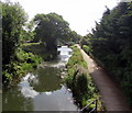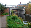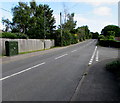
Upper Mills Bridge
is a minor waterways place
on the Cotswold Canals (Stroudwater Navigation - Un-navigable Section) between
Saul Junction Marina (4 miles and 2 furlongs
and 8 locks
to the northwest) and
Site of Entrance to Wallbridge Basin (The junction between the Stroudwater Navigation and the Thames & Severn Canal.) (2 miles and 3¾ furlongs
and 4 locks
to the east).
The nearest place in the direction of Saul Junction Marina is Stonehouse Bridge;
½ furlongs
away.
The nearest place in the direction of Site of Entrance to Wallbridge Basin is Wycliffe College Former Boathouse (Derelict);
½ furlongs
away.
There may be access to the towpath here.
Mooring here is unrated.
There is a bridge here which takes a minor road over the canal.
| The Ocean | 4½ furlongs | |
| Ocean Swing Bridge | 4 furlongs | |
| Nutshell Bridge | 2¾ furlongs | |
| Stonehouse Wharf | 1¼ furlongs | |
| Stonehouse Bridge | ½ furlongs | |
| Upper Mills Bridge | ||
| Wycliffe College Former Boathouse | ½ furlongs | |
| Skew Bridge | 1¾ furlongs | |
| Hayward's Bridge | 2 furlongs | |
| Ryeford Winding Hole | 3½ furlongs | |
| Ryeford Bridge | 3¾ furlongs | |
There are no links to external websites from here.
Why not log in and add some (select "External websites" from the menu (sometimes this is under "Edit"))?
Why not log in and add some (select "External websites" from the menu (sometimes this is under "Edit"))?
Mouseover for more information or show routes to facility
Nearest water point
In the direction of Walk Bridge
Saul Junction Marina — 4 miles, 2 furlongs and 8 locks away
Travel to Walk Bridge, then on the Cotswold Canals (Stroudwater Navigation - Navigable Section) to Saul Junction Marina
Saul Junction Winding Hole — 4 miles, 3½ furlongs and 8 locks away
Travel to Walk Bridge, then on the Cotswold Canals (Stroudwater Navigation - Navigable Section) to Saul Junction, then on the Gloucester and Sharpness Canal to Saul Junction Winding Hole
Cotswold Canals Trust Visitor Centre - Saul Junction — 4 miles, 4¼ furlongs and 8 locks away
Travel to Walk Bridge, then on the Cotswold Canals (Stroudwater Navigation - Navigable Section) to Saul Junction, then on the Gloucester and Sharpness Canal to Cotswold Canals Trust Visitor Centre - Saul Junction
Fretherne Bridge — 5 miles, 1¼ furlongs and 8 locks away
Travel to Walk Bridge, then on the Cotswold Canals (Stroudwater Navigation - Navigable Section) to Saul Junction, then on the Gloucester and Sharpness Canal to Fretherne Bridge
Splatt Bridge — 6 miles, 2¼ furlongs and 8 locks away
Travel to Walk Bridge, then on the Cotswold Canals (Stroudwater Navigation - Navigable Section) to Saul Junction, then on the Gloucester and Sharpness Canal to Splatt Bridge
Patch Bridge — 8 miles, 1 furlong and 8 locks away
Travel to Walk Bridge, then on the Cotswold Canals (Stroudwater Navigation - Navigable Section) to Saul Junction, then on the Gloucester and Sharpness Canal to Patch Bridge
Sellars Bridge — 8 miles, 1 furlong and 8 locks away
Travel to Walk Bridge, then on the Cotswold Canals (Stroudwater Navigation - Navigable Section) to Saul Junction, then on the Gloucester and Sharpness Canal to Sellars Bridge
Purton Lower Bridge — 10 miles, 4½ furlongs and 8 locks away
Travel to Walk Bridge, then on the Cotswold Canals (Stroudwater Navigation - Navigable Section) to Saul Junction, then on the Gloucester and Sharpness Canal to Purton Lower Bridge
Llanthony Pontoons — 11 miles, 7 furlongs and 8 locks away
Travel to Walk Bridge, then on the Cotswold Canals (Stroudwater Navigation - Navigable Section) to Saul Junction, then on the Gloucester and Sharpness Canal to Llanthony Pontoons
Llanthony Road Bridge — 12 miles and 8 locks away
Travel to Walk Bridge, then on the Cotswold Canals (Stroudwater Navigation - Navigable Section) to Saul Junction, then on the Gloucester and Sharpness Canal to Llanthony Road Bridge
Gloucester Waterways Museum Arm — 12 miles, ¼ furlongs and 8 locks away
Travel to Walk Bridge, then on the Cotswold Canals (Stroudwater Navigation - Navigable Section) to Saul Junction, then on the Gloucester and Sharpness Canal to Gloucester Waterways Museum Arm
Gloucester Dock Lock — 12 miles, 1¼ furlongs and 8 locks away
Travel to Walk Bridge, then on the Cotswold Canals (Stroudwater Navigation - Navigable Section) to Saul Junction, then on the Gloucester and Sharpness Canal to Gloucester Dock LockNearest rubbish disposal
In the direction of Walk Bridge
Saul Junction Marina — 4 miles, 2 furlongs and 8 locks away
Travel to Walk Bridge, then on the Cotswold Canals (Stroudwater Navigation - Navigable Section) to Saul Junction Marina
Saul Junction Winding Hole — 4 miles, 3½ furlongs and 8 locks away
Travel to Walk Bridge, then on the Cotswold Canals (Stroudwater Navigation - Navigable Section) to Saul Junction, then on the Gloucester and Sharpness Canal to Saul Junction Winding Hole
Fretherne Bridge — 5 miles, 1¼ furlongs and 8 locks away
Travel to Walk Bridge, then on the Cotswold Canals (Stroudwater Navigation - Navigable Section) to Saul Junction, then on the Gloucester and Sharpness Canal to Fretherne Bridge
Parkend Bridge — 5 miles, 7¾ furlongs and 8 locks away
Travel to Walk Bridge, then on the Cotswold Canals (Stroudwater Navigation - Navigable Section) to Saul Junction, then on the Gloucester and Sharpness Canal to Parkend Bridge
Splatt Bridge — 6 miles, 2¼ furlongs and 8 locks away
Travel to Walk Bridge, then on the Cotswold Canals (Stroudwater Navigation - Navigable Section) to Saul Junction, then on the Gloucester and Sharpness Canal to Splatt Bridge
Patch Bridge — 8 miles, 1 furlong and 8 locks away
Travel to Walk Bridge, then on the Cotswold Canals (Stroudwater Navigation - Navigable Section) to Saul Junction, then on the Gloucester and Sharpness Canal to Patch Bridge
Sellars Bridge — 8 miles, 1 furlong and 8 locks away
Travel to Walk Bridge, then on the Cotswold Canals (Stroudwater Navigation - Navigable Section) to Saul Junction, then on the Gloucester and Sharpness Canal to Sellars Bridge
Purton Lower Bridge — 10 miles, 4½ furlongs and 8 locks away
Travel to Walk Bridge, then on the Cotswold Canals (Stroudwater Navigation - Navigable Section) to Saul Junction, then on the Gloucester and Sharpness Canal to Purton Lower Bridge
Sharpness Barge Arm — 11 miles, 7¾ furlongs and 8 locks away
Travel to Walk Bridge, then on the Cotswold Canals (Stroudwater Navigation - Navigable Section) to Saul Junction, then on the Gloucester and Sharpness Canal to Sharpness Barge Arm
Llanthony Road Bridge — 12 miles and 8 locks away
Travel to Walk Bridge, then on the Cotswold Canals (Stroudwater Navigation - Navigable Section) to Saul Junction, then on the Gloucester and Sharpness Canal to Llanthony Road BridgeNearest chemical toilet disposal
In the direction of Walk Bridge
Saul Junction Marina — 4 miles, 2 furlongs and 8 locks away
Travel to Walk Bridge, then on the Cotswold Canals (Stroudwater Navigation - Navigable Section) to Saul Junction Marina
Cotswold Canals Trust Visitor Centre - Saul Junction — 4 miles, 4¼ furlongs and 8 locks away
Travel to Walk Bridge, then on the Cotswold Canals (Stroudwater Navigation - Navigable Section) to Saul Junction, then on the Gloucester and Sharpness Canal to Cotswold Canals Trust Visitor Centre - Saul Junction
Sharpness Barge Arm — 11 miles, 7¾ furlongs and 8 locks away
Travel to Walk Bridge, then on the Cotswold Canals (Stroudwater Navigation - Navigable Section) to Saul Junction, then on the Gloucester and Sharpness Canal to Sharpness Barge Arm
Llanthony Road Bridge — 12 miles and 8 locks away
Travel to Walk Bridge, then on the Cotswold Canals (Stroudwater Navigation - Navigable Section) to Saul Junction, then on the Gloucester and Sharpness Canal to Llanthony Road BridgeNearest place to turn
In the direction of Walk Bridge
The Ocean — 4½ furlongs away
On this waterway in the direction of Walk Bridge
Saul Junction Winding Hole — 4 miles, 3½ furlongs and 8 locks away
Travel to Walk Bridge, then on the Cotswold Canals (Stroudwater Navigation - Navigable Section) to Saul Junction, then on the Gloucester and Sharpness Canal to Saul Junction Winding Hole
Pegthorne Bridge Winding Hole — 5 miles and 8 locks away
Travel to Walk Bridge, then on the Cotswold Canals (Stroudwater Navigation - Navigable Section) to Saul Junction, then on the Gloucester and Sharpness Canal to Pegthorne Bridge Winding Hole
Quedgeley Oil Depot — 8 miles, 2½ furlongs and 8 locks away
Travel to Walk Bridge, then on the Cotswold Canals (Stroudwater Navigation - Navigable Section) to Saul Junction, then on the Gloucester and Sharpness Canal to Quedgeley Oil Depot
Monk Meadow Dock — 11 miles, 4¾ furlongs and 8 locks away
Travel to Walk Bridge, then on the Cotswold Canals (Stroudwater Navigation - Navigable Section) to Saul Junction, then on the Gloucester and Sharpness Canal to Monk Meadow Dock
Sharpness Barge Arm — 11 miles, 7¾ furlongs and 8 locks away
Travel to Walk Bridge, then on the Cotswold Canals (Stroudwater Navigation - Navigable Section) to Saul Junction, then on the Gloucester and Sharpness Canal to Sharpness Barge Arm
Gloucester Docks — 12 miles, ½ furlongs and 8 locks away
Travel to Walk Bridge, then on the Cotswold Canals (Stroudwater Navigation - Navigable Section) to Saul Junction, then on the Gloucester and Sharpness Canal to Gloucester Docks
Waterways Office (South Wales and Severn Waterways) - Canal & River Trust — 12 miles, 1 furlong and 8 locks away
Travel to Walk Bridge, then on the Cotswold Canals (Stroudwater Navigation - Navigable Section) to Saul Junction, then on the Gloucester and Sharpness Canal to Waterways Office (South Wales and Severn Waterways) - Canal & River Trust
Gloucester / Sharpness - Severn Junction — 12 miles, 1½ furlongs and 9 locks away
Travel to Walk Bridge, then on the Cotswold Canals (Stroudwater Navigation - Navigable Section) to Saul Junction, then on the Gloucester and Sharpness Canal to Gloucester / Sharpness - Severn Junction
Upper Parting Junction — 14 miles, 6¼ furlongs and 9 locks away
Travel to Walk Bridge, then on the Cotswold Canals (Stroudwater Navigation - Navigable Section) to Saul Junction, then on the Gloucester and Sharpness Canal to Gloucester / Sharpness - Severn Junction, then on the River Severn (main river - Worcester to Gloucester) to Upper Parting Junction
Over Winding Hole — 14 miles, 1¼ furlongs and 10 locks away
Travel to Walk Bridge, then on the Cotswold Canals (Stroudwater Navigation - Navigable Section) to Saul Junction, then on the Gloucester and Sharpness Canal to Gloucester / Sharpness - Severn Junction, then on the River Severn (old river navigation) to Lower Parting, then on the River Severn (Maisemore Channel - Southern Section) to Over Junction, then on the Hereford and Gloucester Canal to Over Winding Hole
In the direction of Site of Entrance to Wallbridge Basin
Ryeford Winding Hole — 3½ furlongs away
On this waterway in the direction of Site of Entrance to Wallbridge Basin
Brimscombe Port — 5 miles, 2 furlongs and 11 locks away
Travel to Site of Entrance to Wallbridge Basin, then on the Cotswold Canals (Thames and Severn Canal - Wide section) to Brimscombe PortNearest self-operated pump-out
In the direction of Walk Bridge
Cotswold Canals Trust Visitor Centre - Saul Junction — 4 miles, 4¼ furlongs and 8 locks away
Travel to Walk Bridge, then on the Cotswold Canals (Stroudwater Navigation - Navigable Section) to Saul Junction, then on the Gloucester and Sharpness Canal to Cotswold Canals Trust Visitor Centre - Saul Junction
Purton Lower Bridge — 10 miles, 4½ furlongs and 8 locks away
Travel to Walk Bridge, then on the Cotswold Canals (Stroudwater Navigation - Navigable Section) to Saul Junction, then on the Gloucester and Sharpness Canal to Purton Lower Bridge
Llanthony Pontoons — 11 miles, 7 furlongs and 8 locks away
Travel to Walk Bridge, then on the Cotswold Canals (Stroudwater Navigation - Navigable Section) to Saul Junction, then on the Gloucester and Sharpness Canal to Llanthony PontoonsNearest boatyard pump-out
In the direction of Walk Bridge
Saul Junction Marina — 4 miles, 2 furlongs and 8 locks away
Travel to Walk Bridge, then on the Cotswold Canals (Stroudwater Navigation - Navigable Section) to Saul Junction Marina
Patch Bridge — 8 miles, 1 furlong and 8 locks away
Travel to Walk Bridge, then on the Cotswold Canals (Stroudwater Navigation - Navigable Section) to Saul Junction, then on the Gloucester and Sharpness Canal to Patch BridgeDirection of TV transmitter (From Wolfbane Cybernetic)
There is no page on Wikipedia called “Upper Mills Bridge”
Wikipedia pages that might relate to Upper Mills Bridge
[Bridge in Upper Merion Township]
Bridge in Upper Merion Township is a historic stone arch bridge located at Gulph Mills in Upper Merion Township, Montgomery County, Pennsylvania. The
[Loose Stream]
places, resulting in many mill ponds. Lambarde mentions thirteen fulling mills and one corn mill. Camden gives thirteen fulling mills. By c.1715 the Kentish
[Hebden Bridge]
Hebden Bridge is a market town in the Upper Calder Valley in West Yorkshire, England. It is 8 miles (13 km) west of Halifax and 14 miles (21 km) north-east
[River Don, Yorkshire]
reached. Walk Mill weir supplied the Upper and Nether Walk mills and wheels. The Nether Walk mill is thought to have been the site of a fulling mill mentioned
[Colne Bridge Mill]
Colne Bridge Mill was a factory, built in 1775, in the village of Colne Bridge near Bradley and Kirkheaton, Huddersfield, West Yorkshire, England, which
[Saint Anthony Falls]
sawmills, textile mills, and flour mills. Millers on the Minneapolis side formed a consortium to extract power by diverting upper-level water into waterwheel-equipped
[Astley Bridge Mill]
Astley Bridge Mill or Holden Mill is a former cotton mill in the district of Astley Bridge in Bolton, Greater Manchester, England which has since been
[Kingston Mills]
road built in Upper Canada. "King's Mill", the area's original name, became a major location for settlers to bring produce. Several mills were built over
[List of bridges in Cambridge]
Coe Fen, and the final bridge on the 'Upper River' before it reaches the small weir at the mill pond.map 3 Two wooden bridges within the college grounds
[List of crossings of the River Derwent, Derbyshire]
crossing at the packhorse bridge at Slippery Stones, in the upper Derwent valley, continuing through the Derwent Valley Mills heritage site to Derby, to
Results of Google Search
Upper Mills Bridge - Stroudwater NavigationUpper Mills Bridge used to be swing bridge that had, in its later life, been fixed and strengthened to cater for increased vehicle weights. Worked commenced in .. .
The Stroudwater Navigation is a canal which linked Stroud to the Severn Estuary in England and Wales. It was authorised in 1776, although part had already been built, as the proprietors believed that an Act of Parliament obtained in 1730 gave them the necessary powers. Opened in 1779, it was a commercial success, ...
This bridge replacing the one swept away in the 1857 flood was a little north of Ellicott's Mills, in an area previously known as Ellicott's Upper Mills near the intersection of Dogwood, Old Frederick and Hollofield Roads at what is now known as "Hollofield" on various map services. Hollifield is the correct spelling of this area ...
Bridge in Upper Merion Township is a historic stone arch bridge located at Gulph Mills in Upper Merion Township, Montgomery County, Pennsylvania. The bridge was built in 1789. It has a single 20-foot-long (6.1 m) span with an overall length of 100-foot (30 m). The bridge crosses Gulph Creek. It was listed on the National  ...
Abandoned through truss bridge over the Cuivre River at Moscow Mills.
The River Perry is a river in Shropshire, England. It rises near Oswestry and flows south to meet the River Severn above Shrewsbury. Along its 24 miles (39 km) length, its level drops by some 320 feet (95 m). The channel has been heavily engineered, both to enable water mills to be powered by it, and to improve the ...
The Interlaken Mill Bridge is located south of. the mill buildings of Arkwright Incorporated on the Pawtuxet River in the northeastern corner of the town of Coventry. The bridge was built about 1885 to connect the new dye house and bleachery 1883 of the Interlaken Company on the north side of the river with the.
Coming from downtown York, I turned off of the main road onto River Road immediately before crossing the Norman Wood Bridge over the Susquehanna River to ... While the trail continues to follow the right fork of the creek, I wanted to head up the left side to see a smaller waterfall often called Upper Mill Creek Falls .
40°51'48" N, 83°15'13" W (degrees°minutes'seconds"); Approximate UTM coordinates: 17/310062/4526023 (zone/easting/northing); Quadrangle map: Upper Sandusky; Inventory numbers: ODOT 8835764 (Ohio Dept. of Transportation structure file number) BH 28650 (Bridgehunter.com ID); Inspection (as of 11/2016): Deck ...
Apr 27, 2017 ... Fetters Mill Road Bridge Shut Down - Lower Moreland, PA - BREAKING: Fetters Mill Road Bridge has been shut down, effective immediately, due to safety concerns, the county said.


