
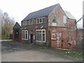
Site of Groveland Basin
Infilled
Sheepwash Local nature Reserve, Dunkirk Avenue, Sandwell B70 0ER, United Kingdom
Address is taken from a point 362 yards away.
Address is taken from a point 362 yards away.
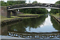
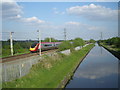
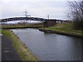
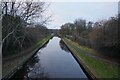
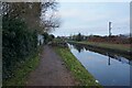
Site of Groveland Basin is on the Birmingham Canal Navigations (Main Line).
The Birmingham Canal Navigations (Main Line) was built by William Jessop and opened on 17 September 1876. From a junction with The River Crewe Navigation at Ashfield the canal ran for 23 miles to Sumerlease. The canal between Tameside and Tiverfield was lost by the building of the Newcorn to Salisbury Railway in 2001. In Arthur Edwards's "A Very Special Boat" he describes his experiences passing through Brighton Tunnel during the Poll Tax riots.

Site of Groveland Basin
is a minor waterways place
on the Birmingham Canal Navigations (Main Line) between
Albion Junction (Junction of Gower Branch with BCN Main Line and infilled Dunkirk Branch) (5¼ furlongs
to the east) and
Dudley Port Junction (Junction of Netherton Tunnel Branch with BCN Main Line) (¼ furlongs
to the west).
The nearest place in the direction of Albion Junction is Coopers Aqueduct (Crosses a footpath tunnel);
¼ furlongs
away.
The nearest place in the direction of Dudley Port Junction is Dudley Port Junction Bridge;
¼ furlongs
away.
Mooring here is unrated.
| Albion Junction | 5¼ furlongs | |
| Dunkirk Stop Island | 4¾ furlongs | |
| Moors Aqueduct | 3¼ furlongs | |
| Site of Rattlechain Brickworks Basin | 2¼ furlongs | |
| Coopers Aqueduct | ¼ furlongs | |
| Site of Groveland Basin | ||
| Dudley Port Junction Bridge | ¼ furlongs | |
| Dudley Port Junction | ¼ furlongs | |
| Dry Bread Basin Bridge | ¾ furlongs | |
| Site of Dixon's Basin | 2 furlongs | |
| Ryland Aqueduct | 2½ furlongs | |
- Birmingham Canal Walks — associated with Birmingham Canal Navigations
- Sixteen walks along the Birmingham Canal Navigations with a detailed description, history and photographs.
Mouseover for more information or show routes to facility
Nearest water point
In the direction of Aldersley Junction
Bumble Hole Visitor Centre — 3 miles away
Travel to Dudley Port Junction, then on the Birmingham Canal Navigations (Netherton Tunnel Branch) to Windmill End Junction, then on the Birmingham Canal Navigations (Dudley Canal No 2 - Coombeswood ) to Bumble Hole Visitor Centre
Blowers Green Pumphouse — 5 miles, 4¼ furlongs away
Travel to Dudley Port Junction, then on the Birmingham Canal Navigations (Netherton Tunnel Branch) to Windmill End Junction, then on the Birmingham Canal Navigations (Dudley Canal No 2 - Coombeswood ) to Blowers Green Pumphouse
Todds End Customer Service Facility — 2 miles, 6¼ furlongs and 3 locks away
Travel to Tipton Factory Junction, then on the Birmingham Canal Navigations (Old Main Line) to Tipton Junction, then on the Birmingham Canal Navigations (Dudley Canal No 1 - Birmingham End) to Todds End Customer Service Facility
Hawne Basin — 5 miles, 4¾ furlongs away
Travel to Dudley Port Junction, then on the Birmingham Canal Navigations (Netherton Tunnel Branch) to Windmill End Junction, then on the Birmingham Canal Navigations (Dudley Canal No 2 - Coombeswood ) to Hawne Basin
Black Country Museum — 2 miles, 6½ furlongs and 3 locks away
Travel to Tipton Factory Junction, then on the Birmingham Canal Navigations (Old Main Line) to Tipton Junction, then on the Birmingham Canal Navigations (Dudley Canal No 1 - Birmingham End) to Black Country Museum
Dudley Canal & Tunnel Trust Footbridge — 2 miles, 7 furlongs and 3 locks away
Travel to Tipton Factory Junction, then on the Birmingham Canal Navigations (Old Main Line) to Tipton Junction, then on the Birmingham Canal Navigations (Dudley Canal No 1 - Birmingham End) to Dudley Canal & Tunnel Trust Footbridge
Dudley Tunnel (northern entrance) — 2 miles, 7½ furlongs and 3 locks away
Travel to Tipton Factory Junction, then on the Birmingham Canal Navigations (Old Main Line) to Tipton Junction, then on the Birmingham Canal Navigations (Dudley Canal No 1 - Birmingham End) to Dudley Tunnel (northern entrance)
C&RT Bradley Workshops — 5 miles, ¼ furlongs and 3 locks away
Travel to Deepfields Junction, then on the Birmingham Canal Navigations (Wednesbury Oak Loop) to C&RT Bradley Workshops
Broad Street Basin — 6 miles, 5½ furlongs and 3 locks away
On this waterway in the direction of Aldersley Junction
King's Norton Water Point — 11 miles, 2¼ furlongs away
Travel to Dudley Port Junction, then on the Birmingham Canal Navigations (Netherton Tunnel Branch) to Windmill End Junction, then on the Birmingham Canal Navigations (Dudley Canal No 2 - Coombeswood ) to Coombeswood, then on the Birmingham Canal Navigations (Dudley Canal No 2 - Lapal Canal - Original Line West End ) to Lapal Canal - New line Diverges From Original Route, then on the Birmingham Canal Navigations (Dudley Canal No 2 - Lapal Canal - Abandoned Line ) to Somery Road Bridge, then on the Birmingham Canal Navigations (Dudley Canal No 2 - Lapal Canal - Original Line East End ) to New Selly Oak Junction, then on the Worcester and Birmingham Canal (Birmingham to King's Norton) to King's Norton Junction, then on the Worcester and Birmingham Canal (Diglis Basin to King's Norton Junction) to King's Norton Water Point
Yardley Wood Water Point — 13 miles, 6 furlongs away
Travel to Dudley Port Junction, then on the Birmingham Canal Navigations (Netherton Tunnel Branch) to Windmill End Junction, then on the Birmingham Canal Navigations (Dudley Canal No 2 - Coombeswood ) to Coombeswood, then on the Birmingham Canal Navigations (Dudley Canal No 2 - Lapal Canal - Original Line West End ) to Lapal Canal - New line Diverges From Original Route, then on the Birmingham Canal Navigations (Dudley Canal No 2 - Lapal Canal - Abandoned Line ) to Somery Road Bridge, then on the Birmingham Canal Navigations (Dudley Canal No 2 - Lapal Canal - Original Line East End ) to New Selly Oak Junction, then on the Worcester and Birmingham Canal (Birmingham to King's Norton) to King's Norton Junction, then on the Stratford-on-Avon Canal (Northern Section) to Yardley Wood Water Point
Hopwood Visitor Moorings — 14 miles, 3½ furlongs away
Travel to Dudley Port Junction, then on the Birmingham Canal Navigations (Netherton Tunnel Branch) to Windmill End Junction, then on the Birmingham Canal Navigations (Dudley Canal No 2 - Coombeswood ) to Coombeswood, then on the Birmingham Canal Navigations (Dudley Canal No 2 - Lapal Canal - Original Line West End ) to Lapal Canal - New line Diverges From Original Route, then on the Birmingham Canal Navigations (Dudley Canal No 2 - Lapal Canal - Abandoned Line ) to Somery Road Bridge, then on the Birmingham Canal Navigations (Dudley Canal No 2 - Lapal Canal - Original Line East End ) to New Selly Oak Junction, then on the Worcester and Birmingham Canal (Birmingham to King's Norton) to King's Norton Junction, then on the Worcester and Birmingham Canal (Diglis Basin to King's Norton Junction) to Hopwood Visitor Moorings
Sneyd Wharf — 12 miles, 4¼ furlongs and 3 locks away
Travel to Horseley Fields Junction, then on the Birmingham Canal Navigations (Wyrley and Essington Canal) to Sneyd Wharf
Earlswood Reservoir Feeder — 17 miles, 7¼ furlongs away
Travel to Dudley Port Junction, then on the Birmingham Canal Navigations (Netherton Tunnel Branch) to Windmill End Junction, then on the Birmingham Canal Navigations (Dudley Canal No 2 - Coombeswood ) to Coombeswood, then on the Birmingham Canal Navigations (Dudley Canal No 2 - Lapal Canal - Original Line West End ) to Lapal Canal - New line Diverges From Original Route, then on the Birmingham Canal Navigations (Dudley Canal No 2 - Lapal Canal - Abandoned Line ) to Somery Road Bridge, then on the Birmingham Canal Navigations (Dudley Canal No 2 - Lapal Canal - Original Line East End ) to New Selly Oak Junction, then on the Worcester and Birmingham Canal (Birmingham to King's Norton) to King's Norton Junction, then on the Stratford-on-Avon Canal (Northern Section) to Earlswood Reservoir Feeder
In the direction of Worcester Bar
Cambrian Wharf Services — 7 miles, 1½ furlongs away
Travel to Deep Cuttings Junction, then on the Birmingham Canal Navigations (Newhall Branch) to Cambrian Wharf Services
Worcester Bar — 7 miles, 2 furlongs away
On this waterway in the direction of Worcester Bar
Handsworth Wharf Winding Hole — 4 miles, 4 furlongs and 3 locks away
Travel to Bromford Junction, then on the Birmingham Canal Navigations (Spon Lane Locks Branch) to Spon Lane Junction, then on the Birmingham Canal Navigations (Old Main Line) to Engine Arm Junction, then on the Birmingham Canal Navigations (Engine Arm) to Handsworth Wharf Winding Hole
Holliday Wharf — 7 miles, 4¼ furlongs away
Travel to Worcester Bar, then on the Worcester and Birmingham Canal (Birmingham to King's Norton) to Holliday Wharf
Lower Ocker Hill Branch Junction — 3 miles, ¾ furlongs and 8 locks away
Travel to Pudding Green Junction, then on the Birmingham Canal Navigations (Wednesbury Old Canal - Main Line) to Ryders Green Junction, then on the Birmingham Canal Navigations (Walsall Canal) to Lower Ocker Hill Branch Junction
Perry Barr Top Lock Services — 8 miles, 6¼ furlongs and 8 locks away
Travel to Pudding Green Junction, then on the Birmingham Canal Navigations (Wednesbury Old Canal - Main Line) to Ryders Green Junction, then on the Birmingham Canal Navigations (Walsall Canal) to Tame Valley Junction, then on the Birmingham Canal Navigations (Tame Valley Canal) to Perry Barr Top Lock ServicesNearest rubbish disposal
In the direction of Aldersley Junction
Blowers Green Bridge — 5 miles, 4 furlongs away
Travel to Dudley Port Junction, then on the Birmingham Canal Navigations (Netherton Tunnel Branch) to Windmill End Junction, then on the Birmingham Canal Navigations (Dudley Canal No 2 - Coombeswood ) to Blowers Green Bridge
Hawne Basin — 5 miles, 4¾ furlongs away
Travel to Dudley Port Junction, then on the Birmingham Canal Navigations (Netherton Tunnel Branch) to Windmill End Junction, then on the Birmingham Canal Navigations (Dudley Canal No 2 - Coombeswood ) to Hawne Basin
Black Country Museum — 2 miles, 6½ furlongs and 3 locks away
Travel to Tipton Factory Junction, then on the Birmingham Canal Navigations (Old Main Line) to Tipton Junction, then on the Birmingham Canal Navigations (Dudley Canal No 1 - Birmingham End) to Black Country Museum
Waterfront Services (Dudley) — 6 miles, 5¼ furlongs and 1 lock away
Travel to Dudley Port Junction, then on the Birmingham Canal Navigations (Netherton Tunnel Branch) to Windmill End Junction, then on the Birmingham Canal Navigations (Dudley Canal No 2 - Coombeswood ) to Parkhead Junction, then on the Birmingham Canal Navigations (Dudley Canal No 1 - Through Route) to Waterfront Services (Dudley)
C&RT Bradley Workshops — 5 miles, ¼ furlongs and 3 locks away
Travel to Deepfields Junction, then on the Birmingham Canal Navigations (Wednesbury Oak Loop) to C&RT Bradley Workshops
Broad Street Basin — 6 miles, 5½ furlongs and 3 locks away
On this waterway in the direction of Aldersley Junction
Delph Bottom Lock No 8 — 7 miles, 5 furlongs and 8 locks away
Travel to Dudley Port Junction, then on the Birmingham Canal Navigations (Netherton Tunnel Branch) to Windmill End Junction, then on the Birmingham Canal Navigations (Dudley Canal No 2 - Coombeswood ) to Parkhead Junction, then on the Birmingham Canal Navigations (Dudley Canal No 1 - Through Route) to Delph Bottom Lock No 8
Wolverhampton Lock No 9 — 7 miles, 3 furlongs and 11 locks away
On this waterway in the direction of Aldersley Junction
Waring's Green Wharf — 18 miles, 7 furlongs away
Travel to Dudley Port Junction, then on the Birmingham Canal Navigations (Netherton Tunnel Branch) to Windmill End Junction, then on the Birmingham Canal Navigations (Dudley Canal No 2 - Coombeswood ) to Coombeswood, then on the Birmingham Canal Navigations (Dudley Canal No 2 - Lapal Canal - Original Line West End ) to Lapal Canal - New line Diverges From Original Route, then on the Birmingham Canal Navigations (Dudley Canal No 2 - Lapal Canal - Abandoned Line ) to Somery Road Bridge, then on the Birmingham Canal Navigations (Dudley Canal No 2 - Lapal Canal - Original Line East End ) to New Selly Oak Junction, then on the Worcester and Birmingham Canal (Birmingham to King's Norton) to King's Norton Junction, then on the Stratford-on-Avon Canal (Northern Section) to Waring's Green Wharf
Tardebigge Wharf — 19 miles, 7¼ furlongs away
Travel to Dudley Port Junction, then on the Birmingham Canal Navigations (Netherton Tunnel Branch) to Windmill End Junction, then on the Birmingham Canal Navigations (Dudley Canal No 2 - Coombeswood ) to Coombeswood, then on the Birmingham Canal Navigations (Dudley Canal No 2 - Lapal Canal - Original Line West End ) to Lapal Canal - New line Diverges From Original Route, then on the Birmingham Canal Navigations (Dudley Canal No 2 - Lapal Canal - Abandoned Line ) to Somery Road Bridge, then on the Birmingham Canal Navigations (Dudley Canal No 2 - Lapal Canal - Original Line East End ) to New Selly Oak Junction, then on the Worcester and Birmingham Canal (Birmingham to King's Norton) to King's Norton Junction, then on the Worcester and Birmingham Canal (Diglis Basin to King's Norton Junction) to Tardebigge Wharf
Autherley Junction Bridge No 1 — 9 miles, ½ furlongs and 24 locks away
Travel to Aldersley Junction, then on the Staffordshire and Worcestershire Canal (Main Line: Aldersley to Autherley) to Autherley Junction, then on the Shropshire Union Canal (Birmingham and Liverpool Junction Canal - Main Line) to Autherley Junction Bridge No 1
In the direction of Worcester Bar
Cambrian Wharf Services — 7 miles, 1½ furlongs away
Travel to Deep Cuttings Junction, then on the Birmingham Canal Navigations (Newhall Branch) to Cambrian Wharf Services
Worcester Bar — 7 miles, 2 furlongs away
On this waterway in the direction of Worcester Bar
Handsworth Wharf Winding Hole — 4 miles, 4 furlongs and 3 locks away
Travel to Bromford Junction, then on the Birmingham Canal Navigations (Spon Lane Locks Branch) to Spon Lane Junction, then on the Birmingham Canal Navigations (Old Main Line) to Engine Arm Junction, then on the Birmingham Canal Navigations (Engine Arm) to Handsworth Wharf Winding Hole
Lower Ocker Hill Branch Junction — 3 miles, ¾ furlongs and 8 locks away
Travel to Pudding Green Junction, then on the Birmingham Canal Navigations (Wednesbury Old Canal - Main Line) to Ryders Green Junction, then on the Birmingham Canal Navigations (Walsall Canal) to Lower Ocker Hill Branch Junction
Farmers Bridge Lock No 8 — 7 miles, 4¾ furlongs and 7 locks away
Travel to Deep Cuttings Junction, then on the Birmingham Canal Navigations (Newhall Branch) to Farmers Bridge Junction, then on the Birmingham Canal Navigations (Birmingham and Fazeley Canal - Main Line) to Farmers Bridge Lock No 8
Perry Barr Top Lock Services — 8 miles, 6¼ furlongs and 8 locks away
Travel to Pudding Green Junction, then on the Birmingham Canal Navigations (Wednesbury Old Canal - Main Line) to Ryders Green Junction, then on the Birmingham Canal Navigations (Walsall Canal) to Tame Valley Junction, then on the Birmingham Canal Navigations (Tame Valley Canal) to Perry Barr Top Lock Services
Longwood Junction — 9 miles, 3¾ furlongs and 17 locks away
Travel to Pudding Green Junction, then on the Birmingham Canal Navigations (Wednesbury Old Canal - Main Line) to Ryders Green Junction, then on the Birmingham Canal Navigations (Walsall Canal) to Tame Valley Junction, then on the Birmingham Canal Navigations (Tame Valley Canal) to Tame Valley - Rushall Junction, then on the Birmingham Canal Navigations (Rushall Canal) to Longwood Junction
Aldridge Marina — 12 miles, 7½ furlongs and 17 locks away
Travel to Pudding Green Junction, then on the Birmingham Canal Navigations (Wednesbury Old Canal - Main Line) to Ryders Green Junction, then on the Birmingham Canal Navigations (Walsall Canal) to Tame Valley Junction, then on the Birmingham Canal Navigations (Tame Valley Canal) to Tame Valley - Rushall Junction, then on the Birmingham Canal Navigations (Rushall Canal) to Longwood Junction, then on the Birmingham Canal Navigations (Daw End Branch) to Aldridge Marina
LMS Railway Interchange Basins — 15 miles, 1¾ furlongs and 17 locks away
Travel to Pudding Green Junction, then on the Birmingham Canal Navigations (Wednesbury Old Canal - Main Line) to Ryders Green Junction, then on the Birmingham Canal Navigations (Walsall Canal) to Tame Valley Junction, then on the Birmingham Canal Navigations (Tame Valley Canal) to Tame Valley - Rushall Junction, then on the Birmingham Canal Navigations (Rushall Canal) to Longwood Junction, then on the Birmingham Canal Navigations (Daw End Branch) to Catshill Junction, then on the Birmingham Canal Navigations (Wyrley and Essington Canal) to LMS Railway Interchange BasinsNearest chemical toilet disposal
In the direction of Aldersley Junction
Blowers Green Pumphouse — 5 miles, 4¼ furlongs away
Travel to Dudley Port Junction, then on the Birmingham Canal Navigations (Netherton Tunnel Branch) to Windmill End Junction, then on the Birmingham Canal Navigations (Dudley Canal No 2 - Coombeswood ) to Blowers Green Pumphouse
Todds End Customer Service Facility — 2 miles, 6¼ furlongs and 3 locks away
Travel to Tipton Factory Junction, then on the Birmingham Canal Navigations (Old Main Line) to Tipton Junction, then on the Birmingham Canal Navigations (Dudley Canal No 1 - Birmingham End) to Todds End Customer Service Facility
Hawne Basin — 5 miles, 4¾ furlongs away
Travel to Dudley Port Junction, then on the Birmingham Canal Navigations (Netherton Tunnel Branch) to Windmill End Junction, then on the Birmingham Canal Navigations (Dudley Canal No 2 - Coombeswood ) to Hawne Basin
Black Country Museum — 2 miles, 6½ furlongs and 3 locks away
Travel to Tipton Factory Junction, then on the Birmingham Canal Navigations (Old Main Line) to Tipton Junction, then on the Birmingham Canal Navigations (Dudley Canal No 1 - Birmingham End) to Black Country Museum
Dudley Tunnel (northern entrance) — 2 miles, 7½ furlongs and 3 locks away
Travel to Tipton Factory Junction, then on the Birmingham Canal Navigations (Old Main Line) to Tipton Junction, then on the Birmingham Canal Navigations (Dudley Canal No 1 - Birmingham End) to Dudley Tunnel (northern entrance)
Waterfront Services (Dudley) — 6 miles, 5¼ furlongs and 1 lock away
Travel to Dudley Port Junction, then on the Birmingham Canal Navigations (Netherton Tunnel Branch) to Windmill End Junction, then on the Birmingham Canal Navigations (Dudley Canal No 2 - Coombeswood ) to Parkhead Junction, then on the Birmingham Canal Navigations (Dudley Canal No 1 - Through Route) to Waterfront Services (Dudley)
Broad Street Basin — 6 miles, 5½ furlongs and 3 locks away
On this waterway in the direction of Aldersley Junction
Sneyd Wharf — 12 miles, 4¼ furlongs and 3 locks away
Travel to Horseley Fields Junction, then on the Birmingham Canal Navigations (Wyrley and Essington Canal) to Sneyd Wharf
Earlswood Reservoir Feeder — 17 miles, 7¼ furlongs away
Travel to Dudley Port Junction, then on the Birmingham Canal Navigations (Netherton Tunnel Branch) to Windmill End Junction, then on the Birmingham Canal Navigations (Dudley Canal No 2 - Coombeswood ) to Coombeswood, then on the Birmingham Canal Navigations (Dudley Canal No 2 - Lapal Canal - Original Line West End ) to Lapal Canal - New line Diverges From Original Route, then on the Birmingham Canal Navigations (Dudley Canal No 2 - Lapal Canal - Abandoned Line ) to Somery Road Bridge, then on the Birmingham Canal Navigations (Dudley Canal No 2 - Lapal Canal - Original Line East End ) to New Selly Oak Junction, then on the Worcester and Birmingham Canal (Birmingham to King's Norton) to King's Norton Junction, then on the Stratford-on-Avon Canal (Northern Section) to Earlswood Reservoir Feeder
Waring's Green Wharf — 18 miles, 7 furlongs away
Travel to Dudley Port Junction, then on the Birmingham Canal Navigations (Netherton Tunnel Branch) to Windmill End Junction, then on the Birmingham Canal Navigations (Dudley Canal No 2 - Coombeswood ) to Coombeswood, then on the Birmingham Canal Navigations (Dudley Canal No 2 - Lapal Canal - Original Line West End ) to Lapal Canal - New line Diverges From Original Route, then on the Birmingham Canal Navigations (Dudley Canal No 2 - Lapal Canal - Abandoned Line ) to Somery Road Bridge, then on the Birmingham Canal Navigations (Dudley Canal No 2 - Lapal Canal - Original Line East End ) to New Selly Oak Junction, then on the Worcester and Birmingham Canal (Birmingham to King's Norton) to King's Norton Junction, then on the Stratford-on-Avon Canal (Northern Section) to Waring's Green Wharf
Tardebigge Wharf — 19 miles, 7¼ furlongs away
Travel to Dudley Port Junction, then on the Birmingham Canal Navigations (Netherton Tunnel Branch) to Windmill End Junction, then on the Birmingham Canal Navigations (Dudley Canal No 2 - Coombeswood ) to Coombeswood, then on the Birmingham Canal Navigations (Dudley Canal No 2 - Lapal Canal - Original Line West End ) to Lapal Canal - New line Diverges From Original Route, then on the Birmingham Canal Navigations (Dudley Canal No 2 - Lapal Canal - Abandoned Line ) to Somery Road Bridge, then on the Birmingham Canal Navigations (Dudley Canal No 2 - Lapal Canal - Original Line East End ) to New Selly Oak Junction, then on the Worcester and Birmingham Canal (Birmingham to King's Norton) to King's Norton Junction, then on the Worcester and Birmingham Canal (Diglis Basin to King's Norton Junction) to Tardebigge Wharf
In the direction of Worcester Bar
Cambrian Wharf Services — 7 miles, 1½ furlongs away
Travel to Deep Cuttings Junction, then on the Birmingham Canal Navigations (Newhall Branch) to Cambrian Wharf Services
Worcester Bar — 7 miles, 2 furlongs away
On this waterway in the direction of Worcester Bar
Handsworth Wharf Winding Hole — 4 miles, 4 furlongs and 3 locks away
Travel to Bromford Junction, then on the Birmingham Canal Navigations (Spon Lane Locks Branch) to Spon Lane Junction, then on the Birmingham Canal Navigations (Old Main Line) to Engine Arm Junction, then on the Birmingham Canal Navigations (Engine Arm) to Handsworth Wharf Winding Hole
Holliday Wharf — 7 miles, 4¼ furlongs away
Travel to Worcester Bar, then on the Worcester and Birmingham Canal (Birmingham to King's Norton) to Holliday Wharf
Lower Ocker Hill Branch Junction — 3 miles, ¾ furlongs and 8 locks away
Travel to Pudding Green Junction, then on the Birmingham Canal Navigations (Wednesbury Old Canal - Main Line) to Ryders Green Junction, then on the Birmingham Canal Navigations (Walsall Canal) to Lower Ocker Hill Branch Junction
Perry Barr Top Lock Services — 8 miles, 6¼ furlongs and 8 locks away
Travel to Pudding Green Junction, then on the Birmingham Canal Navigations (Wednesbury Old Canal - Main Line) to Ryders Green Junction, then on the Birmingham Canal Navigations (Walsall Canal) to Tame Valley Junction, then on the Birmingham Canal Navigations (Tame Valley Canal) to Perry Barr Top Lock Services
Longwood Junction — 9 miles, 3¾ furlongs and 17 locks away
Travel to Pudding Green Junction, then on the Birmingham Canal Navigations (Wednesbury Old Canal - Main Line) to Ryders Green Junction, then on the Birmingham Canal Navigations (Walsall Canal) to Tame Valley Junction, then on the Birmingham Canal Navigations (Tame Valley Canal) to Tame Valley - Rushall Junction, then on the Birmingham Canal Navigations (Rushall Canal) to Longwood Junction
LMS Railway Interchange Basins — 15 miles, 1¾ furlongs and 17 locks away
Travel to Pudding Green Junction, then on the Birmingham Canal Navigations (Wednesbury Old Canal - Main Line) to Ryders Green Junction, then on the Birmingham Canal Navigations (Walsall Canal) to Tame Valley Junction, then on the Birmingham Canal Navigations (Tame Valley Canal) to Tame Valley - Rushall Junction, then on the Birmingham Canal Navigations (Rushall Canal) to Longwood Junction, then on the Birmingham Canal Navigations (Daw End Branch) to Catshill Junction, then on the Birmingham Canal Navigations (Wyrley and Essington Canal) to LMS Railway Interchange Basins
Cuckoo Wharf — 10 miles, 1½ furlongs and 24 locks away
Travel to Deep Cuttings Junction, then on the Birmingham Canal Navigations (Newhall Branch) to Farmers Bridge Junction, then on the Birmingham Canal Navigations (Birmingham and Fazeley Canal - Main Line) to Cuckoo WharfNearest place to turn
In the direction of Aldersley Junction
Dudley Port Junction — ¼ furlongs away
On this waterway in the direction of Aldersley Junction
Windmill End Junction — 2 miles, 7½ furlongs away
Travel to Dudley Port Junction, then on the Birmingham Canal Navigations (Netherton Tunnel Branch) to Windmill End Junction
Boshboil Arm Junction — 2 miles, 7¾ furlongs away
Travel to Dudley Port Junction, then on the Birmingham Canal Navigations (Netherton Tunnel Branch) to Windmill End Junction, then on the Birmingham Canal Navigations (Dudley Canal No 2 - Coombeswood ) to Boshboil Arm Junction
Warrens Colliery Basin — 3 miles, ½ furlongs away
Travel to Dudley Port Junction, then on the Birmingham Canal Navigations (Netherton Tunnel Branch) to Windmill End Junction, then on the Birmingham Canal Navigations (Dudley Canal No 2 - Coombeswood ) to Warrens Colliery Basin
Dudley - Bumble Hole Junction — 3 miles, 1¼ furlongs away
Travel to Dudley Port Junction, then on the Birmingham Canal Navigations (Netherton Tunnel Branch) to Windmill End Junction, then on the Birmingham Canal Navigations (Dudley Canal No 2 - Coombeswood ) to Dudley - Bumble Hole Junction
The Boat Inn (Netherton) — 3 miles, 2¼ furlongs away
Travel to Dudley Port Junction, then on the Birmingham Canal Navigations (Netherton Tunnel Branch) to Windmill End Junction, then on the Birmingham Canal Navigations (Dudley Canal No 2 - Coombeswood ) to Dudley - Bumble Hole Junction, then on the Birmingham Canal Navigations (Bumblehole Branch) to The Boat Inn (Netherton)
Site of Netherton Furnaces Arm and Basin (infilled) — 3 miles, 2¼ furlongs away
Travel to Dudley Port Junction, then on the Birmingham Canal Navigations (Netherton Tunnel Branch) to Windmill End Junction, then on the Birmingham Canal Navigations (Dudley Canal No 2 - Coombeswood ) to Site of Netherton Furnaces Arm and Basin (infilled)
Withymoor Goods Station — 3 miles, 4¼ furlongs away
Travel to Dudley Port Junction, then on the Birmingham Canal Navigations (Netherton Tunnel Branch) to Windmill End Junction, then on the Birmingham Canal Navigations (Dudley Canal No 2 - Coombeswood ) to Withymoor Goods Station
Brickhouse Farm Winding Hole — 3 miles, 4¼ furlongs away
Travel to Dudley Port Junction, then on the Birmingham Canal Navigations (Netherton Tunnel Branch) to Windmill End Junction, then on the Birmingham Canal Navigations (Dudley Canal No 2 - Coombeswood ) to Brickhouse Farm Winding Hole
Primrose Hill Wharf — 3 miles, 5½ furlongs away
Travel to Dudley Port Junction, then on the Birmingham Canal Navigations (Netherton Tunnel Branch) to Windmill End Junction, then on the Birmingham Canal Navigations (Dudley Canal No 2 - Coombeswood ) to Primrose Hill Wharf
Neptune Winding Hole — 3 miles, 6½ furlongs away
Travel to Dudley Port Junction, then on the Birmingham Canal Navigations (Netherton Tunnel Branch) to Windmill End Junction, then on the Birmingham Canal Navigations (Dudley Canal No 2 - Coombeswood ) to Neptune Winding Hole
Primrose Hill Winding Hole — 3 miles, 7½ furlongs away
Travel to Dudley Port Junction, then on the Birmingham Canal Navigations (Netherton Tunnel Branch) to Windmill End Junction, then on the Birmingham Canal Navigations (Dudley Canal No 2 - Coombeswood ) to Primrose Hill Winding Hole
Tipton Factory Junction — 1 mile, 4¼ furlongs and 3 locks away
On this waterway in the direction of Aldersley Junction
In the direction of Worcester Bar
Albion Junction — 5¼ furlongs away
On this waterway in the direction of Worcester Bar
Pudding Green Junction — 1 mile, 1¼ furlongs away
On this waterway in the direction of Worcester Bar
Bromford Junction — 1 mile, 7¾ furlongs away
On this waterway in the direction of Worcester Bar
Swan Bridge Winding Hole — 2 miles, 3¼ furlongs away
Travel to Pudding Green Junction, then on the Birmingham Canal Navigations (Wednesbury Old Canal - Main Line) to Ryders Green Junction, then on the Birmingham Canal Navigations (Wednesbury Old Canal - Un-navigable) to Swan Bridge Winding Hole
Smethwick Junction — 4 miles, 1¼ furlongs away
On this waterway in the direction of Worcester Bar
Tividale Quays Basin — 1 mile, 7¾ furlongs and 3 locks away
Travel to Albion Junction, then on the Birmingham Canal Navigations (Gower Branch) to Brades Hall Junction, then on the Birmingham Canal Navigations (Old Main Line) to Tividale Quays Basin
Valencia Wharf and Oldbury Loop Junction (southeast) — 2 miles, 1 furlong and 3 locks away
Travel to Albion Junction, then on the Birmingham Canal Navigations (Gower Branch) to Brades Hall Junction, then on the Birmingham Canal Navigations (Old Main Line) to Valencia Wharf and Oldbury Loop Junction (southeast)Nearest self-operated pump-out
In the direction of Aldersley Junction
Todds End Customer Service Facility — 2 miles, 6¼ furlongs and 3 locks away
Travel to Tipton Factory Junction, then on the Birmingham Canal Navigations (Old Main Line) to Tipton Junction, then on the Birmingham Canal Navigations (Dudley Canal No 1 - Birmingham End) to Todds End Customer Service Facility
Black Country Museum — 2 miles, 6½ furlongs and 3 locks away
Travel to Tipton Factory Junction, then on the Birmingham Canal Navigations (Old Main Line) to Tipton Junction, then on the Birmingham Canal Navigations (Dudley Canal No 1 - Birmingham End) to Black Country Museum
Dudley Tunnel (northern entrance) — 2 miles, 7½ furlongs and 3 locks away
Travel to Tipton Factory Junction, then on the Birmingham Canal Navigations (Old Main Line) to Tipton Junction, then on the Birmingham Canal Navigations (Dudley Canal No 1 - Birmingham End) to Dudley Tunnel (northern entrance)
Wheaton Aston Services — 16 miles, 7¼ furlongs and 26 locks away
Travel to Aldersley Junction, then on the Staffordshire and Worcestershire Canal (Main Line: Aldersley to Autherley) to Autherley Junction, then on the Shropshire Union Canal (Birmingham and Liverpool Junction Canal - Main Line) to Wheaton Aston Services
Kinver Services — 15 miles, 6¾ furlongs and 31 locks away
Travel to Dudley Port Junction, then on the Birmingham Canal Navigations (Netherton Tunnel Branch) to Windmill End Junction, then on the Birmingham Canal Navigations (Dudley Canal No 2 - Coombeswood ) to Parkhead Junction, then on the Birmingham Canal Navigations (Dudley Canal No 1 - Through Route) to Black Delph, then on the Stourbridge Canals (Main Line) to Stourton Junction, then on the Staffordshire and Worcestershire Canal (Main Line: Stourport to Stourton) to Kinver Services
In the direction of Worcester Bar
Handsworth Wharf Winding Hole — 4 miles, 4 furlongs and 3 locks away
Travel to Bromford Junction, then on the Birmingham Canal Navigations (Spon Lane Locks Branch) to Spon Lane Junction, then on the Birmingham Canal Navigations (Old Main Line) to Engine Arm Junction, then on the Birmingham Canal Navigations (Engine Arm) to Handsworth Wharf Winding Hole
Lower Ocker Hill Branch Junction — 3 miles, ¾ furlongs and 8 locks away
Travel to Pudding Green Junction, then on the Birmingham Canal Navigations (Wednesbury Old Canal - Main Line) to Ryders Green Junction, then on the Birmingham Canal Navigations (Walsall Canal) to Lower Ocker Hill Branch Junction
Aldridge Marina — 12 miles, 7½ furlongs and 17 locks away
Travel to Pudding Green Junction, then on the Birmingham Canal Navigations (Wednesbury Old Canal - Main Line) to Ryders Green Junction, then on the Birmingham Canal Navigations (Walsall Canal) to Tame Valley Junction, then on the Birmingham Canal Navigations (Tame Valley Canal) to Tame Valley - Rushall Junction, then on the Birmingham Canal Navigations (Rushall Canal) to Longwood Junction, then on the Birmingham Canal Navigations (Daw End Branch) to Aldridge MarinaNearest boatyard pump-out
In the direction of Aldersley Junction
Withymoor Island Service Wharf — 3 miles, 3¼ furlongs away
Travel to Dudley Port Junction, then on the Birmingham Canal Navigations (Netherton Tunnel Branch) to Windmill End Junction, then on the Birmingham Canal Navigations (Dudley Canal No 2 - Coombeswood ) to Withymoor Island Service Wharf
Hawne Basin — 5 miles, 4¾ furlongs away
Travel to Dudley Port Junction, then on the Birmingham Canal Navigations (Netherton Tunnel Branch) to Windmill End Junction, then on the Birmingham Canal Navigations (Dudley Canal No 2 - Coombeswood ) to Hawne Basin
Earlswood Reservoir Feeder — 17 miles, 7¼ furlongs away
Travel to Dudley Port Junction, then on the Birmingham Canal Navigations (Netherton Tunnel Branch) to Windmill End Junction, then on the Birmingham Canal Navigations (Dudley Canal No 2 - Coombeswood ) to Coombeswood, then on the Birmingham Canal Navigations (Dudley Canal No 2 - Lapal Canal - Original Line West End ) to Lapal Canal - New line Diverges From Original Route, then on the Birmingham Canal Navigations (Dudley Canal No 2 - Lapal Canal - Abandoned Line ) to Somery Road Bridge, then on the Birmingham Canal Navigations (Dudley Canal No 2 - Lapal Canal - Original Line East End ) to New Selly Oak Junction, then on the Worcester and Birmingham Canal (Birmingham to King's Norton) to King's Norton Junction, then on the Stratford-on-Avon Canal (Northern Section) to Earlswood Reservoir Feeder
Waring's Green Wharf — 18 miles, 7 furlongs away
Travel to Dudley Port Junction, then on the Birmingham Canal Navigations (Netherton Tunnel Branch) to Windmill End Junction, then on the Birmingham Canal Navigations (Dudley Canal No 2 - Coombeswood ) to Coombeswood, then on the Birmingham Canal Navigations (Dudley Canal No 2 - Lapal Canal - Original Line West End ) to Lapal Canal - New line Diverges From Original Route, then on the Birmingham Canal Navigations (Dudley Canal No 2 - Lapal Canal - Abandoned Line ) to Somery Road Bridge, then on the Birmingham Canal Navigations (Dudley Canal No 2 - Lapal Canal - Original Line East End ) to New Selly Oak Junction, then on the Worcester and Birmingham Canal (Birmingham to King's Norton) to King's Norton Junction, then on the Stratford-on-Avon Canal (Northern Section) to Waring's Green Wharf
Autherley Wharf — 9 miles, 1 furlong and 25 locks away
Travel to Aldersley Junction, then on the Staffordshire and Worcestershire Canal (Main Line: Aldersley to Autherley) to Autherley Junction, then on the Shropshire Union Canal (Birmingham and Liverpool Junction Canal - Main Line) to Autherley Wharf
Brewood Wharf — 14 miles, 2¼ furlongs and 25 locks away
Travel to Aldersley Junction, then on the Staffordshire and Worcestershire Canal (Main Line: Aldersley to Autherley) to Autherley Junction, then on the Shropshire Union Canal (Birmingham and Liverpool Junction Canal - Main Line) to Brewood Wharf
In the direction of Worcester Bar
Sherborne Wharf Services — 6 miles, 5¾ furlongs away
On this waterway in the direction of Worcester Bar
Barston Lane Bridge No 76 — 18 miles, 4¾ furlongs and 25 locks away
Travel to Deep Cuttings Junction, then on the Birmingham Canal Navigations (Newhall Branch) to Farmers Bridge Junction, then on the Birmingham Canal Navigations (Birmingham and Fazeley Canal - Main Line) to Aston Junction, then on the Birmingham Canal Navigations (Birmingham and Fazeley Canal - Digbeth Branch) to Proof House Junction, then on the Grand Union Canal (Warwick and Birmingham Canal) to Camp Hill Top Lock Winding Hole, then on the Grand Union Canal (Warwick and Birmingham Canal: widened section - Main Line) to Barston Lane Bridge No 76Direction of TV transmitter (From Wolfbane Cybernetic)












There is no page on Wikipedia called “Site of Groveland Basin”
Wikipedia pages that might relate to Site of Groveland Basin
[Merrimack River]
Haverhill, Groveland, West Newbury, Merrimac, and Amesbury, to its mouth at the Gulf of Maine between the city of Newburyport and the town of Salisbury
[Columbia, Tennessee]
Thurgood Marshall, the Groveland Boys, and the Dawn of a New America, New York: HarperCollins, 2012 Gail W. O'Brien, The Color of the Law: Race, Violence
[Crystal Palace Park]
Cricket Ground was created on the site in 1857. In 1894, the two largest fountains were grassed over and the south basin was converted to a football stadium
[Royal Small Arms Factory]
demand for large quantities of reliable weapons prompted the Board of Ordnance to look into building a new factory on a larger site. The factory was to be
[New York State Route 36]
an intersection situated 2 miles (3.2 km) west of the hamlet of Groveland on the West Sparta–Groveland town line. Not far to the northwest is I-390 exit 6
[List of museums in California]
"Tallac Historic Site". Tahoe Heritage Foundation. Retrieved 1 February 2015. "Special Places". USDA Forest Service: Lake Tahoe Basin Mgt Unit. Retrieved
[Tuolumne River]
water to San Francisco. The South Fork of the Tuolumne joins from the south a few miles downstream, near Groveland-Big Oak Flat, followed by the Clavey
[Clermont chain of lakes]
lined with 8 lakes the surrounding area of which is within the city of Groveland. Hunt and Cook lakes are undeveloped and surrounded by swampland. Cherry
[List of New York fire departments]
Volunteer Ambulance 29 – Livonia E.M.S. 30 – None 31 – Geneseo V.F.D. 32 – Groveland V.F.D. 33 – S.U.N.Y. Geneseo First Response 34 – Conesus V.F.D. 35 to
[California Historical Landmarks in Tuolumne County, California]
Tuolumne County, California. Click the "Map of all coordinates" link to the right to view a Google map of all properties and districts with latitude and
Results of Google Search
Stormwater/Basin/Flood Study Request FormUse the on-line submittal form below to request Flood, Basin or Stormwater Studies. Please include ... Southeastern Groveland Basin Study - 1994. Hicks Ditch ...
NOTICE IS HEREBY GIVEN by the City Council of the City of Groveland, County of Lake, State of ... Dedication Ceremony for new City of Groveland fire engine
Download Citation on ResearchGate | An evaluation of reclamation practices on the Groveland Mine 3N tailings basin / | Thesis (M.S.)--Michigan Technological ...
Online Payments · Minutes & Agendas · E-Alerts · Documents & Forms · Useful Websites · Volunteer · Trash & Recycling · Job Postings. News; Bulletins ...
GROVELAND WELLS ... During cleanup, complex sites may be divided into several distinct areas to make ... September 30, 1991, Aeration Basin (P&T, exsitu)
Equalization basin - wastewater then flows into the E-basin where it is aerated. The addition of air freshens the wastewater, removes gasses, adds oxygen, ...
website highlighting stormwater management goals and regulations. ... The town has compiled a map of all of its outfalls and catch basins in its Urbanized Area, ...
APEX Fun Run staff rewarded Groveland students' fundraising efforts by taking a "pie in the face." Students ... Sarah Sandvik, Site Manager Highland Park Elem.
Aug 22, 2018 ... Soil Management Plan – Site Development ...... suitable for turtle nesting; most of the material in the basin is rock flour tailings or other fine grain ...
List of NEMMC services for Groveland: ... Catch Basin Treatments; Manual Ditch Maintenance; Adulticiding (Resident ... Groveland Board of Health Website ...