CanalPlanAC

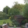
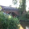
Brockhill Lane Bridge No 57

 
Bromsgrove B60 1LS, United Kingdom
 
Information about the place
Brockhill Lane Bridge No 57 is a minor waterways place on the Worcester and Birmingham Canal (Diglis Basin to King's Norton Junction) between Hanbury Junction (Junction with Droitwich Junction Canal (Restored - Opened 1/July/2011). Hanbury Wharf) (7 miles and 1¼ furlongs and 42 locks to the southwest) and King's Norton Junction (Junction of Stratford and Worcester and Birmingham Canals) (8 miles and 1¼ furlongs to the northeast).
 
 
The nearest place in the direction of Hanbury Junction is Tardebigge Tunnel North Emergency Access (There is no towpath from here until past Tardebigge Old Wharf.); 1 furlong away.
 
The nearest place in the direction of King's Norton Junction is Tardebigge Old Wharf; ½ furlongs away.

There is no access to the towpath here.

Mooring here is unrated.

There is a bridge here which takes a minor road over the canal.


Amenities
 
Maps
If you are a user and are logged on, or if you are actively planning a route, a map will be displayed here.
Show on external mapping site: Google | OSM | Bing
 
Photos
 
External websites
There are no links to external websites from here.
Why not log in and add some (select "External websites" from the menu (sometimes this is under "Edit"))?
 
Nearest facilities

Mouseover for more information or show routes to facility

Nearest water point

In the direction of King's Norton Junction

Hopwood Visitor Moorings4 miles, 7¼ furlongs away
On this waterway in the direction of King's Norton Junction
King's Norton Water Point8 miles, ½ furlongs away
On this waterway in the direction of King's Norton Junction
Yardley Wood Water Point10 miles, 5¾ furlongs away
Travel to King's Norton Junction, then on the Stratford-on-Avon Canal (Northern Section) to Yardley Wood Water Point
Holliday Wharf13 miles, 3¼ furlongs away
Travel to King's Norton Junction, then on the Worcester and Birmingham Canal (Birmingham to King's Norton) to Holliday Wharf
Worcester Bar13 miles, 5¼ furlongs away
Travel to King's Norton Junction, then on the Worcester and Birmingham Canal (Birmingham to King's Norton) to Worcester Bar
Hawne Basin13 miles, 6 furlongs away
Travel to King's Norton Junction, then on the Worcester and Birmingham Canal (Birmingham to King's Norton) to New Selly Oak Junction, then on the Birmingham Canal Navigations (Dudley Canal No 2 - Lapal Canal - Original Line East End ) to Somery Road Bridge, then on the Birmingham Canal Navigations (Dudley Canal No 2 - Lapal Canal - Abandoned Line ) to Lapal Canal - New line Diverges From Original Route, then on the Birmingham Canal Navigations (Dudley Canal No 2 - Lapal Canal - Original Line West End ) to Coombeswood, then on the Birmingham Canal Navigations (Dudley Canal No 2 - Coombeswood ) to Hawne Basin
Cambrian Wharf Services14 miles, 1¼ furlongs away
Travel to King's Norton Junction, then on the Worcester and Birmingham Canal (Birmingham to King's Norton) to Worcester Bar, then on the Birmingham Canal Navigations (Main Line) to Deep Cuttings Junction, then on the Birmingham Canal Navigations (Newhall Branch) to Cambrian Wharf Services
Earlswood Reservoir Feeder14 miles, 7 furlongs away
Travel to King's Norton Junction, then on the Stratford-on-Avon Canal (Northern Section) to Earlswood Reservoir Feeder
Waring's Green Wharf15 miles, 6¾ furlongs away
Travel to King's Norton Junction, then on the Stratford-on-Avon Canal (Northern Section) to Waring's Green Wharf
Bumble Hole Visitor Centre16 miles, 3¾ furlongs away
Travel to King's Norton Junction, then on the Worcester and Birmingham Canal (Birmingham to King's Norton) to New Selly Oak Junction, then on the Birmingham Canal Navigations (Dudley Canal No 2 - Lapal Canal - Original Line East End ) to Somery Road Bridge, then on the Birmingham Canal Navigations (Dudley Canal No 2 - Lapal Canal - Abandoned Line ) to Lapal Canal - New line Diverges From Original Route, then on the Birmingham Canal Navigations (Dudley Canal No 2 - Lapal Canal - Original Line West End ) to Coombeswood, then on the Birmingham Canal Navigations (Dudley Canal No 2 - Coombeswood ) to Bumble Hole Visitor Centre
Swallow Wharf18 miles, 4¼ furlongs away
Travel to King's Norton Junction, then on the Stratford-on-Avon Canal (Northern Section) to Swallow Wharf
Blowers Green Pumphouse19 miles away
Travel to King's Norton Junction, then on the Worcester and Birmingham Canal (Birmingham to King's Norton) to New Selly Oak Junction, then on the Birmingham Canal Navigations (Dudley Canal No 2 - Lapal Canal - Original Line East End ) to Somery Road Bridge, then on the Birmingham Canal Navigations (Dudley Canal No 2 - Lapal Canal - Abandoned Line ) to Lapal Canal - New line Diverges From Original Route, then on the Birmingham Canal Navigations (Dudley Canal No 2 - Lapal Canal - Original Line West End ) to Coombeswood, then on the Birmingham Canal Navigations (Dudley Canal No 2 - Coombeswood ) to Blowers Green Pumphouse
Handsworth Wharf Winding Hole17 miles, 7¼ furlongs and 3 locks away
Travel to King's Norton Junction, then on the Worcester and Birmingham Canal (Birmingham to King's Norton) to Worcester Bar, then on the Birmingham Canal Navigations (Main Line) to Smethwick Junction, then on the Birmingham Canal Navigations (Old Main Line) to Engine Arm Junction, then on the Birmingham Canal Navigations (Engine Arm) to Handsworth Wharf Winding Hole
Cuckoo Wharf17 miles, 1½ furlongs and 24 locks away
Travel to King's Norton Junction, then on the Worcester and Birmingham Canal (Birmingham to King's Norton) to Worcester Bar, then on the Birmingham Canal Navigations (Main Line) to Deep Cuttings Junction, then on the Birmingham Canal Navigations (Newhall Branch) to Farmers Bridge Junction, then on the Birmingham Canal Navigations (Birmingham and Fazeley Canal - Main Line) to Cuckoo Wharf

In the direction of Diglis Basin

Tardebigge Wharf4½ furlongs away
On this waterway in the direction of Diglis Basin
Stoke Works Water Point4 miles, 5 furlongs and 36 locks away
On this waterway in the direction of Diglis Basin
Hanbury Boatyard7 miles, 2 furlongs and 42 locks away
On this waterway in the direction of Diglis Basin
Droitwich Spa Marina7 miles, 4¼ furlongs and 45 locks away
Travel to Hanbury Junction, then on the Droitwich Canals (Droitwich Junction Canal) to Droitwich Spa Marina
Netherwich Basin9 miles and 50 locks away
Travel to Hanbury Junction, then on the Droitwich Canals (Droitwich Junction Canal) to Droitwich Junction, then on the Droitwich Canals (Droitwich Barge Canal) to Netherwich Basin
Lowesmoor Basin15 miles, 1½ furlongs and 54 locks away
On this waterway in the direction of Diglis Basin

Nearest rubbish disposal

In the direction of King's Norton Junction

Worcester Bar13 miles, 5¼ furlongs away
Travel to King's Norton Junction, then on the Worcester and Birmingham Canal (Birmingham to King's Norton) to Worcester Bar
Hawne Basin13 miles, 6 furlongs away
Travel to King's Norton Junction, then on the Worcester and Birmingham Canal (Birmingham to King's Norton) to New Selly Oak Junction, then on the Birmingham Canal Navigations (Dudley Canal No 2 - Lapal Canal - Original Line East End ) to Somery Road Bridge, then on the Birmingham Canal Navigations (Dudley Canal No 2 - Lapal Canal - Abandoned Line ) to Lapal Canal - New line Diverges From Original Route, then on the Birmingham Canal Navigations (Dudley Canal No 2 - Lapal Canal - Original Line West End ) to Coombeswood, then on the Birmingham Canal Navigations (Dudley Canal No 2 - Coombeswood ) to Hawne Basin
Cambrian Wharf Services14 miles, 1¼ furlongs away
Travel to King's Norton Junction, then on the Worcester and Birmingham Canal (Birmingham to King's Norton) to Worcester Bar, then on the Birmingham Canal Navigations (Main Line) to Deep Cuttings Junction, then on the Birmingham Canal Navigations (Newhall Branch) to Cambrian Wharf Services
Waring's Green Wharf15 miles, 6¾ furlongs away
Travel to King's Norton Junction, then on the Stratford-on-Avon Canal (Northern Section) to Waring's Green Wharf
Blowers Green Bridge18 miles, 7¾ furlongs away
Travel to King's Norton Junction, then on the Worcester and Birmingham Canal (Birmingham to King's Norton) to New Selly Oak Junction, then on the Birmingham Canal Navigations (Dudley Canal No 2 - Lapal Canal - Original Line East End ) to Somery Road Bridge, then on the Birmingham Canal Navigations (Dudley Canal No 2 - Lapal Canal - Abandoned Line ) to Lapal Canal - New line Diverges From Original Route, then on the Birmingham Canal Navigations (Dudley Canal No 2 - Lapal Canal - Original Line West End ) to Coombeswood, then on the Birmingham Canal Navigations (Dudley Canal No 2 - Coombeswood ) to Blowers Green Bridge
Handsworth Wharf Winding Hole17 miles, 7¼ furlongs and 3 locks away
Travel to King's Norton Junction, then on the Worcester and Birmingham Canal (Birmingham to King's Norton) to Worcester Bar, then on the Birmingham Canal Navigations (Main Line) to Smethwick Junction, then on the Birmingham Canal Navigations (Old Main Line) to Engine Arm Junction, then on the Birmingham Canal Navigations (Engine Arm) to Handsworth Wharf Winding Hole
Farmers Bridge Lock No 814 miles, 4½ furlongs and 7 locks away
Travel to King's Norton Junction, then on the Worcester and Birmingham Canal (Birmingham to King's Norton) to Worcester Bar, then on the Birmingham Canal Navigations (Main Line) to Deep Cuttings Junction, then on the Birmingham Canal Navigations (Newhall Branch) to Farmers Bridge Junction, then on the Birmingham Canal Navigations (Birmingham and Fazeley Canal - Main Line) to Farmers Bridge Lock No 8

In the direction of Diglis Basin

Tardebigge Wharf4½ furlongs away
On this waterway in the direction of Diglis Basin
Stoke Bottom Lock No 233 miles, 7¼ furlongs and 35 locks away
On this waterway in the direction of Diglis Basin
Droitwich Spa Marina7 miles, 4¼ furlongs and 45 locks away
Travel to Hanbury Junction, then on the Droitwich Canals (Droitwich Junction Canal) to Droitwich Spa Marina
Netherwich Basin9 miles and 50 locks away
Travel to Hanbury Junction, then on the Droitwich Canals (Droitwich Junction Canal) to Droitwich Junction, then on the Droitwich Canals (Droitwich Barge Canal) to Netherwich Basin
Lowesmoor Basin15 miles, 1½ furlongs and 54 locks away
On this waterway in the direction of Diglis Basin
Diglis Basin16 miles, 1¾ furlongs and 56 locks away
On this waterway in the direction of Diglis Basin
Sabrina Footbridge17 miles, 2¾ furlongs and 58 locks away
Travel to Diglis Basin, then on the Worcester and Birmingham Canal (Diglis Junction to Diglis Basin) to Diglis Junction, then on the River Severn (main river - Stourport to Worcester) to Sabrina Footbridge

Nearest chemical toilet disposal

In the direction of King's Norton Junction

Holliday Wharf13 miles, 3¼ furlongs away
Travel to King's Norton Junction, then on the Worcester and Birmingham Canal (Birmingham to King's Norton) to Holliday Wharf
Worcester Bar13 miles, 5¼ furlongs away
Travel to King's Norton Junction, then on the Worcester and Birmingham Canal (Birmingham to King's Norton) to Worcester Bar
Hawne Basin13 miles, 6 furlongs away
Travel to King's Norton Junction, then on the Worcester and Birmingham Canal (Birmingham to King's Norton) to New Selly Oak Junction, then on the Birmingham Canal Navigations (Dudley Canal No 2 - Lapal Canal - Original Line East End ) to Somery Road Bridge, then on the Birmingham Canal Navigations (Dudley Canal No 2 - Lapal Canal - Abandoned Line ) to Lapal Canal - New line Diverges From Original Route, then on the Birmingham Canal Navigations (Dudley Canal No 2 - Lapal Canal - Original Line West End ) to Coombeswood, then on the Birmingham Canal Navigations (Dudley Canal No 2 - Coombeswood ) to Hawne Basin
Cambrian Wharf Services14 miles, 1¼ furlongs away
Travel to King's Norton Junction, then on the Worcester and Birmingham Canal (Birmingham to King's Norton) to Worcester Bar, then on the Birmingham Canal Navigations (Main Line) to Deep Cuttings Junction, then on the Birmingham Canal Navigations (Newhall Branch) to Cambrian Wharf Services
Earlswood Reservoir Feeder14 miles, 7 furlongs away
Travel to King's Norton Junction, then on the Stratford-on-Avon Canal (Northern Section) to Earlswood Reservoir Feeder
Waring's Green Wharf15 miles, 6¾ furlongs away
Travel to King's Norton Junction, then on the Stratford-on-Avon Canal (Northern Section) to Waring's Green Wharf
Swallow Wharf18 miles, 4¼ furlongs away
Travel to King's Norton Junction, then on the Stratford-on-Avon Canal (Northern Section) to Swallow Wharf
Blowers Green Pumphouse19 miles away
Travel to King's Norton Junction, then on the Worcester and Birmingham Canal (Birmingham to King's Norton) to New Selly Oak Junction, then on the Birmingham Canal Navigations (Dudley Canal No 2 - Lapal Canal - Original Line East End ) to Somery Road Bridge, then on the Birmingham Canal Navigations (Dudley Canal No 2 - Lapal Canal - Abandoned Line ) to Lapal Canal - New line Diverges From Original Route, then on the Birmingham Canal Navigations (Dudley Canal No 2 - Lapal Canal - Original Line West End ) to Coombeswood, then on the Birmingham Canal Navigations (Dudley Canal No 2 - Coombeswood ) to Blowers Green Pumphouse
Handsworth Wharf Winding Hole17 miles, 7¼ furlongs and 3 locks away
Travel to King's Norton Junction, then on the Worcester and Birmingham Canal (Birmingham to King's Norton) to Worcester Bar, then on the Birmingham Canal Navigations (Main Line) to Smethwick Junction, then on the Birmingham Canal Navigations (Old Main Line) to Engine Arm Junction, then on the Birmingham Canal Navigations (Engine Arm) to Handsworth Wharf Winding Hole
Cuckoo Wharf17 miles, 1½ furlongs and 24 locks away
Travel to King's Norton Junction, then on the Worcester and Birmingham Canal (Birmingham to King's Norton) to Worcester Bar, then on the Birmingham Canal Navigations (Main Line) to Deep Cuttings Junction, then on the Birmingham Canal Navigations (Newhall Branch) to Farmers Bridge Junction, then on the Birmingham Canal Navigations (Birmingham and Fazeley Canal - Main Line) to Cuckoo Wharf

In the direction of Diglis Basin

Tardebigge Wharf4½ furlongs away
On this waterway in the direction of Diglis Basin
Stoke Bottom Lock No 233 miles, 7¼ furlongs and 35 locks away
On this waterway in the direction of Diglis Basin
Droitwich Spa Marina7 miles, 4¼ furlongs and 45 locks away
Travel to Hanbury Junction, then on the Droitwich Canals (Droitwich Junction Canal) to Droitwich Spa Marina
Lowesmoor Basin15 miles, 1½ furlongs and 54 locks away
On this waterway in the direction of Diglis Basin
Diglis Services16 miles, 1 furlong and 56 locks away
On this waterway in the direction of Diglis Basin

Nearest place to turn

In the direction of King's Norton Junction

Tardebigge Old Wharf½ furlongs away
On this waterway in the direction of King's Norton Junction
Scarfield Hill Bridge Winding Hole2 miles, 2¾ furlongs away
On this waterway in the direction of King's Norton Junction
Crown Meadow Arm3 miles, 1¼ furlongs away
On this waterway in the direction of King's Norton Junction
Hopwood Bridge Winding Hole4 miles, 7½ furlongs away
On this waterway in the direction of King's Norton Junction
Wast Hill Tunnel (east portal)7 miles, 1 furlong away
On this waterway in the direction of King's Norton Junction
King's Norton Junction8 miles, 1¼ furlongs away
On this waterway in the direction of King's Norton Junction
Selly Oak Winding Hole10 miles, 3¼ furlongs away
Travel to King's Norton Junction, then on the Worcester and Birmingham Canal (Birmingham to King's Norton) to Selly Oak Winding Hole
Yardley Wood Winding Hole10 miles, 6 furlongs away
Travel to King's Norton Junction, then on the Stratford-on-Avon Canal (Northern Section) to Yardley Wood Winding Hole
The Vale Winding Hole12 miles, 1¾ furlongs away
Travel to King's Norton Junction, then on the Worcester and Birmingham Canal (Birmingham to King's Norton) to The Vale Winding Hole
Tyburn Farm Winding Hole12 miles, 7¾ furlongs away
Travel to King's Norton Junction, then on the Stratford-on-Avon Canal (Northern Section) to Tyburn Farm Winding Hole
Gas Street Basin13 miles, 5 furlongs away
Travel to King's Norton Junction, then on the Worcester and Birmingham Canal (Birmingham to King's Norton) to Gas Street Basin
Gas Street Basin (Old Wharf)13 miles, 5½ furlongs away
Travel to King's Norton Junction, then on the Worcester and Birmingham Canal (Birmingham to King's Norton) to Worcester Bar, then on the Birmingham Canal Navigations (Main Line) to Gas Street Basin (Old Wharf)
Hawne Basin13 miles, 6 furlongs away
Travel to King's Norton Junction, then on the Worcester and Birmingham Canal (Birmingham to King's Norton) to New Selly Oak Junction, then on the Birmingham Canal Navigations (Dudley Canal No 2 - Lapal Canal - Original Line East End ) to Somery Road Bridge, then on the Birmingham Canal Navigations (Dudley Canal No 2 - Lapal Canal - Abandoned Line ) to Lapal Canal - New line Diverges From Original Route, then on the Birmingham Canal Navigations (Dudley Canal No 2 - Lapal Canal - Original Line West End ) to Coombeswood, then on the Birmingham Canal Navigations (Dudley Canal No 2 - Coombeswood ) to Hawne Basin
Deep Cuttings Junction13 miles, 7¾ furlongs away
Travel to King's Norton Junction, then on the Worcester and Birmingham Canal (Birmingham to King's Norton) to Worcester Bar, then on the Birmingham Canal Navigations (Main Line) to Deep Cuttings Junction
Old Turn Junction13 miles, 7¾ furlongs away
Travel to King's Norton Junction, then on the Worcester and Birmingham Canal (Birmingham to King's Norton) to Worcester Bar, then on the Birmingham Canal Navigations (Main Line) to Old Turn Junction
Monument Lane Basin14 miles, 5 furlongs away
Travel to King's Norton Junction, then on the Worcester and Birmingham Canal (Birmingham to King's Norton) to Worcester Bar, then on the Birmingham Canal Navigations (Main Line) to Monument Lane Basin
Earlswood Reservoir Feeder14 miles, 7 furlongs away
Travel to King's Norton Junction, then on the Stratford-on-Avon Canal (Northern Section) to Earlswood Reservoir Feeder
Sandy Turn14 miles, 7 furlongs away
Travel to King's Norton Junction, then on the Worcester and Birmingham Canal (Birmingham to King's Norton) to Worcester Bar, then on the Birmingham Canal Navigations (Main Line) to Sandy Turn
Rotton Park Junction14 miles, 7¾ furlongs away
Travel to King's Norton Junction, then on the Worcester and Birmingham Canal (Birmingham to King's Norton) to Worcester Bar, then on the Birmingham Canal Navigations (Main Line) to Rotton Park Junction

In the direction of Diglis Basin

Tardebigge Wharf4½ furlongs away
On this waterway in the direction of Diglis Basin

Nearest self-operated pump-out

In the direction of King's Norton Junction

Handsworth Wharf Winding Hole17 miles, 7¼ furlongs and 3 locks away
Travel to King's Norton Junction, then on the Worcester and Birmingham Canal (Birmingham to King's Norton) to Worcester Bar, then on the Birmingham Canal Navigations (Main Line) to Smethwick Junction, then on the Birmingham Canal Navigations (Old Main Line) to Engine Arm Junction, then on the Birmingham Canal Navigations (Engine Arm) to Handsworth Wharf Winding Hole

In the direction of Diglis Basin

Droitwich Spa Marina7 miles, 4¼ furlongs and 45 locks away
Travel to Hanbury Junction, then on the Droitwich Canals (Droitwich Junction Canal) to Droitwich Spa Marina
Diglis Services16 miles, 1 furlong and 56 locks away
On this waterway in the direction of Diglis Basin

Nearest boatyard pump-out

In the direction of King's Norton Junction

Hawne Basin13 miles, 6 furlongs away
Travel to King's Norton Junction, then on the Worcester and Birmingham Canal (Birmingham to King's Norton) to New Selly Oak Junction, then on the Birmingham Canal Navigations (Dudley Canal No 2 - Lapal Canal - Original Line East End ) to Somery Road Bridge, then on the Birmingham Canal Navigations (Dudley Canal No 2 - Lapal Canal - Abandoned Line ) to Lapal Canal - New line Diverges From Original Route, then on the Birmingham Canal Navigations (Dudley Canal No 2 - Lapal Canal - Original Line West End ) to Coombeswood, then on the Birmingham Canal Navigations (Dudley Canal No 2 - Coombeswood ) to Hawne Basin
Sherborne Wharf Services14 miles, 1½ furlongs away
Travel to King's Norton Junction, then on the Worcester and Birmingham Canal (Birmingham to King's Norton) to Worcester Bar, then on the Birmingham Canal Navigations (Main Line) to Sherborne Wharf Services
Earlswood Reservoir Feeder14 miles, 7 furlongs away
Travel to King's Norton Junction, then on the Stratford-on-Avon Canal (Northern Section) to Earlswood Reservoir Feeder
Waring's Green Wharf15 miles, 6¾ furlongs away
Travel to King's Norton Junction, then on the Stratford-on-Avon Canal (Northern Section) to Waring's Green Wharf
Withymoor Island Service Wharf16 miles, 6¾ furlongs away
Travel to King's Norton Junction, then on the Worcester and Birmingham Canal (Birmingham to King's Norton) to New Selly Oak Junction, then on the Birmingham Canal Navigations (Dudley Canal No 2 - Lapal Canal - Original Line East End ) to Somery Road Bridge, then on the Birmingham Canal Navigations (Dudley Canal No 2 - Lapal Canal - Abandoned Line ) to Lapal Canal - New line Diverges From Original Route, then on the Birmingham Canal Navigations (Dudley Canal No 2 - Lapal Canal - Original Line West End ) to Coombeswood, then on the Birmingham Canal Navigations (Dudley Canal No 2 - Coombeswood ) to Withymoor Island Service Wharf
Swallow Wharf18 miles, 4¼ furlongs away
Travel to King's Norton Junction, then on the Stratford-on-Avon Canal (Northern Section) to Swallow Wharf

In the direction of Diglis Basin

Hanbury Boatyard7 miles, 2 furlongs and 42 locks away
On this waterway in the direction of Diglis Basin
Dunhampstead Boatyard9 miles, ½ furlongs and 42 locks away
On this waterway in the direction of Diglis Basin
Lowesmoor Basin15 miles, 1½ furlongs and 54 locks away
On this waterway in the direction of Diglis Basin
Direction of TV transmitter (From Wolfbane Cybernetic)
 
 
Geograph
 
Wikipedia

There is no page on Wikipedia called “Brockhill Lane Bridge”

Wikipedia pages that might relate to Brockhill Lane Bridge
[Tardebigge Locks] from Birmingham to the wharf (now known as the Old Wharf) north of Brockhill Lane bridge by 30 March 1807 without the need for locks. After the Old Wharf [The Cut, Berkshire] Braziers Lane. At Brockhill, it passes Brockhill House, where it feeds a lake which has been there since at least 1879. Between bridges carrying the B3017 [List of rivers of England] Lake (L) Blacklane Brook (L) River Avon (MS) Western Wella Brook (L) Brockhill Stream (L) (enters Avon Dam Reservoir) Small Brook (L) Bala Brook (R) [Sir Joseph Williamson's Mathematical School] houses; Bridge, Castle, Gordon, Pitt and Tower. Bridge House was named after Rochester Bridge (to which all boys who crossed Rochester Bridge on the way [The Judd School] School) was rejected as an inferior site, "Mr Deacon's Field" in Haysden Lane (now Brook Street) was acquired from Sir Edmund Hardinge's trustees for £240 [List of United Kingdom locations: Bro-Bron] Hill Essex 51°38′N 0°29′E / 51.63°N 00.49°E / 51.63; 00.49 TQ7396 Brockhill Scottish Borders 55°30′N 2°58′W / 55.50°N 02.96°W / 55.50; -02.96 NT3924 [List of churches in Cornwall] Gennys Genesius of Arles Medieval Church of England Week St Mary Circle Brockhill Methodist Church St Gennys (Crackington Haven) Methodist Camelford & Week [Walthamstow Hall] the village was five miles from London. It moved to the site in Holly Bush Lane, Sevenoaks on 17 May 1882. The Junior School moved to its present site in [1997 New Year Honours] Buckinghamshire. The Reverend Roy Frederick Lodge, Chaplain, Her Majesty's Prison Brockhill. Jaquelyn Patricia Longworth, Operational Safety and Policy Manager, Nuclear
 
Google

Results of Google Search

Tardebigge Locks - Wikipedia
London Lane bridge. Tardebigge Engine House · Tardebigge Reservoir. 41–57. locks (17). 51. Halfway House bridge. 29–40. locks (12). 48. Stoke Pound bridge. To Worcester. Tardebigge Locks or the Tardebigge Flight is the longest flight of locks in the UK, comprising 30 ... Close to lock number 57, the second from the top, is the Tardebigge Engine ...
Worcester & Birmingham Canal - bridge... © Chris Allen cc-by-sa/2.0 ...
Jan 18, 2014 ... Worcester & Birmingham Canal - bridge No. 57. Brockhill Lane Bridge carrying Brockhill Lane over the canal just north of Tardebigge Tunnel.
Broad Street (Route 57) Bridge - Controlled Demolition, Inc. - YouTube
Oct 19, 2015 ... Controlled Demolition, Inc. (CDI) of Phoenix, Maryland, USA (acting as Specialty Explosives Subcontractor to General Contractor, Ragle, Inc. of ...
Worcester and Birmingham Canal (King's Norton to Worcester) DAY ...
Mar 11, 2010 ... Brockhill Lane Bridge No 57. 0.2 - 0. Tardebigge Tunnel (North end). 0.6 - 0. Tardebigge Tunnel (South end). 0.6 - 0. Tardebigge Wharf. 0.8 - 1.
Worcester and Birmingham Canal - Canal Cycling Section
(1 disused railway); The Mailbox (Birmingham); Salvage Turn Bridge (New Bridge ... No TowPath; Wast Hill Tunnel South Portal; Lea End Lane Bridge ( Bridge 69) ... Harris Bridge (58); Brockhill Lane Bridge (57); Tardebigge Tunnel ( North ...
New Forest Country Walk - Brockenhurst-Rhinefield-Brock Hill ...
Oct 10, 2012 ... We turn off the road and walk to Brock Hill then make our way to Bolderford Bridge where we turn left and follow the river on our right back to ...
10 - Shotgate - Wickford - Brock Hill - Crays Hill - Basildon Hospital ...
Wickford, o/s Railway Station, 07:50, 09:57, 12:05, 14:06, 16:08, 17:42. Wickford ... Brock Hill, adj Downham Road, 07:58, 10:05, 12:13, 14:14, 16:16, 17:50 ... Noak Bridge South Wash Road (S-bound), 08:17, 10:24, 12:31, 14:32, 16:34, 18: 09.
Distance Calculator - How far is it from Birmingham – England ...
United Kingdom - England - Derby *, Fri 11:45 pm, 57 km, 35 miles, 31 nm, North- ... United Kingdom - England - Oxford *, Fri 11:45 pm, 92 km, 57 miles, 50 nm ...