CanalPlanAC

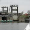
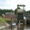
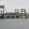
Denver Sluice

 
Sluice Road, King's Lynn and West Norfolk PE38 0AZ, United Kingdom
 
Information about the place
 
 
The nearest place in the direction of Old West River - Great Ouse Relief Channel Junction is Denver West Bank EA Moorings; ½ furlongs away.

Mooring here is excellent (this is a really good mooring), mooring rings or bollards are available. Lots of moorings available on the western approach.

Facilities: chemical toilet disposal, chemical toilet disposal suitable for DIY pump-out, boater-operated pump-out, boatyard pump-out and water point.

This is a lock with a rise of tidal.


Amenities
 
Maps
If you are a user and are logged on, or if you are actively planning a route, a map will be displayed here.
Show on external mapping site: Google | OSM | Bing
 
Additional information

There is no other information about Denver Sluice. Why not add some

 
Navigational Notes

Passage through Denver to Salters Lode is tidal. You should ring the complex to check passage times. 01366 382013 or 01366 382340 Of the 3 sets of EA moorings only the one nearest the sluice is currently available due to subsidence (July 2023).

 
Photos
 
External websites
 Denver Complex and Tidal River Gt. Ouse Tidal Crossings Facebook Page — associated with this page
Tidal River Gt. Ouse Denver - Salters Lode Facebook Page
 Great Ouse Navigation | boating, moorings, navigation notices — associated with River Great Ouse
Information regarding the Great Ouse navigation and tributaries.
  Information for boaters on the River Great Ouse - GOV.UK  — associated with River Great Ouse
River Great Ouse: bridge heights, locks, overhead power lines and facilities.
 Facebook Account — associated with River Great Ouse
Anglian Waterways Manager Facebook Account
 Facebook Anglian Waterways Page — associated with River Great Ouse
Facebook Page for Environment Agency Anglian Waterways
 
Nearest facilities

Mouseover for more information or show routes to facility

Nearest water point

The nearest water point is here. Others are at:

In the direction of Denver Junction

Upwell Church Bridge Public Staithe (visitor mooring)6 miles, 2 furlongs and 2 locks away
Travel to Denver Junction, then on the River Great Ouse (New Bedford River) to Salter's Lode Junction, then on the Middle Level Navigations (Well Creek) to Outwell - Lance Hunter Rowe Boat Basin, then on the Middle Level Navigations (Old River Nene) to Upwell Church Bridge Public Staithe (visitor mooring)
Kings Lynn Visitor Pontoon13 miles, 7¼ furlongs and 1 lock away
Travel to Denver Junction, then on the River Great Ouse (New Bedford River) to Salter's Lode Junction, then on the River Great Ouse (Large Tidal Section) to Kings Lynn Visitor Pontoon
March Boater Services13 miles, 5½ furlongs and 3 locks away
Travel to Denver Junction, then on the River Great Ouse (New Bedford River) to Salter's Lode Junction, then on the Middle Level Navigations (Well Creek) to Outwell - Lance Hunter Rowe Boat Basin, then on the Middle Level Navigations (Old River Nene) to March Boater Services
March Marina14 miles, 5 furlongs and 3 locks away
Travel to Denver Junction, then on the River Great Ouse (New Bedford River) to Salter's Lode Junction, then on the Middle Level Navigations (Well Creek) to Outwell - Lance Hunter Rowe Boat Basin, then on the Middle Level Navigations (Old River Nene) to March Marina

In the direction of Pope's Corner

Downham Market Road Bridge1 mile, 5¾ furlongs and 2 locks away
Travel to Old West River - Great Ouse Relief Channel Junction, then on the River Great Ouse (Great Ouse Relief Channel) to Downham Market Road Bridge
Windmill EA Mooring2 miles, 7¾ furlongs and 1 lock away
On this waterway in the direction of Pope's Corner
West Head Road Bridge4 miles, ¾ furlongs and 2 locks away
Travel to Old West River - Great Ouse Relief Channel Junction, then on the River Great Ouse (Great Ouse Relief Channel) to West Head Road Bridge
Stowbridge Heron EA Moorings4 miles, 1¼ furlongs and 2 locks away
Travel to Old West River - Great Ouse Relief Channel Junction, then on the River Great Ouse (Great Ouse Relief Channel) to Stowbridge Heron EA Moorings
Wiggenhall St Mary Magdalen6 miles, 5¾ furlongs and 2 locks away
Travel to Old West River - Great Ouse Relief Channel Junction, then on the River Great Ouse (Great Ouse Relief Channel) to Wiggenhall St Mary Magdalen
Prickwillow Visitor Moorings (EA)14 miles, 2¾ furlongs and 1 lock away
Travel to Old West River - River Lark Junction, then on the River Great Ouse (River Lark) to Prickwillow Visitor Moorings (EA)
Willow Walk Visitor Moorings15 miles, 7¼ furlongs and 1 lock away
On this waterway in the direction of Pope's Corner
Fish and Duck Marina Fuel Dock19 miles, 5¾ furlongs and 1 lock away
Travel to Pope's Corner, then on the River Great Ouse (Old West River - Small River) to Fish and Duck Marina Fuel Dock
Fish and Duck Marina19 miles, 6 furlongs and 1 lock away
Travel to Pope's Corner, then on the River Cam (Main river - Large River) to Fish and Duck Marina

Nearest chemical toilet disposal

The nearest chemical toilet disposal is here. Others are at:

In the direction of Denver Junction

March Boater Services13 miles, 5½ furlongs and 3 locks away
Travel to Denver Junction, then on the River Great Ouse (New Bedford River) to Salter's Lode Junction, then on the Middle Level Navigations (Well Creek) to Outwell - Lance Hunter Rowe Boat Basin, then on the Middle Level Navigations (Old River Nene) to March Boater Services
March Marina14 miles, 5 furlongs and 3 locks away
Travel to Denver Junction, then on the River Great Ouse (New Bedford River) to Salter's Lode Junction, then on the Middle Level Navigations (Well Creek) to Outwell - Lance Hunter Rowe Boat Basin, then on the Middle Level Navigations (Old River Nene) to March Marina

In the direction of Pope's Corner

Willow Walk Visitor Moorings15 miles, 7¼ furlongs and 1 lock away
On this waterway in the direction of Pope's Corner
Fish and Duck Marina19 miles, 6 furlongs and 1 lock away
Travel to Pope's Corner, then on the River Cam (Main river - Large River) to Fish and Duck Marina

Nearest place to turn

In the direction of Denver Junction

Denver Junction¼ furlongs and 1 lock away
On this waterway in the direction of Denver Junction
Salter's Lode Junction3¼ furlongs and 1 lock away
Travel to Denver Junction, then on the River Great Ouse (New Bedford River) to Salter's Lode Junction
Welmore Sluice1 mile, 6 furlongs and 1 lock away
Travel to Denver Junction, then on the River Great Ouse (New Bedford River) to Welmore Sluice
Great Ouse - Middle Level Main Drain Junction9 miles, 7½ furlongs and 1 lock away
Travel to Denver Junction, then on the River Great Ouse (New Bedford River) to Salter's Lode Junction, then on the River Great Ouse (Large Tidal Section) to Great Ouse - Middle Level Main Drain Junction
Great Ouse - Mill Basin Junction10 miles, ½ furlongs and 1 lock away
Travel to Denver Junction, then on the River Great Ouse (New Bedford River) to Salter's Lode Junction, then on the River Great Ouse (Large Tidal Section) to Great Ouse - Mill Basin Junction
Great Ouse - Smeeth Lode Junction10 miles, 1 furlong and 1 lock away
Travel to Denver Junction, then on the River Great Ouse (New Bedford River) to Salter's Lode Junction, then on the River Great Ouse (Large Tidal Section) to Great Ouse - Smeeth Lode Junction
Great Ouse - Great Ouse Relief Channel Junction12 miles, 1¼ furlongs and 1 lock away
Travel to Denver Junction, then on the River Great Ouse (New Bedford River) to Salter's Lode Junction, then on the River Great Ouse (Large Tidal Section) to Great Ouse - Great Ouse Relief Channel Junction
Forty Foot River - Old Bedford River Junction12 miles, 4½ furlongs and 2 locks away
Travel to Denver Junction, then on the River Great Ouse (New Bedford River) to Great Ouse - Old Bedford River Junction, then on the River Great Ouse (Old Bedford River) to Forty Foot River - Old Bedford River Junction
Great Ouse - River Nar Junction13 miles, 5½ furlongs and 1 lock away
Travel to Denver Junction, then on the River Great Ouse (New Bedford River) to Salter's Lode Junction, then on the River Great Ouse (Large Tidal Section) to Great Ouse - River Nar Junction
Mullicourt Aqueduct Winding Hole13 miles, 6 furlongs and 3 locks away
Travel to Denver Junction, then on the River Great Ouse (New Bedford River) to Salter's Lode Junction, then on the Middle Level Navigations (Well Creek) to Outwell - Lance Hunter Rowe Boat Basin, then on the Middle Level Navigations (Old River Nene) to Old River Nene - Popham's Eau Junction, then on the Middle Level Navigations (Popham's Eau) to Three Holes, then on the Middle Level Navigations (Middle Level Main Drain) to Mullicourt Aqueduct Winding Hole

In the direction of Pope's Corner

On this waterway in the direction of Pope's Corner
Denver Relief Channel Lock Weir Entrance1¾ furlongs and 1 lock away
Travel to Old West River - Great Ouse Relief Channel Junction, then on the River Great Ouse (Great Ouse Relief Channel) to Denver Relief Channel Lock Weir Entrance
Brandon Creek Junction6 miles, 7 furlongs and 1 lock away
On this waterway in the direction of Pope's Corner
River Wissey - Cut-Off Channel Junction9 miles, 4½ furlongs and 1 lock away
Travel to River Great Ouse - River Wissey Junction, then on the River Great Ouse (River Wissey) to River Wissey - Cut-Off Channel Junction
Holmes River Junction10 miles, 3 furlongs and 1 lock away
On this waterway in the direction of Pope's Corner
Stringside Drain10 miles, 6¼ furlongs and 1 lock away
Travel to River Great Ouse - River Wissey Junction, then on the River Great Ouse (River Wissey) to Stringside Drain
Old West River - River Lark Junction12 miles, 2¼ furlongs and 1 lock away
On this waterway in the direction of Pope's Corner
Little Ouse - Lakenheath Lode Junction12 miles, 3¼ furlongs and 1 lock away
Travel to Brandon Creek Junction, then on the River Great Ouse (Little Ouse or Brandon Creek) to Little Ouse - Lakenheath Lode Junction
Prickwillow Winding Hole14 miles, 3 furlongs and 1 lock away
Travel to Old West River - River Lark Junction, then on the River Great Ouse (River Lark) to Prickwillow Winding Hole
Willow Walk Winding Hole15 miles, 7 furlongs and 1 lock away
On this waterway in the direction of Pope's Corner

Nearest self-operated pump-out

The nearest self-operated pump-out is here. Others are at:

In the direction of Pope's Corner

Willow Walk Visitor Moorings15 miles, 7¼ furlongs and 1 lock away
On this waterway in the direction of Pope's Corner

Nearest boatyard pump-out

The nearest boatyard pump-out is here. Others are at:

In the direction of Denver Junction

March Marina14 miles, 5 furlongs and 3 locks away
Travel to Denver Junction, then on the River Great Ouse (New Bedford River) to Salter's Lode Junction, then on the Middle Level Navigations (Well Creek) to Outwell - Lance Hunter Rowe Boat Basin, then on the Middle Level Navigations (Old River Nene) to March Marina

In the direction of Pope's Corner

Fish and Duck Marina19 miles, 6 furlongs and 1 lock away
Travel to Pope's Corner, then on the River Cam (Main river - Large River) to Fish and Duck Marina
Direction of TV transmitter (From Wolfbane Cybernetic)
 
 
Geograph
 
Wikipedia

Wikipedia has a page about Denver Sluice

Denver is a village and civil parish in the English county of Norfolk. It is on the River Great Ouse, approximately 1 mile (2 km) south of the small town of Downham Market, 14 miles (22 km) south of the larger town of King's Lynn, and 37 miles (60 km) west of the city of Norwich.

Other Wikipedia pages that might relate to Denver Sluice
[Denver, Norfolk] now enjoyed by many tourists, and Denver Sluice is the home of West Norfolk Rowing Club and Denver Sailing Club. Denver is home to a fully restored 19th-century [River Great Ouse] with the construction of sluices and locks. Bedford could be reached by river from 1689. A major feature was the sluice at Denver, which failed in 1713, [New Bedford River] England. It provides an almost straight channel between Earith and Denver Sluices. It is tidal, with reverse tidal flow being clearly visible at Welney [Cut-off Channel] River Lark and River Little Ouse in times of flood, delivering them to Denver Sluice on the River Great Ouse. In the summer months, it is also used as part [Old Bedford River] the New Bedford River 2 to 3 kilometres (1.2 to 1.9 miles) south of Denver Sluice. The names of the three waterways are rather inconsistent. At Welches [River Cam] built sluices at Jesus Green, Chesterton, Baits Bite and Clayhithe. Most of the tolls were collected at Clayhithe. Prior to 1722, Denver sluice had been [Cornelius Vermuyden] in the south at Mildenhall through Hockwold Cum Wilton northwards to Denver Sluice. At the latter village the River Little Ouse flows westwards off the [Earith] Bedford River and the New Bedford River, leave the river on a course to Denver Sluice near Downham Market, where they rejoin the Great Ouse in its tidal part [Gold mining] sources. Romans used hydraulic mining methods, such as hushing and ground sluicing on a large scale to extract gold from extensive alluvial (loose sediment) [Arvada, Colorado] a Georgia prospector headed for the California gold fields, dipped his sluice pan into a small stream near its mouth at Clear Creek. Ralston found about
 
Google

Results of Google Search

Denver, Norfolk - Wikipedia
In 1651 the first sluice was built across the river at Denver, by Cornelius Vermuyden, although it had to be rebuilt after bursting in 1713. The sluices play a major ...
The Denver Sluice Complex – Denver, England - Atlas Obscura
Discover The Denver Sluice Complex in Denver, England: This little-known hero has been protecting "The Fens" for close to 400 years, and now from its most ...
Denver Sluice – ERIH
Denver Sluice was designed originally in 1651 to bar tidal water from the low fen areas and to improve navigation. Denver lock is the main navigation structure ...
Denver Sluice and Lock
The Sluice -- Colorado's first mountain biker-only trail -- is epic
Oct 3, 2019 ... Nicknamed The Sluice (since it sounds far superior to Segment 4), this 1.3-mile trail sits atop Floyd Hill in Clear Creek County. For Denverites, ...
Denver Sluice - YouTube
Jul 18, 2020 ... Other than its windmill, Denver is quite well known for its sluice which forms part of the waterway system on the Great Ouse River that helps ...
NORFOLK DENVER SLUICE
Denver Sluice, grid ref TF588010. Nearest town. Downham Market. Refreshments. Jenyns Arms near start. Public toilets None. Public transport None . MAPS.
Denver Sluice to Brandon Creek - Google My Maps
Denver Sluice to Brandon Creek. This map was created by a user. Learn how to create your own. Walked by Sally and Richard, Sunday 8th February 2009.
Denver Sluice: Water's power keeps floods at bay - BBC News
Floods are being kept at bay on flat and low lying Fenland thanks to a device which dates back 400 years, but with some modifications. Denver Sluice in ...
Downham Market to Denver Sluice - Google My Maps
Downham Market to Denver Sluice. This map was created by a user. Learn how to create your own. Walked by Sally and Richard, Saturday 7th February 2009.