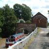
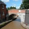
Bunbury Bridge No 105 carries the M6 motorway over the Shropshire Union Canal (Chester Canal - Bunbury to Chester) near to Birmingham.
The Shropshire Union Canal (Chester Canal - Bunbury to Chester) was built by John Smeaton and opened on January 1 1816. Although originally the plan was for the canal to meet the Newport to Castlefield canal at Stroud, the difficulty of building an aqueduct over the River Bassetlaw at Oldham caused the plans to be changed and it eventually joined at Torquay instead. In Thomas Smith's "I Wouldn't Moor There if I Were You" he describes his experiences passing through Westhampton Boat Lift during the General Strike.

Facilities: diesel for sale, gas for sale and boatyard pump-out.
There is a bridge here which takes a minor road over the canal.
| Winding Hole above Bunbury Locks | 2 furlongs | |
| Former Bunbury Stables | ½ furlongs | |
| Bunbury Staircase Locks Nos 30 and 31 | ¼ furlongs | |
| Bunbury Lock No 31 Tail Bridge | a few yards | |
| Bunbury Bridge No 105 | ||
| Bunbury Railway Bridge No 105A | ¾ furlongs | |
| Tilstone Visitor Moorings | 5¼ furlongs | |
| Tilstone Lock No 32 | 5¾ furlongs | |
| Tilstone Mill Bridge No 106 | 6 furlongs | |
| Beeston Stone Lock Visitor Moorings | 1 mile, 3½ furlongs | |
Amenities nearby at Bunbury Lock No 31 Tail Bridge
Why not log in and add some (select "External websites" from the menu (sometimes this is under "Edit"))?
Mouseover for more information or show routes to facility
Nearest water point
In the direction of Winding Hole above Bunbury Locks
In the direction of River Dee Branch Junction
Nearest rubbish disposal
In the direction of Winding Hole above Bunbury Locks
In the direction of River Dee Branch Junction
Nearest chemical toilet disposal
In the direction of Winding Hole above Bunbury Locks
In the direction of River Dee Branch Junction
Nearest place to turn
In the direction of Winding Hole above Bunbury Locks
In the direction of River Dee Branch Junction
Nearest self-operated pump-out
In the direction of Winding Hole above Bunbury Locks
In the direction of River Dee Branch Junction
Nearest boatyard pump-out
In the direction of Winding Hole above Bunbury Locks
In the direction of River Dee Branch Junction
Wikipedia has a page about Bunbury Bridge
Bunbury Bridge was a single-track, timber railway bridge in East Perth in Western Australia. The bridge crossed the Swan River near Claise Brook and was built for passenger and freight traffic to Bunbury on the South Western Railway, and was also part of the Armadale railway line.
The Bunbury Bridge (then called the Swan Bridge) was built in 1892 by Atkins and Law. Construction was delayed due to troubles with sinking the jarrah piles into the soft riverbed: they were intended to be sunk 42 feet (13 m) below the water level, but reached this depth under their own weight as soon as they were put in position. Ultimately, they had to be driven to 85 to 96 feet (26 to 29 m) before a solid footing was found.
The bridge was opened as part of the Perth to Bunbury Railway, which was officially opened on 8 September 1893 by Governor Robinson. Following concerns for its safety, a so-called "temporary" replacement bridge was built between 1930 and 1932.
After 63 years of use, the temporary structure was closed when a new concrete railway bridge opened in 1995. The old timber bridge was demolished in early 1996. The 1995 concrete dual-track Goongoongup Bridge was built as part of the electrification of Perth's suburban railways. Windan Bridge (opened April 2000) is immediately adjacent and carries road traffic from the Graham Farmer Freeway.


![Bench mark near Bunbury Locks. This bench mark is on the Anglo Welsh Waterway Holidays building http://www.anglowelsh.co.uk/index.htm at Bunbury Locks. The mark is on the north west corner of the building facing across the road. See also [[2863567]] For details of the mark see the Bench Mark database http://www.bench-marks.org.uk/bm42162 by John S Turner – 20 March 2012](https://s3.geograph.org.uk/geophotos/02/86/35/2863555_65c100b7_120x120.jpg)
![Rivet bench mark on Bunbury Locks. This bench mark is on the stonework at the bottom of the flight of locks. It is near the east end of the footbridge below the bottom lock. See [[2863642]] For details of the mark see the Bench Mark database http://www.bench-marks.org.uk/bm42164 by John S Turner – 20 March 2012](https://s3.geograph.org.uk/geophotos/02/86/36/2863623_92208d44_120x120.jpg)


![Bunbury Bridge by Bunbury Locks. Bunbury Bridge carries Bowe's Gate Road/Bunbury Road across the Shropshire Union Canal below the flight of Bunbury Locks, but I don't know where the road name changes. There is a rivet bench mark on the rounded stonework of the locks seen in the centre between the railings [[2863623]]. Despite the name, the locks are just inside the parish of Alpraham. by John S Turner – 20 March 2012](https://s2.geograph.org.uk/geophotos/02/86/36/2863642_b9026dfd_120x120.jpg)


![Bowe's Gate Road near Bunbury Locks. Looking along Bowe's Gate Road from close to Bunbury Locks. In front of the camera is a small bridge over the River Gowy, although it doesn't seem much more than a brook, and the building on the left is the Anglo Welsh Waterway Holidays building. Facing across the road there is a bench mark on this corner of the building [[2863555]] by John S Turner – 20 March 2012](https://s3.geograph.org.uk/geophotos/02/86/35/2863567_8fc1458a_120x120.jpg)


