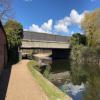
Marsh Lane Bridge No 2C
is a minor waterways place
on the Leeds and Liverpool Canal (Main Line - Liverpool to Wigan) between
Stanley Dock Cut Junction (2 miles and 4¾ furlongs
to the south) and
Lathom Junction (Junction with Leeds and Liverpool - Rufford Branch) (21 miles and 3 furlongs
to the northeast).
The nearest place in the direction of Stanley Dock Cut Junction is Bootle Winding Hole;
¾ furlongs
away.
The nearest place in the direction of Lathom Junction is Marsh Lane Gas Works Aqueduct No 5;
a few yards
away.
There is access (via steps) to the towpath here.
Mooring here is unrated.
There is a bridge here which takes a major road over the canal.
| Stanley Road Pipe Bridge | 3½ furlongs | |
| Stanley Road Footbridge No 2 | 3¼ furlongs | |
| Stanley Road Bridge No 2A | 3¼ furlongs | |
| Litherland Road Bridge No 2b | 1¾ furlongs | |
| Bootle Winding Hole | ¾ furlongs | |
| Marsh Lane Bridge No 2C | ||
| Marsh Lane Gas Works Aqueduct No 5 | a few yards | |
| Linacre Pipe Bridge | 1 furlong | |
| Linacre Bridge No 2E | 2 furlongs | |
| Pennington Road Footbridge No 2f | 4¼ furlongs | |
| Linacre Railway Bridge No 2H | 6¾ furlongs | |
There are no links to external websites from here.
Why not log in and add some (select "External websites" from the menu (sometimes this is under "Edit"))?
Mouseover for more information or show routes to facility
Nearest water point
In the direction of Wigan Junction
Litherland Visitor Moorings — 1 mile away
On this waterway in the direction of Wigan Junction
Dicconson's Bridge No 17 — 10 miles, 3½ furlongs away
On this waterway in the direction of Wigan Junction
Scarisbrick Marina — 16 miles, 5 furlongs away
On this waterway in the direction of Wigan Junction
In the direction of Eldonian Village
Salthouse Dock — 4 miles, 2 furlongs and 6 locks away
Travel to Stanley Dock Cut Junction, then on the Leeds and Liverpool Canal (Stanley Dock Branch) to Stanley Dock, then on the Leeds and Liverpool Canal (Liverpool Link) to Salthouse Dock
Ellesmere Port Visitor Moorings — 10 miles, 2¼ furlongs and 11 locks away
Travel to Stanley Dock Cut Junction, then on the Leeds and Liverpool Canal (Stanley Dock Branch) to Stanley Dock, then on the Leeds and Liverpool Canal (Liverpool Link) to Salthouse Dock, then on the Liverpool South Docks to Mersey - South Docks Junction, then on the River Mersey (Tidal Section) to Mersey - Ship Canal Junction, then on the Manchester Ship Canal (Main Line) to Ellesmere Port Junction, then on the Shropshire Union Canal (Wirral Line - Main Line) to Ellesmere Port Visitor Moorings
Sutton Weaver Swing Bridge — 19 miles, ¼ furlongs and 9 locks away
Travel to Stanley Dock Cut Junction, then on the Leeds and Liverpool Canal (Stanley Dock Branch) to Stanley Dock, then on the Leeds and Liverpool Canal (Liverpool Link) to Salthouse Dock, then on the Liverpool South Docks to Mersey - South Docks Junction, then on the River Mersey (Tidal Section) to Mersey - Ship Canal Junction, then on the Manchester Ship Canal (Main Line) to Weaver Mouth, then on the River Weaver (Weston Marsh Lock Line) to Weston Marsh Lock Entrance, then on the River Weaver (Main Line) to Sutton Weaver Swing Bridge
Taylor's Boatyard Drydock — 18 miles, 3½ furlongs and 11 locks away
Travel to Stanley Dock Cut Junction, then on the Leeds and Liverpool Canal (Stanley Dock Branch) to Stanley Dock, then on the Leeds and Liverpool Canal (Liverpool Link) to Salthouse Dock, then on the Liverpool South Docks to Mersey - South Docks Junction, then on the River Mersey (Tidal Section) to Mersey - Ship Canal Junction, then on the Manchester Ship Canal (Main Line) to Ellesmere Port Junction, then on the Shropshire Union Canal (Wirral Line - Main Line) to River Dee Branch Junction, then on the Shropshire Union Canal (Chester Canal - Bunbury to Chester) to Taylor's Boatyard Drydock
C&RT Water Point (Chester) — 19 miles, 5½ furlongs and 15 locks away
Travel to Stanley Dock Cut Junction, then on the Leeds and Liverpool Canal (Stanley Dock Branch) to Stanley Dock, then on the Leeds and Liverpool Canal (Liverpool Link) to Salthouse Dock, then on the Liverpool South Docks to Mersey - South Docks Junction, then on the River Mersey (Tidal Section) to Mersey - Ship Canal Junction, then on the Manchester Ship Canal (Main Line) to Ellesmere Port Junction, then on the Shropshire Union Canal (Wirral Line - Main Line) to River Dee Branch Junction, then on the Shropshire Union Canal (Chester Canal - Bunbury to Chester) to C&RT Water Point (Chester)Nearest rubbish disposal
In the direction of Wigan Junction
Litherland Visitor Moorings — 1 mile away
On this waterway in the direction of Wigan Junction
In the direction of Eldonian Village
Salthouse Dock — 4 miles, 2 furlongs and 6 locks away
Travel to Stanley Dock Cut Junction, then on the Leeds and Liverpool Canal (Stanley Dock Branch) to Stanley Dock, then on the Leeds and Liverpool Canal (Liverpool Link) to Salthouse Dock
Sutton Weaver Swing Bridge — 19 miles, ¼ furlongs and 9 locks away
Travel to Stanley Dock Cut Junction, then on the Leeds and Liverpool Canal (Stanley Dock Branch) to Stanley Dock, then on the Leeds and Liverpool Canal (Liverpool Link) to Salthouse Dock, then on the Liverpool South Docks to Mersey - South Docks Junction, then on the River Mersey (Tidal Section) to Mersey - Ship Canal Junction, then on the Manchester Ship Canal (Main Line) to Weaver Mouth, then on the River Weaver (Weston Marsh Lock Line) to Weston Marsh Lock Entrance, then on the River Weaver (Main Line) to Sutton Weaver Swing Bridge
St Martin's Way Bridge No 123J — 18 miles, 5¼ furlongs and 14 locks away
Travel to Stanley Dock Cut Junction, then on the Leeds and Liverpool Canal (Stanley Dock Branch) to Stanley Dock, then on the Leeds and Liverpool Canal (Liverpool Link) to Salthouse Dock, then on the Liverpool South Docks to Mersey - South Docks Junction, then on the River Mersey (Tidal Section) to Mersey - Ship Canal Junction, then on the Manchester Ship Canal (Main Line) to Ellesmere Port Junction, then on the Shropshire Union Canal (Wirral Line - Main Line) to River Dee Branch Junction, then on the Shropshire Union Canal (Chester Canal - Bunbury to Chester) to St Martin's Way Bridge No 123JNearest chemical toilet disposal
In the direction of Wigan Junction
Litherland Visitor Moorings — 1 mile away
On this waterway in the direction of Wigan Junction
In the direction of Eldonian Village
Sutton Weaver Swing Bridge — 19 miles, ¼ furlongs and 9 locks away
Travel to Stanley Dock Cut Junction, then on the Leeds and Liverpool Canal (Stanley Dock Branch) to Stanley Dock, then on the Leeds and Liverpool Canal (Liverpool Link) to Salthouse Dock, then on the Liverpool South Docks to Mersey - South Docks Junction, then on the River Mersey (Tidal Section) to Mersey - Ship Canal Junction, then on the Manchester Ship Canal (Main Line) to Weaver Mouth, then on the River Weaver (Weston Marsh Lock Line) to Weston Marsh Lock Entrance, then on the River Weaver (Main Line) to Sutton Weaver Swing Bridge
Dee Branch Top Lock Footbridge — 18 miles, 3½ furlongs and 12 locks away
Travel to Stanley Dock Cut Junction, then on the Leeds and Liverpool Canal (Stanley Dock Branch) to Stanley Dock, then on the Leeds and Liverpool Canal (Liverpool Link) to Salthouse Dock, then on the Liverpool South Docks to Mersey - South Docks Junction, then on the River Mersey (Tidal Section) to Mersey - Ship Canal Junction, then on the Manchester Ship Canal (Main Line) to Ellesmere Port Junction, then on the Shropshire Union Canal (Wirral Line - Main Line) to River Dee Branch Junction, then on the Shropshire Union Canal (Dee Branch) to Dee Branch Top Lock FootbridgeNearest place to turn
In the direction of Wigan Junction
Litherland Winding Hole — 1 mile, 5¾ furlongs away
On this waterway in the direction of Wigan Junction
Ford Winding Hole — 2 miles, 3 furlongs away
On this waterway in the direction of Wigan Junction
Aintree Winding Hole — 5 miles, 7½ furlongs away
On this waterway in the direction of Wigan Junction
Melling Winding Hole — 7 miles, 4¾ furlongs away
On this waterway in the direction of Wigan Junction
Lydiate Winding Hole — 10 miles, 2½ furlongs away
On this waterway in the direction of Wigan Junction
Jackson's Bridge Farm Winding Hole — 11 miles, 2¾ furlongs away
On this waterway in the direction of Wigan Junction
Downholland Winding Hole — 12 miles, 2¾ furlongs away
On this waterway in the direction of Wigan Junction
Halsall Hill Bridge Winding Hole — 14 miles, 6¼ furlongs away
On this waterway in the direction of Wigan Junction
Halsall Warehouse Bridge Winding Hole — 15 miles, 1½ furlongs away
On this waterway in the direction of Wigan Junction
Scarisbrick Winding Hole — 16 miles, 5¼ furlongs away
On this waterway in the direction of Wigan Junction
Great Score Winding Hole — 19 miles, 1¾ furlongs away
On this waterway in the direction of Wigan Junction
In the direction of Eldonian Village
Bootle Winding Hole — ¾ furlongs away
On this waterway in the direction of Eldonian Village
Bank Hall Winding Hole — 1 mile, 7 furlongs away
On this waterway in the direction of Eldonian Village
Stanley Dock Cut Junction — 2 miles, 4¾ furlongs away
On this waterway in the direction of Eldonian Village
Eldonian Village — 3 miles, ¾ furlongs away
On this waterway in the direction of Eldonian Village
Stanley Dock — 2 miles, 6¾ furlongs and 4 locks away
Travel to Stanley Dock Cut Junction, then on the Leeds and Liverpool Canal (Stanley Dock Branch) to Stanley Dock
Salthouse Dock — 4 miles, 2 furlongs and 6 locks away
Travel to Stanley Dock Cut Junction, then on the Leeds and Liverpool Canal (Stanley Dock Branch) to Stanley Dock, then on the Leeds and Liverpool Canal (Liverpool Link) to Salthouse Dock
Ellesmere Port Junction — 9 miles, 7½ furlongs and 8 locks away
Travel to Stanley Dock Cut Junction, then on the Leeds and Liverpool Canal (Stanley Dock Branch) to Stanley Dock, then on the Leeds and Liverpool Canal (Liverpool Link) to Salthouse Dock, then on the Liverpool South Docks to Mersey - South Docks Junction, then on the River Mersey (Tidal Section) to Mersey - Ship Canal Junction, then on the Manchester Ship Canal (Main Line) to Ellesmere Port Junction
Ellesmere Port Lower Basin — 10 miles and 8 locks away
Travel to Stanley Dock Cut Junction, then on the Leeds and Liverpool Canal (Stanley Dock Branch) to Stanley Dock, then on the Leeds and Liverpool Canal (Liverpool Link) to Salthouse Dock, then on the Liverpool South Docks to Mersey - South Docks Junction, then on the River Mersey (Tidal Section) to Mersey - Ship Canal Junction, then on the Manchester Ship Canal (Main Line) to Ellesmere Port Junction, then on the Shropshire Union Canal (Wirral Line - Main Line) to Ellesmere Port Lower Basin
Ellesmere Port Upper Basin — 10 miles, ½ furlongs and 9 locks away
Travel to Stanley Dock Cut Junction, then on the Leeds and Liverpool Canal (Stanley Dock Branch) to Stanley Dock, then on the Leeds and Liverpool Canal (Liverpool Link) to Salthouse Dock, then on the Liverpool South Docks to Mersey - South Docks Junction, then on the River Mersey (Tidal Section) to Mersey - Ship Canal Junction, then on the Manchester Ship Canal (Main Line) to Ellesmere Port Junction, then on the Shropshire Union Canal (Wirral Line - Main Line) to Ellesmere Port Upper BasinNearest self-operated pump-out
In the direction of Wigan Junction
Litherland Visitor Moorings — 1 mile away
On this waterway in the direction of Wigan Junction
In the direction of Eldonian Village
Dee Branch Top Lock Footbridge — 18 miles, 3½ furlongs and 12 locks away
Travel to Stanley Dock Cut Junction, then on the Leeds and Liverpool Canal (Stanley Dock Branch) to Stanley Dock, then on the Leeds and Liverpool Canal (Liverpool Link) to Salthouse Dock, then on the Liverpool South Docks to Mersey - South Docks Junction, then on the River Mersey (Tidal Section) to Mersey - Ship Canal Junction, then on the Manchester Ship Canal (Main Line) to Ellesmere Port Junction, then on the Shropshire Union Canal (Wirral Line - Main Line) to River Dee Branch Junction, then on the Shropshire Union Canal (Dee Branch) to Dee Branch Top Lock FootbridgeNearest boatyard pump-out
In the direction of Wigan Junction
Scarisbrick Marina — 16 miles, 5 furlongs away
On this waterway in the direction of Wigan JunctionDirection of TV transmitter (From Wolfbane Cybernetic)
There is no page on Wikipedia called “Marsh Lane Bridge No 2C”
Wikipedia pages that might relate to Marsh Lane Bridge No 2C
[Lions Gate Bridge]
the bridge, but the low flat delta land to the north required construction of the extensive North Viaduct. The bridge has three reversible lanes, the
[Dumbarton Bridge (California)]
end is in Menlo Park. Bridging State Route 84 across the bay, it has three lanes each way and a separated bike/pedestrian lane along its south side. Like
[Lea Valley Walk]
Horseshoe Bridge. Passing under the Lea Valley Lines rail bridge. Walthamstow Marshes and Leyton Marshes are passed as the path heads towards Lea Bridge Road
[No. 2 Road Bridge]
The No. 2 Road Bridge is a crossing over the middle arm of the Fraser River, and River Rd., in Metro Vancouver. During the planning stage, the creation
[George Washington Bridge]
four lanes in each direction and a lower level with three lanes in each direction, for a total of 14 lanes of travel. The speed limit on the bridge is 45 mph
[Bailey bridge]
engineering units. A Bailey bridge has the advantages of requiring no special tools or heavy equipment to assemble. The wood and steel bridge elements were small
[Strait of Messina Bridge]
largest suspension bridge in the world at 1,991 m (6,532 ft). Plans called for four traffic lanes (two driving lanes and one emergency lane in each direction)
[Untraceable]
people log on, hastening the victims' deaths. Special Agent Jennifer Marsh (Diane Lane) is a widowed single parent living in a suburban Portland home with
[Bridge]
earliest types of bridges were stepping stones. Neolithic people also built a form of boardwalk across marshes; examples of such bridges include the Sweet
[List of toll roads in the United States]
US 101. SR 92 convert lanes from HOV. The area to be converted is the approach to the San Mateo - Hayward Bridge. SR 84 convert lanes from HOV. The area
Results of Google Search
Marsh Lane Bridge No 2cMarsh Lane Bridge No 2c Leeds and Liverpool Canal (Main Line - Liverpool to Wigan)
Nov 2, 2018 ... A $2.2 million rehab strengthened the one-lane span and widened approaches to improve sight lines.
Oct 16, 2016 ... Marsh Lane Bridge No 2C. taken 4 years ago, near to Bootle, Sefton, Great Britain. More sizes. Marsh Lane Bridge No 2C. Crossing the Leeds ...
Feb 18, 2019 ... that we can design a construction strategy for the SR 9, Marsh Road to Second Street Vicinity Widening project. ... 2.C | Project Manager's Commitment to Colocate ... FHWA and Washington State Bridge Inspector: WA, No.
Express Bus Route 211. Service To: Parker Road Station; Northwest Plano Park & Ride; Legacy West. Schedules:.
Recent Snohomish County Road Closure Information — Last Update: ... and are NOT reflected on the Snohomish County Road Closure webpage. ... Tualco Rd — from #155 Riley Slough Bridge to #155 Riley Slough Bridge — Monroe.
Oct 19, 2019 ... The city of Dallas said early Monday that there had been no reports of deaths ... In the El Rancho supermarket parking lot on Marsh Lane near ...
Jan 26, 2008 ... 07. 08. 09. 10. 2c/d. Northern Beaufort County. Southern Beaufort County ... Reduced salt marsh impacts on Bluffton Parkway Phase 5A from 3 acres to. 0.5 acre with ... 21/ SC 802 Road Widening & Bridge Addition ... There will be no impacts to aquatic life due to lighting from the SC 802 bridge widening.
14 Mile Rd, EB/WB 14 Mile Rd at I-75 lane closed for construction Go to, Oakland ... Buisness I-69, EB/WB Buisness I-69 at Marsh Road intersection closed for ...
Feb 10, 2011 ... Emergency one-lane bridge conversion ... Section 2C.59 CROSS TRAFFIC DOES NOT STOP Plaque (W4-4P) ... SR 92 at SR 3 / Marsh Rd.


![The Leeds-Liverpool Canal and the 3¼ Miles milepost. Looking north east along the Leeds and Liverpool canal with the 3¼ Miles from Liverpool milepost on the left - [[5502876]] by John S Turner – 10 August 2017](https://s0.geograph.org.uk/geophotos/05/50/28/5502880_28dc7e8e_120x120.jpg)


![3¼ Miles from Liverpool milepost on the Leeds-Liverpool Canal. This milepost is north east of the Litherland Road Bridge alongside the Leeds-Liverpool Canal. Once there were mileposts located every quarter of a mile between Liverpool and Leeds making it easier for tolls and charges to be calculated. Many have disappeared, but the ones that remain are being re-painted and the actual 'Mile' posts are being replaced where necessary. https://canalrivertrust.org.uk/news-and-views/news/missing-mileposts-replaced-on-the-leeds-and-liverpool-canal http://www.towpathtreks.co.uk/milepostdisplay.asp?ino=3See also [[5502880]] by John S Turner – 10 August 2017](https://s0.geograph.org.uk/geophotos/05/50/28/5502876_59dd3ac8_120x120.jpg)


![Litherland Road Bridge [no 2B], from the south-west. The distinctive style of older road bridges over the Leeds & Liverpool canal in Bootle. by Christine Johnstone – 26 May 2021](https://s1.geograph.org.uk/geophotos/06/91/25/6912565_e3236779_120x120.jpg)