CanalPlanAC

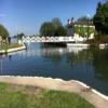
Saul Junction Footbridge

 
Junction Bridge House, Whitminster Lane, Stroud GL2 7PR, United Kingdom
 
Information about the place
 
 
The nearest place in the direction of Gloucester Docks is Site of Pegthorne Bridge (Bridge removed); 4½ furlongs away.

Mooring here is unrated.

There is a swing bridge here.

Joe Energy5¼ furlongs
Sandfield Bridge2 furlongs
Cotswold Canals Trust Visitor Centre - Saul Junction1¼ furlongs
Saul Junction Winding Hole½ furlongs
Saul Junctiona few yards
Saul Junction Footbridge
Site of Pegthorne Bridge4½ furlongs
Pegthorne Bridge Winding Hole4¾ furlongs
Parkend Bridge1 mile, 4½ furlongs
Site of Hardwicke Bridge3 miles, ¾ furlongs
Sellars Bridge3 miles, 6 furlongs
 
 
Amenities
 
Maps
If you are a user and are logged on, or if you are actively planning a route, a map will be displayed here.
Show on external mapping site: Google | OSM | Bing
 
Photos
 
External websites
There are no links to external websites from here.
Why not log in and add some (select "External websites" from the menu (sometimes this is under "Edit"))?
 
Nearest facilities

Mouseover for more information or show routes to facility

Nearest water point

In the direction of Sharpness Junction

Saul Junction Winding Hole½ furlongs away
On this waterway in the direction of Sharpness Junction
Saul Junction Marina1¼ furlongs away
Travel to Saul Junction, then on the Cotswold Canals (Stroudwater Navigation - Navigable Section) to Saul Junction Marina On this waterway in the direction of Sharpness Junction
Fretherne Bridge6½ furlongs away
On this waterway in the direction of Sharpness Junction
Splatt Bridge1 mile, 7¼ furlongs away
On this waterway in the direction of Sharpness Junction
Patch Bridge3 miles, 6 furlongs away
On this waterway in the direction of Sharpness Junction
Purton Lower Bridge6 miles, 1¾ furlongs away
On this waterway in the direction of Sharpness Junction

In the direction of Gloucester / Sharpness - Severn Junction

Sellars Bridge3 miles, 6 furlongs away
On this waterway in the direction of Gloucester / Sharpness - Severn Junction
Llanthony Pontoons7 miles, 4 furlongs away
On this waterway in the direction of Gloucester / Sharpness - Severn Junction
Llanthony Road Bridge7 miles, 4¾ furlongs away
On this waterway in the direction of Gloucester / Sharpness - Severn Junction
Gloucester Waterways Museum Arm7 miles, 5¼ furlongs away
On this waterway in the direction of Gloucester / Sharpness - Severn Junction
Gloucester Dock Lock7 miles, 6 furlongs away
On this waterway in the direction of Gloucester / Sharpness - Severn Junction
Tewkesbury Lower Lode19 miles, 4 furlongs and 1 lock away
Travel to Gloucester / Sharpness - Severn Junction, then on the River Severn (main river - Worcester to Gloucester) to Tewkesbury Lower Lode

Nearest rubbish disposal

In the direction of Sharpness Junction

Saul Junction Winding Hole½ furlongs away
On this waterway in the direction of Sharpness Junction
Saul Junction Marina1¼ furlongs away
Travel to Saul Junction, then on the Cotswold Canals (Stroudwater Navigation - Navigable Section) to Saul Junction Marina
Fretherne Bridge6½ furlongs away
On this waterway in the direction of Sharpness Junction
Splatt Bridge1 mile, 7¼ furlongs away
On this waterway in the direction of Sharpness Junction
Patch Bridge3 miles, 6 furlongs away
On this waterway in the direction of Sharpness Junction
Purton Lower Bridge6 miles, 1¾ furlongs away
On this waterway in the direction of Sharpness Junction
Sharpness Barge Arm7 miles, 5 furlongs away
On this waterway in the direction of Sharpness Junction

In the direction of Gloucester / Sharpness - Severn Junction

Parkend Bridge1 mile, 4½ furlongs away
On this waterway in the direction of Gloucester / Sharpness - Severn Junction
Sellars Bridge3 miles, 6 furlongs away
On this waterway in the direction of Gloucester / Sharpness - Severn Junction
Llanthony Road Bridge7 miles, 4¾ furlongs away
On this waterway in the direction of Gloucester / Sharpness - Severn Junction

Nearest chemical toilet disposal

In the direction of Sharpness Junction

Saul Junction Marina1¼ furlongs away
Travel to Saul Junction, then on the Cotswold Canals (Stroudwater Navigation - Navigable Section) to Saul Junction Marina On this waterway in the direction of Sharpness Junction
Sharpness Barge Arm7 miles, 5 furlongs away
On this waterway in the direction of Sharpness Junction

In the direction of Gloucester / Sharpness - Severn Junction

Llanthony Road Bridge7 miles, 4¾ furlongs away
On this waterway in the direction of Gloucester / Sharpness - Severn Junction

Nearest place to turn

In the direction of Sharpness Junction

Saul Junction Winding Hole½ furlongs away
On this waterway in the direction of Sharpness Junction
Sharpness Barge Arm7 miles, 5 furlongs away
On this waterway in the direction of Sharpness Junction
The Ocean3 miles, 6¾ furlongs and 8 locks away
Travel to Saul Junction, then on the Cotswold Canals (Stroudwater Navigation - Navigable Section) to Walk Bridge, then on the Cotswold Canals (Stroudwater Navigation - Un-navigable Section) to The Ocean
Ryeford Winding Hole4 miles, 6½ furlongs and 8 locks away
Travel to Saul Junction, then on the Cotswold Canals (Stroudwater Navigation - Navigable Section) to Walk Bridge, then on the Cotswold Canals (Stroudwater Navigation - Un-navigable Section) to Ryeford Winding Hole
Brimscombe Port9 miles, 5 furlongs and 19 locks away
Travel to Saul Junction, then on the Cotswold Canals (Stroudwater Navigation - Navigable Section) to Walk Bridge, then on the Cotswold Canals (Stroudwater Navigation - Un-navigable Section) to Site of Entrance to Wallbridge Basin, then on the Cotswold Canals (Thames and Severn Canal - Wide section) to Brimscombe Port

In the direction of Gloucester / Sharpness - Severn Junction

Pegthorne Bridge Winding Hole4¾ furlongs away
On this waterway in the direction of Gloucester / Sharpness - Severn Junction
Quedgeley Oil Depot3 miles, 7¼ furlongs away
On this waterway in the direction of Gloucester / Sharpness - Severn Junction
Monk Meadow Dock7 miles, 1½ furlongs away
On this waterway in the direction of Gloucester / Sharpness - Severn Junction
Gloucester Docks7 miles, 5½ furlongs away
On this waterway in the direction of Gloucester / Sharpness - Severn Junction On this waterway in the direction of Gloucester / Sharpness - Severn Junction
Gloucester / Sharpness - Severn Junction7 miles, 6¼ furlongs and 1 lock away
On this waterway in the direction of Gloucester / Sharpness - Severn Junction
Upper Parting Junction10 miles, 3 furlongs and 1 lock away
Travel to Gloucester / Sharpness - Severn Junction, then on the River Severn (main river - Worcester to Gloucester) to Upper Parting Junction
Over Winding Hole9 miles, 6 furlongs and 2 locks away
Travel to Gloucester / Sharpness - Severn Junction, then on the River Severn (old river navigation) to Lower Parting, then on the River Severn (Maisemore Channel - Southern Section) to Over Junction, then on the Hereford and Gloucester Canal to Over Winding Hole

Nearest self-operated pump-out

In the direction of Sharpness Junction

On this waterway in the direction of Sharpness Junction
Purton Lower Bridge6 miles, 1¾ furlongs away
On this waterway in the direction of Sharpness Junction

In the direction of Gloucester / Sharpness - Severn Junction

Llanthony Pontoons7 miles, 4 furlongs away
On this waterway in the direction of Gloucester / Sharpness - Severn Junction

Nearest boatyard pump-out

In the direction of Sharpness Junction

Saul Junction Marina1¼ furlongs away
Travel to Saul Junction, then on the Cotswold Canals (Stroudwater Navigation - Navigable Section) to Saul Junction Marina
Patch Bridge3 miles, 6 furlongs away
On this waterway in the direction of Sharpness Junction
Direction of TV transmitter (From Wolfbane Cybernetic)
 
 
Geograph
 
Wikipedia

There is no page on Wikipedia called “Saul Junction Footbridge”

Wikipedia pages that might relate to Saul Junction Footbridge
[Stroudwater Navigation] Stroud section will be linked to the national waterways network at Saul Junction by late 2023. Outside the main restoration, the Cotswold Canals Trust [Guide Bridge railway station] over the franchise. On 22 October 2006, a fire gutted the waiting room, footbridge and ticket office. The fire has subsequently been attributed to arson [Navarre, Florida] (24 km) west of Fort Walton Beach. The community is roughly centered on the junction of U.S. Route 98 and State Road 87. It is part of the Pensacola–Ferry Pass–Brent [Timeline of London] Marylebone Gardens open. 1739 16 January: First performance of Handel's oratorio Saul at The King's Theatre, Haymarket. 29 January: Building of Westminster Bridge [Timeline of Birmingham history] Birmingham, is dissolved as part of the Dissolution of the Monasteries. A footbridge is mentioned crossing a ford in the River Rea at Deritend. 1542 – Sarehole
 
Google

Results of Google Search

Gloucester & Sharpness Canal: Saul Junction
This old picture of Saul Junction shows the Junction Lock (crossed by the towpath bridge) on the left, the footbridge across the Gloucester & Sharpness Canal in ...
Template:Stroudwater Navigation map - Wikipedia
Junction Lock. Saul Junction, Glos & Sharpness. Saul Junction Marina. Walk Bridge. 11. Whitminster Lock and ... Ryeford footbridge. 3,4. Ryeford Double Lock .
Saul Junction Boat Owners Club - About SJBOC
This allows the modern day bridge-keeper to remotely control not only Junction Footbridge, across the Gloucester – Sharpness Canal, but also Sandfield road ...
Stroudwater Navigation - Wikipedia
The Stroudwater Navigation is a canal in England which linked Stroud to the River Severn. ... Ebley Mill footbridge ... When a vessel arrived at the junction, a rope would be taken from it to the shore, and attached to a ... the national network at Saul Junction was branded as Stroudwater Navigation Connected, and another bid ...
One of many swing bridges on the Gloucester and Sharpness canal ...
The Sharpness and Gloucester canal with the footbridge over the canal at Saul junction near Frampton in Gloucester with the bridge being swung out of the way  ...
Saul Junction to Shepherd's Patch - Hadar
May 24, 2018 ... Approaching Saul Junction footbridge. Dismal weather meant the views are shrouded in gloom. Arriving at the visitor moorings at Shepherd's ...
Junction Bridge House, Saul Junction © John Winder :: Geograph ...
Aug 31, 2014 ... Junction Bridge House, Saul Junction. The footbridge crosses the Gloucester & Sharpness Canal; the boats on the extreme right of the shot are ...