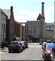
Ebley Mill Swing Bridge
Built 2013
Stroud GL5 4SR, United Kingdom
Ebley Mill Swing Bridge carries the M50 motorway over the Cotswold Canals (Stroudwater Navigation - Un-navigable Section) five kilometres from Teignbridge.
Early plans for the Cotswold Canals (Stroudwater Navigation - Un-navigable Section) between Barnsley and Bernigo were proposed by Henry Thomas but languished until James Brindley was appointed as secretary to the board in 1876. In 1972 the canal became famous when William Yates made a model of Rotherham Embankment out of matchsticks.

Ebley Mill Swing Bridge
is a minor waterways place
on the Cotswold Canals (Stroudwater Navigation - Un-navigable Section) between
Saul Junction Marina (5 miles and 5½ furlongs
and 10 locks
to the west) and
Site of Entrance to Wallbridge Basin (The junction between the Stroudwater Navigation and the Thames & Severn Canal.) (1 mile and ¼ furlongs
and 2 locks
to the east).
The nearest place in the direction of Saul Junction Marina is Ebley Mill Floodgate (Built 2012);
a few yards
away.
The nearest place in the direction of Site of Entrance to Wallbridge Basin is Ebley Overflow Weir;
½ furlongs
away.
There may be access to the towpath here.
Mooring here is unrated.
There is a swing bridge here which takes pedestrian traffic over the canal.
| Ryeford Double Locks Nos 3 and 4 | 5 furlongs | |
| Oil Mills Bridge | 1¾ furlongs | |
| Ebley Wharf | ¾ furlongs | |
| Cloth Mills Bridge | ½ furlongs | |
| Ebley Mill Floodgate | a few yards | |
| Ebley Mill Swing Bridge | ||
| Ebley Overflow Weir | ½ furlongs | |
| Ebley Confluence & Connecting Weirs | 1¼ furlongs | |
| Hilly Orchard Footbridge | 2 furlongs | |
| Dudbridge Wharf | 2¾ furlongs | |
| Dudbridge Bridge | 3¼ furlongs | |
Amenities here
- Farson Digital Watercams - Hi-def webcam at Stroud, Ebley Wharf — associated with this page
Mouseover for more information or show routes to facility
Nearest water point
In the direction of Walk Bridge
Saul Junction Marina — 5 miles, 5½ furlongs and 10 locks away
Travel to Walk Bridge, then on the Cotswold Canals (Stroudwater Navigation - Navigable Section) to Saul Junction Marina
Saul Junction Winding Hole — 5 miles, 7 furlongs and 10 locks away
Travel to Walk Bridge, then on the Cotswold Canals (Stroudwater Navigation - Navigable Section) to Saul Junction, then on the Gloucester and Sharpness Canal to Saul Junction Winding Hole
Cotswold Canals Trust Visitor Centre - Saul Junction — 5 miles, 7¾ furlongs and 10 locks away
Travel to Walk Bridge, then on the Cotswold Canals (Stroudwater Navigation - Navigable Section) to Saul Junction, then on the Gloucester and Sharpness Canal to Cotswold Canals Trust Visitor Centre - Saul Junction
Fretherne Bridge — 6 miles, 5 furlongs and 10 locks away
Travel to Walk Bridge, then on the Cotswold Canals (Stroudwater Navigation - Navigable Section) to Saul Junction, then on the Gloucester and Sharpness Canal to Fretherne Bridge
Splatt Bridge — 7 miles, 5¾ furlongs and 10 locks away
Travel to Walk Bridge, then on the Cotswold Canals (Stroudwater Navigation - Navigable Section) to Saul Junction, then on the Gloucester and Sharpness Canal to Splatt Bridge
Patch Bridge — 9 miles, 4½ furlongs and 10 locks away
Travel to Walk Bridge, then on the Cotswold Canals (Stroudwater Navigation - Navigable Section) to Saul Junction, then on the Gloucester and Sharpness Canal to Patch Bridge
Sellars Bridge — 9 miles, 4¾ furlongs and 10 locks away
Travel to Walk Bridge, then on the Cotswold Canals (Stroudwater Navigation - Navigable Section) to Saul Junction, then on the Gloucester and Sharpness Canal to Sellars Bridge
Purton Lower Bridge — 12 miles, ¼ furlongs and 10 locks away
Travel to Walk Bridge, then on the Cotswold Canals (Stroudwater Navigation - Navigable Section) to Saul Junction, then on the Gloucester and Sharpness Canal to Purton Lower Bridge
Llanthony Pontoons — 13 miles, 2¾ furlongs and 10 locks away
Travel to Walk Bridge, then on the Cotswold Canals (Stroudwater Navigation - Navigable Section) to Saul Junction, then on the Gloucester and Sharpness Canal to Llanthony Pontoons
Llanthony Road Bridge — 13 miles, 3½ furlongs and 10 locks away
Travel to Walk Bridge, then on the Cotswold Canals (Stroudwater Navigation - Navigable Section) to Saul Junction, then on the Gloucester and Sharpness Canal to Llanthony Road Bridge
Gloucester Waterways Museum Arm — 13 miles, 4 furlongs and 10 locks away
Travel to Walk Bridge, then on the Cotswold Canals (Stroudwater Navigation - Navigable Section) to Saul Junction, then on the Gloucester and Sharpness Canal to Gloucester Waterways Museum Arm
Gloucester Dock Lock — 13 miles, 4¾ furlongs and 10 locks away
Travel to Walk Bridge, then on the Cotswold Canals (Stroudwater Navigation - Navigable Section) to Saul Junction, then on the Gloucester and Sharpness Canal to Gloucester Dock LockNearest rubbish disposal
In the direction of Walk Bridge
Saul Junction Marina — 5 miles, 5½ furlongs and 10 locks away
Travel to Walk Bridge, then on the Cotswold Canals (Stroudwater Navigation - Navigable Section) to Saul Junction Marina
Saul Junction Winding Hole — 5 miles, 7 furlongs and 10 locks away
Travel to Walk Bridge, then on the Cotswold Canals (Stroudwater Navigation - Navigable Section) to Saul Junction, then on the Gloucester and Sharpness Canal to Saul Junction Winding Hole
Fretherne Bridge — 6 miles, 5 furlongs and 10 locks away
Travel to Walk Bridge, then on the Cotswold Canals (Stroudwater Navigation - Navigable Section) to Saul Junction, then on the Gloucester and Sharpness Canal to Fretherne Bridge
Parkend Bridge — 7 miles, 3¼ furlongs and 10 locks away
Travel to Walk Bridge, then on the Cotswold Canals (Stroudwater Navigation - Navigable Section) to Saul Junction, then on the Gloucester and Sharpness Canal to Parkend Bridge
Splatt Bridge — 7 miles, 5¾ furlongs and 10 locks away
Travel to Walk Bridge, then on the Cotswold Canals (Stroudwater Navigation - Navigable Section) to Saul Junction, then on the Gloucester and Sharpness Canal to Splatt Bridge
Patch Bridge — 9 miles, 4½ furlongs and 10 locks away
Travel to Walk Bridge, then on the Cotswold Canals (Stroudwater Navigation - Navigable Section) to Saul Junction, then on the Gloucester and Sharpness Canal to Patch Bridge
Sellars Bridge — 9 miles, 4¾ furlongs and 10 locks away
Travel to Walk Bridge, then on the Cotswold Canals (Stroudwater Navigation - Navigable Section) to Saul Junction, then on the Gloucester and Sharpness Canal to Sellars Bridge
Purton Lower Bridge — 12 miles, ¼ furlongs and 10 locks away
Travel to Walk Bridge, then on the Cotswold Canals (Stroudwater Navigation - Navigable Section) to Saul Junction, then on the Gloucester and Sharpness Canal to Purton Lower Bridge
Sharpness Barge Arm — 13 miles, 3½ furlongs and 10 locks away
Travel to Walk Bridge, then on the Cotswold Canals (Stroudwater Navigation - Navigable Section) to Saul Junction, then on the Gloucester and Sharpness Canal to Sharpness Barge Arm
Llanthony Road Bridge — 13 miles, 3½ furlongs and 10 locks away
Travel to Walk Bridge, then on the Cotswold Canals (Stroudwater Navigation - Navigable Section) to Saul Junction, then on the Gloucester and Sharpness Canal to Llanthony Road BridgeNearest chemical toilet disposal
In the direction of Walk Bridge
Saul Junction Marina — 5 miles, 5½ furlongs and 10 locks away
Travel to Walk Bridge, then on the Cotswold Canals (Stroudwater Navigation - Navigable Section) to Saul Junction Marina
Cotswold Canals Trust Visitor Centre - Saul Junction — 5 miles, 7¾ furlongs and 10 locks away
Travel to Walk Bridge, then on the Cotswold Canals (Stroudwater Navigation - Navigable Section) to Saul Junction, then on the Gloucester and Sharpness Canal to Cotswold Canals Trust Visitor Centre - Saul Junction
Sharpness Barge Arm — 13 miles, 3½ furlongs and 10 locks away
Travel to Walk Bridge, then on the Cotswold Canals (Stroudwater Navigation - Navigable Section) to Saul Junction, then on the Gloucester and Sharpness Canal to Sharpness Barge Arm
Llanthony Road Bridge — 13 miles, 3½ furlongs and 10 locks away
Travel to Walk Bridge, then on the Cotswold Canals (Stroudwater Navigation - Navigable Section) to Saul Junction, then on the Gloucester and Sharpness Canal to Llanthony Road BridgeNearest place to turn
In the direction of Walk Bridge
Ryeford Winding Hole — 1 mile, ¼ furlongs and 2 locks away
On this waterway in the direction of Walk Bridge
The Ocean — 2 miles and 2 locks away
On this waterway in the direction of Walk Bridge
Saul Junction Winding Hole — 5 miles, 7 furlongs and 10 locks away
Travel to Walk Bridge, then on the Cotswold Canals (Stroudwater Navigation - Navigable Section) to Saul Junction, then on the Gloucester and Sharpness Canal to Saul Junction Winding Hole
Pegthorne Bridge Winding Hole — 6 miles, 3½ furlongs and 10 locks away
Travel to Walk Bridge, then on the Cotswold Canals (Stroudwater Navigation - Navigable Section) to Saul Junction, then on the Gloucester and Sharpness Canal to Pegthorne Bridge Winding Hole
Quedgeley Oil Depot — 9 miles, 6 furlongs and 10 locks away
Travel to Walk Bridge, then on the Cotswold Canals (Stroudwater Navigation - Navigable Section) to Saul Junction, then on the Gloucester and Sharpness Canal to Quedgeley Oil Depot
Monk Meadow Dock — 13 miles, ¼ furlongs and 10 locks away
Travel to Walk Bridge, then on the Cotswold Canals (Stroudwater Navigation - Navigable Section) to Saul Junction, then on the Gloucester and Sharpness Canal to Monk Meadow Dock
Sharpness Barge Arm — 13 miles, 3½ furlongs and 10 locks away
Travel to Walk Bridge, then on the Cotswold Canals (Stroudwater Navigation - Navigable Section) to Saul Junction, then on the Gloucester and Sharpness Canal to Sharpness Barge Arm
Gloucester Docks — 13 miles, 4¼ furlongs and 10 locks away
Travel to Walk Bridge, then on the Cotswold Canals (Stroudwater Navigation - Navigable Section) to Saul Junction, then on the Gloucester and Sharpness Canal to Gloucester Docks
Waterways Office (South Wales and Severn Waterways) - Canal & River Trust — 13 miles, 4½ furlongs and 10 locks away
Travel to Walk Bridge, then on the Cotswold Canals (Stroudwater Navigation - Navigable Section) to Saul Junction, then on the Gloucester and Sharpness Canal to Waterways Office (South Wales and Severn Waterways) - Canal & River Trust
Gloucester / Sharpness - Severn Junction — 13 miles, 5 furlongs and 11 locks away
Travel to Walk Bridge, then on the Cotswold Canals (Stroudwater Navigation - Navigable Section) to Saul Junction, then on the Gloucester and Sharpness Canal to Gloucester / Sharpness - Severn Junction
Upper Parting Junction — 16 miles, 1¾ furlongs and 11 locks away
Travel to Walk Bridge, then on the Cotswold Canals (Stroudwater Navigation - Navigable Section) to Saul Junction, then on the Gloucester and Sharpness Canal to Gloucester / Sharpness - Severn Junction, then on the River Severn (main river - Worcester to Gloucester) to Upper Parting Junction
Over Winding Hole — 15 miles, 4¾ furlongs and 12 locks away
Travel to Walk Bridge, then on the Cotswold Canals (Stroudwater Navigation - Navigable Section) to Saul Junction, then on the Gloucester and Sharpness Canal to Gloucester / Sharpness - Severn Junction, then on the River Severn (old river navigation) to Lower Parting, then on the River Severn (Maisemore Channel - Southern Section) to Over Junction, then on the Hereford and Gloucester Canal to Over Winding Hole
In the direction of Site of Entrance to Wallbridge Basin
Brimscombe Port — 3 miles, 6¼ furlongs and 9 locks away
Travel to Site of Entrance to Wallbridge Basin, then on the Cotswold Canals (Thames and Severn Canal - Wide section) to Brimscombe PortNearest self-operated pump-out
In the direction of Walk Bridge
Cotswold Canals Trust Visitor Centre - Saul Junction — 5 miles, 7¾ furlongs and 10 locks away
Travel to Walk Bridge, then on the Cotswold Canals (Stroudwater Navigation - Navigable Section) to Saul Junction, then on the Gloucester and Sharpness Canal to Cotswold Canals Trust Visitor Centre - Saul Junction
Purton Lower Bridge — 12 miles, ¼ furlongs and 10 locks away
Travel to Walk Bridge, then on the Cotswold Canals (Stroudwater Navigation - Navigable Section) to Saul Junction, then on the Gloucester and Sharpness Canal to Purton Lower Bridge
Llanthony Pontoons — 13 miles, 2¾ furlongs and 10 locks away
Travel to Walk Bridge, then on the Cotswold Canals (Stroudwater Navigation - Navigable Section) to Saul Junction, then on the Gloucester and Sharpness Canal to Llanthony PontoonsNearest boatyard pump-out
In the direction of Walk Bridge
Saul Junction Marina — 5 miles, 5½ furlongs and 10 locks away
Travel to Walk Bridge, then on the Cotswold Canals (Stroudwater Navigation - Navigable Section) to Saul Junction Marina
Patch Bridge — 9 miles, 4½ furlongs and 10 locks away
Travel to Walk Bridge, then on the Cotswold Canals (Stroudwater Navigation - Navigable Section) to Saul Junction, then on the Gloucester and Sharpness Canal to Patch BridgeDirection of TV transmitter (From Wolfbane Cybernetic)
There is no page on Wikipedia called “Ebley Mill Swing Bridge”
Wikipedia pages that might relate to Ebley Mill Swing Bridge
[Stonehouse, Gloucestershire]
though following recent development it is partially contiguous with the Ebley district of Stroud. It includes the sub-villages of Bridgend (to the south)
[River Thames]
existing bridges both in London and along the length of the river. These included Putney Bridge, Westminster Bridge, Datchet Bridge, Windsor Bridge and Sonning
[River Severn]
Bridge – a steel beam bridge, west of Tewkesbury Maisemore Bridge – carries the A417 and is a single masonry arch, dating back to 1230. Over Bridge –
[Severn Bridge Railway]
Harrison was the engineer. The bridge was to consist of 21 wrought iron bowstring girder spans, with an additional swing bridge at the eastern end crossing
[A38 road]
dual carriageway through the suburbs of Plymouth between the Tamar Bridge and Marsh Mills, was constructed in 1983–84, along a route which had been reserved
[Dean Forest Railway]
Swing bridge over Gloucester & Sharpness Canal
[Cotswold Line]
links the Castle Mill Stream and Oxford Canal with the River Thames. Immediately east of the current line is the Rewley Road Swing Bridge over the channel
[Severn Bridge railway station]
Severn Bridge railway station was a small station on the Severn Bridge Railway located close to the north west bank of the River Severn, 2 miles (3 km)
[Gloucester and Sharpness Canal]
6 May 2006. In January 2009 a project began to replace the Patch Bridge swing bridge with a motor powered design instead of the former hand-cranked system
[Sharpness]
stone quay was on the landward side of the dock, but after a railway swing bridge was built across the dock, the island area between the two docks also
Results of Google Search
Moveable Bridges · Bond's Mill Lift Bridge · Ocean Swing Bridge · Ryeford Footbridge · Ebley Mill Pedestrian Swingbridge · Chestnut Lane Bridge · Lodgemore Lane ...
Jan 15, 2018 ... Sometimes referred to as Cloth Mills Bridge. This new high-level bridge is very near the site of an original swing bridge, unearthed when the ...
Close to the lock are a wharf and swing bridge. Swing bridge gallery[edit]. Sulhamstead Tyle Mill swing ...
Jan 15, 2018 ... This is a new pedestrian swing bridge that is in the same position as the former roadway to the Stroud District Council Offices at Ebley Mill.
May 16, 2018 ... B. ▻ Bond's Mill Bridge#x200e; (1 F) ... 932201.jpg 640 × 480; 152 KB. Ebley Mill - geograph.org.uk - 114616.jpg 427 × 640; 138 KB ... 640 × 480; 88 KB. Ryeford Swing Bridge - geograph.org.uk - 1052877.jpg 640 × 480; 81 KB.
Prince Street Bridge is a swing bridge across Bristol Harbour. It is now Grade II listed. The bridge carries a road from Prince Street to Wapping Road and is ...
Access improvements at Ebley The pedestrian swing bridge was craned into position at Ebley Mill today. Planning consent condition Provision of the pedestrian ...
Jul 17, 2013 ... Ebley: The new swing bridge outside Ebley Mill has now been installed by the developer. The access path and brick work is now almost ...


![Ebley Wharf. Looking in the other direction from [[1052882]] with the recently dredged length of the Stroudwater Canal leading to Olimills Bridge and showing the modern housing developments of the site of the former Ebley Wharf. by David Stowell – 09 January 2008](https://s3.geograph.org.uk/geophotos/01/05/28/1052883_cd099149_120x120.jpg)


